
Maps
'n' More
Created
By
Sharon McAllister

|
|
Maps
'n' More |
|
|
|
||
|
|
|
||
|
|
|
|
|
|
|
|
|
|
|
|
|
|
|
|
|
|||
| Back to Major Co. Map Links |
1915 Atlas
Major County
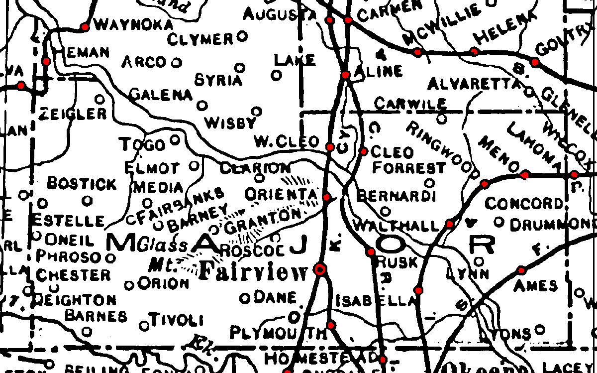
Railroad Stations are shown in red.
The line through the northwest corner was the St. Louis and San Francisco. It was still operational in 1972.
The line north-south line through Fairview and Aline was the Kansas Ciry, Mexico and Orient. Later acquired by the Santa Fe, it was still operational in 1972.
The Short Line extending southeast from Fairview is not labeled and had been abandoned by 1972.
The north/south line through Rusk and line arcing through Isabella, Walthall, and Lahoma were branches of the Chicago, Rock Island & Pacific. Both had been abandoned by 1972.
The line cutting through the southeaster corner of the county was the St. Louis and San Francisco. It was still operational in 1972.
The Atlas shows no roads in Major County. The thin lines are rivers and creeks.
![]()
|
Page last updated
on
Wednesday, April 15, 2026
This site maintained by
Mel Owings
![]()