
Maps
'n' More
Created
By
Sharon McAllister

|
|
Maps
'n' More |
|
|
|
||
|
|
|
||
|
|
|
|
|
|
|
|
|
|
|
|
|
|
|
|
|
|||
| Back to Oklahoma County Township Maps | Back to Oklahoma County Cemetery Lists |
Oklahoma County - T13N-R1W
Click on Cemetery Name for links to online information such as canvasses.
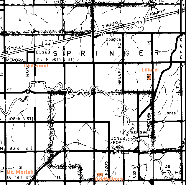
| Cemetery | Directions/Comments/Links | Sec | Latitude | Longitude | Quad |
| Chitwood | Corner of Memorial and Post Roads. Go to GNIS Map. Chitwood Canvass | 18 | 353632N | 0972111W | Jones |
| Lillard | See Map. Go to GNIS Map. | 14 | 353604N | 0971554W | Jones |
| Mount Moriah | North of 78th Street, just west of the railroad. Go to GNIS Map. | 31 | 353308N | 0972022W | Jones |
| Odd Fellows | See Above Map. | 34 | Jones |
![]()
|
Page last updated
on
Tuesday, June 30, 2026
This site maintained by
Mel Owings
![]()