
Maps
'n' More
Created
By
Sharon McAllister

|
|
Maps
'n' More |
|
|
|
||
|
|
|
||
|
|
|
|
|
|
|
|
|
|
|
|
|
|
|
|
|
|||
| Back to Okmulgee Co. Map Links |
1915 Atlas
Ok
mulgee County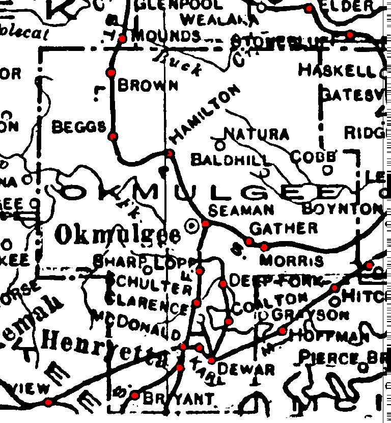
Railroad Stations are shown in red.
Both the curved line through the northern part of the county and the line running southwest to northeast through the southern portion belonged to the St. Louis and San Francisco. All were still operational in 1972.
The line that enters Henryetta from the south, then loops through Dewar and and Coalton was the Kansas, Oklahoma, and Gulf. It had been abandoned by 1972.
The Atlas shows no roads in Okmulgee County. The thin lines are rivers and creeks.
![]()
|
Page last updated
on
Wednesday, April 15, 2026
This site maintained by
Mel Owings
![]()