| State Maps |
Description |
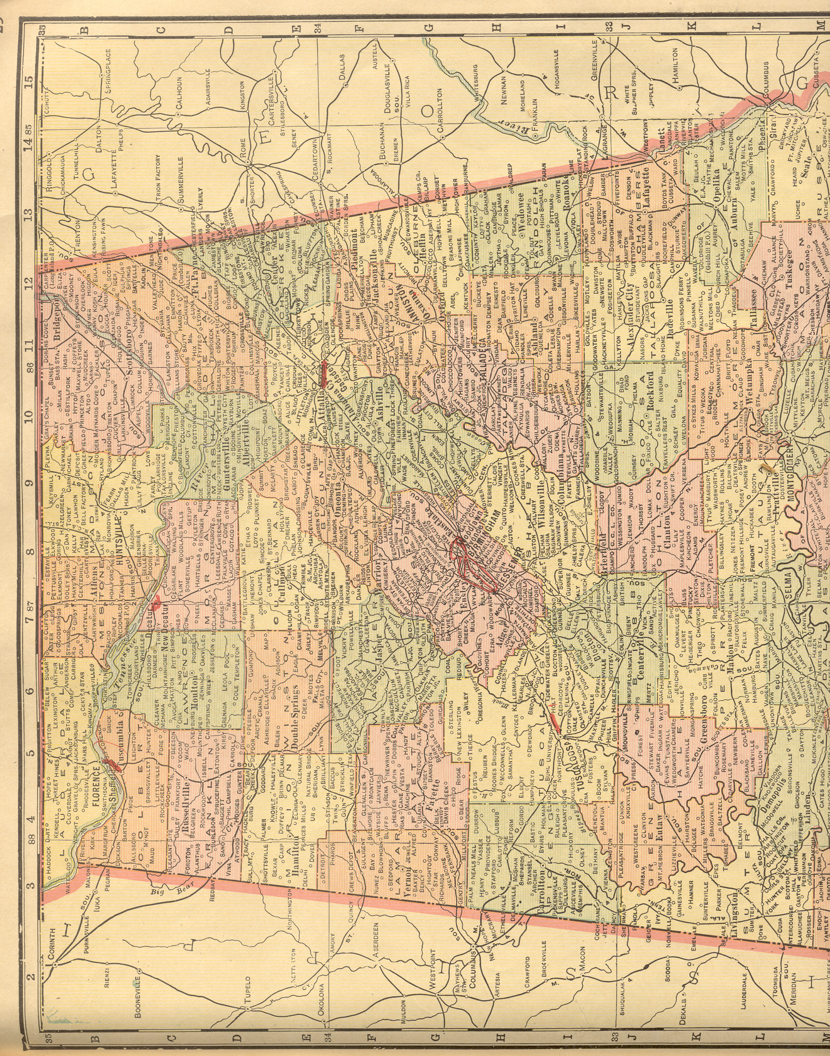
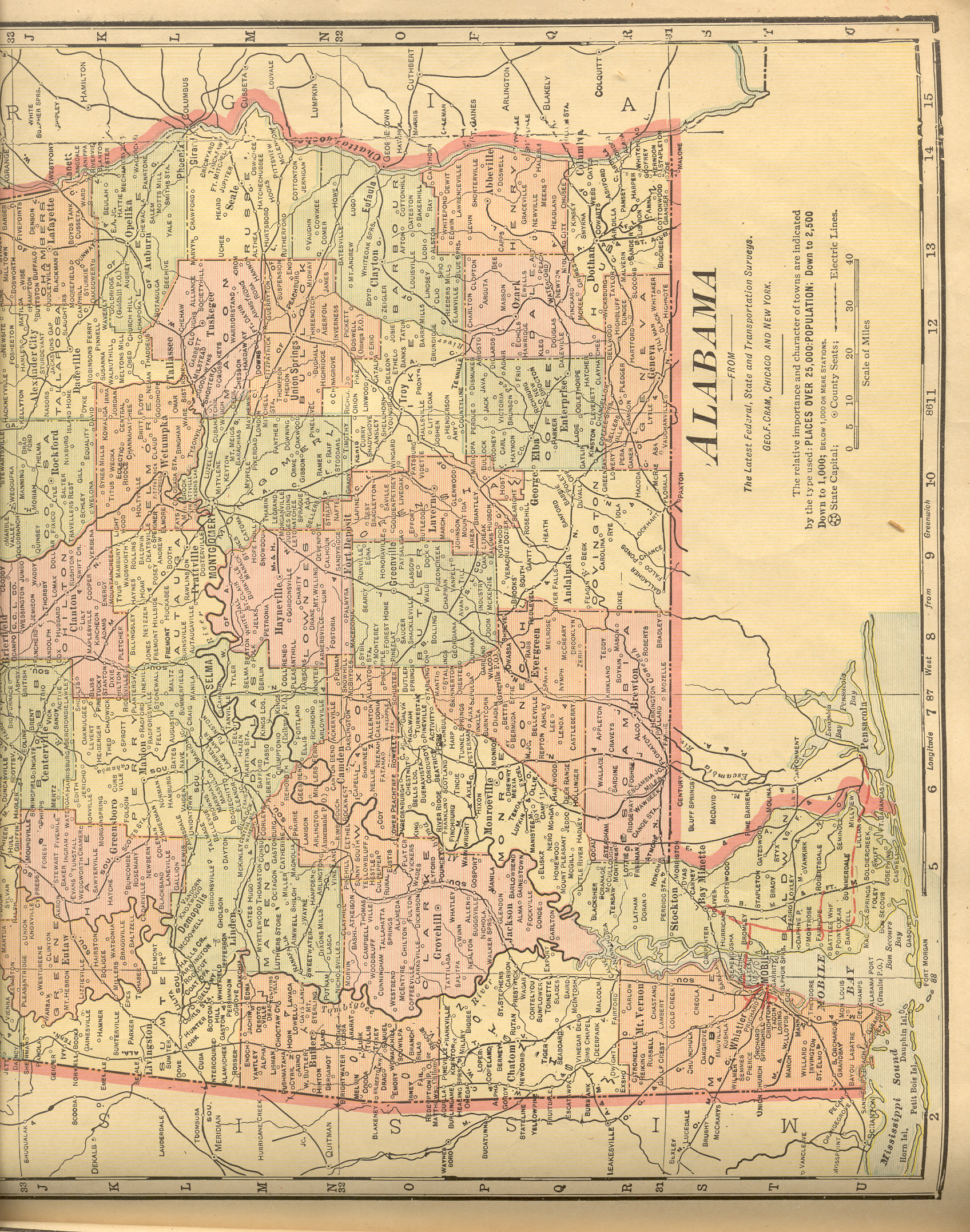
| Alabama |
New:
Color Image of the Northern
part of the state. Color Image of the Southern
part of the state. Together, they cover the entire state. |
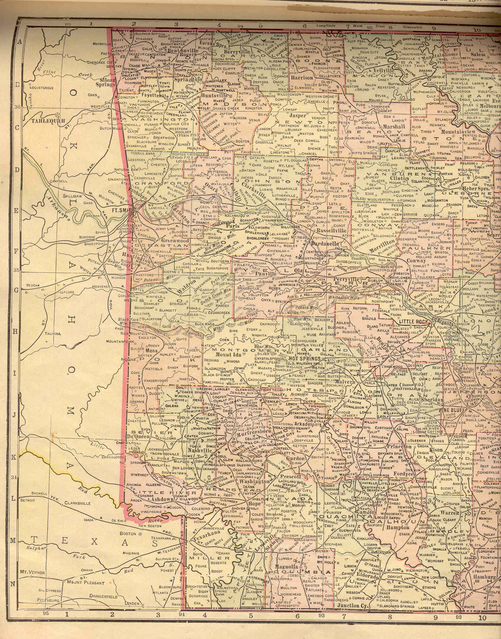
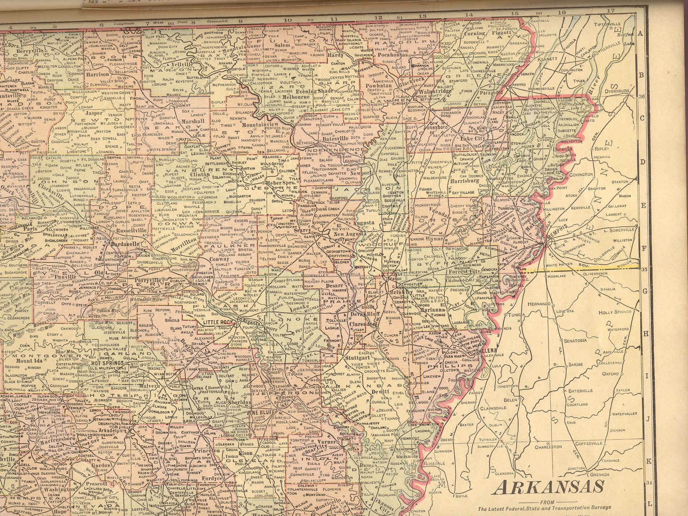
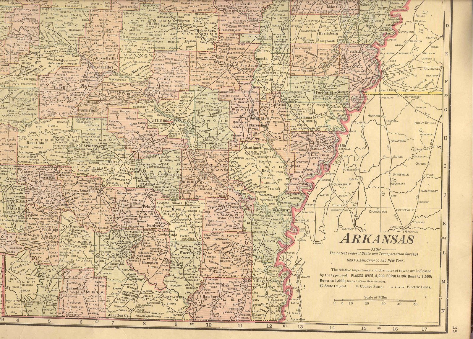
| Arkansas |
Color Image of the western
part of the state, including all of the Oklahoma/Arkansas border. Color images of Northeastern and Southeastern
Arkansas complete coverage of the state. |
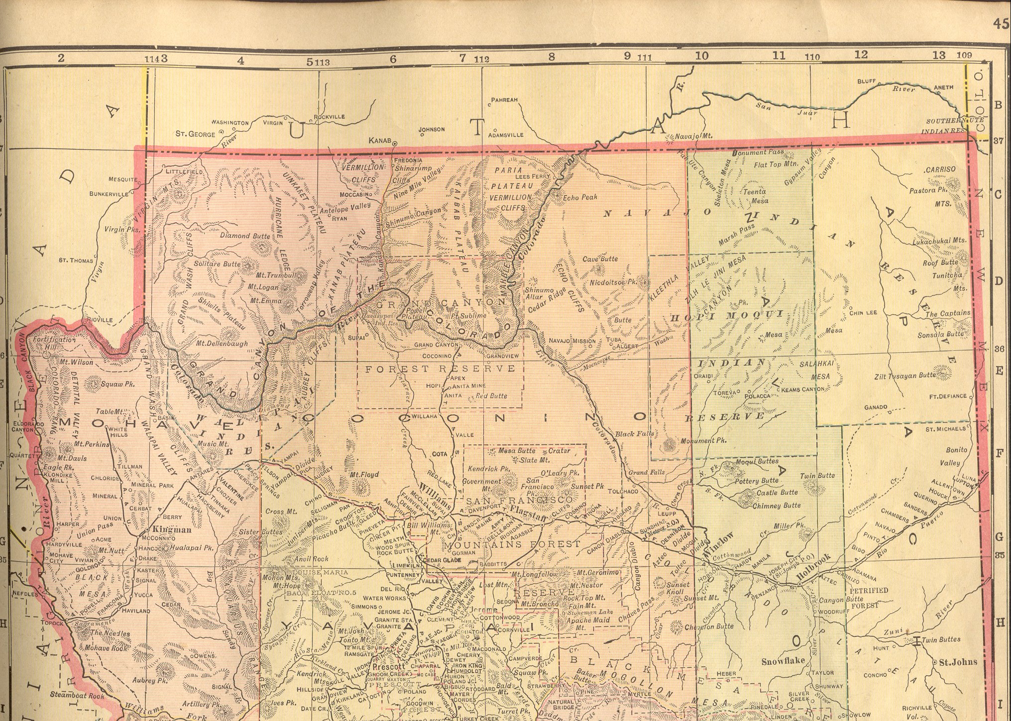
| Arizona |
New:
Color Image of the Northern
part of the state. Color Image of the Southern
part of the state. Together, they cover the entire state. |
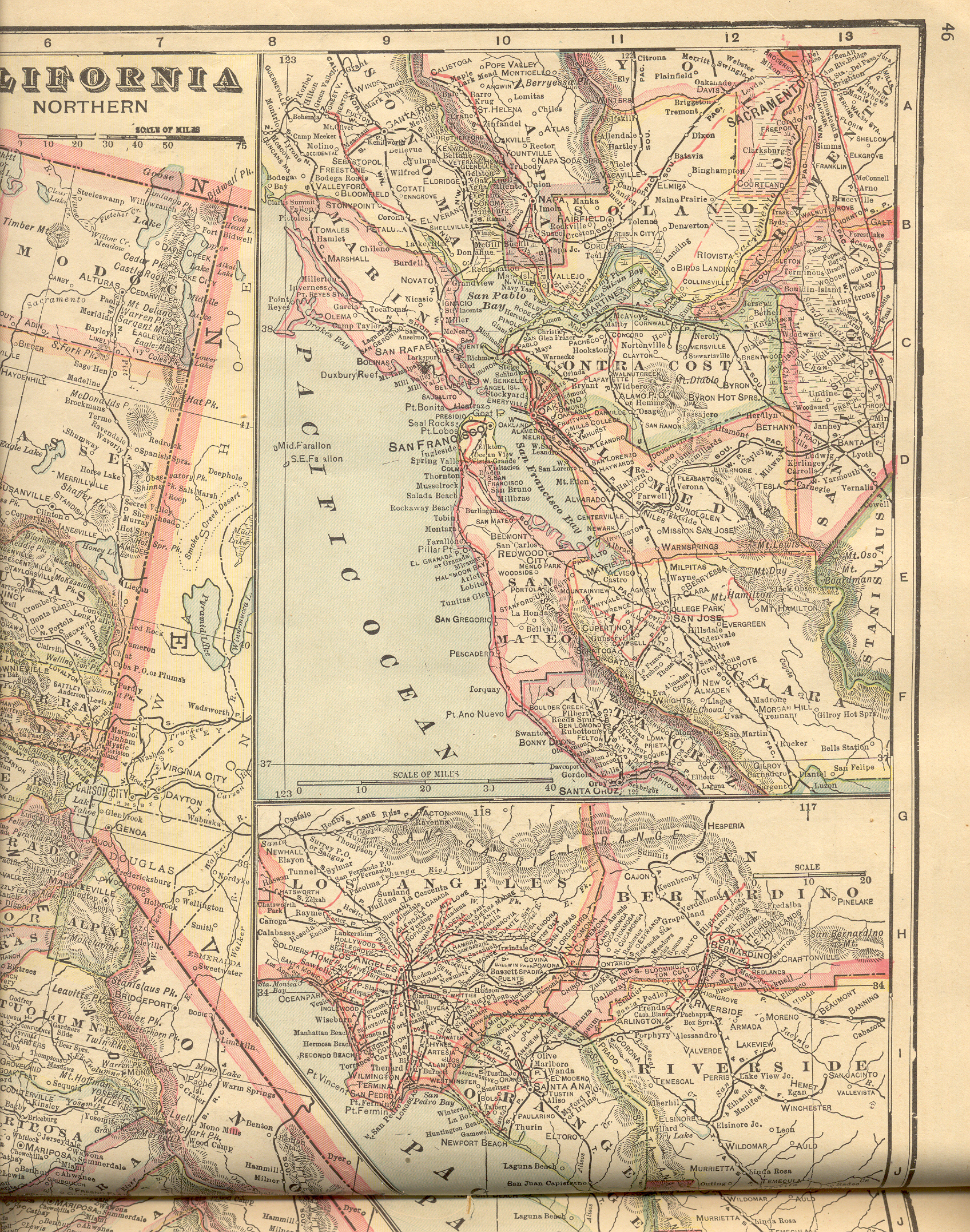
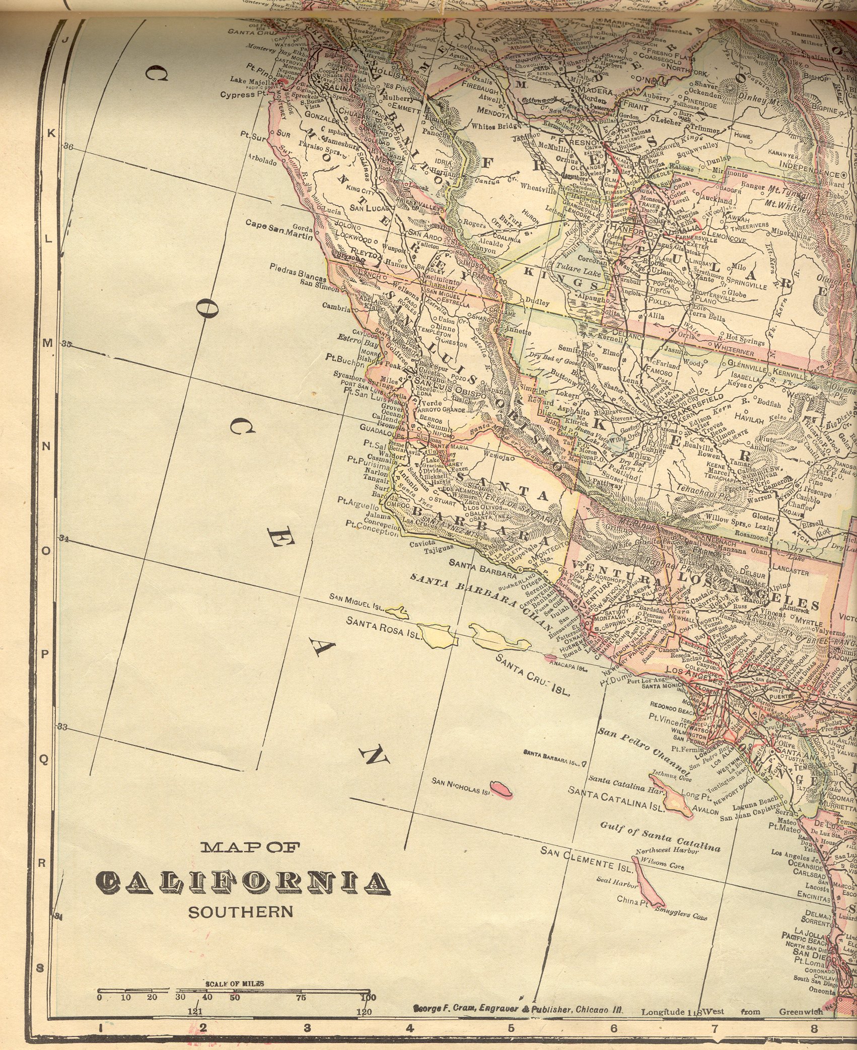
| California |
New:
Color Image of the Northeastern
part of the state. Color Image of the Southeastern
part of the state. Color Image of the Northwestern
part of the state. Color Image of the Southwestern
part of the state. Together, they cover the entire state. |
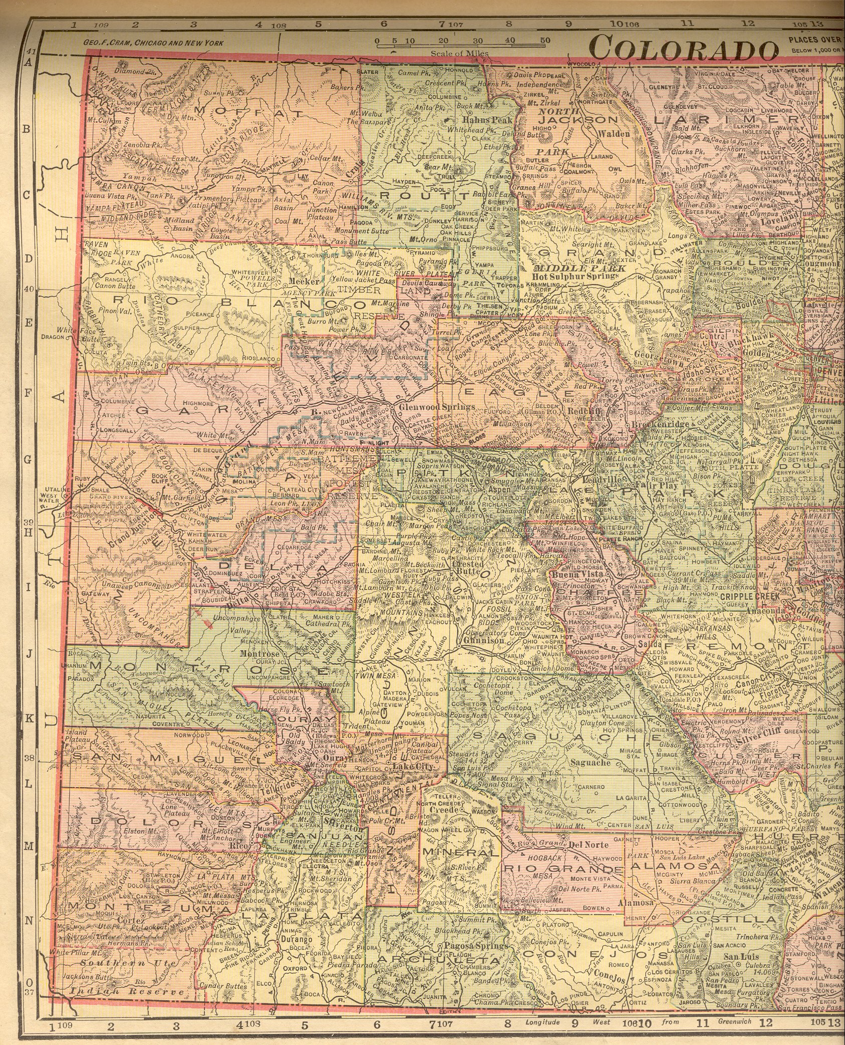
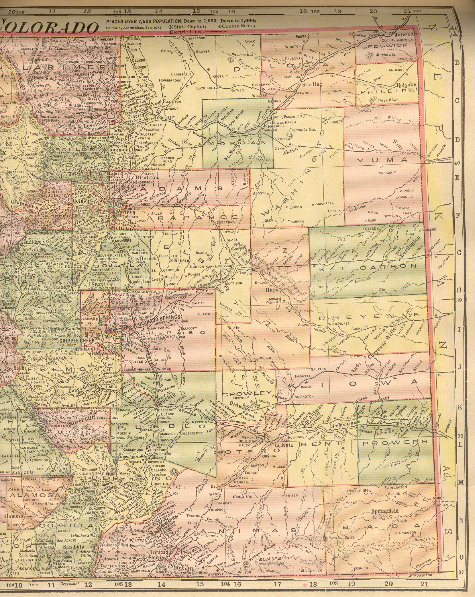
| Colorado |
New:
Color Image of the Western
part of the state. Color Image of the Eastern
part of the state. Together, they cover the entire state. |
| Connecticut |
New:
Color Image of the Western
part of the state. Color Image of the Eastern
part of the state. Together, they cover the entire state. |
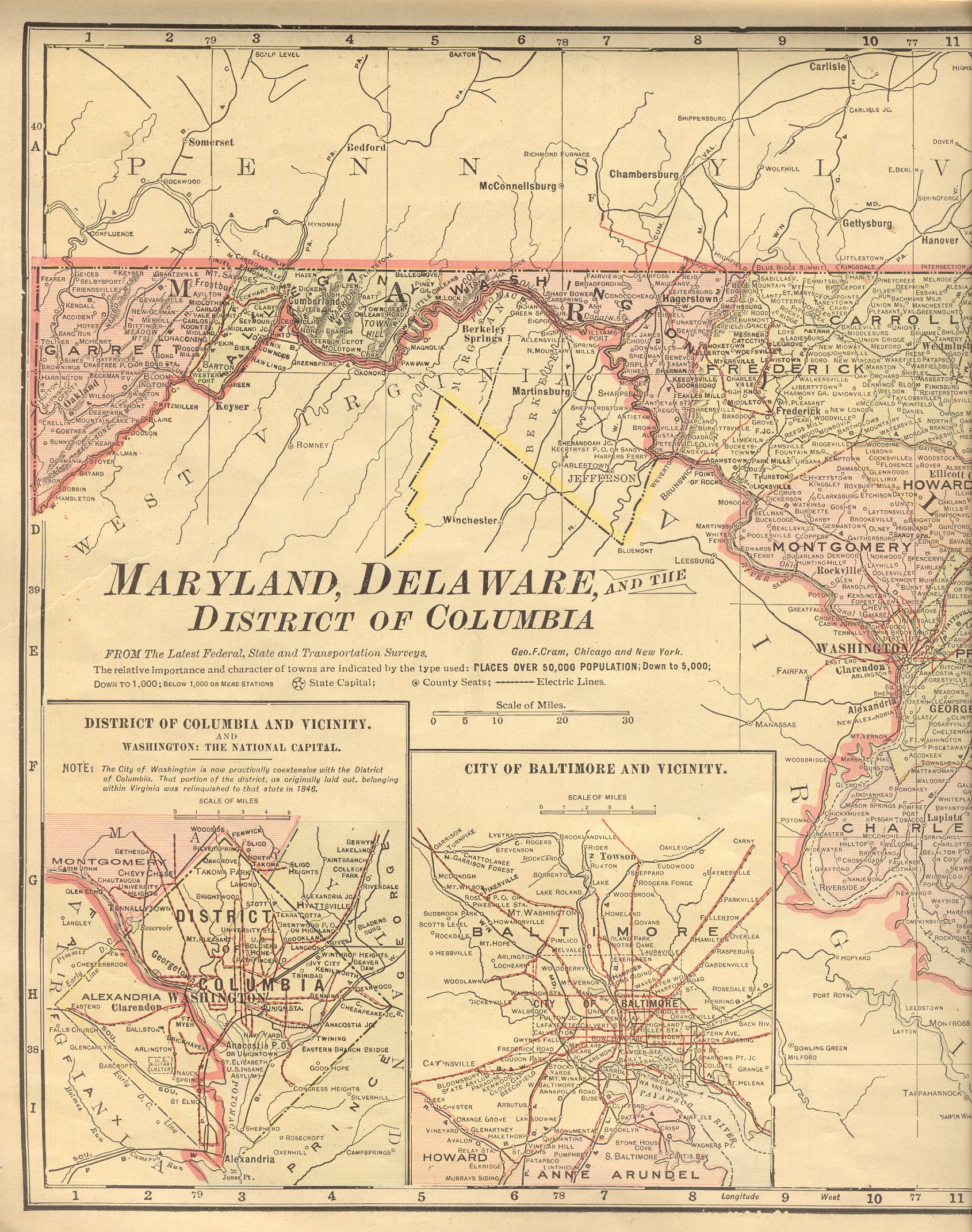
| Delaware |
New:
Color Image of the entire state. |
| District of Columbia |
New:
Color Image of the district and some of
the state of Maryland. |
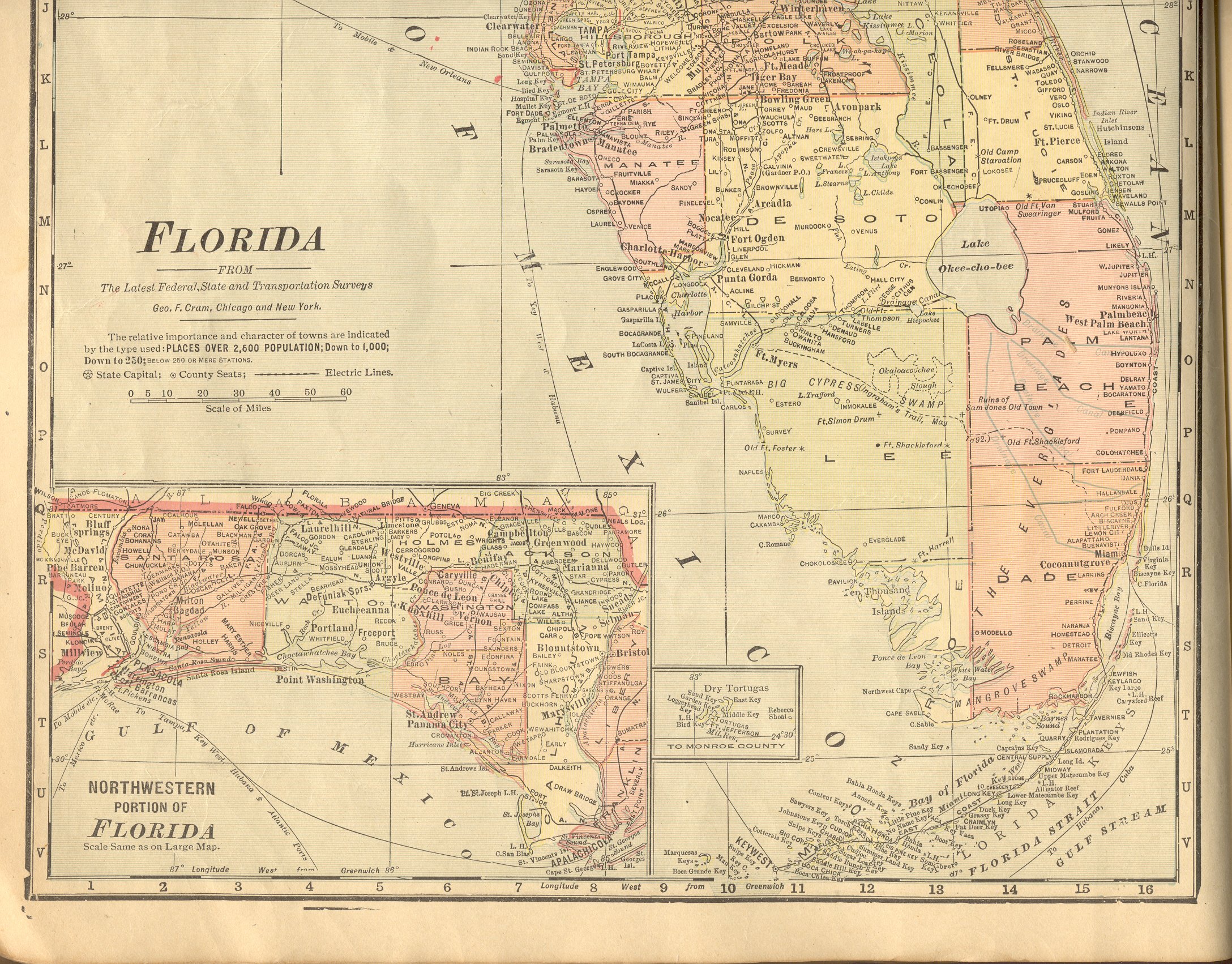
| Florida |
New:
Color Image of the Northern
part of the state. Color Image of the Southern
part of the state. Together, they cover the entire state. |
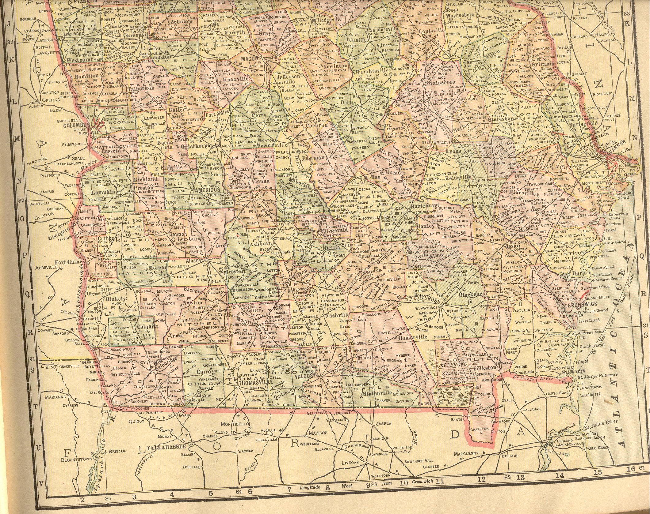
| Georgia |
New:
Color Image of the Northern
part of the state. Color Image of the Southern
part of the state. Together, they cover the entire state. |
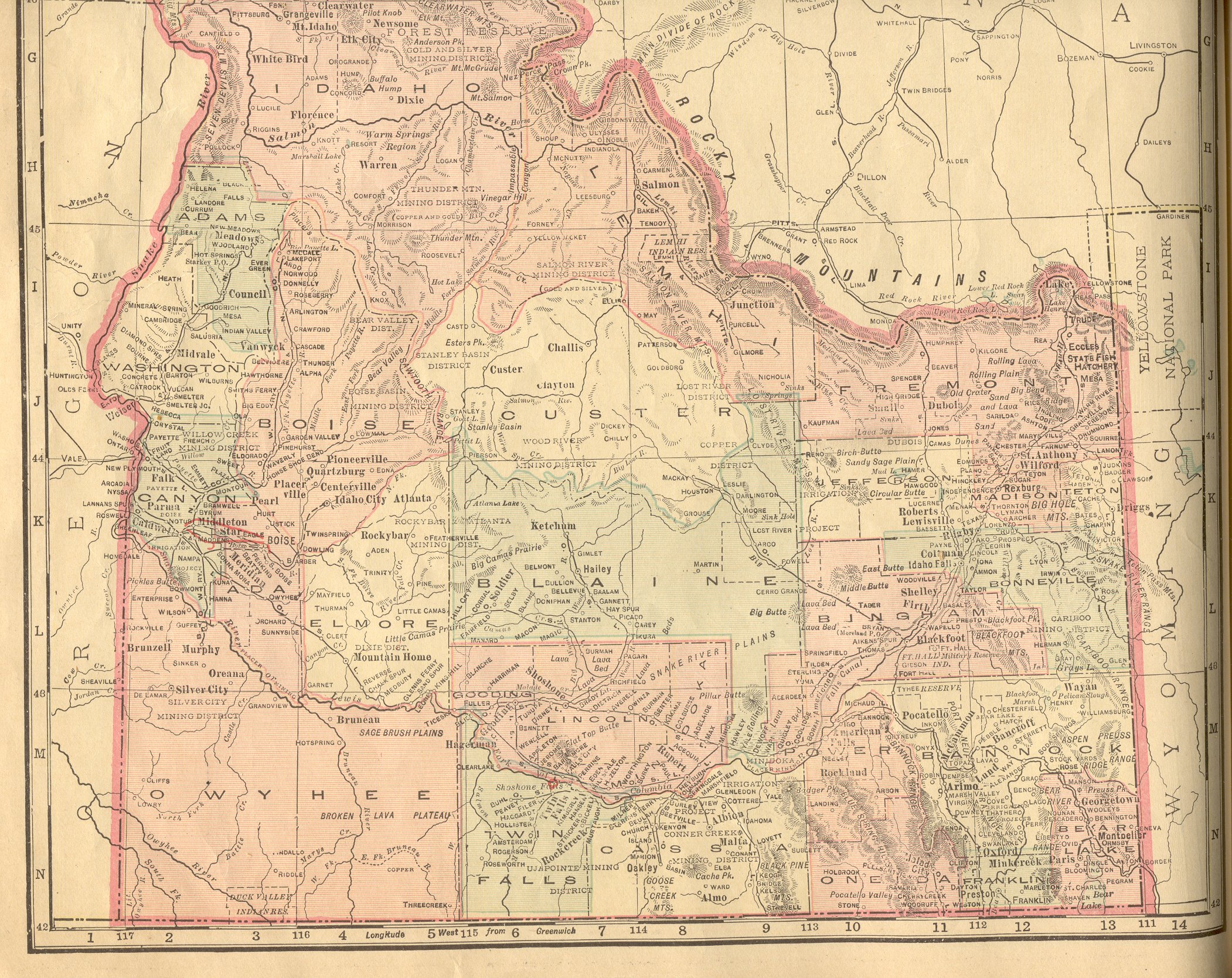
| Idaho |
New:
Color Image of the Northern
part of the state. Color Image of the Southern
part of the state. Together, they cover the entire state. |
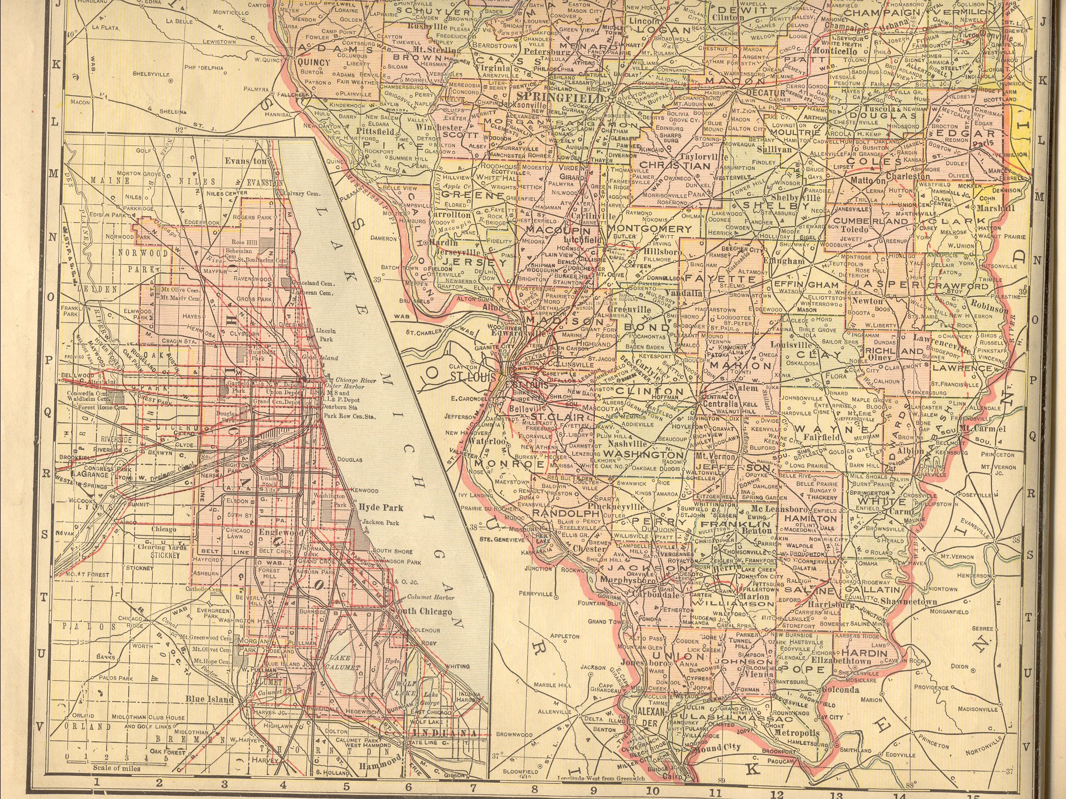
| Illinois |
New:
Color Image of the Northern part of the state. Color Image of the
Southern part of the state. Together, they cover the entire state. |
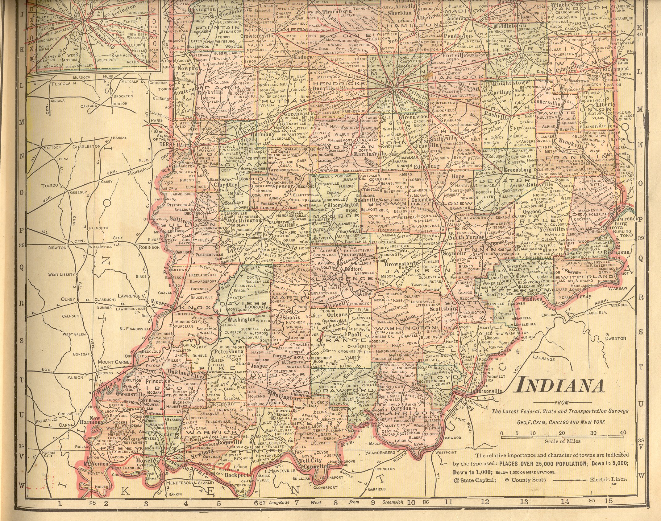
| Indiana |
New:
Color Image of the Northern
part of the state. Color Image of the Southern
part of the state. Together, they cover the entire state. |
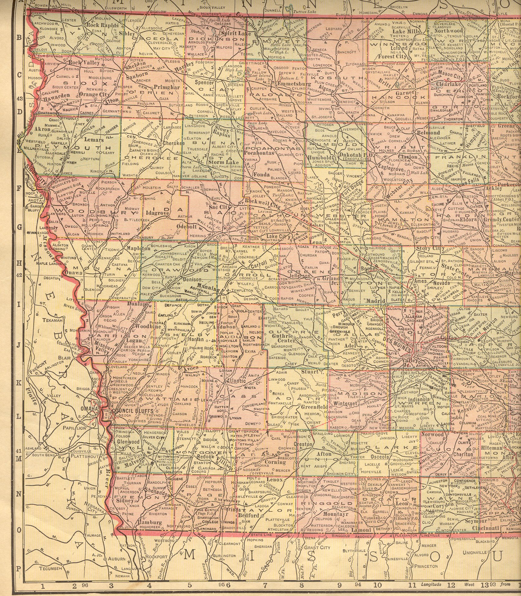
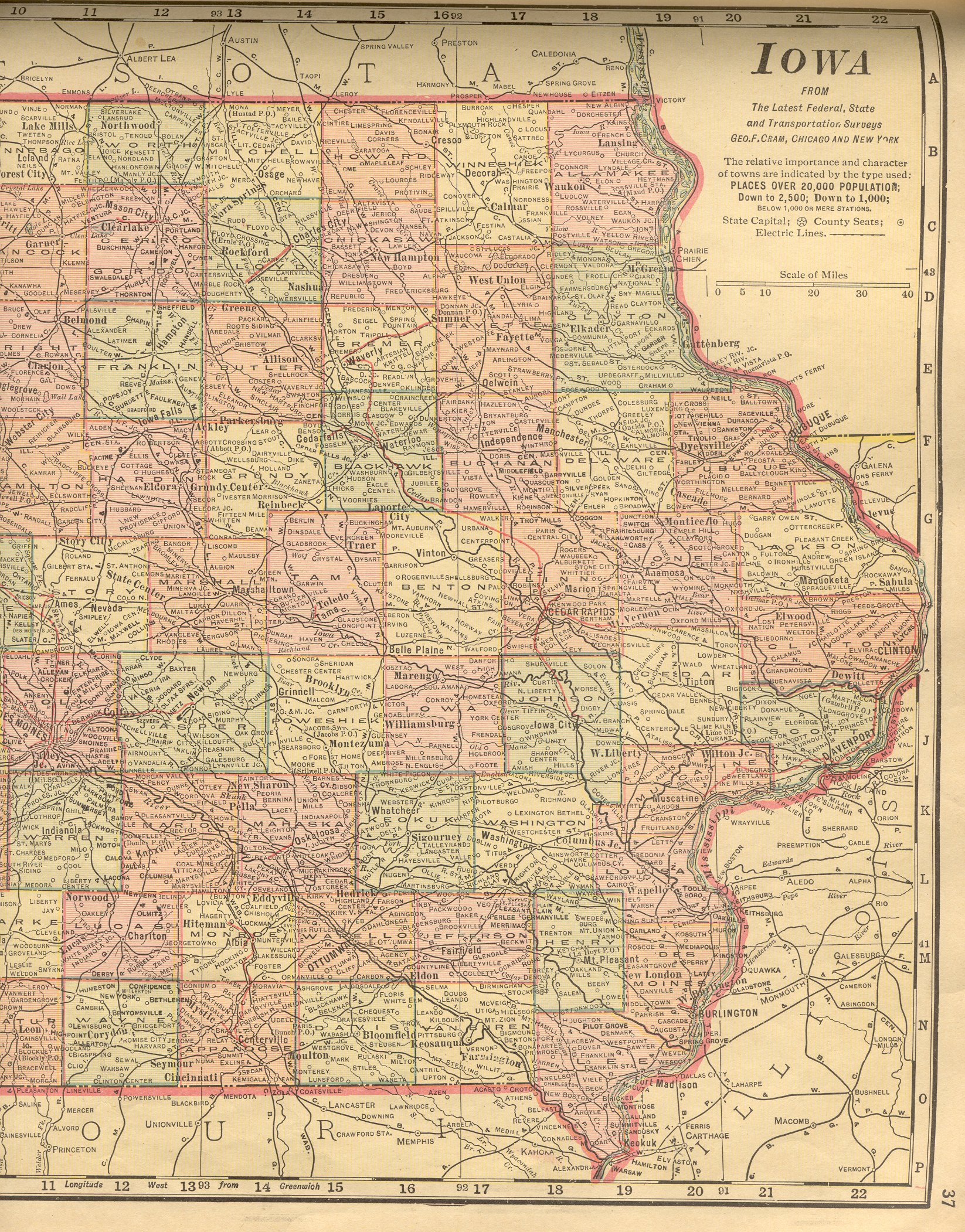
| Iowa |
New:
Color Image of the Western
part of the state. Color Image of the Eastern
part of the state. Together, they cover the entire state. |
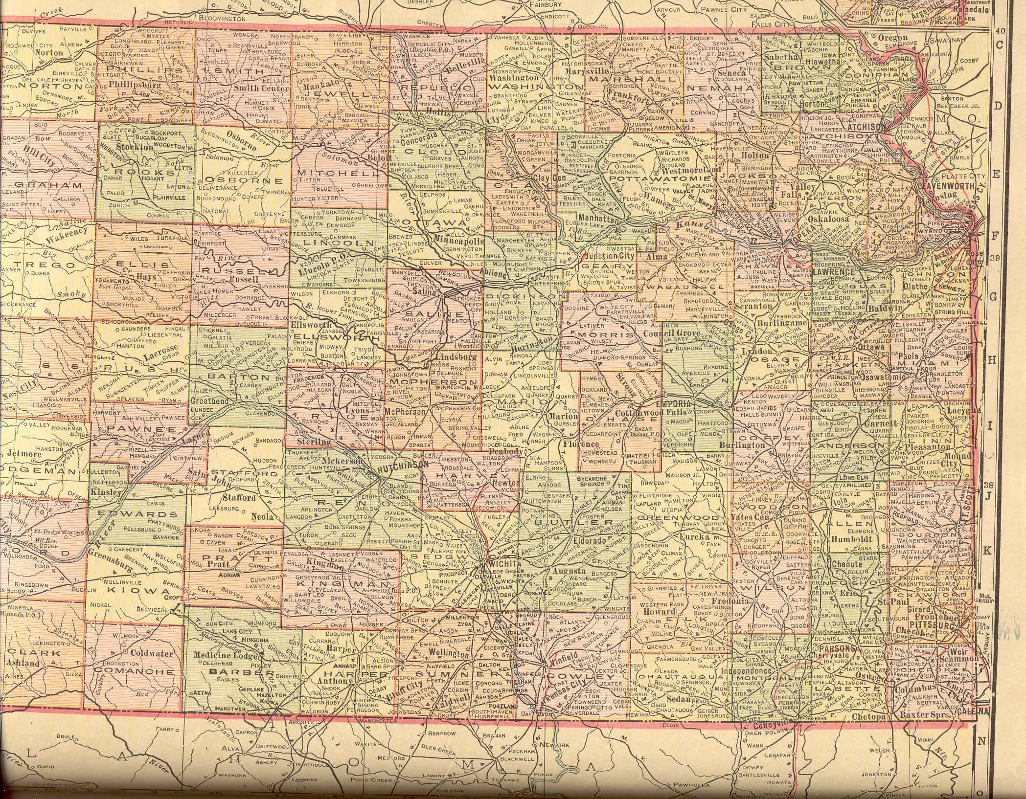
| Kansas |
Color Image of the Western
part of the state. Color Image of the Eastern
part of the state. Together, they cover the entire state. |
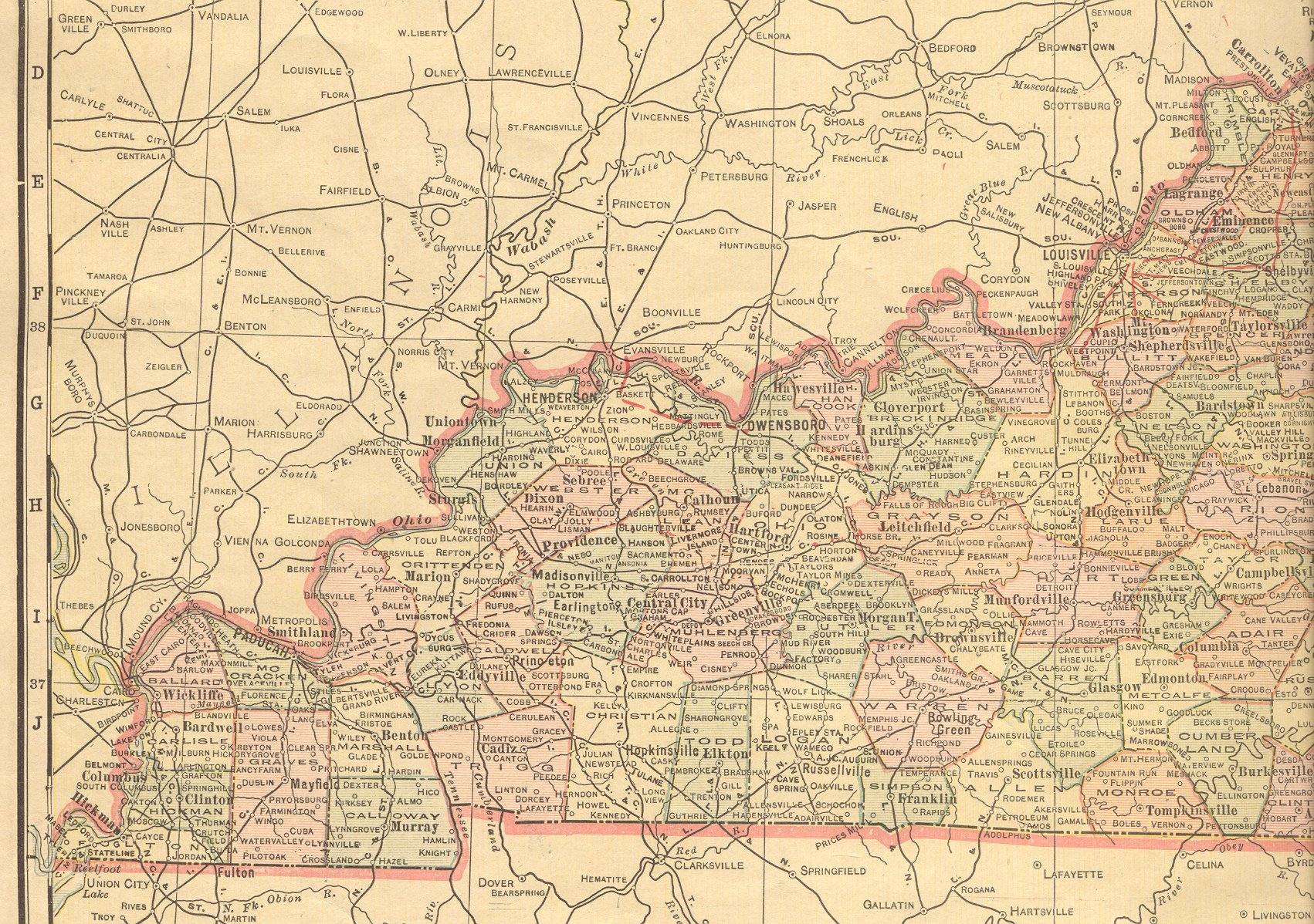
| Kentucky |
New:
Color Image of the Western
part of the state. Color Image of the Eastern
part of the state. Together, they cover the entire state. |
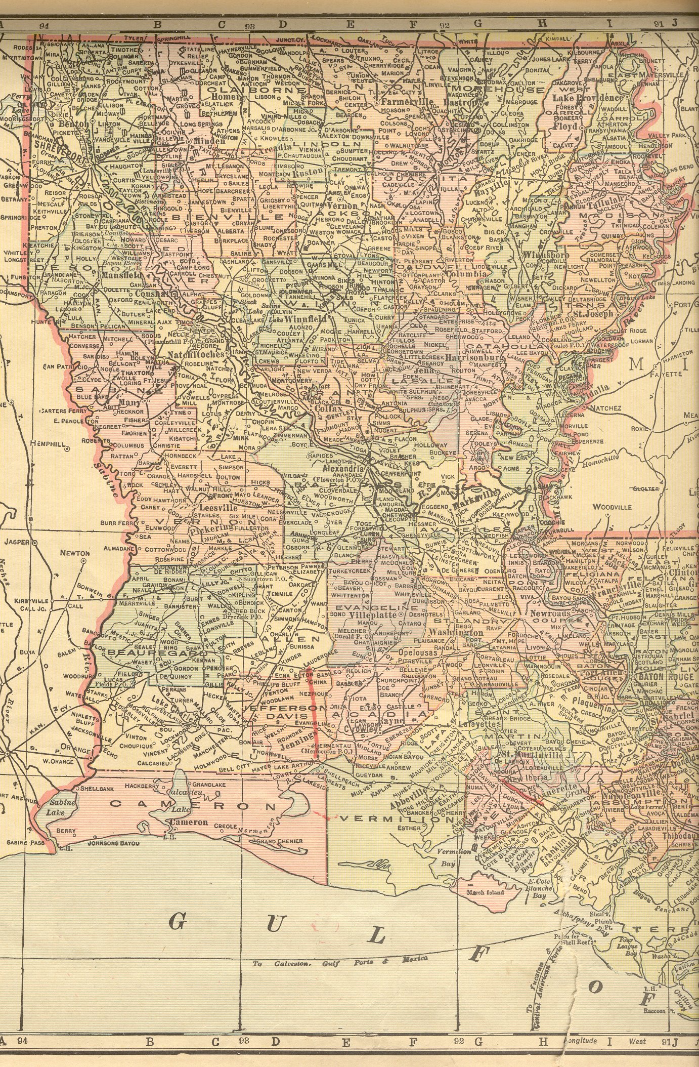
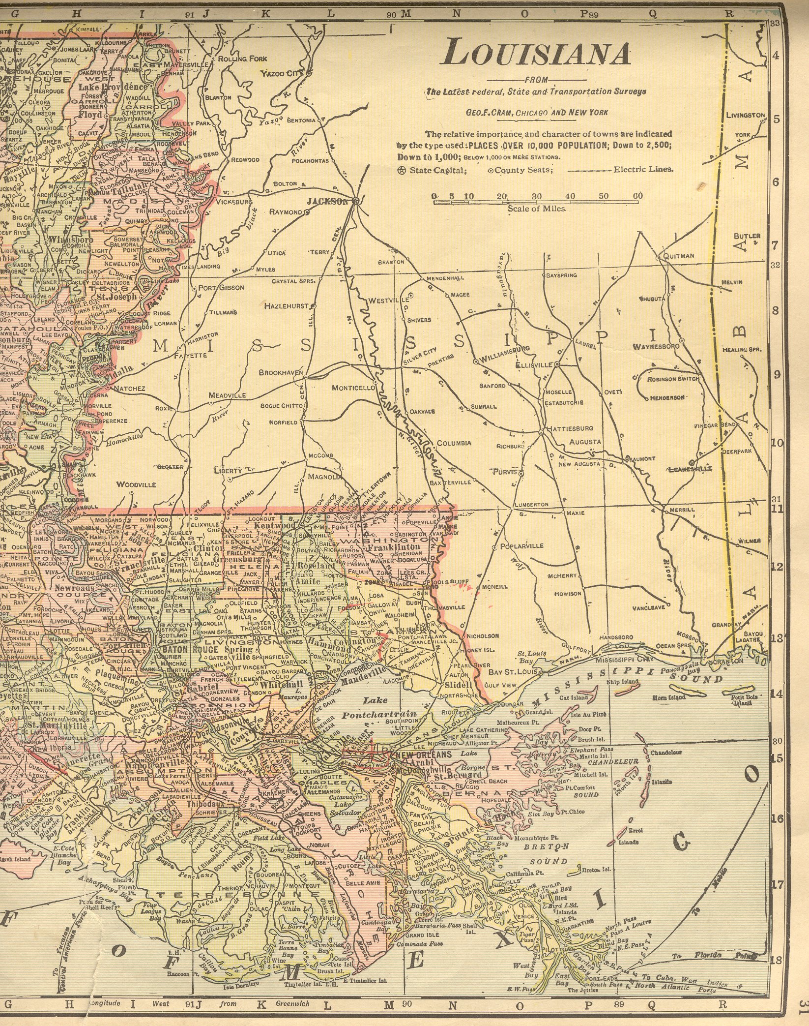
| Louisiana |
New:
Color Image of the Western
part of the state. Color Image of the Eastern
part of the state. Together, they cover the entire state. |
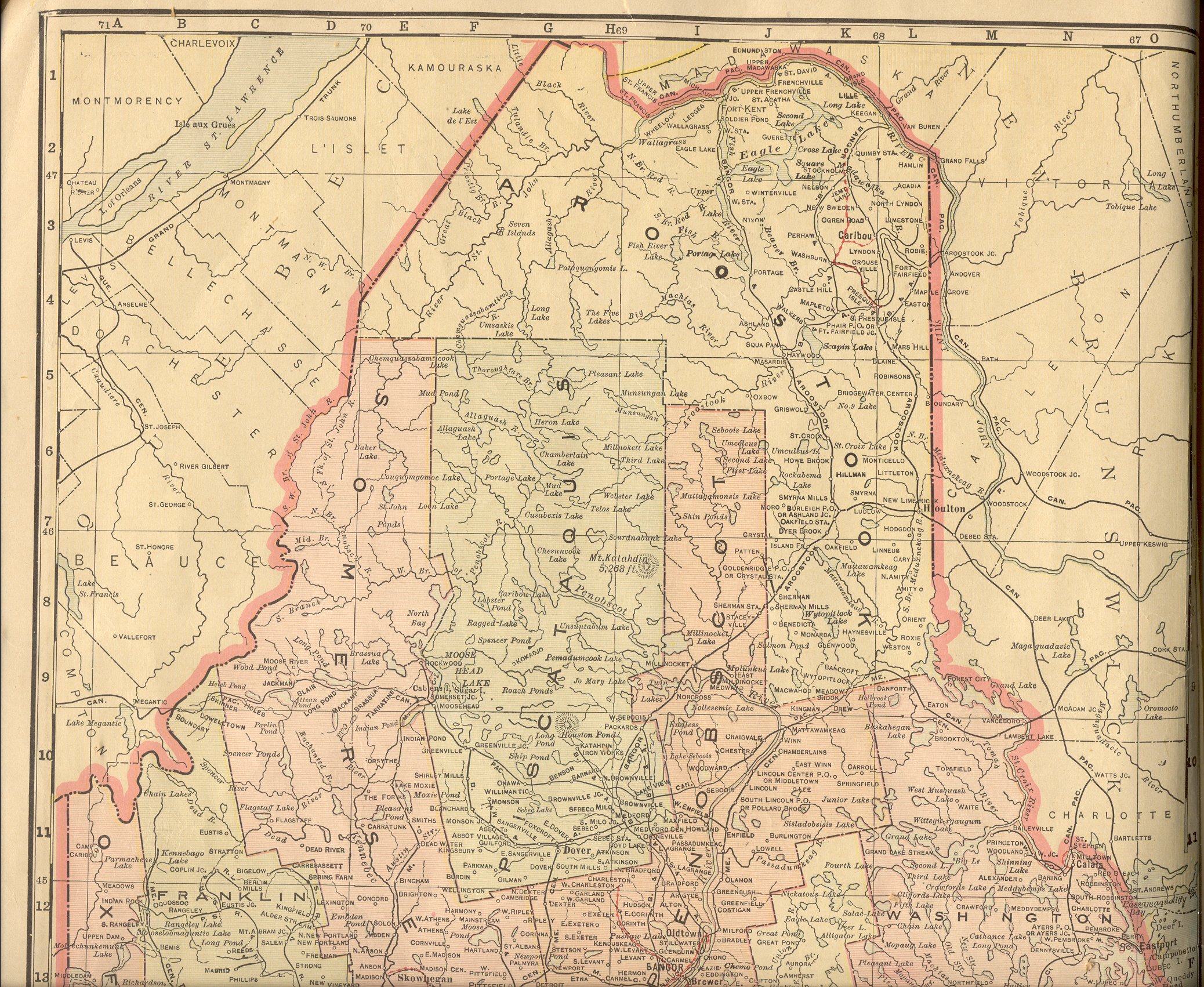
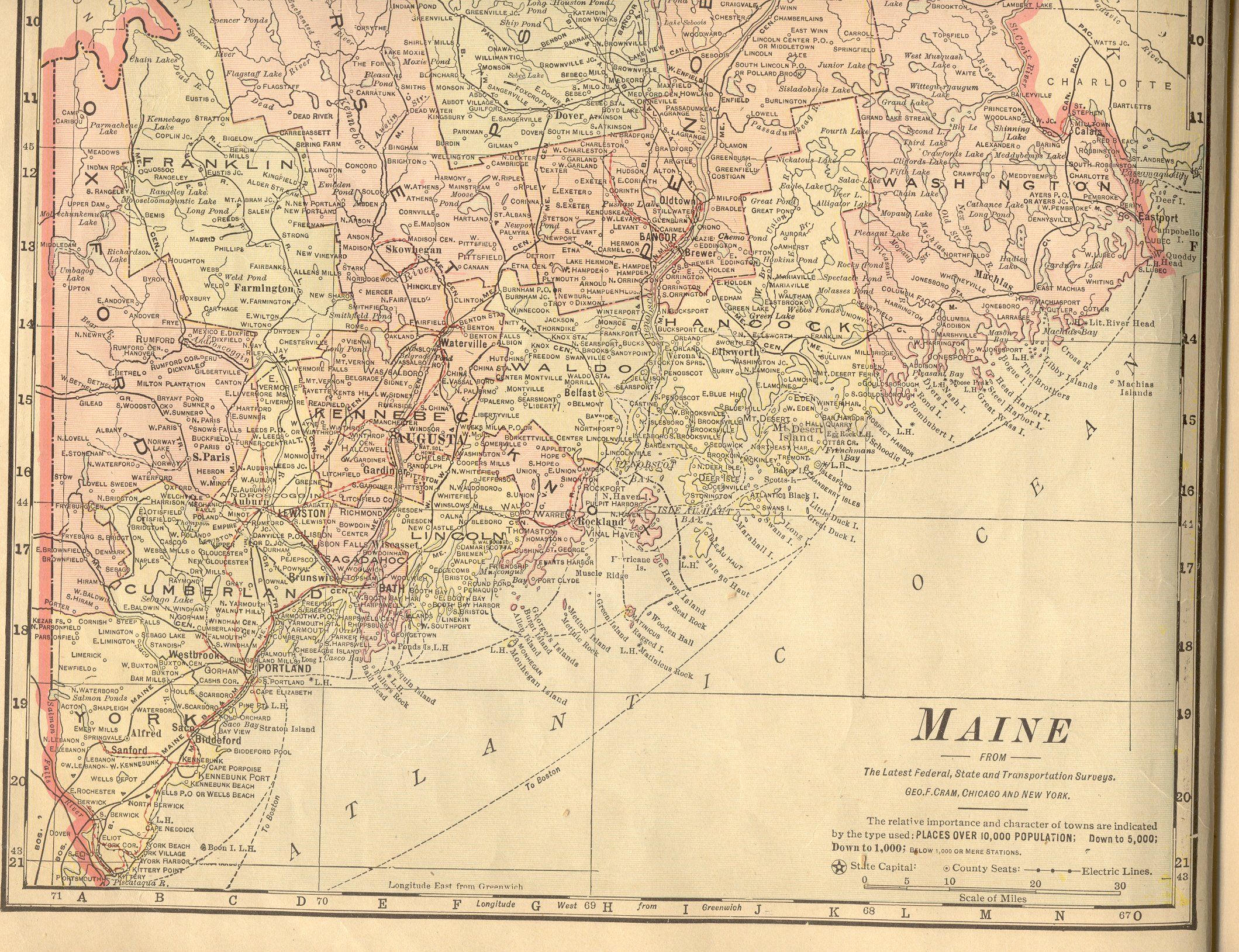
| Maine |
New:
Color Image of the Northern
part of the state. Color Image of the Southern
part of the state. Together, they cover the entire state. |
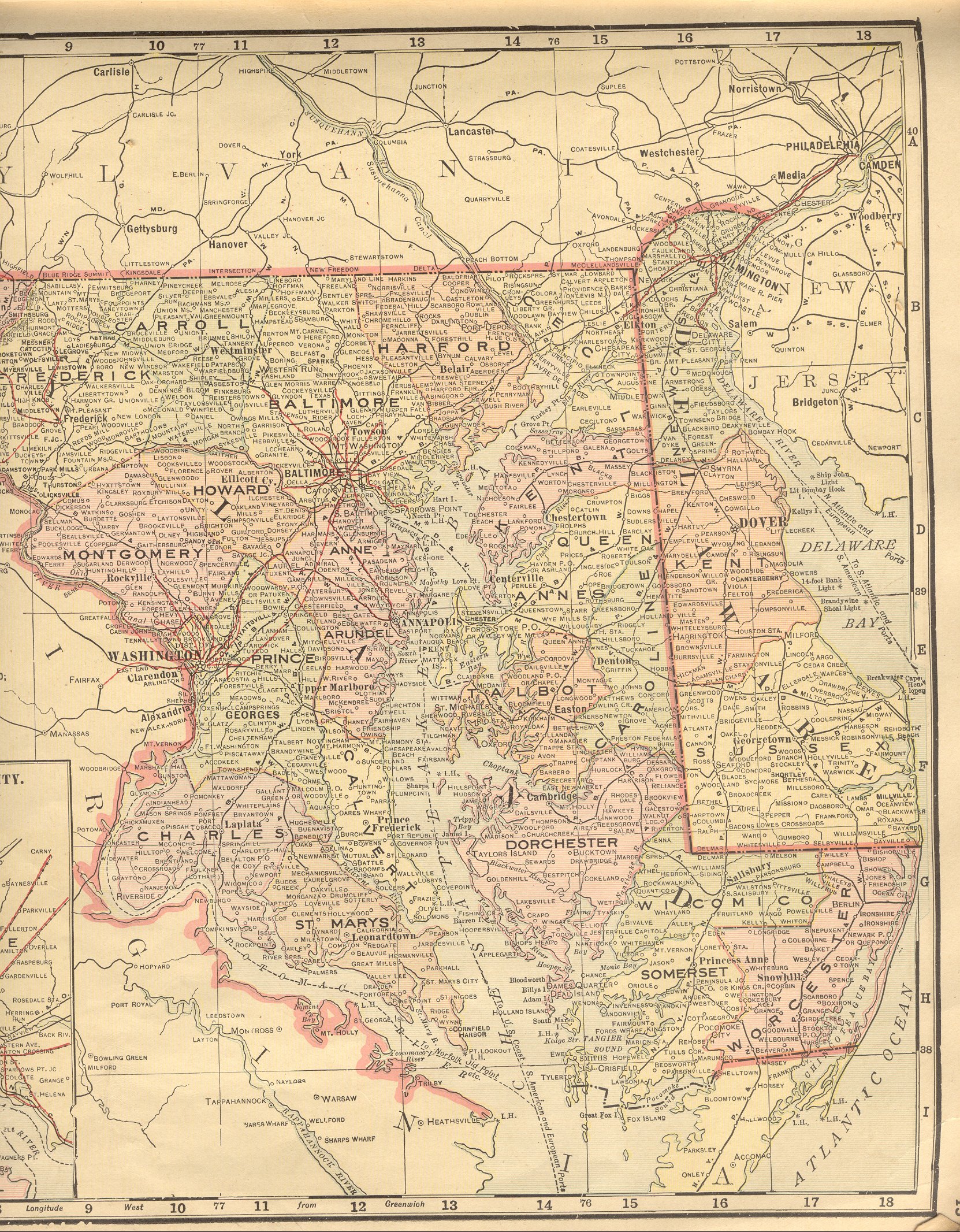
| Maryland |
New:
Color Image of the Western
part of the state. Color Image of the Eastern
part of the state. Together, they cover the entire state. |
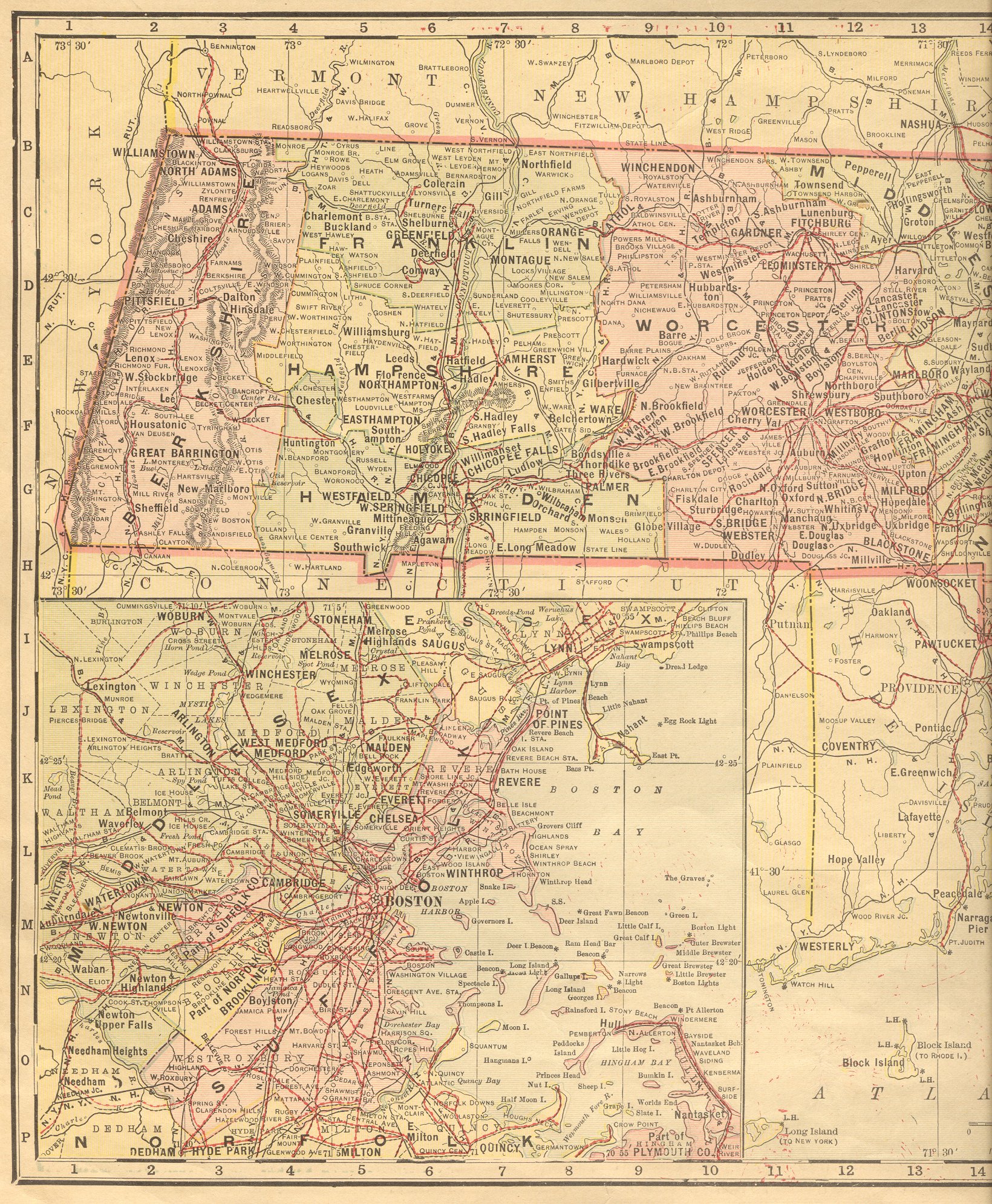
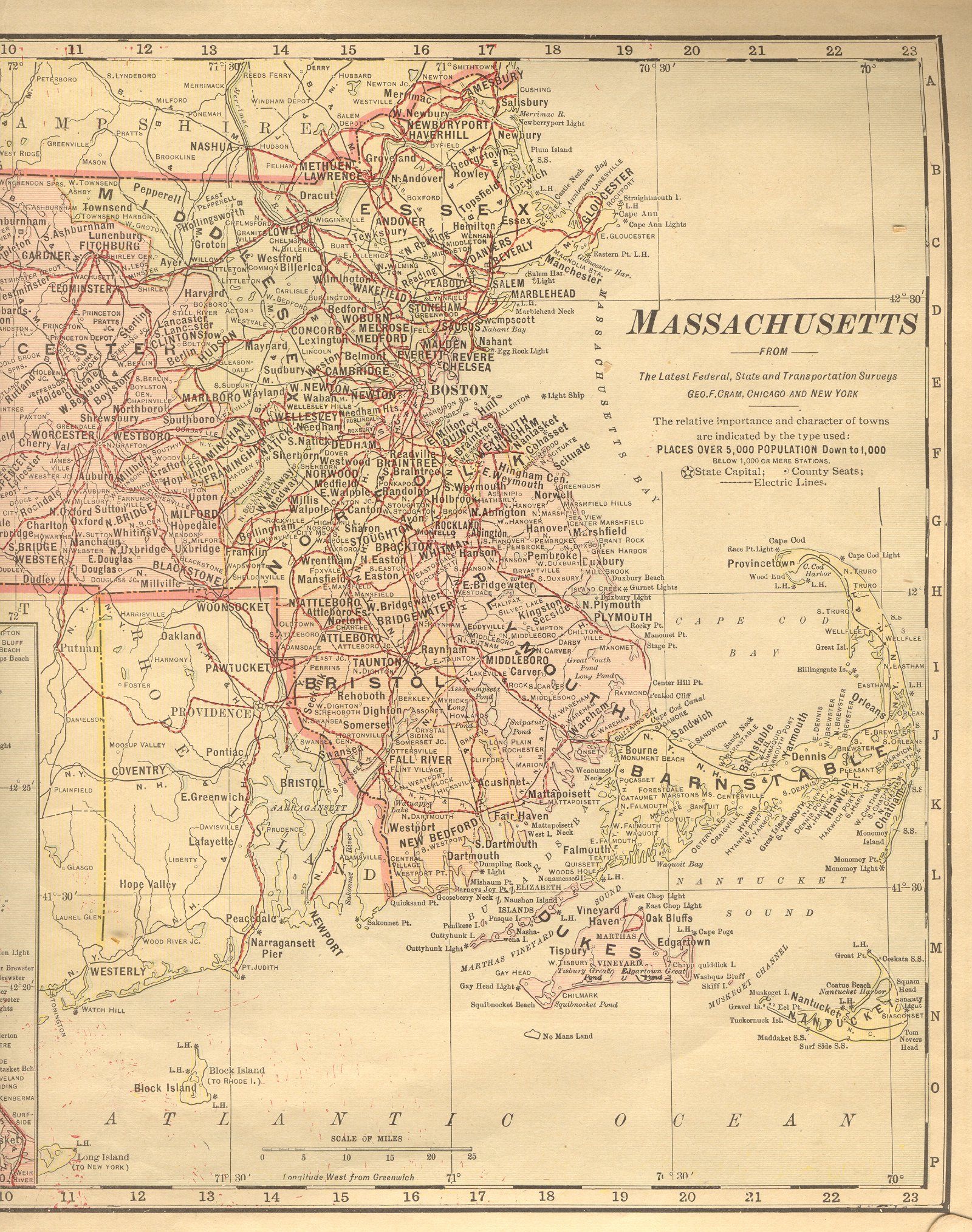
| Massachusetts |
New:
Color Image of the Western
part of the state. Color Image of the Eastern
part of the state. Together, they cover the entire state. |
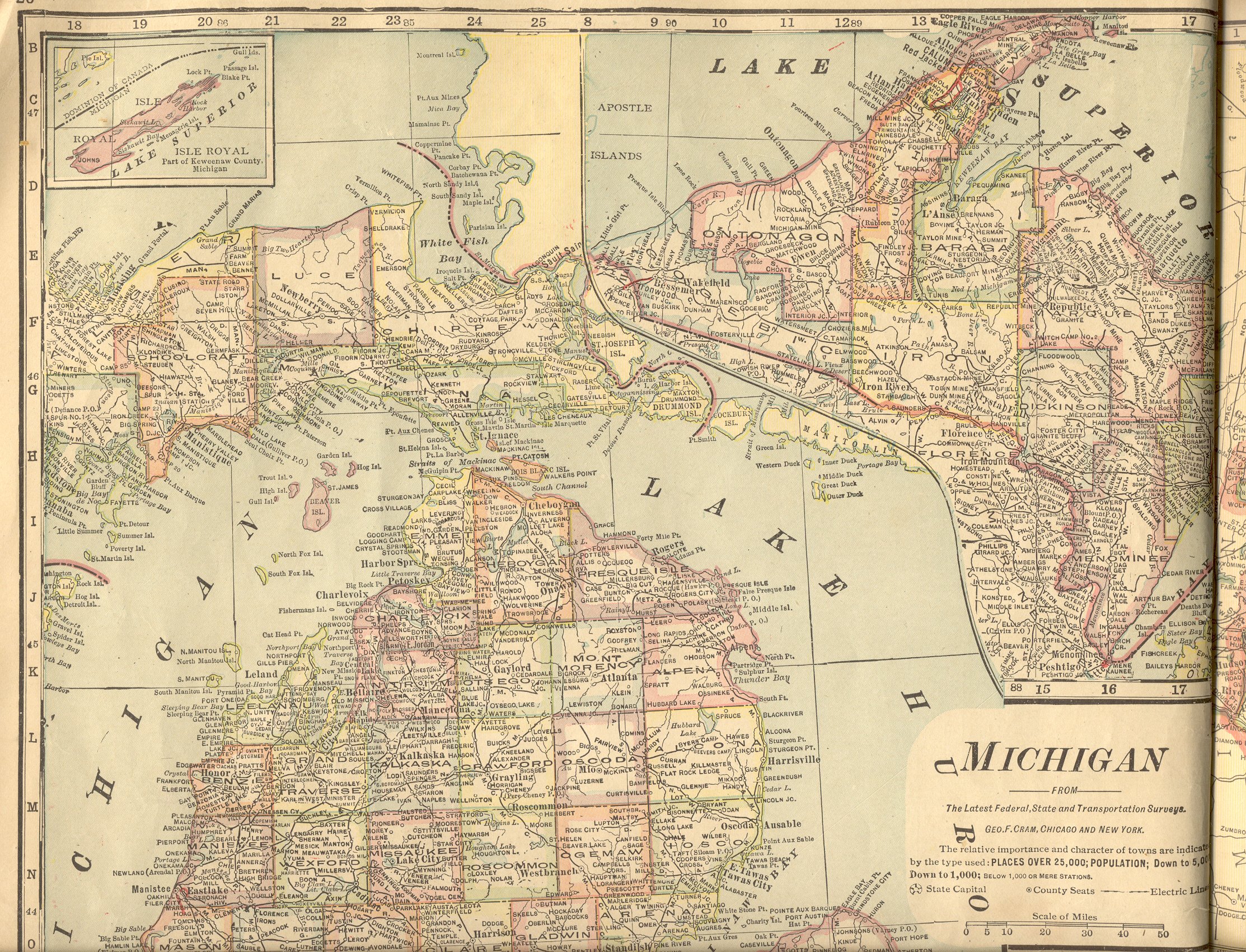
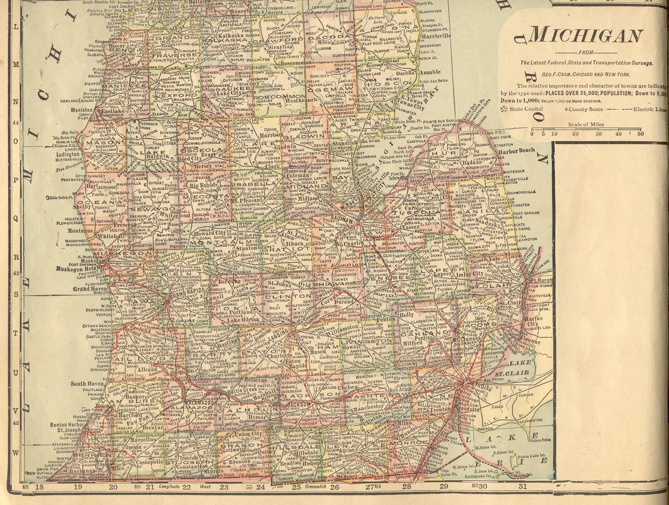
| Michigan |
New:
Color Image of the Northern part of the
state. Color Image of the Southern
part of the state. Together, they cover the entire state. |
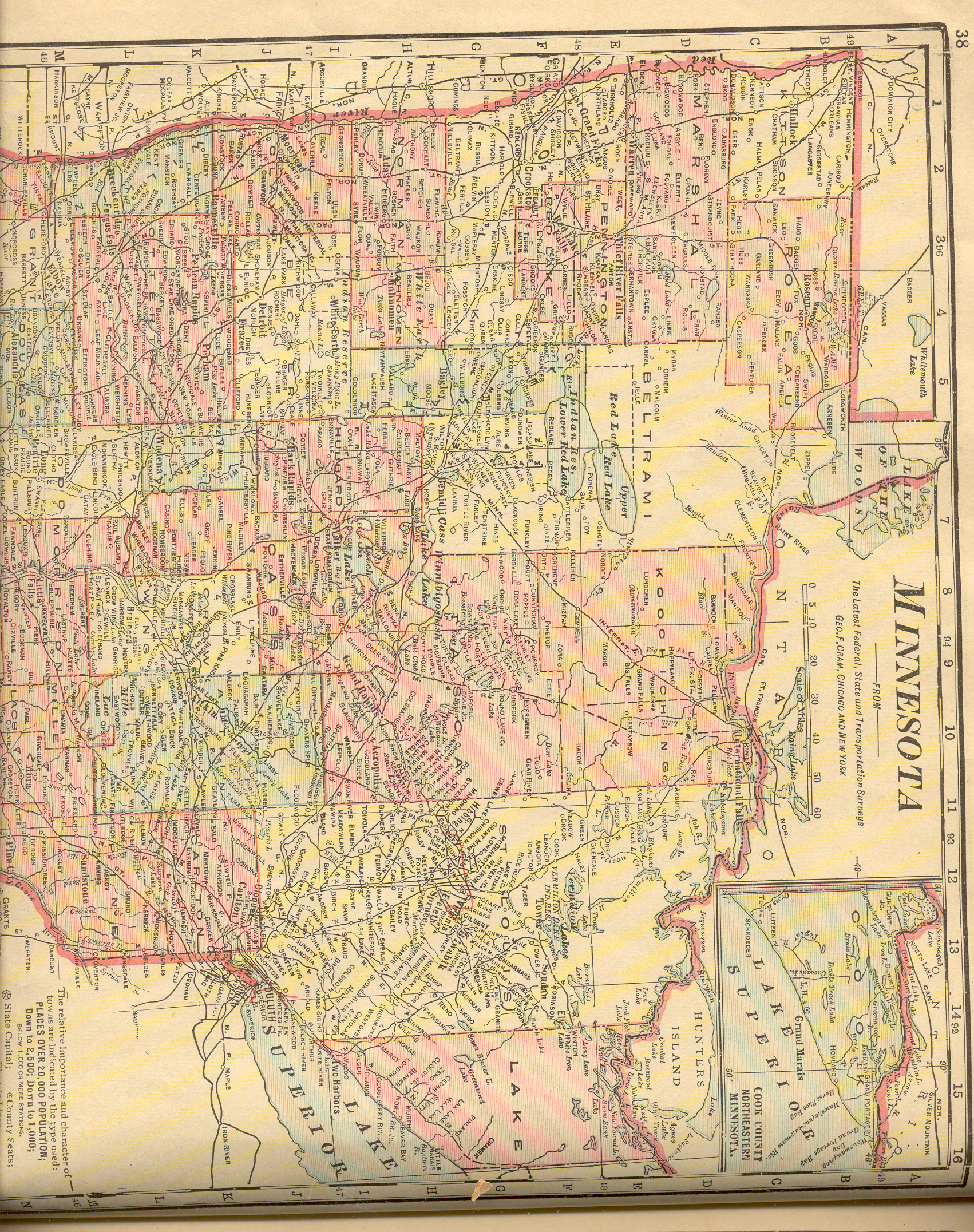
| Minnesota |
New:
Color Image of the Northern part of the
state. Color Image of the Southern
part of the state. Together, they cover the entire state. |
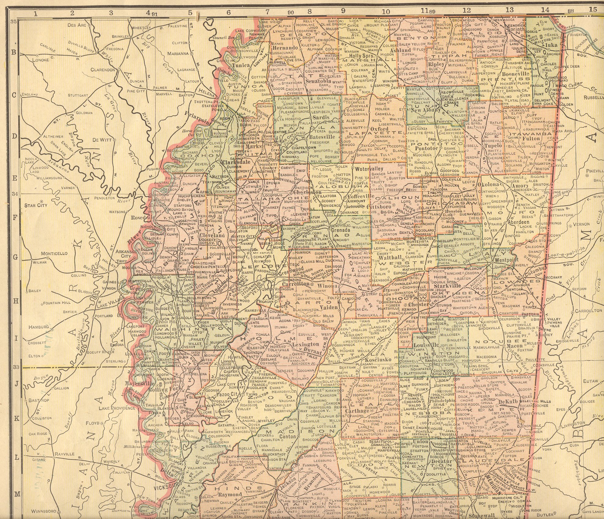
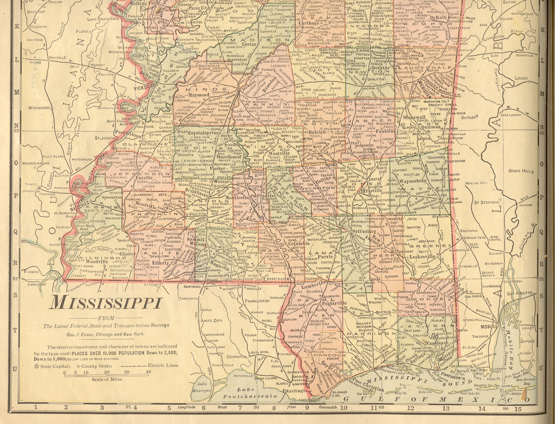
| Mississippi |
New:
Color Image of the Northern
part of the state. Color Image of the Southern
part of the state. Together, they cover the entire state. |
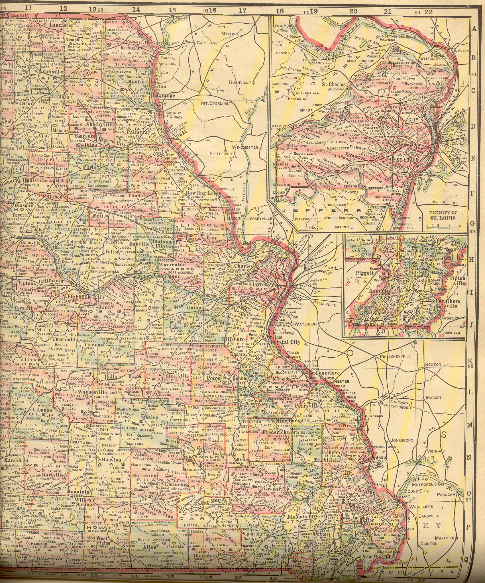
| Missouri |
New:
Color Image of the Western
part of the state. Color Image of the Eastern
part of the state. Together, they cover the entire state. |
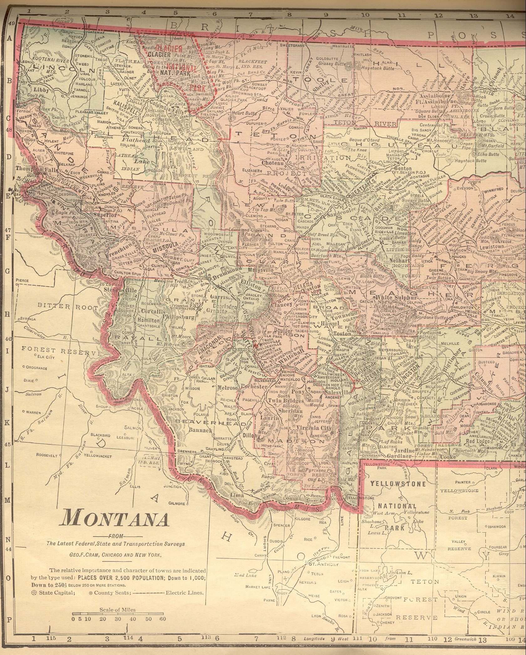
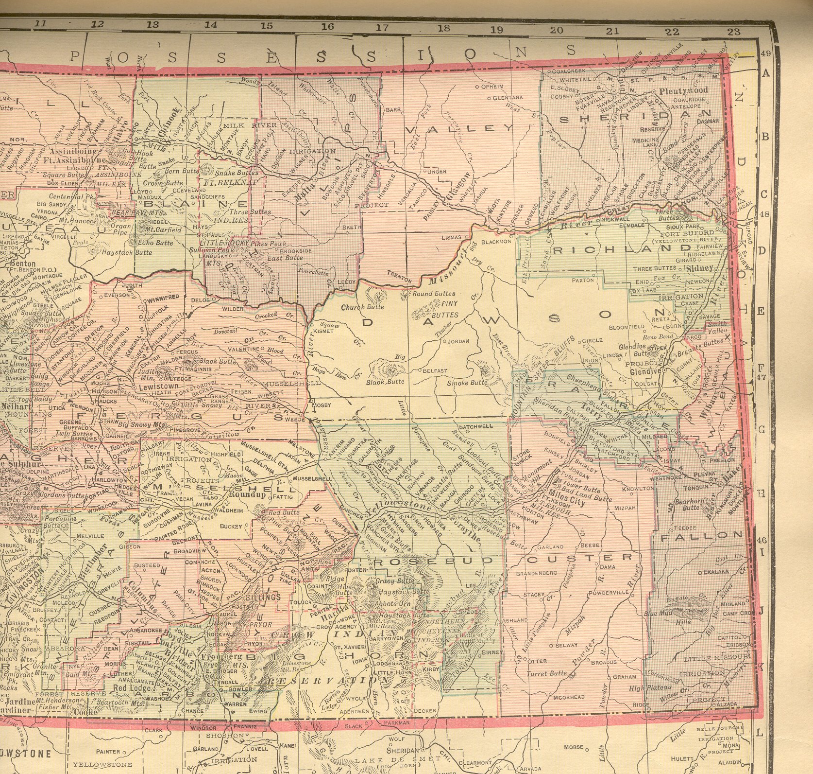
| Montana |
New:
Color Image of the Western
part of the state. Color Image of the Eastern
part of the state. Together, they cover the entire state. |
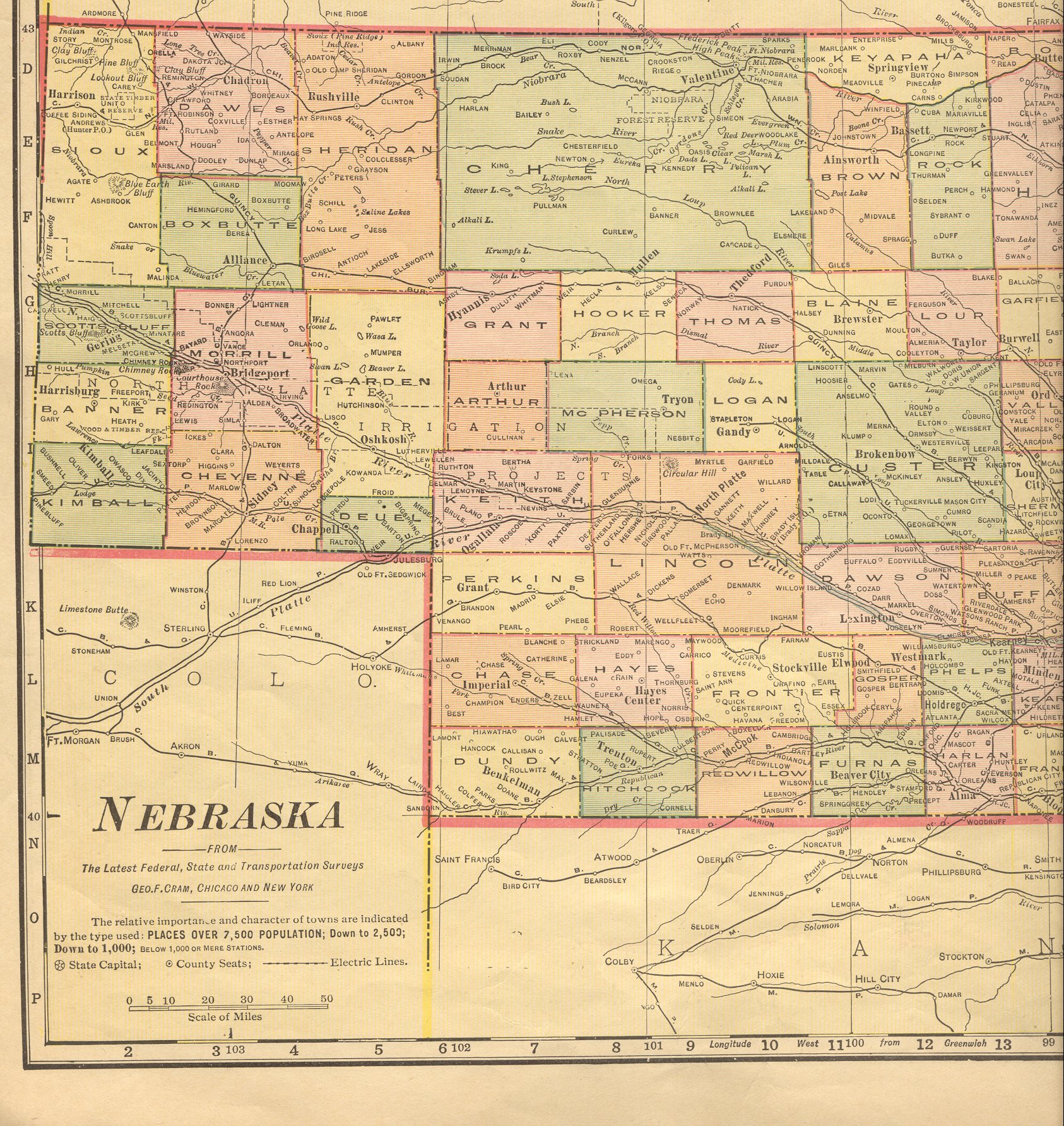
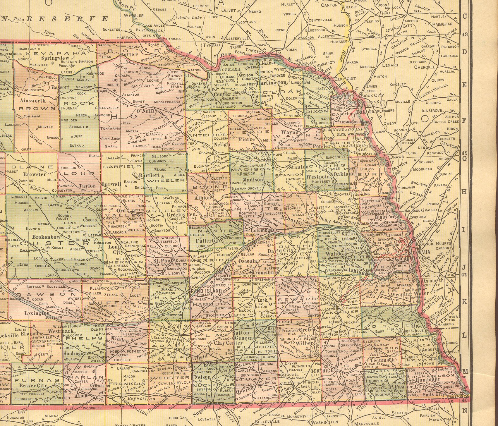
| Nebraska |
New:
Color Image of the Western
part of the state. Color Image of the Eastern
part of the state. Together, they cover the entire state. |
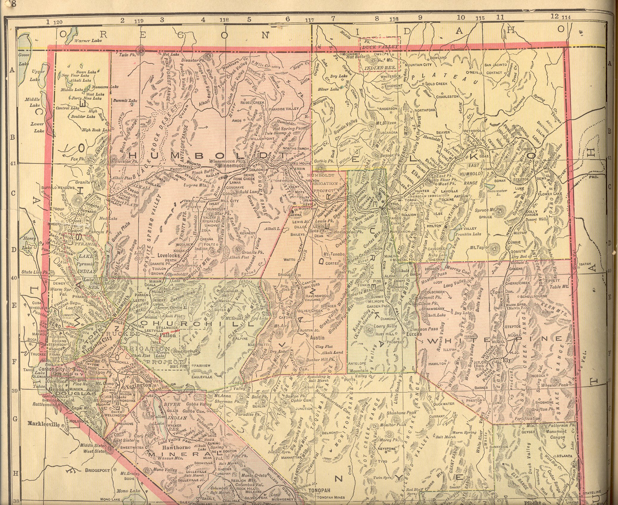
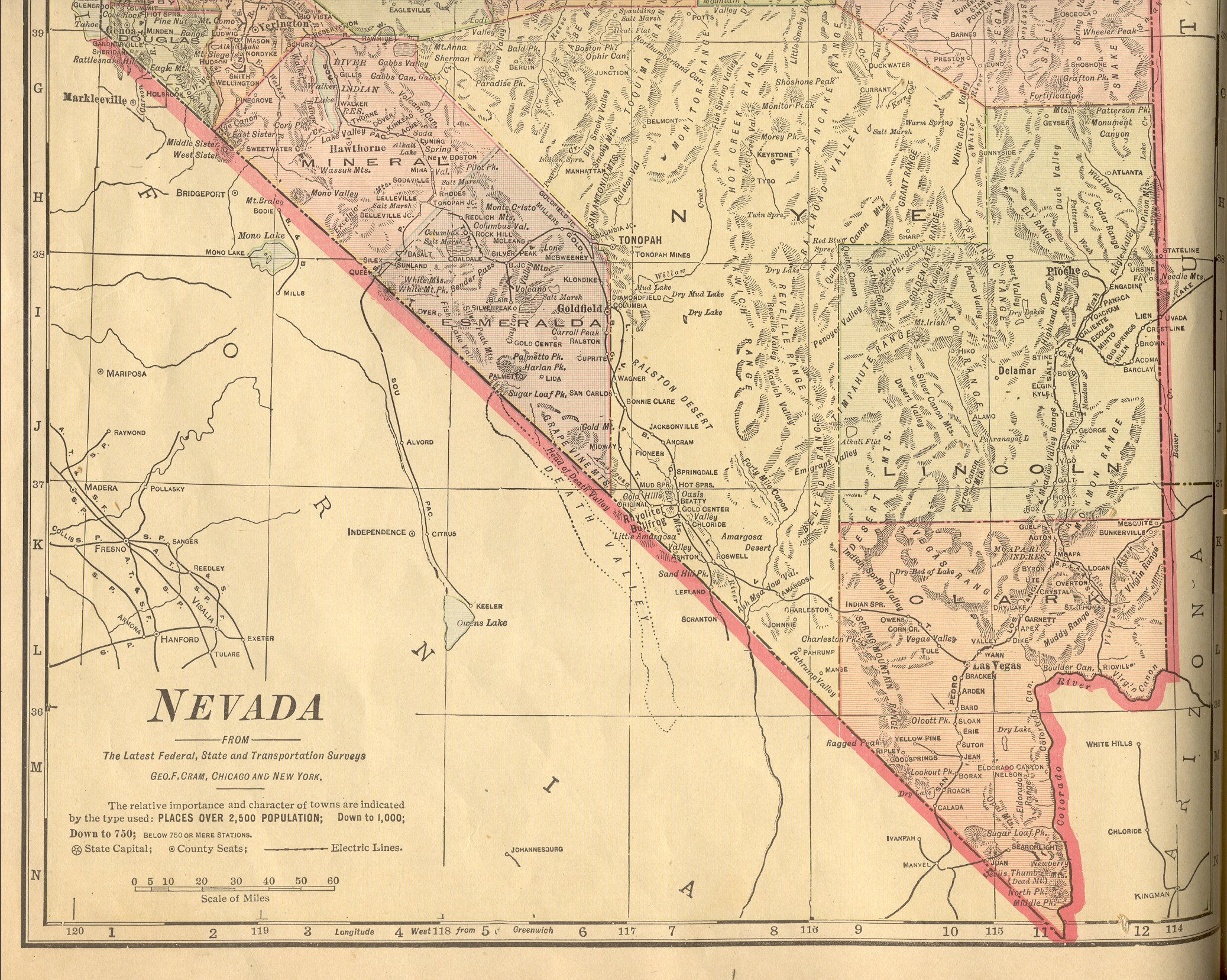
| Nevada |
New:
Color Image of the Northern
part of the state. Color Image of the Southern
part of the state. Together, they cover the entire state. |
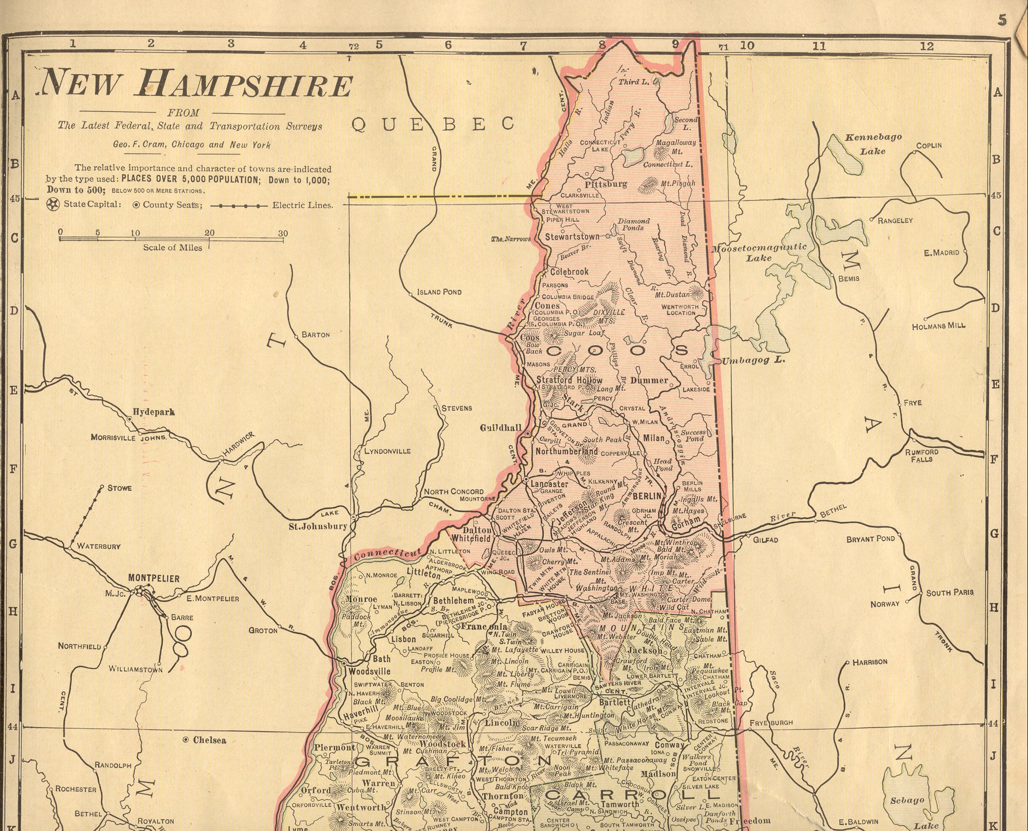
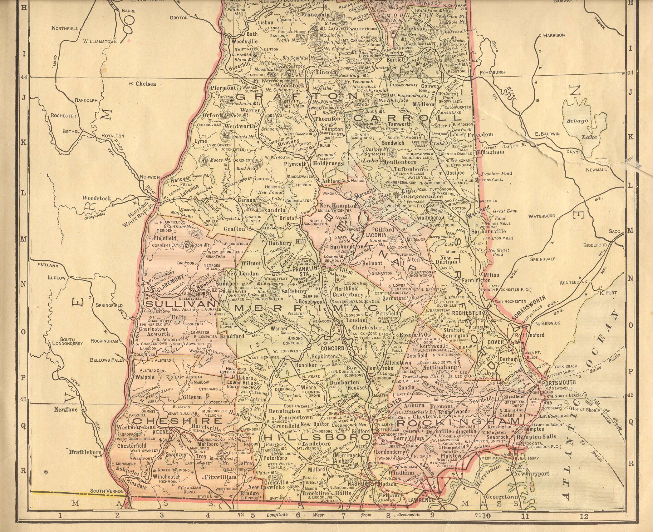
| New Hampshire |
New:
Color Image of the Northern
part of the state. Color Image of the Southern
part of the state. Together, they cover the entire state. |
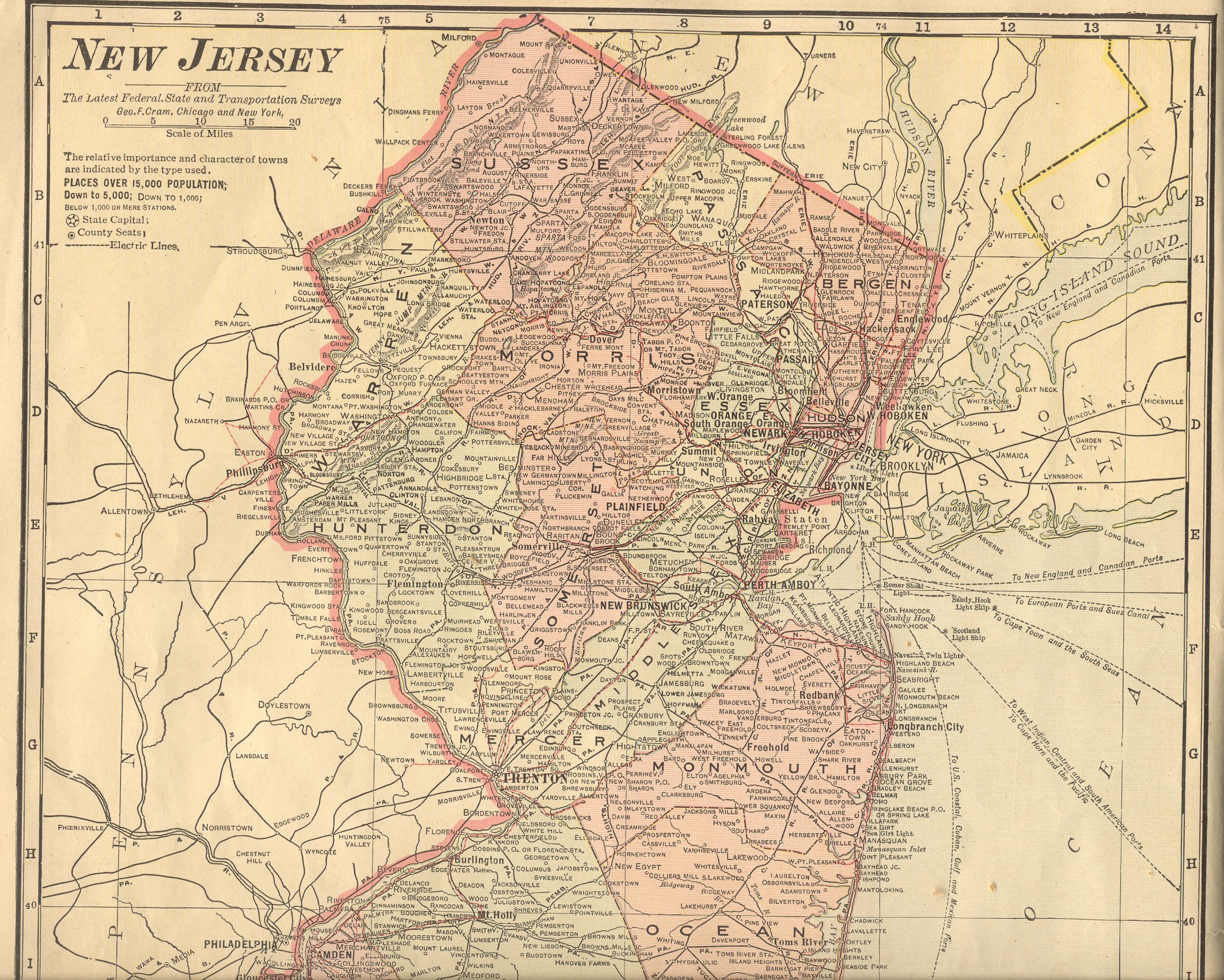
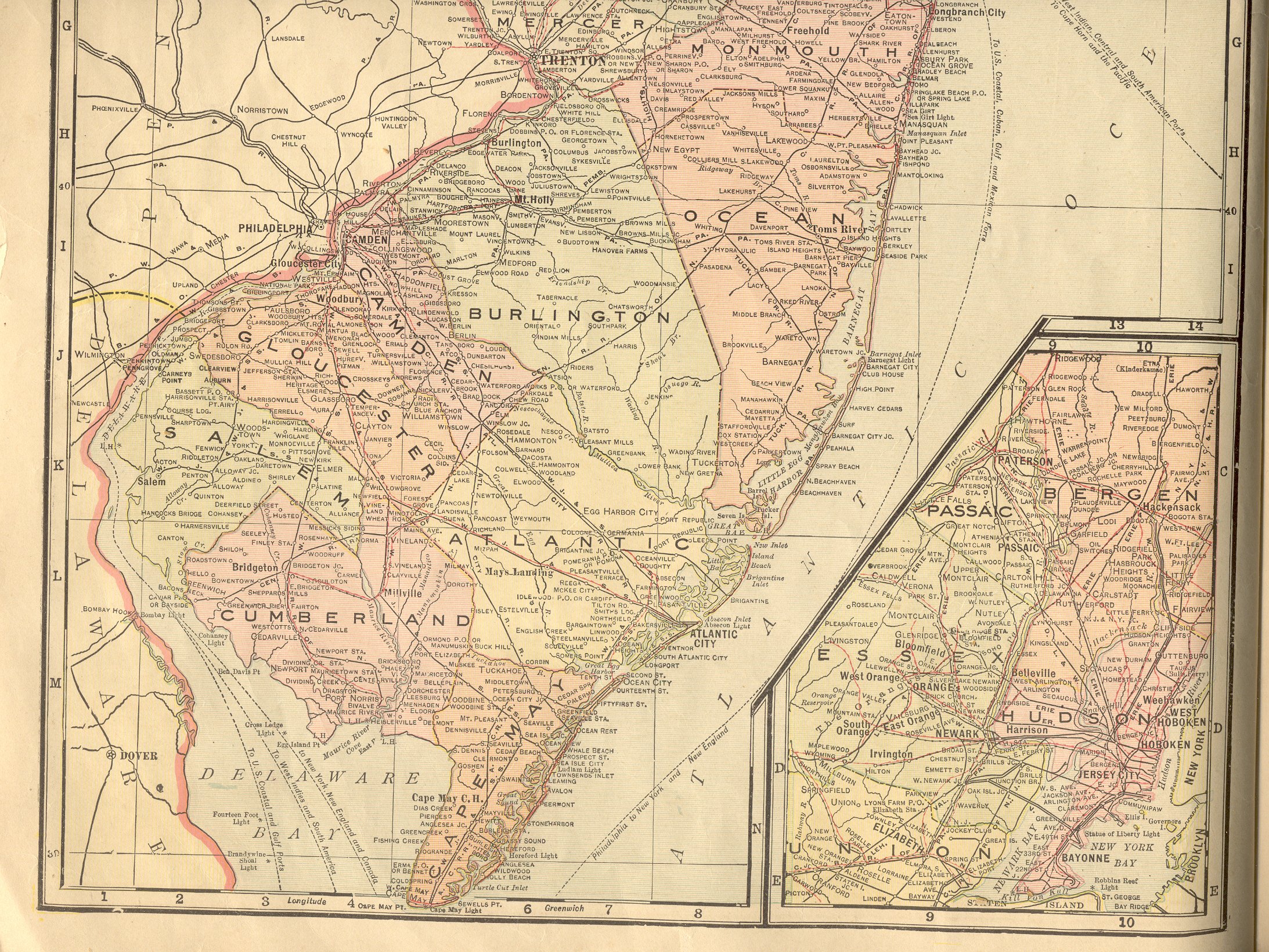
| New Jersey |
New:
Color Image of the Northern
part of the state. Color Image of the Southern
part of the state. Together, they cover the entire state. |
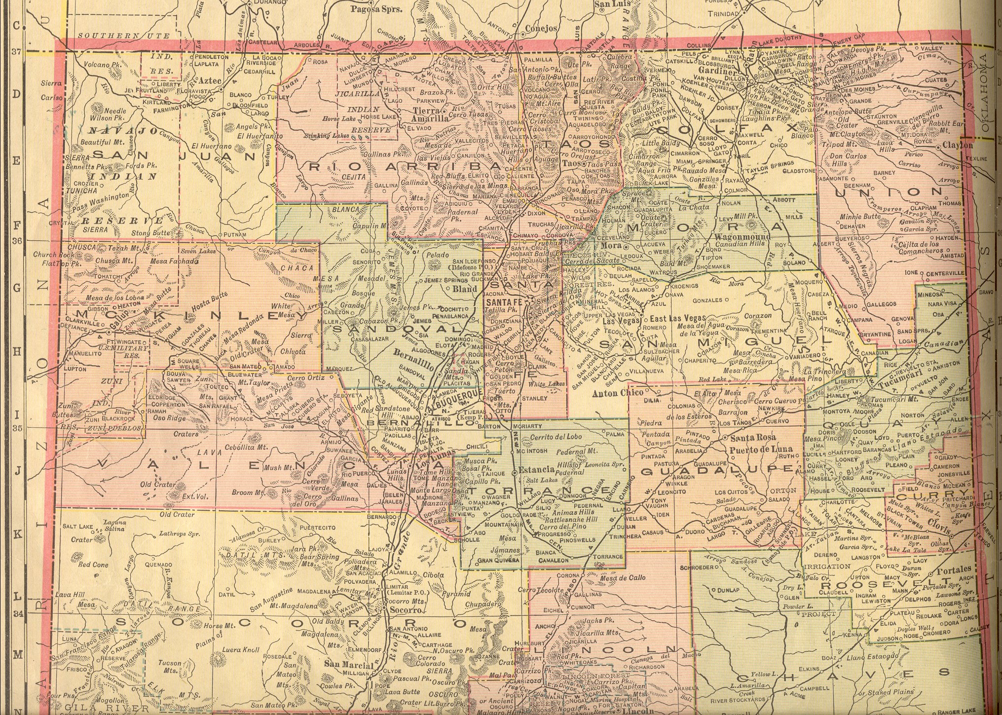
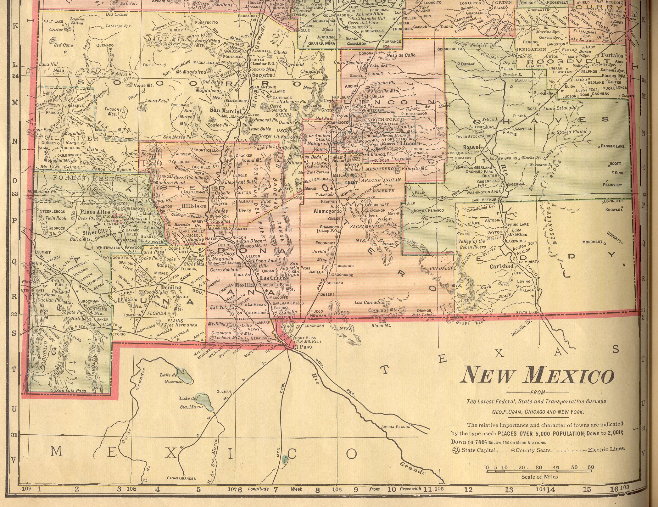
| New Mexico |
New:
Color Image of the Northern
part of the state. Color Image of the Southern
part of the state. Together, they cover the entire state. |
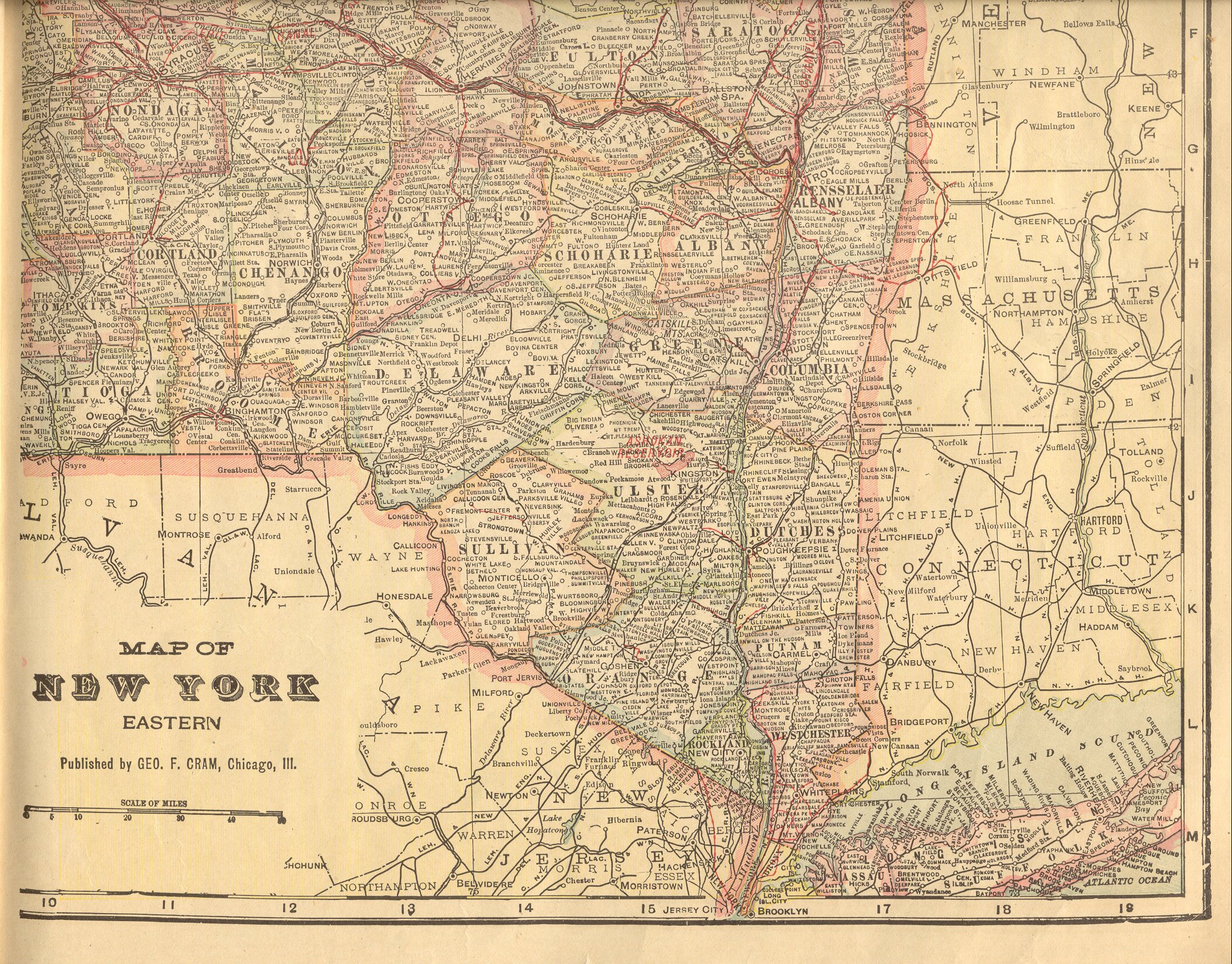
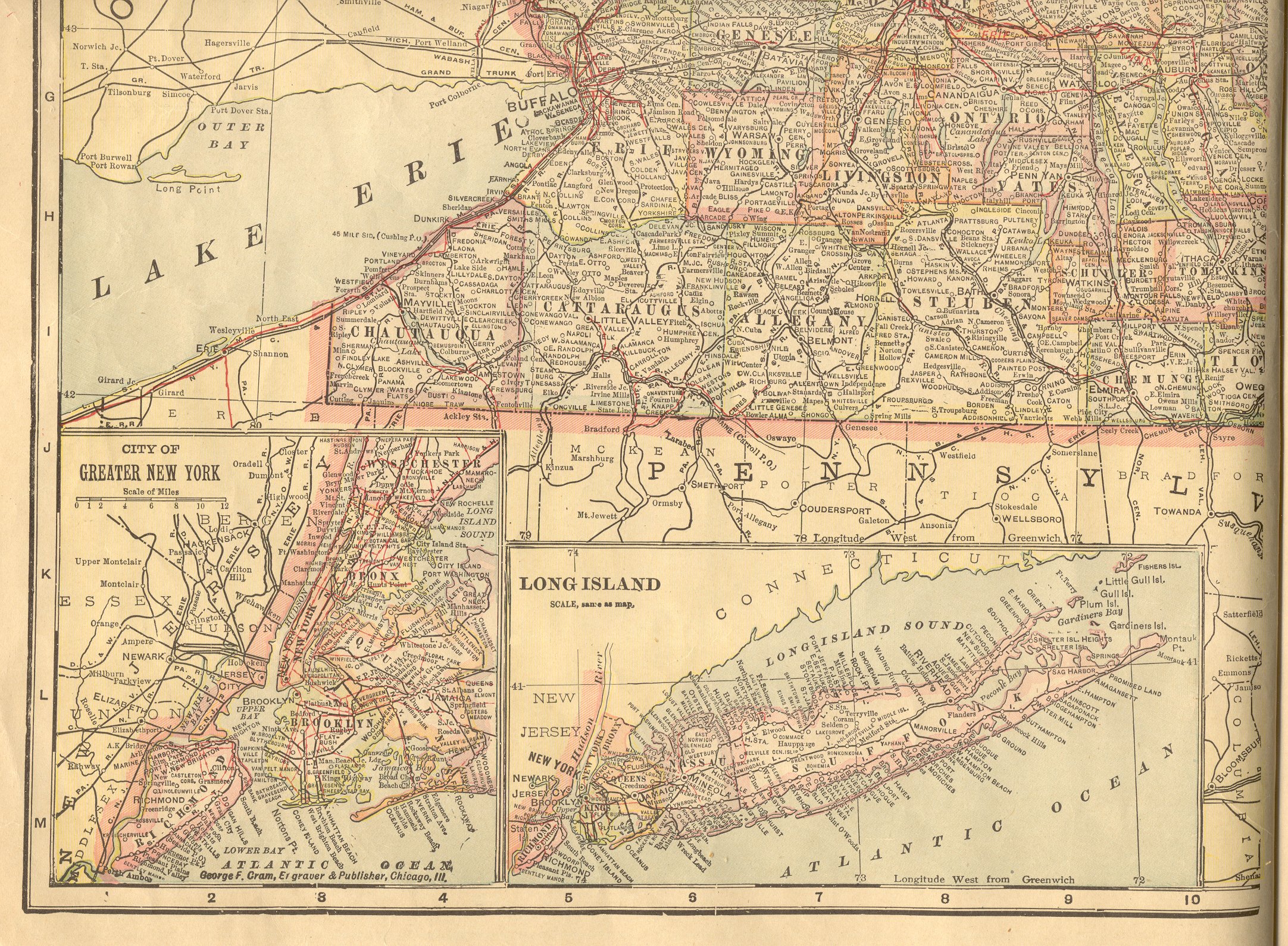
| New York |
New:
Color Image of the Northeastern
part of the state. Color Image of the Southeastern
part of the state. Color Image of the Northwestern
part of the state. Color Image of the Southwestern
part of the state. Together, they cover the entire state. |
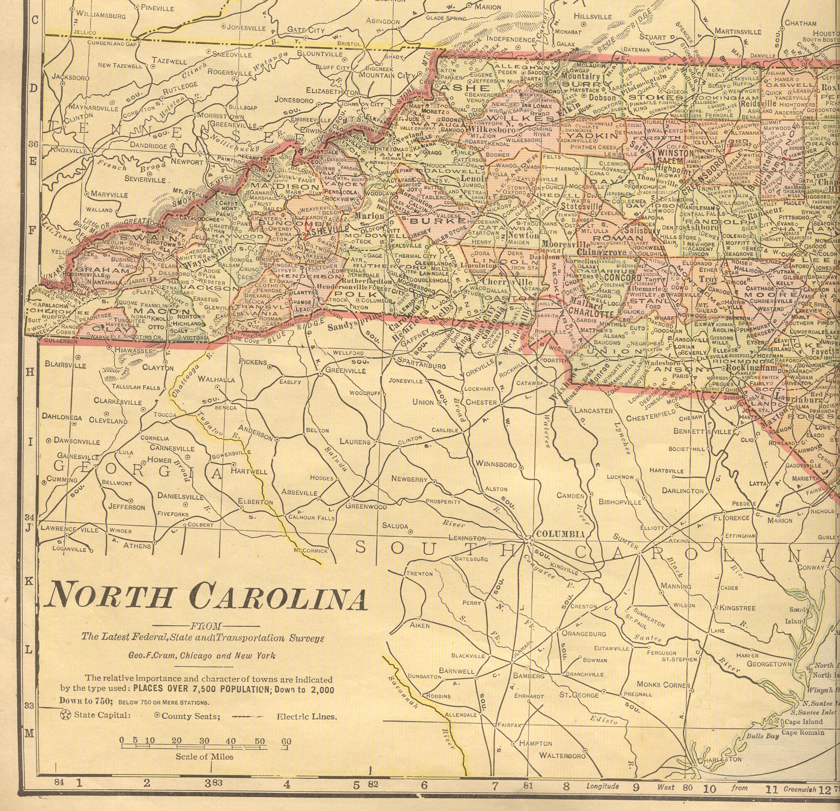
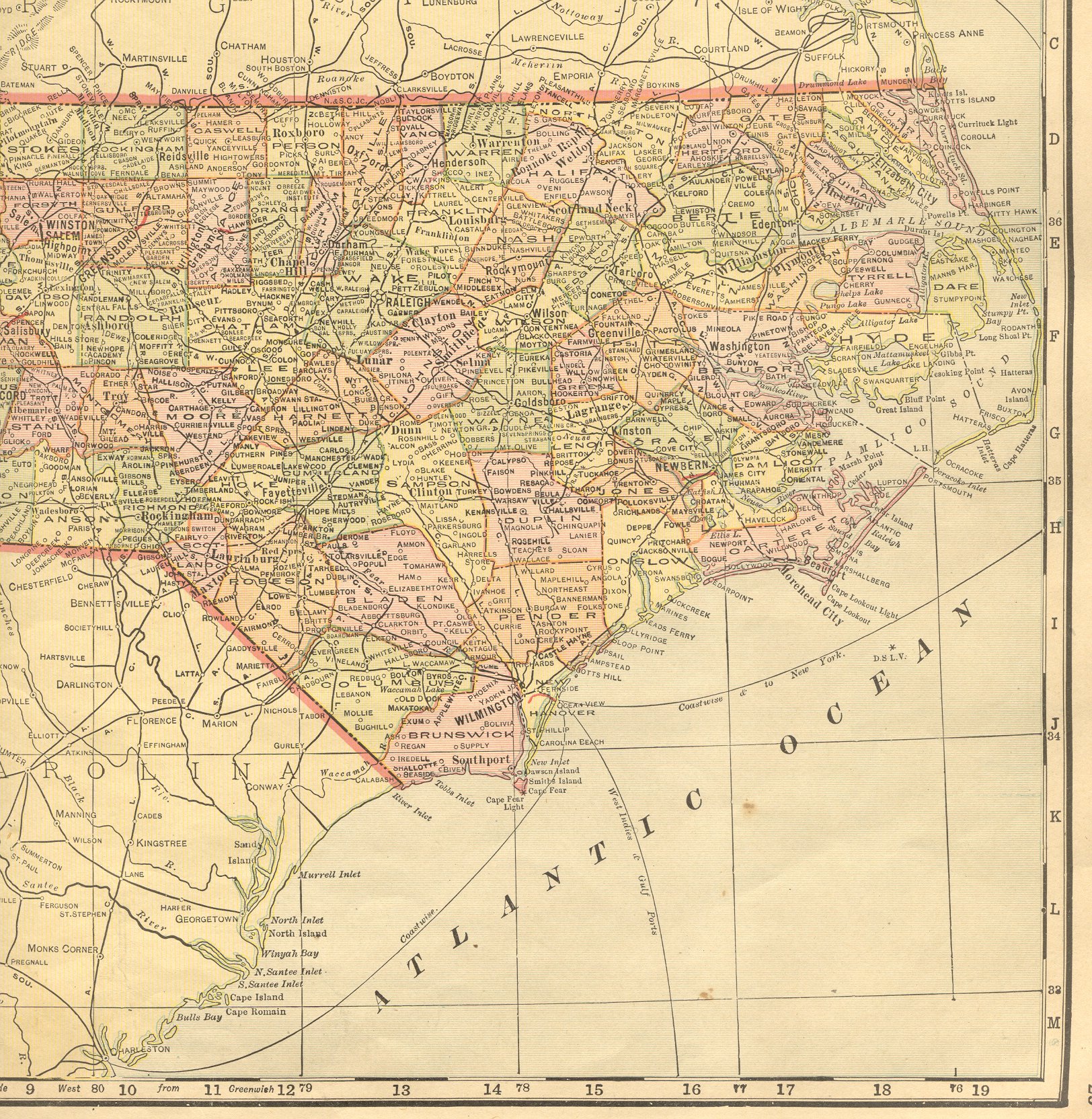
| North Carolina |
New:
Color Image of the Western
part of the state. Color Image of the Eastern
part of the state. Together, they cover the entire state. |
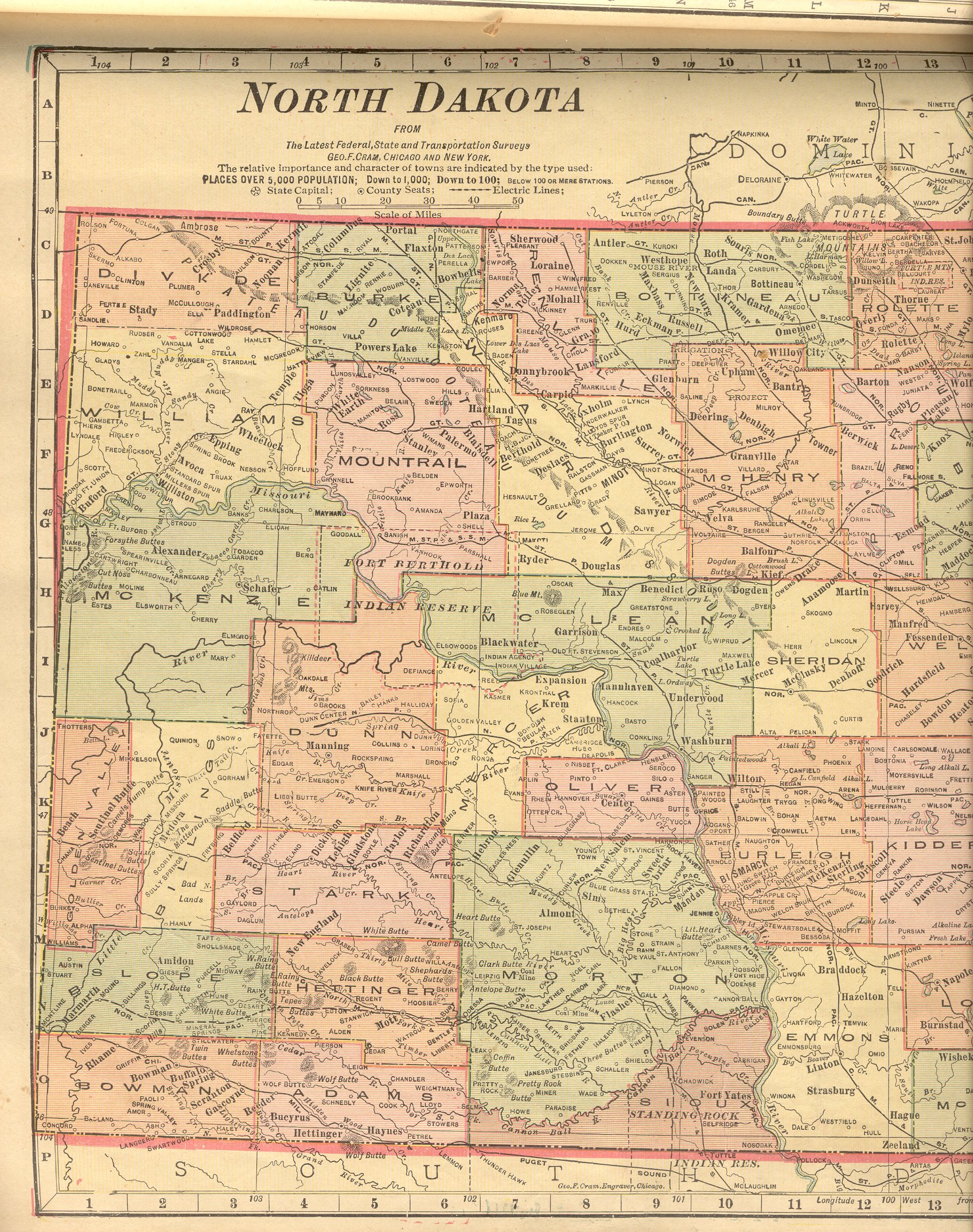
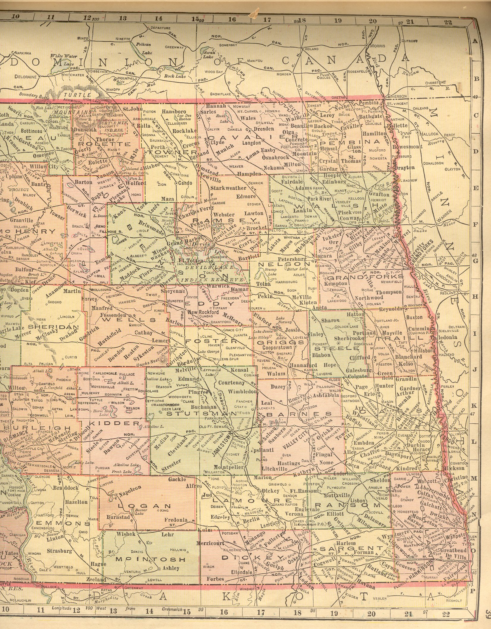
| North Dakota |
New:
Color Image of the Western
part of the state. Color Image of the Eastern
part of the state. Together, they cover the entire state. |
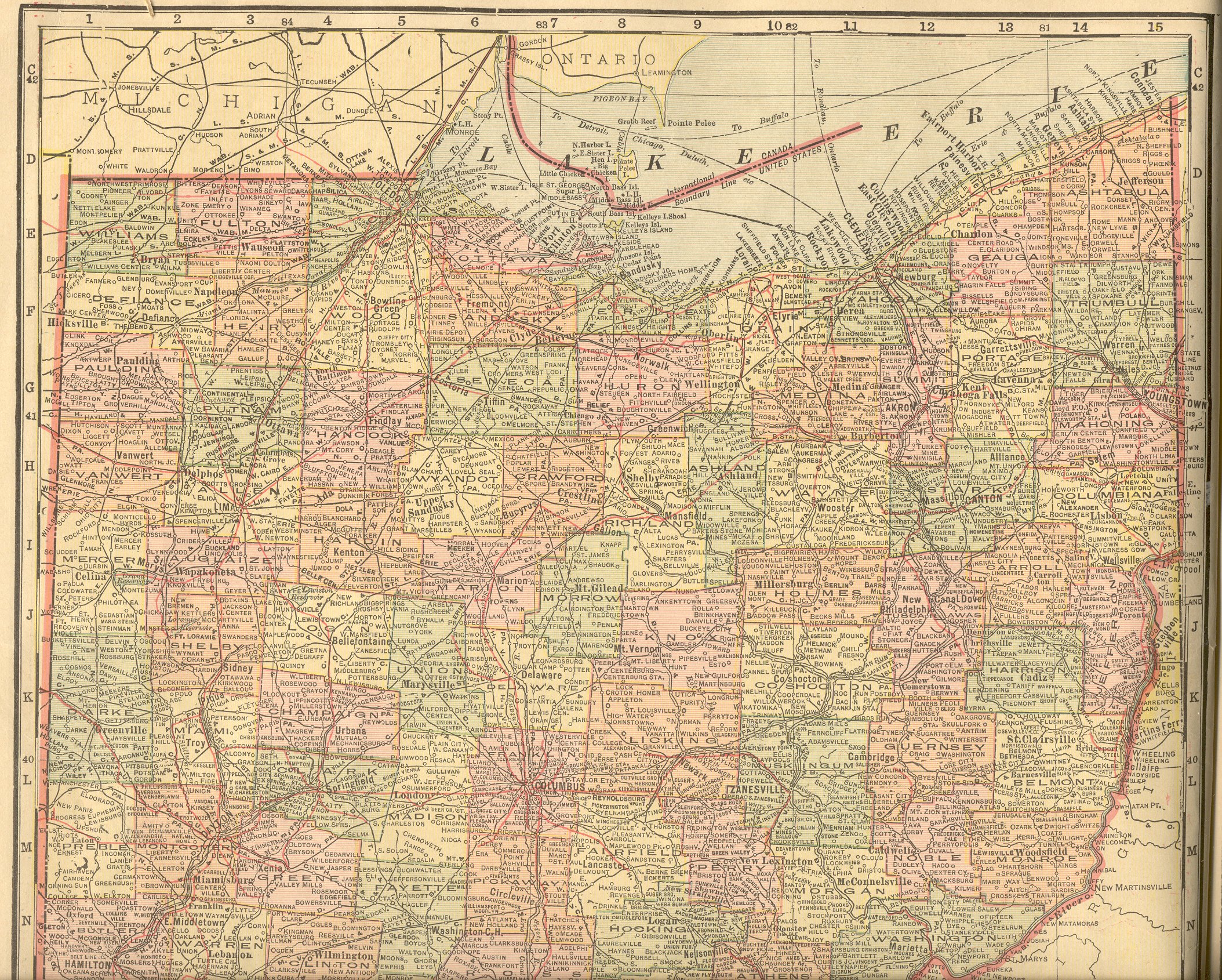
| Ohio |
New:
Color Image of the Northern
part of the state. Color Image of the Southern
part of the state. Together, they cover the entire state. |
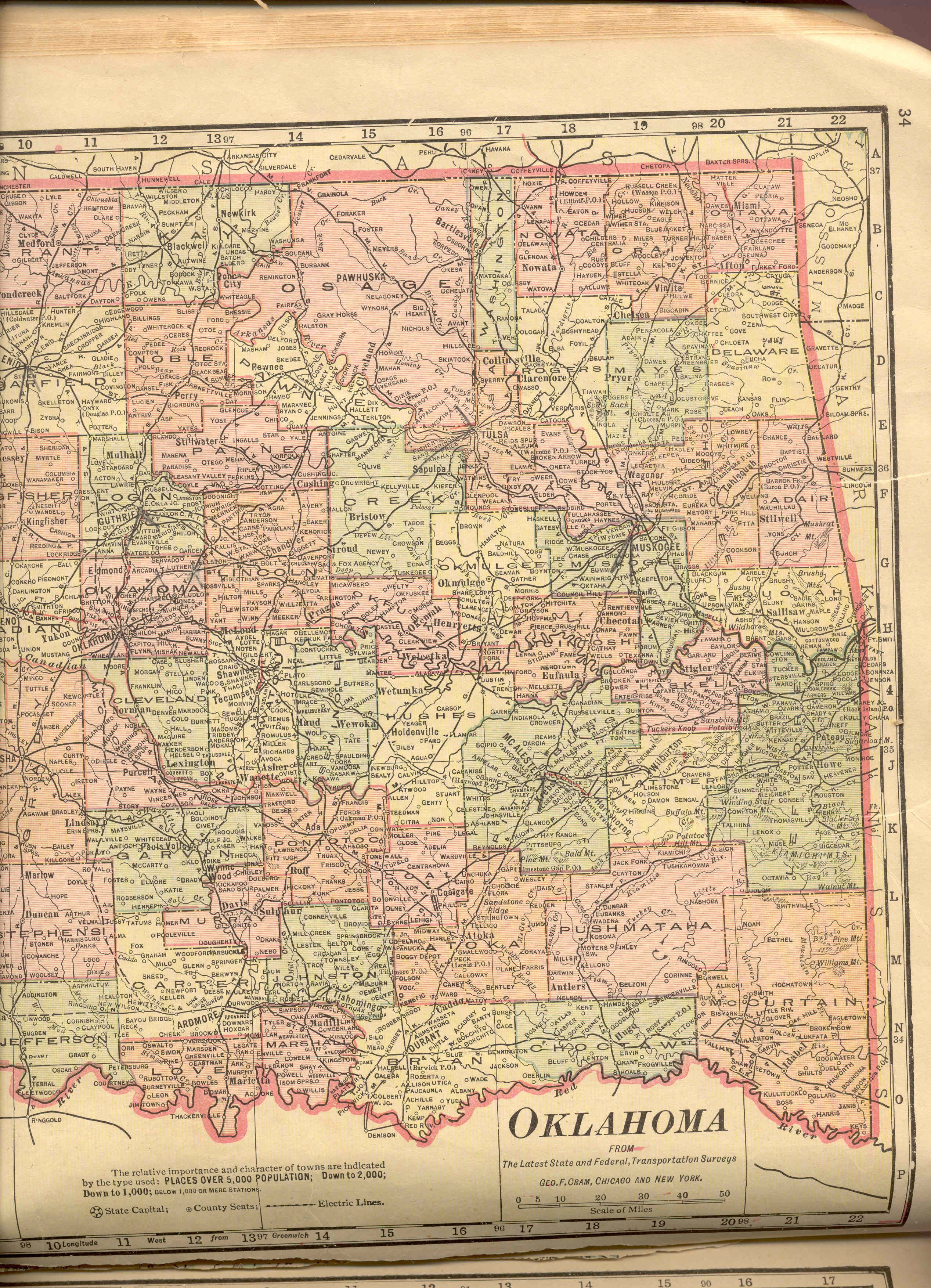
| Oklahoma |
Color Image of the Western
part of the state. Color Image of the Eastern
part of the state. Together, they cover the entire state. |
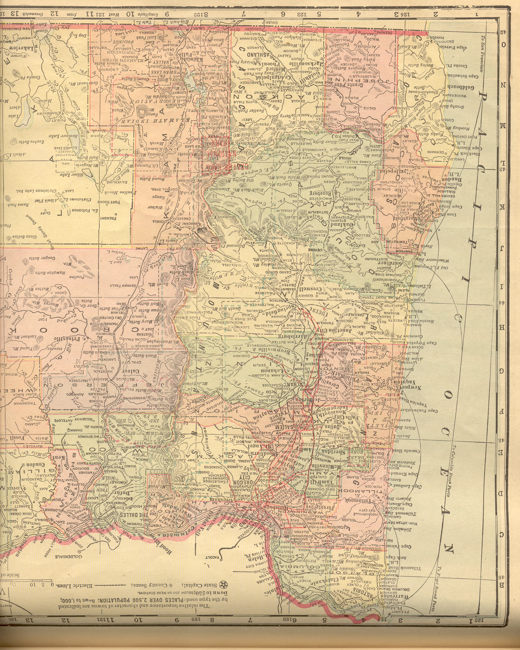
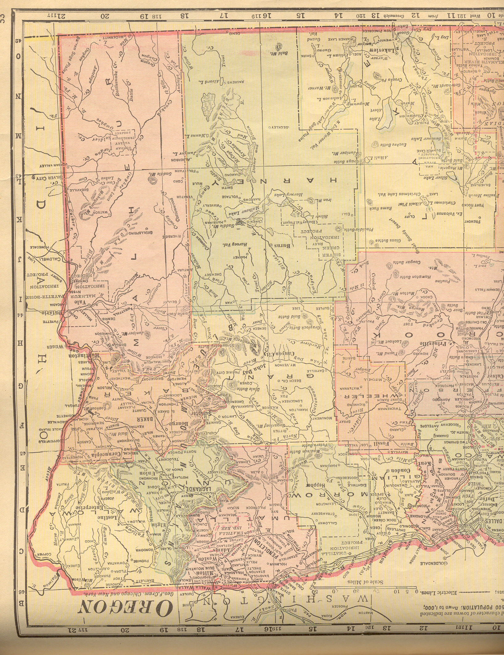
| Oregon |
New:
Color Image of the Western
part of the state. Color Image of the Eastern
part of the state. Together, they cover the entire state. |
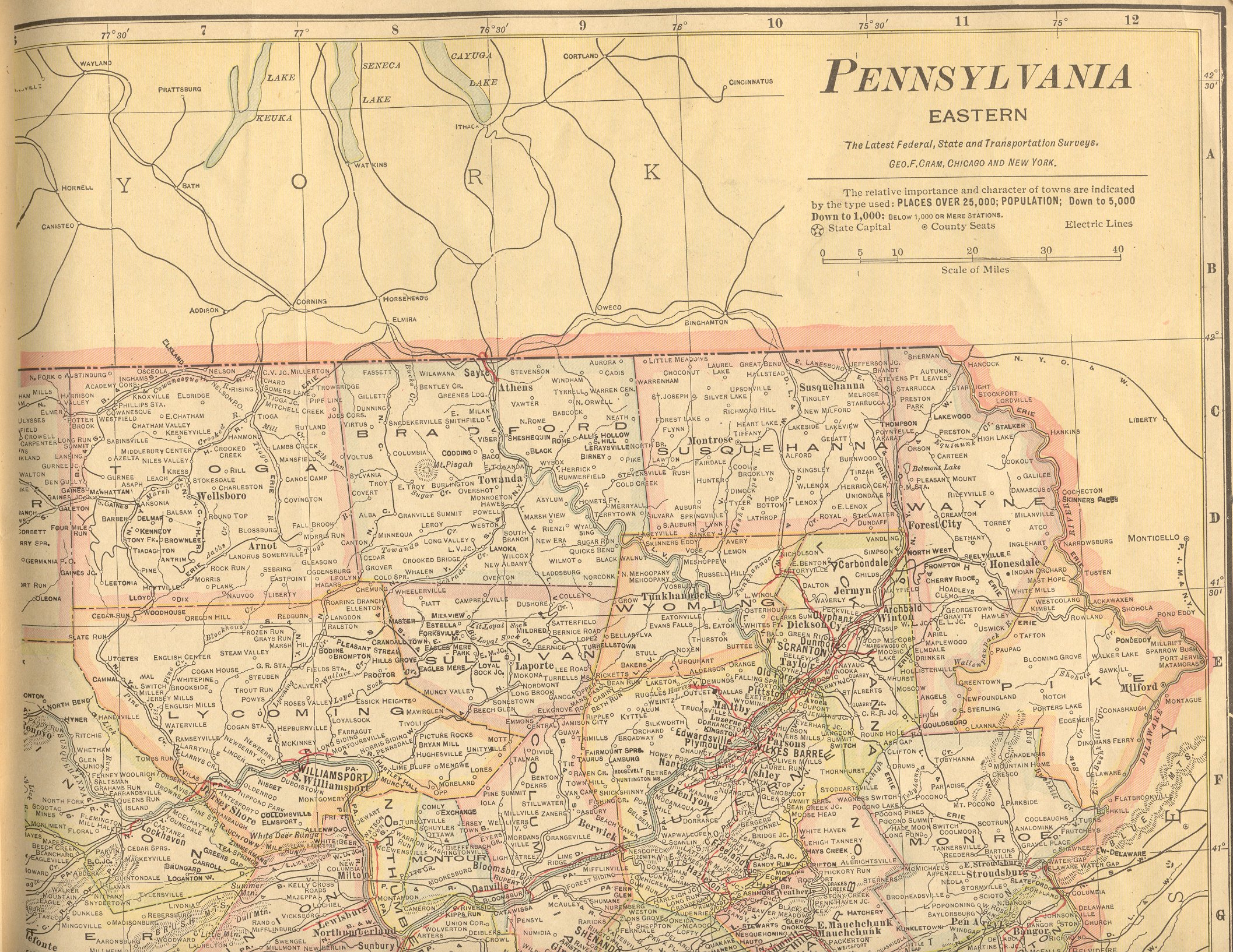
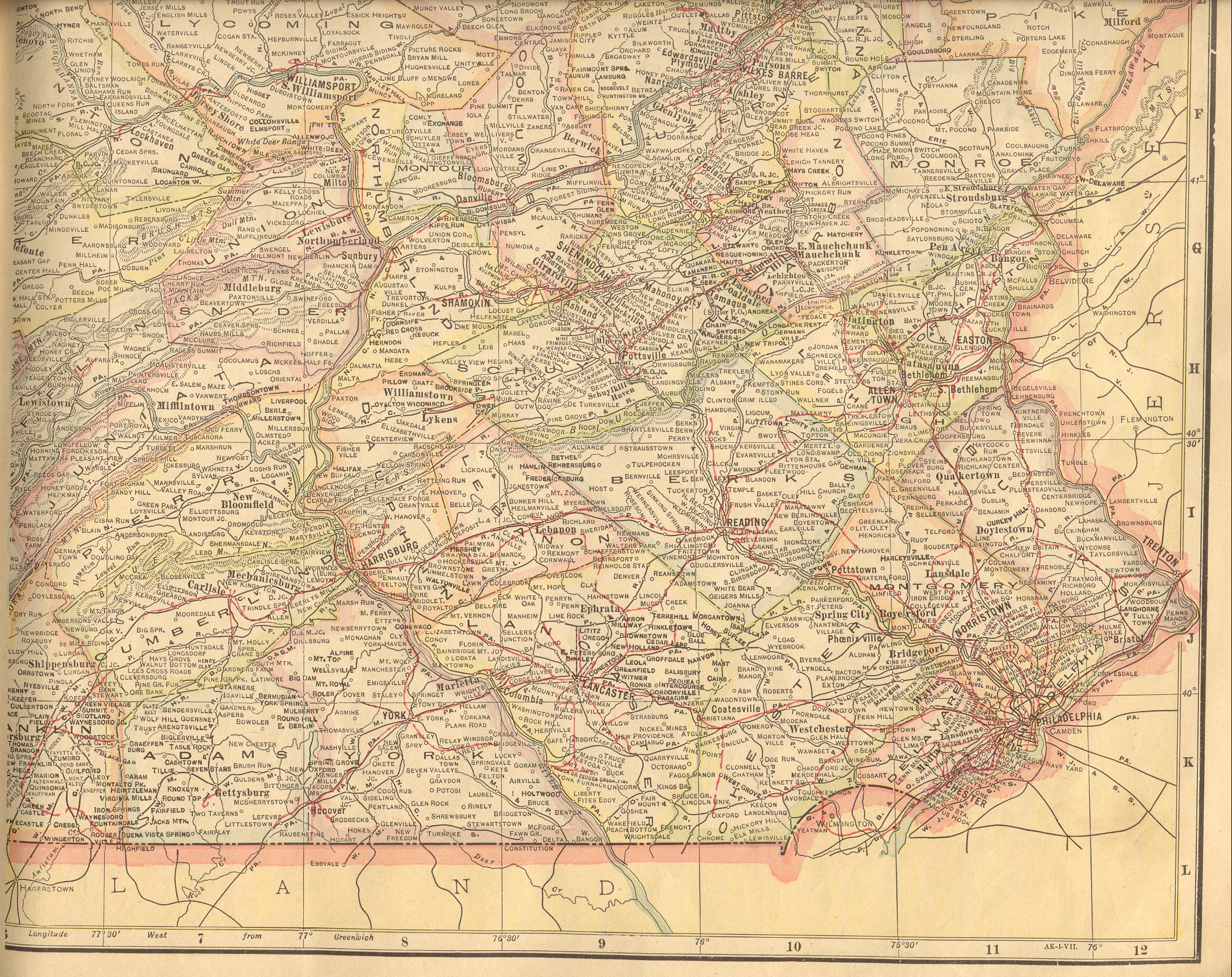
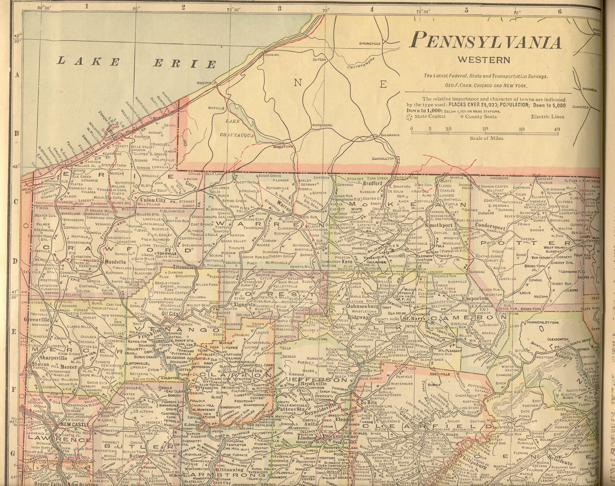
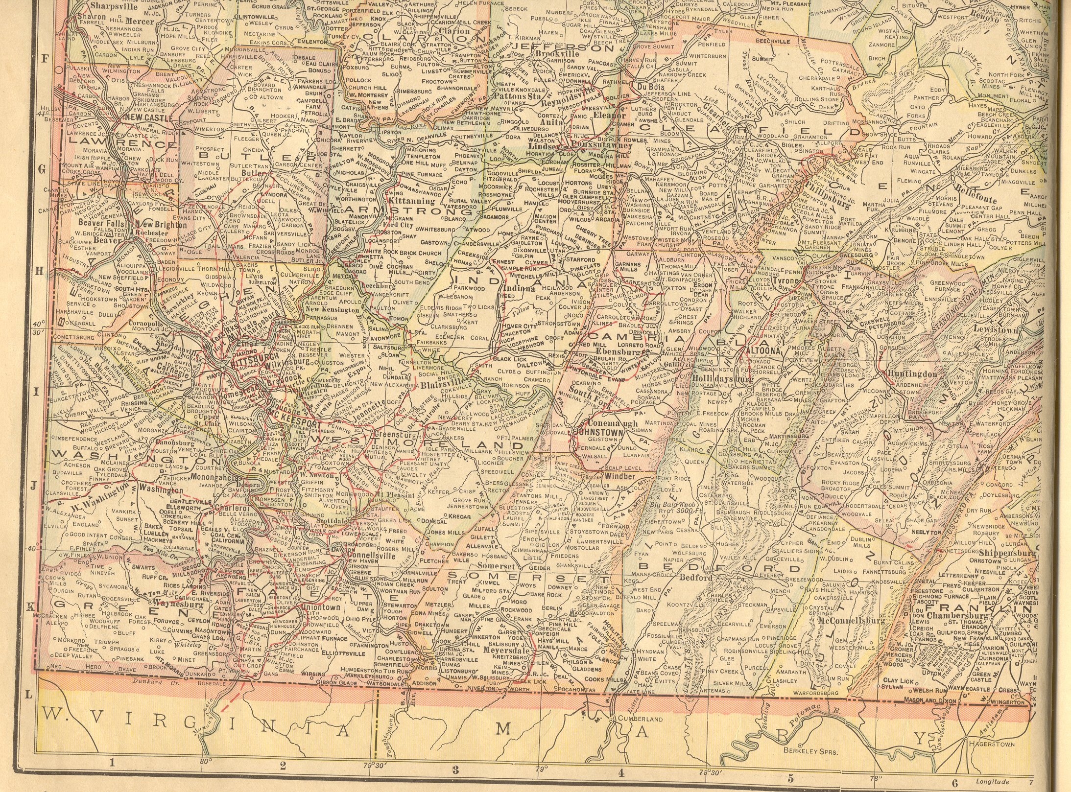
| Pennsylvania |
New:
Color Image of the Northeastern
part of the state. Color Image of the Southeastern
part of the state. Color Image of the Northwestern
part of the state. Color Image of the Southwestern
part of the state. Together, they cover the entire state. |
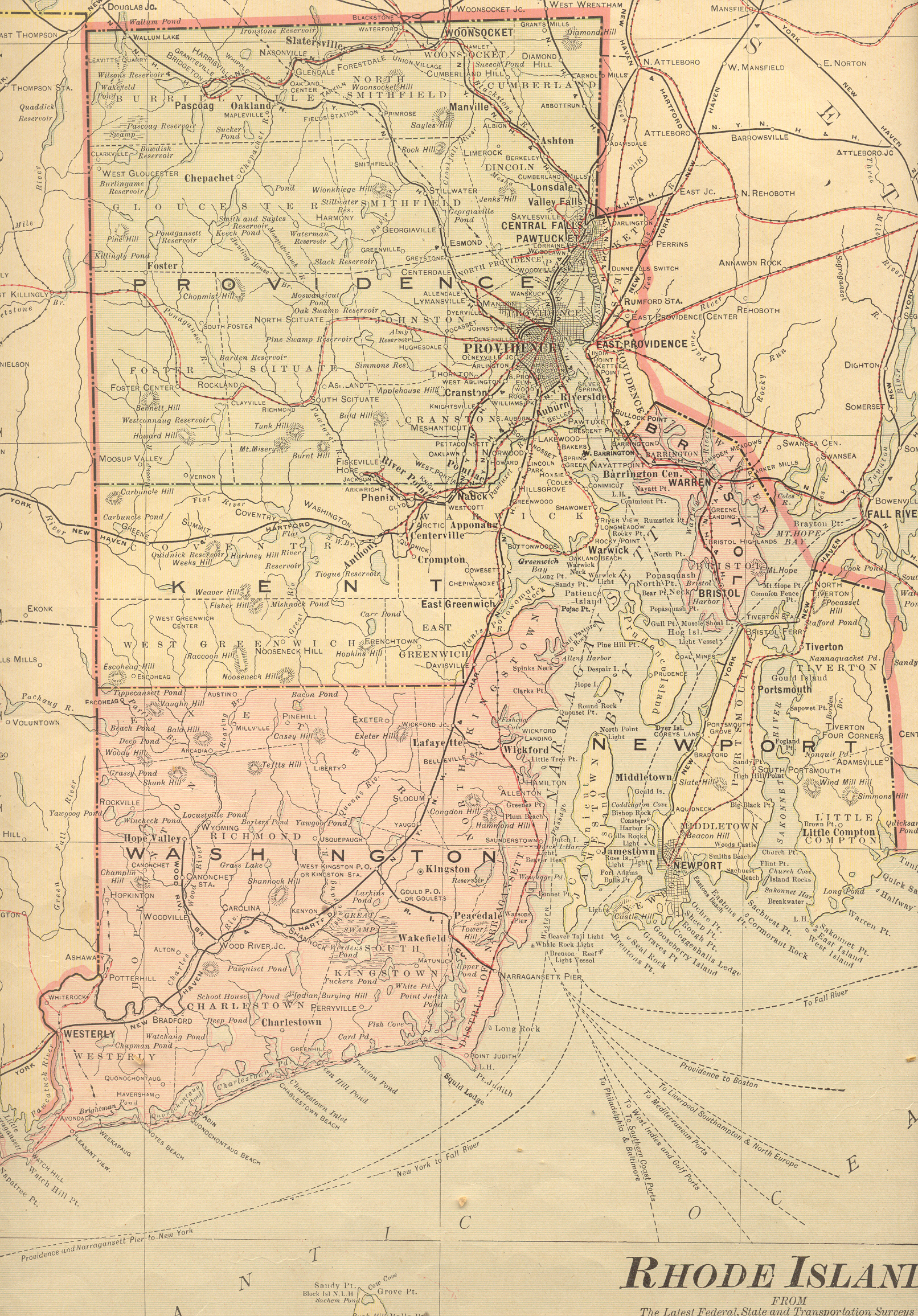
| Rhode Island |
New:
Color Image of the entire state. |
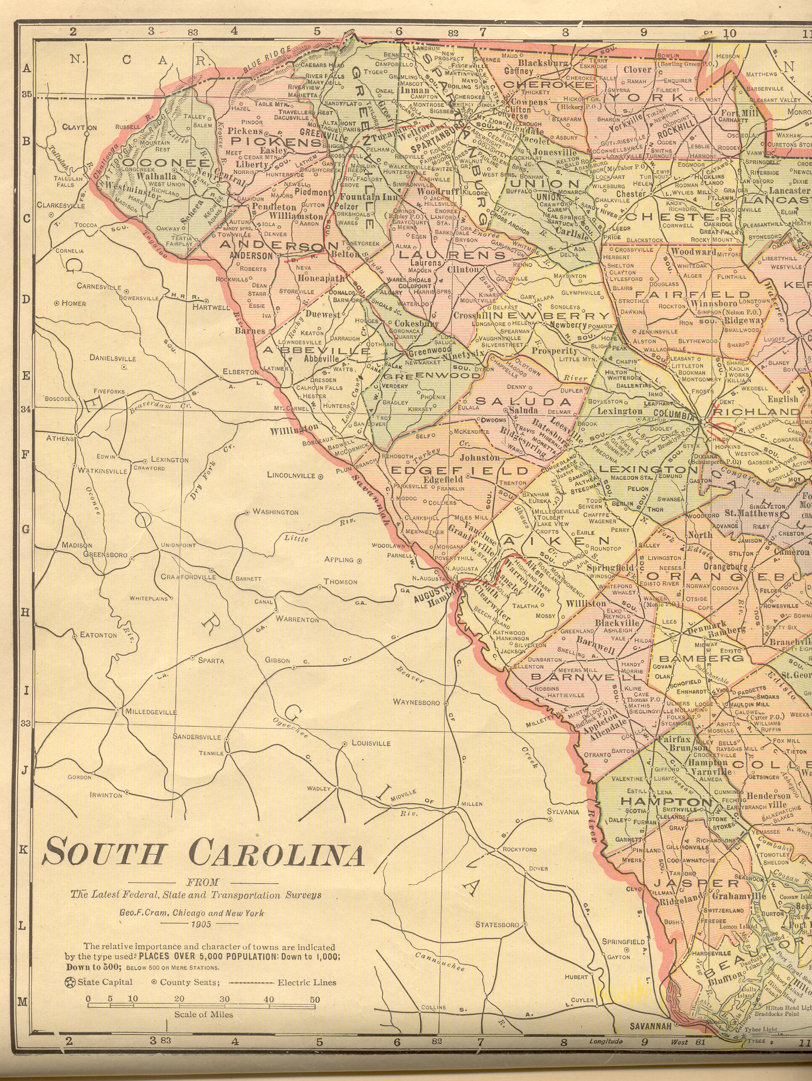
| South Carolina |
New:
Color Image of the Western
part of the state. Color Image of the Eastern
part of the state. Together, they cover the entire state. |
| South Dakota |
New:
Color Image of the Western
part of the state. Color Image of the Eastern
part of the state. Together, they cover the entire state. |
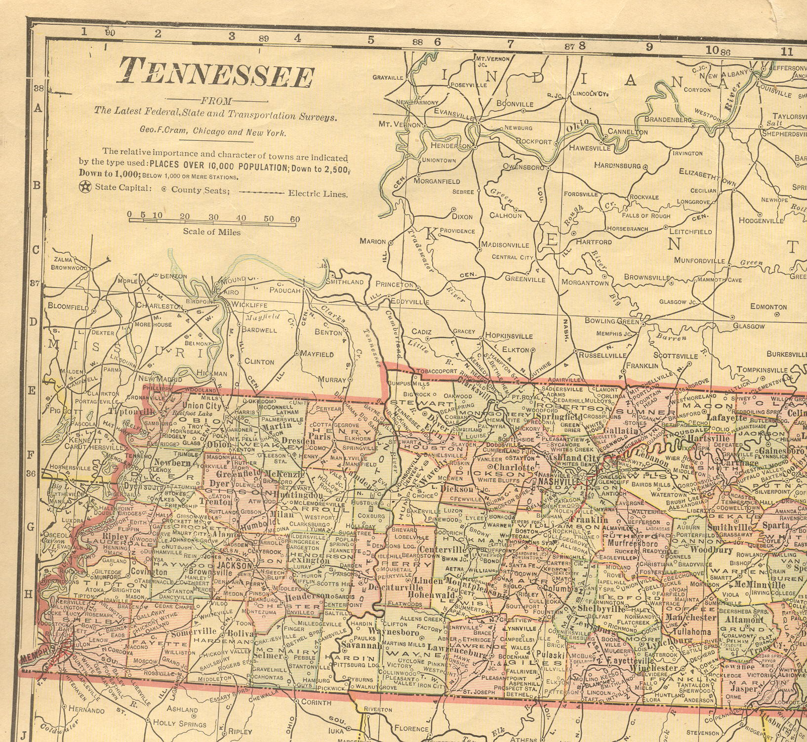
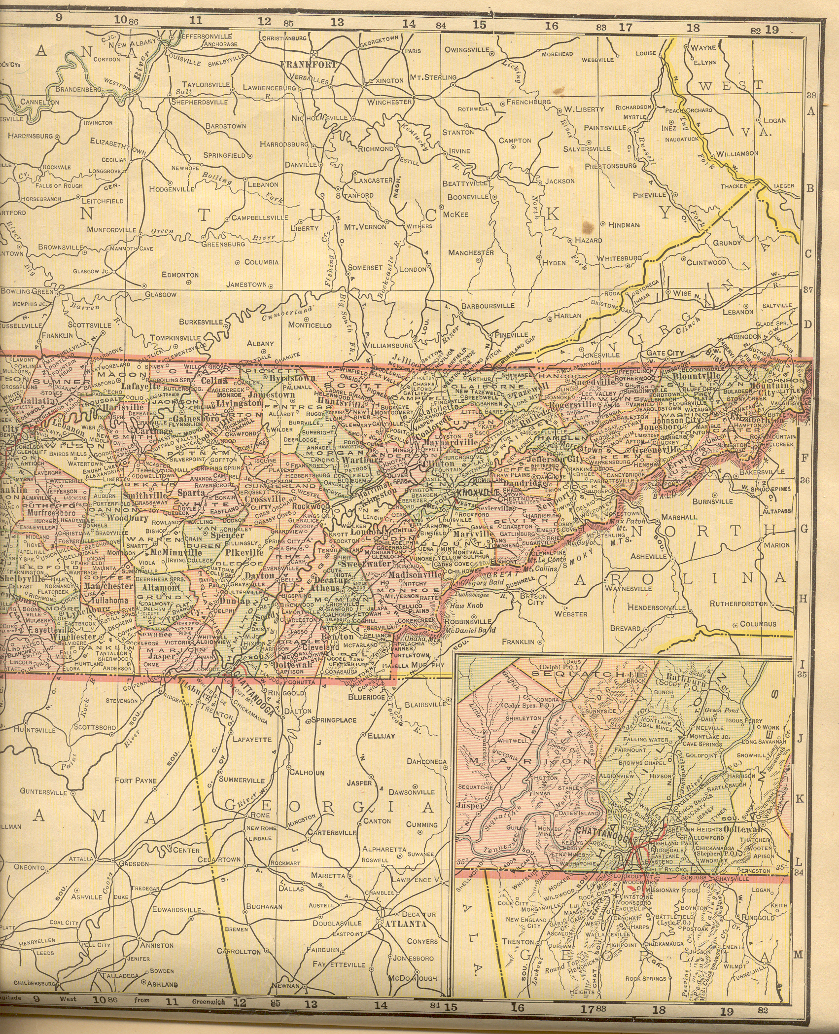
| Tennessee |
New:
Color Image of the Western
part of the state. Color Image of the Eastern
part of the state. Together, they cover the entire state. |
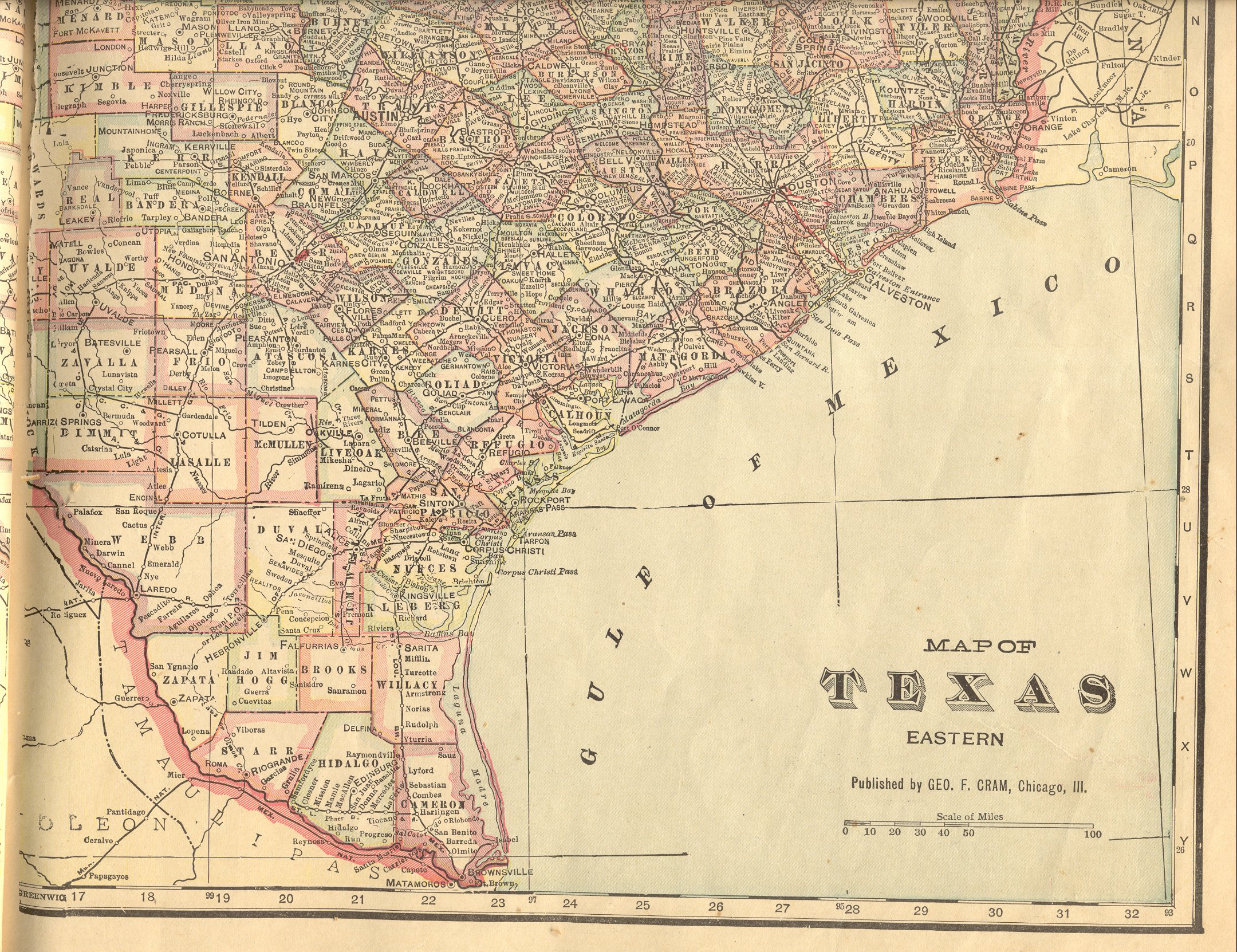
| Texas |
New:
Color Image of the central part of West Texas.
Color image of the southern part of West Texas,
including an insert of the northern part of the Panhandle.
Color Image of the Northeastern part of the
state. Color Image of the Southeastern
part of the state. Together, these cover the entire state.
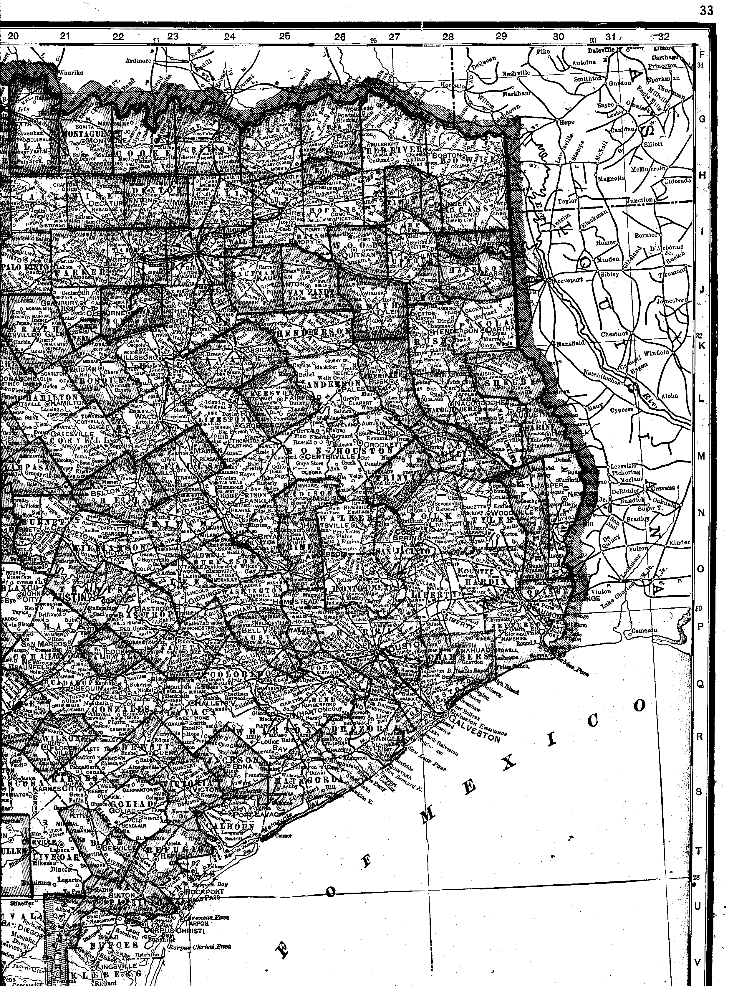
Still online: a very large Black
& White image of eastern Texas, covering the Oklahoma/Texas
border from Clay County on the west all the way through Bowie County and
the Arkansas border and extending south past Corpus Cristi. |
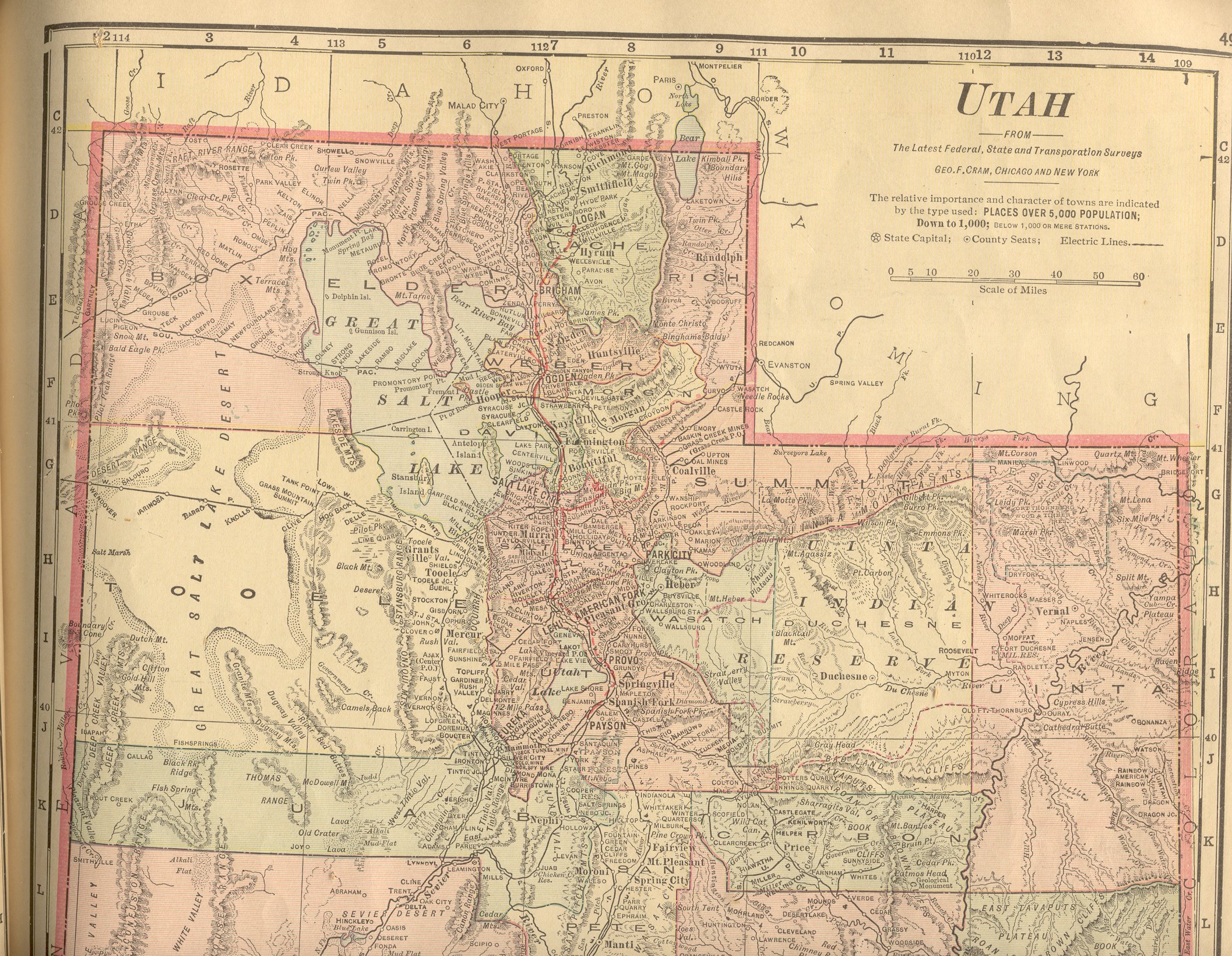
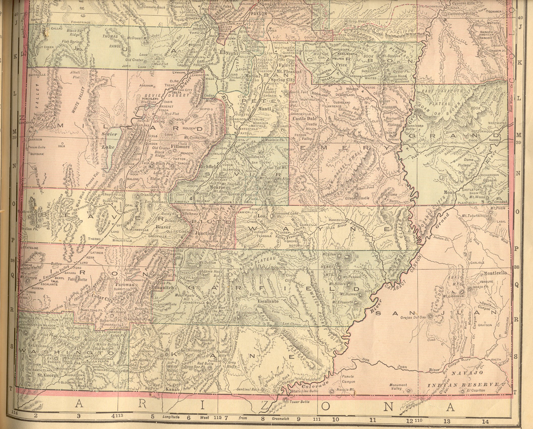
| Utah |
New:
Color Image of the Northern part of the
state. Color Image of the Southern
part of the state. Together, they cover the entire state. |
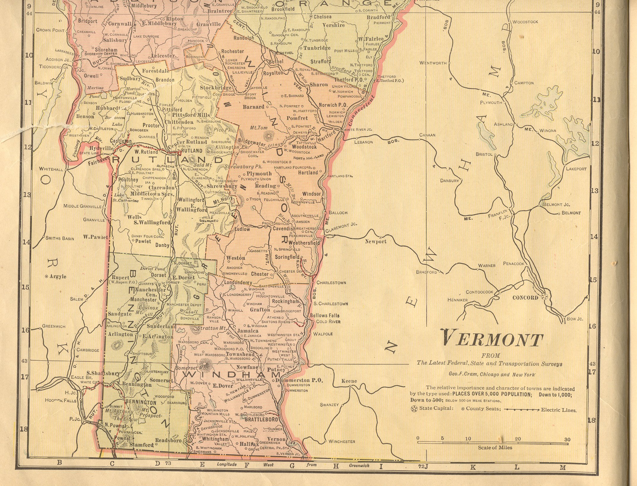
| Vermont |
New:
Color Image of the Northern
part of the state. Color Image of the Southern
part of the state. Together, they cover the entire state. |
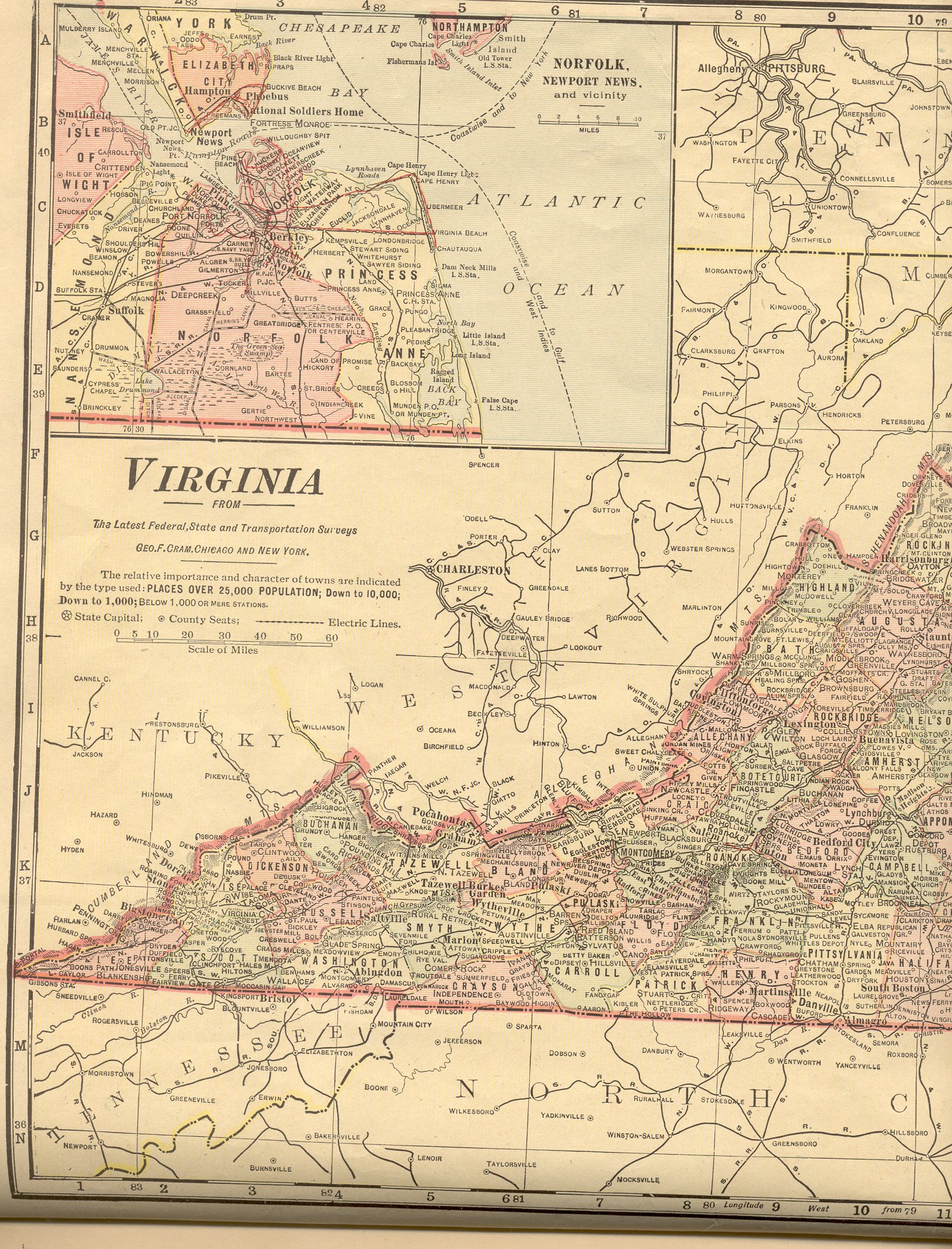
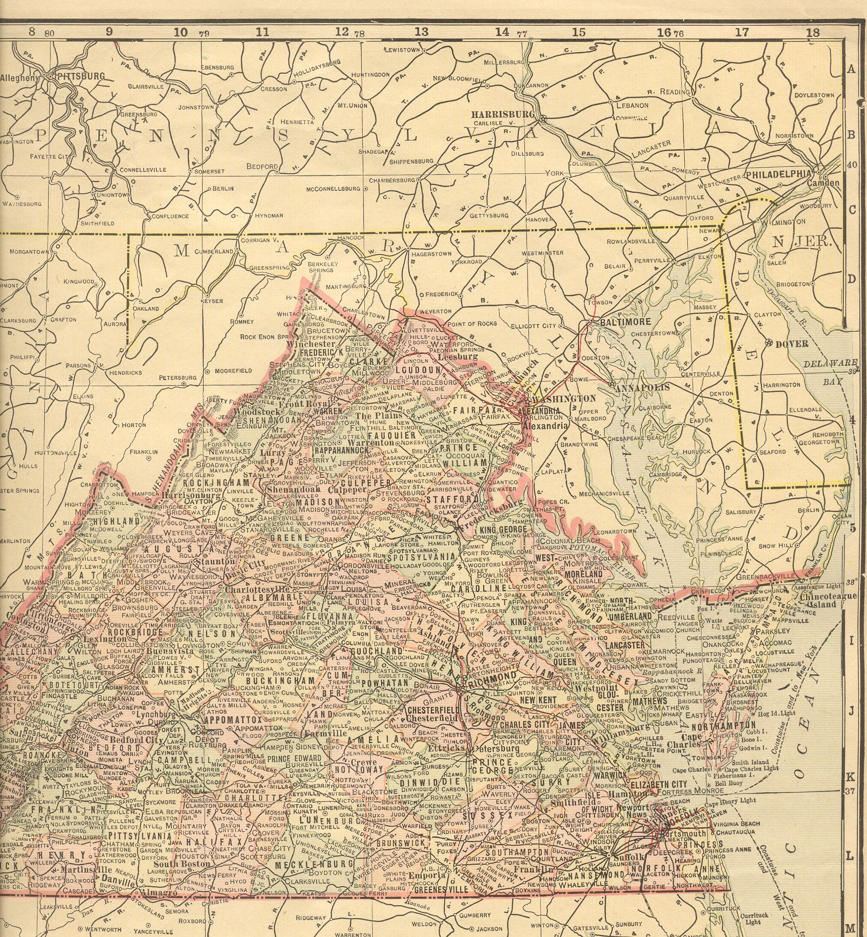
| Virginia |
New:
Color Image of the Western
part of the state. Color Image of the Eastern
part of the state. Together, they cover the entire state. |
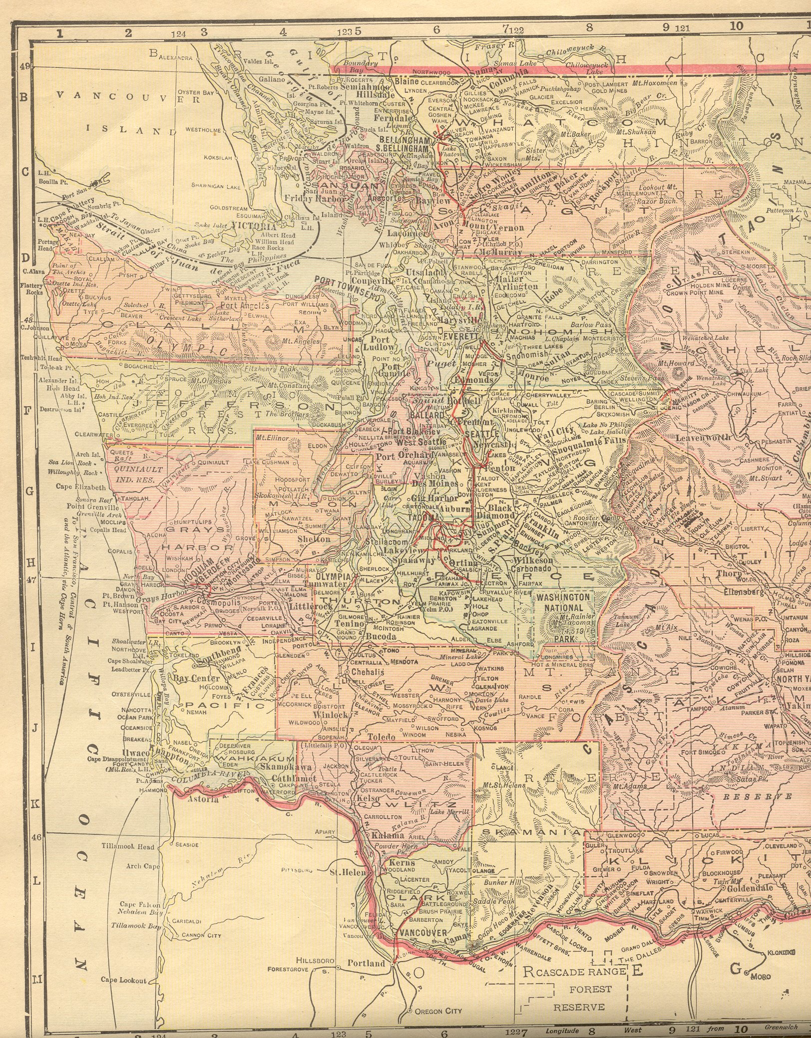
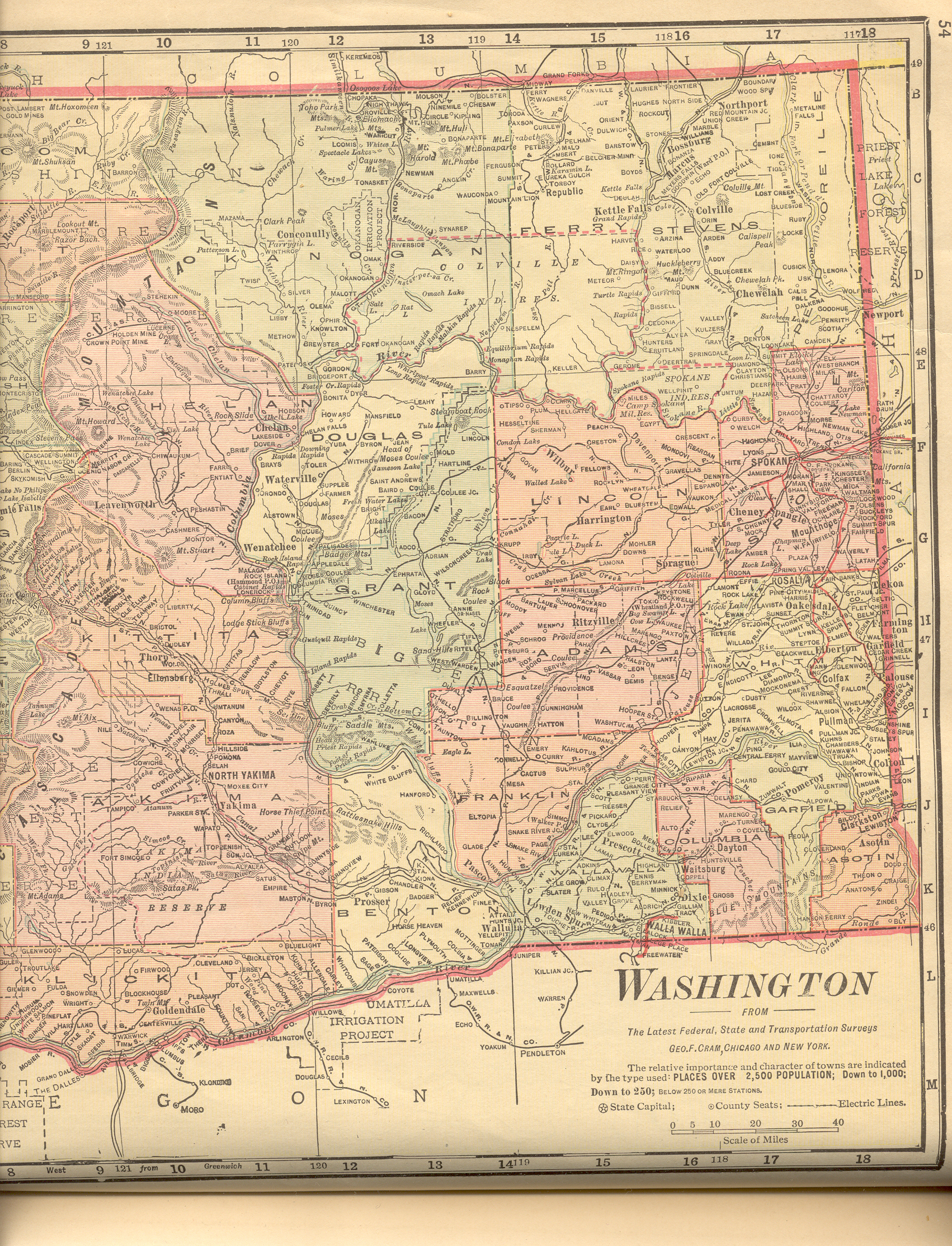
| Washington |
New:
Color Image of the Western
part of the state. Color Image of the Eastern
part of the state. Together, they cover the entire state. |
| West Virginia |
New:
Color Image of the Western
part of the state. Color Image of the Eastern
part of the state. Together, they cover the entire state. |
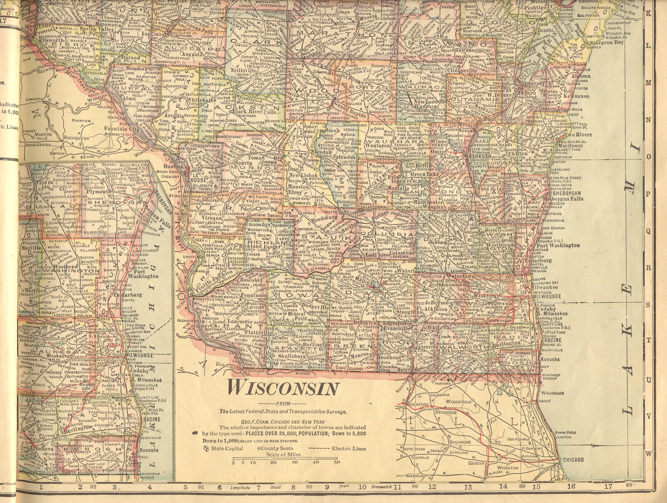
| Wisconsin |
New:
Color Image of the Northern part of the
state. Color Image of the Southern
part of the state. Together, they cover the entire state. |
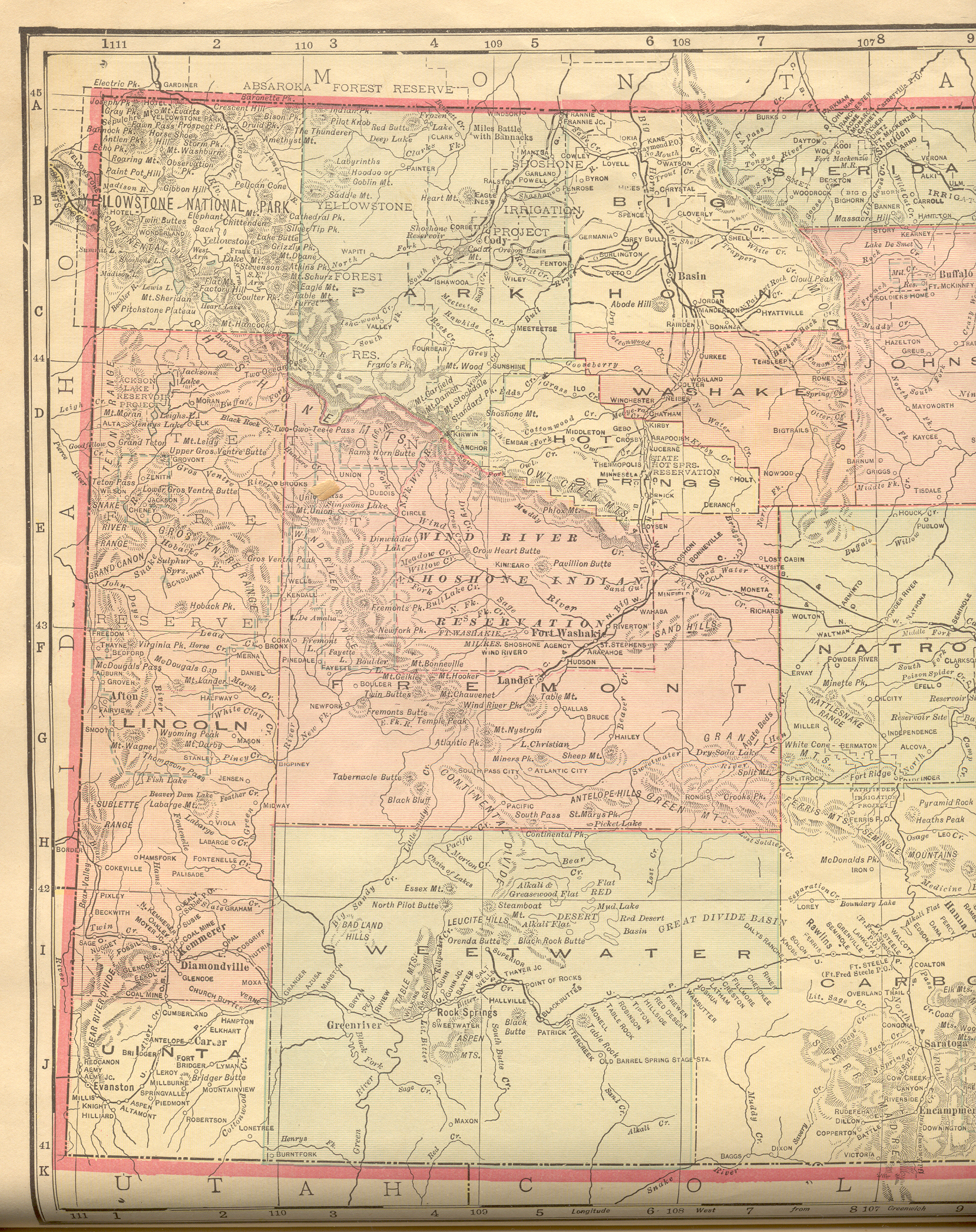
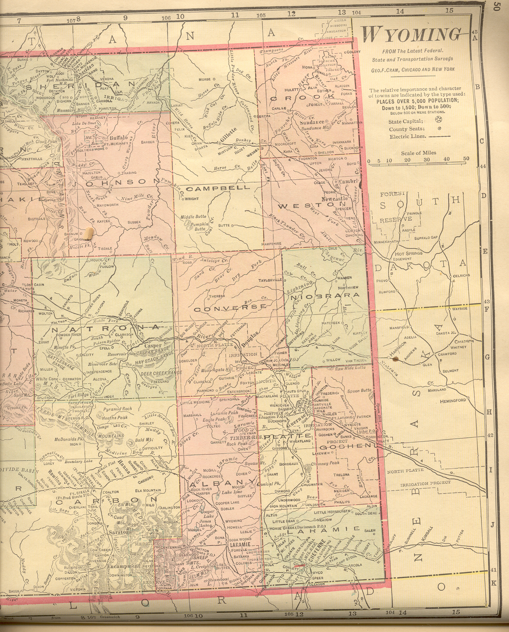
| Wyoming |
New:
Color Image of the Western
part of the state. Color Image of the Eastern
part of the state. Together, they cover the entire state. |
