
| OKGenWeb | ITGenWeb | |||||
| |
|||||
| Cultural Areas | Migrations | Removals | State Links | Timeline Maps | Trails & Roads |
| Indian Country Home Page | Postal Routes of 1903 | 1900 Census EDs | |||
|
|
|||||
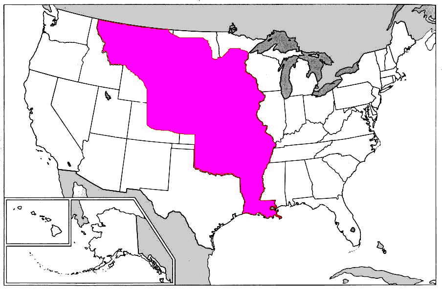
After the Louisiana Purchase in 1803, there was a movement to make the Mississippi River a natural barrier, with Indian Country to the west and everything east to be opened to settlement. This map shows the Louisiana Purchase , which included all of present-day Arkansas, Missouri, Iowa, Nebraska, and South Dakota; parts of Louisiana, Minnesota, Oklahoma, Kansas, North Dakota, Colorado, Wyoming, and Montana. Other references include parts of Texas and New Mexico because the boundaries were not well defined. The logic of the proposed division is obvious, but it proved untenable in the face of the pressures of westward expansion.
|
|
OK/IT Coordinators Linda Simpson |
 (This information is available free. If you paid money for a subscription to get to this site, demand a refund) |
|
© 1996 -2026 all rights reserved |
|