Nowata County Maps
This page contains links to maps related to Nowata County
as well as the 1895 Atlas which includes 48 States.
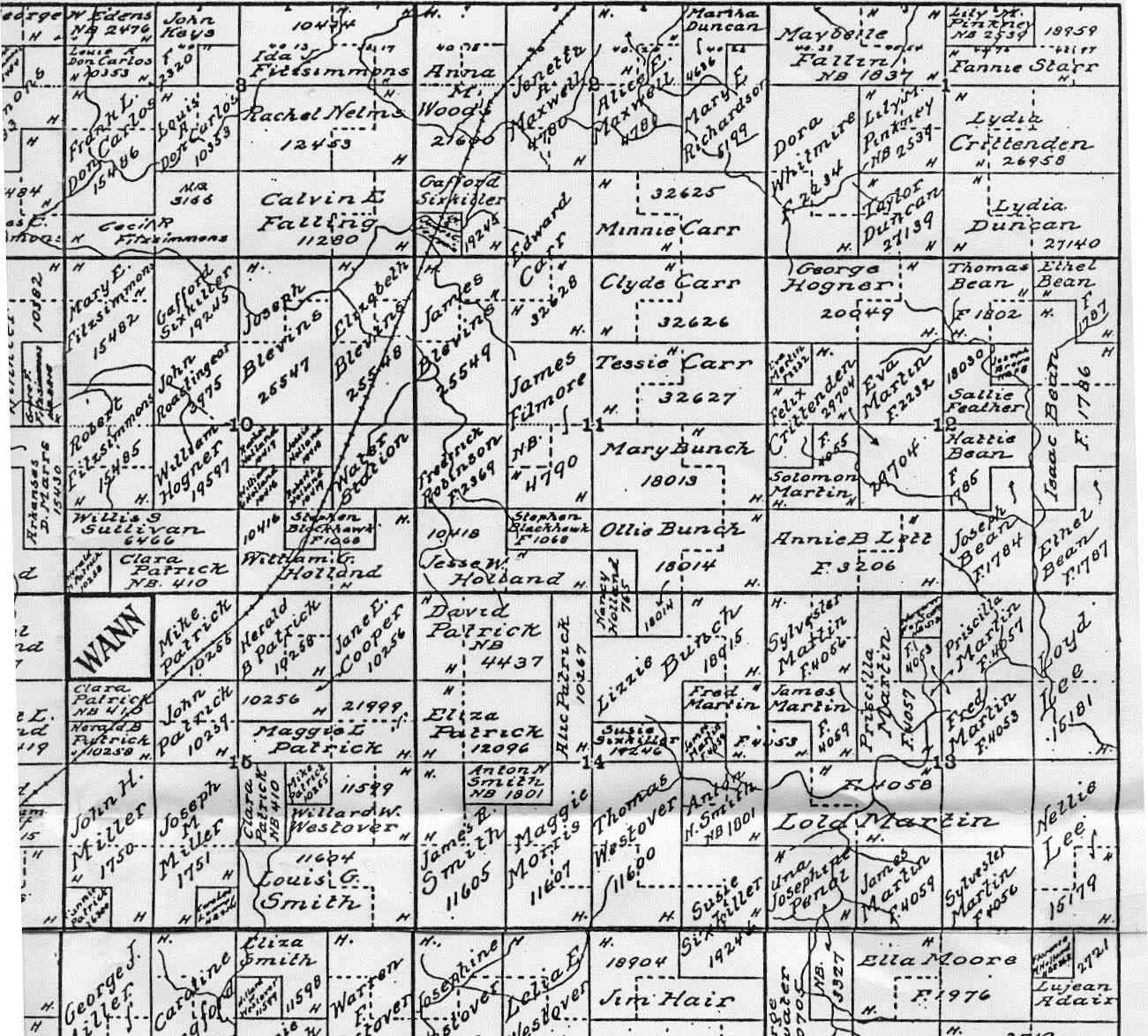
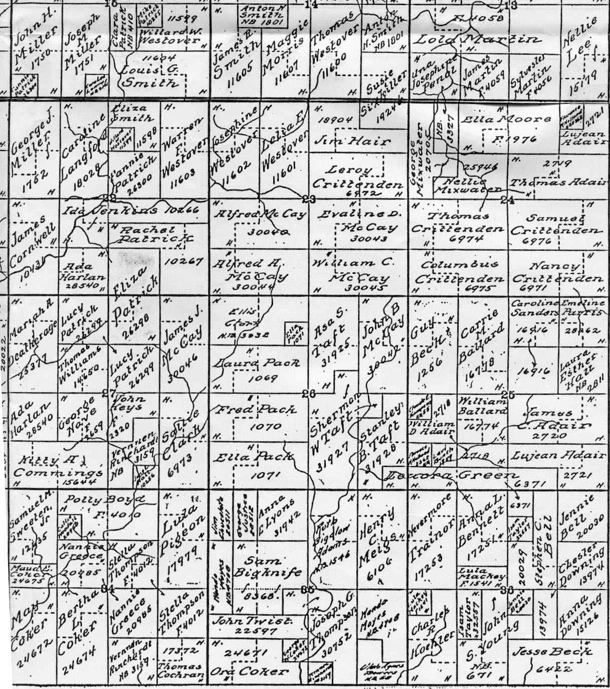
Map of Land Allotments Around Wann, Oklahoma, contributed
by Carl Myers.
Large size. Scanned in 4 quadrants.
Northwestern Corner
Northeastern Corner
Southwestern Corner
Southeastern Corner
Link to 1895 Atlas
Click on the link, which includes 48 States and Counties.
Credit to the
www.MemorialLibrary.com
hosted by www.USGenNet.org
which is the first 501c3 site totally supported by donations. When
I was hit by an idiot that ran a red light 6 years ago and slammed
into me causing me dozens of surgeries I could not afford the cost
of my sites staying on line any longer and they graciously offered
me space on their server. I have now gifted the pages to them. Pam
Received this from Pam, 05 March, 2007.
********
|