
Maps
'n' More
Created
By
Sharon McAllister

|
|
Maps
'n' More |
|
|
|
||
|
|
|
||
|
|
|
|
|
|
|
|
|
|
|
|
|
|
|
|
|
|||
| Back to Caddo Co. Map Links |
1915 Atlas
Caddo County
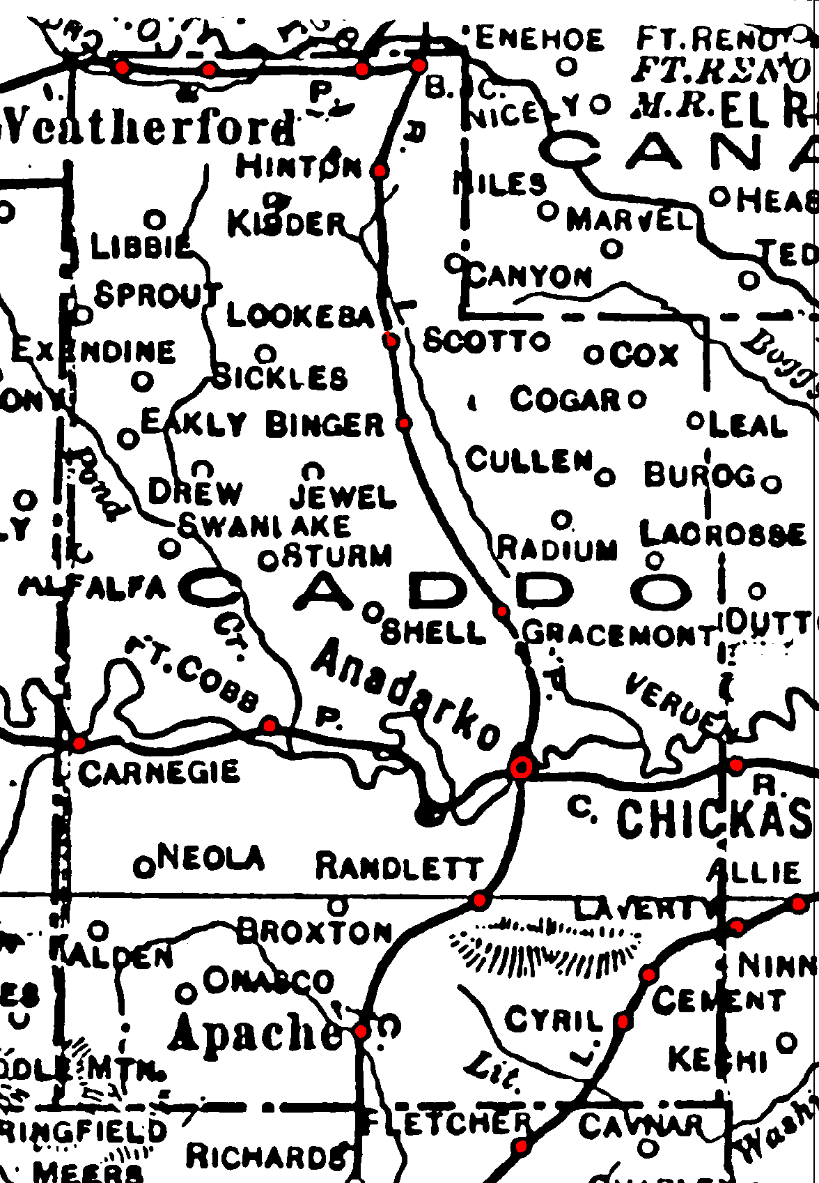
Railroad Stations are shown in red.
The north/south line was the Chicago, Rock Island & Pacific. By 1972, the segment north of Anadarko had been abandoned.
Both east/west lines were also branches of the Chicago, Rock Island & Pacific, and both were still operational in 1972.
The southwest/northeast line line cutting through the southeast corner of the county was the St. Louis & San Francisco. It was also still operational in 1972.
The Atlas shows no roads in Caddo County. The thin lines are rivers and creeks.
![]()
|
Page last updated
on
Wednesday, July 15, 2026
This site maintained by
Mel Owings
![]()