
Maps
'n' More
Created
By
Sharon McAllister

|
|
Maps
'n' More |
|
|
|
||
|
|
|
||
|
|
|
|
|
|
|
|
|
|
|
|
|
|
|
|
|
|||
| Back to Custer Co. Map Links |
1915 Atlas
Custer County
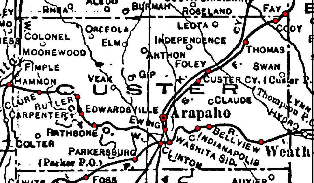
Railroad Stations are shown in red.
The line from Clinton through Hammon, in neighboring Roger Mills Co., was the Clinton & Oklahoma Western. It was later acquired by the Santa Fe, and was still in operation in 1972.
St. Louis and San Francisco entered Custer County at the northeast corner and turned south at Clinton. It was still in operation in 1972.
The east/west line through the southern part of the county was the Chicago, Rock Island & Pacific. It was still operational in 1972.
The remaining line is the Kansas City, Mexico and Orient, which ran all of way across the state from Kansas to Texas. It was still in operation in 1972 as the Atchison, Topeka, and Santa Fe.
The Atlas shows no roads in Custer County. The thin lines are rivers and creeks.
![]()
|
Page last updated
on
Monday, July 27, 2026
This site maintained by
Mel Owings
![]()