Luther Dwellings The First 60 Years
To trace the history of Luther, identify its oldest houses, and get the most information we could out of old photographs, we used a map to pinpoint who lived where in the late 1950s. That provided a starting point, from which we could work back in time through interviews and available census data. Details about the color coding are provided below the map. For more information about Luther and its families, go to the Heart & Hand Site.
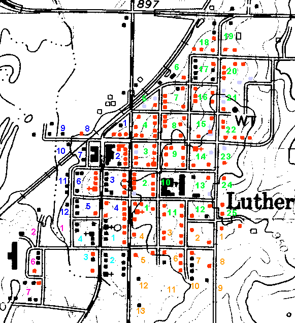
The map itself dates to 1966. Individual locations taken from the 1955 Telephone Book and an undated sketch are shown in red and houses known to have been built after 1955 are shown only in shadow. Churches, schools, and businesses are shown in black -- as are the buildings we're still researching.
Block numbers for the Original Town Site are in dark blue. Those for the First Delaporte Addition are in lighter blue, while the ones for the Second Delaporte Addition are in fuchsia. Those for the School Land Addition are in green, and the Chamberlain Addition are gold.
For more about Luther and its families go to the Heart & Hand Site, where you'll find a copy of this map linked to a number of other pages that provide detailed information.
