|
Counties with
Corresponding 1900
I. T. Enumeration Districts
The 1900 Census of Indian Territory covers the
Quapaw Tract
and the Five Nations: Cherokee, Chickasaw, Choctaw, Creek, and
Seminole. Using the census data now available online, it's
possible to
find records and still not easily pinpoint the modern-day location
because
present-day counties did not exist in 1900.
The following table, organized by
present-day county, provides links to both sketches of the ED
boundaries and to
various maps that show the referenced township boundaries [1972 Maps],
rivers
[1915 maps], and treaty lines [DoT Maps]. A green
background
indicates that a county is ready for the preparation of a
computer-generated map:
the sketch has been completed and the corresponding USGS map has been
rescanned
in color.
For those counties whose sketches are not yet
online, some
EDs may be included on the EDs
Worksheet.
| County |
I.T. Entity |
Worksheet |
1915 Map |
1972 Map |
DoT Maps |
1900 EDs. |
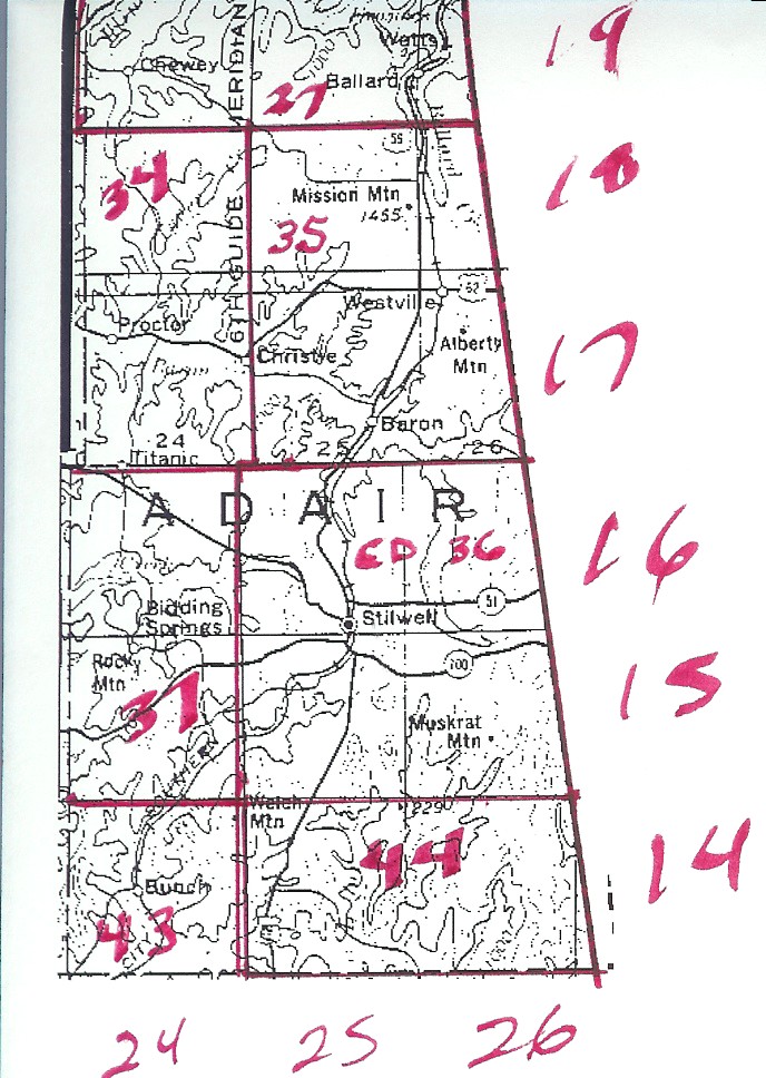
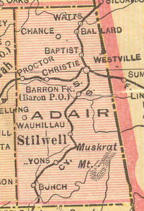
| Adair |
Cherokee Nation |
Sketch |
Adair
1915 |
USGS
Color |
Adair
DoT |
27, 34, 35, 36, 37, 43, 44 |
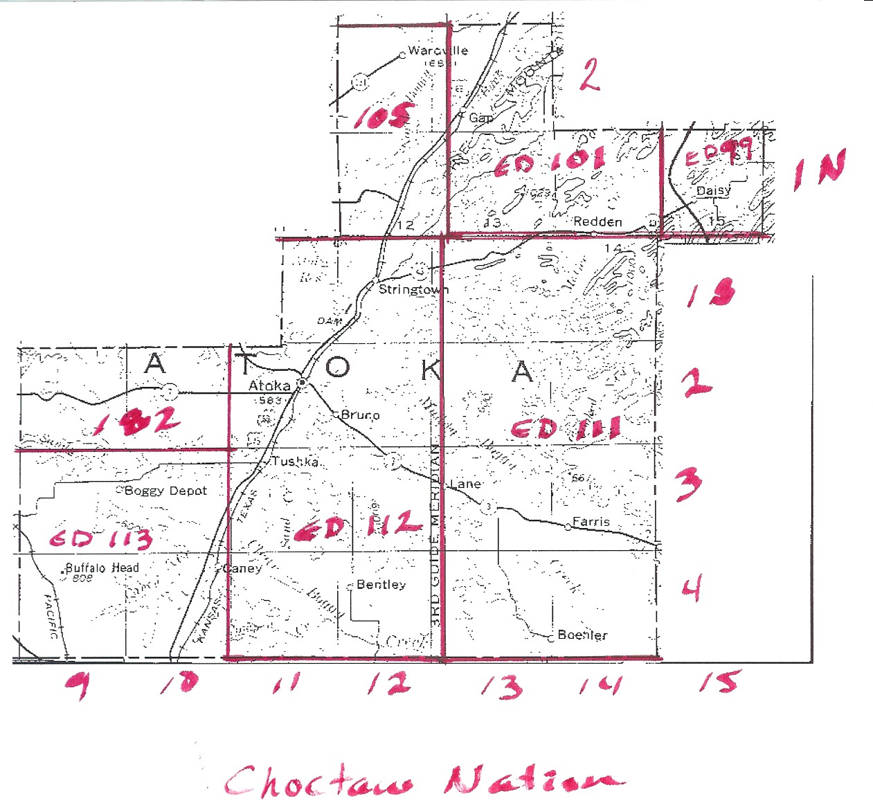
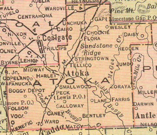
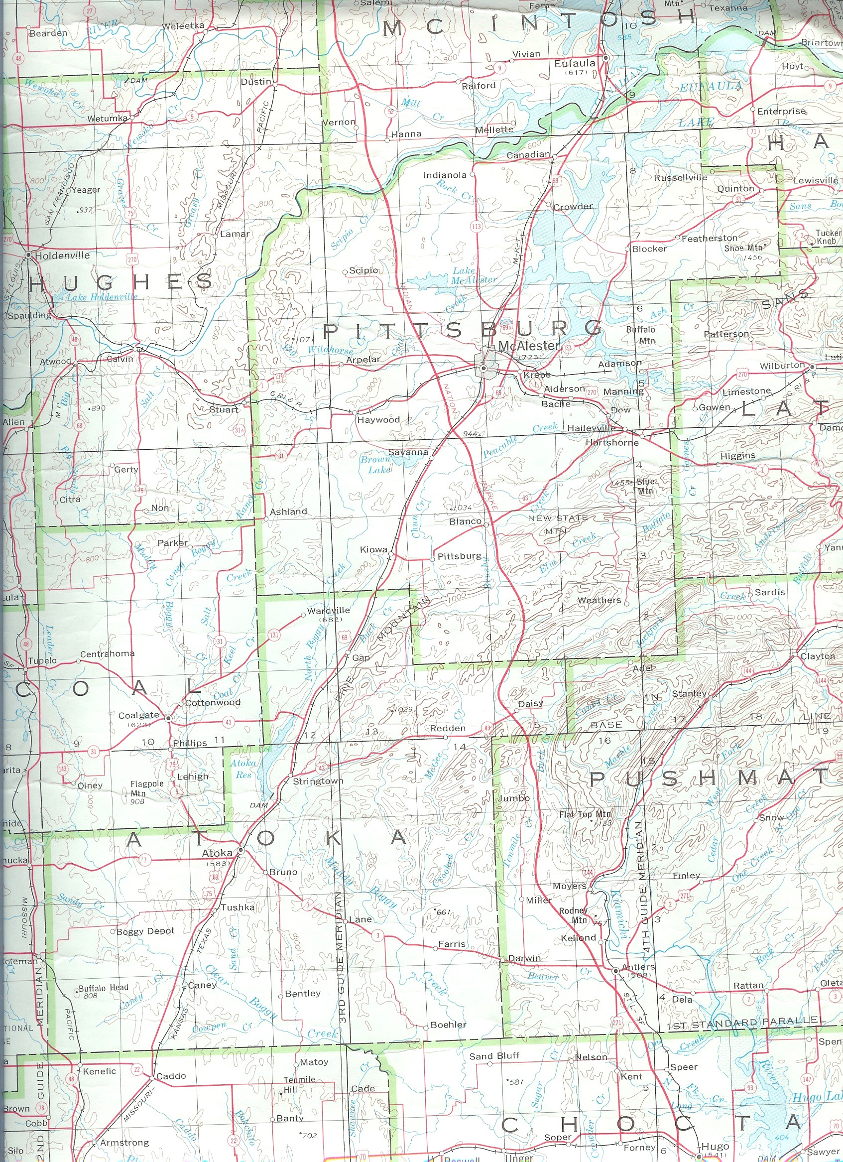
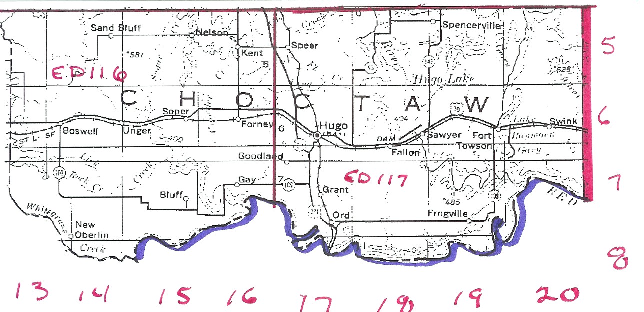
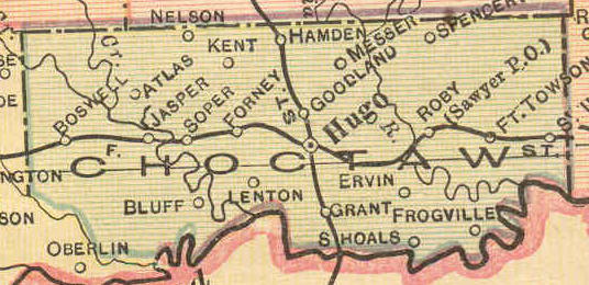
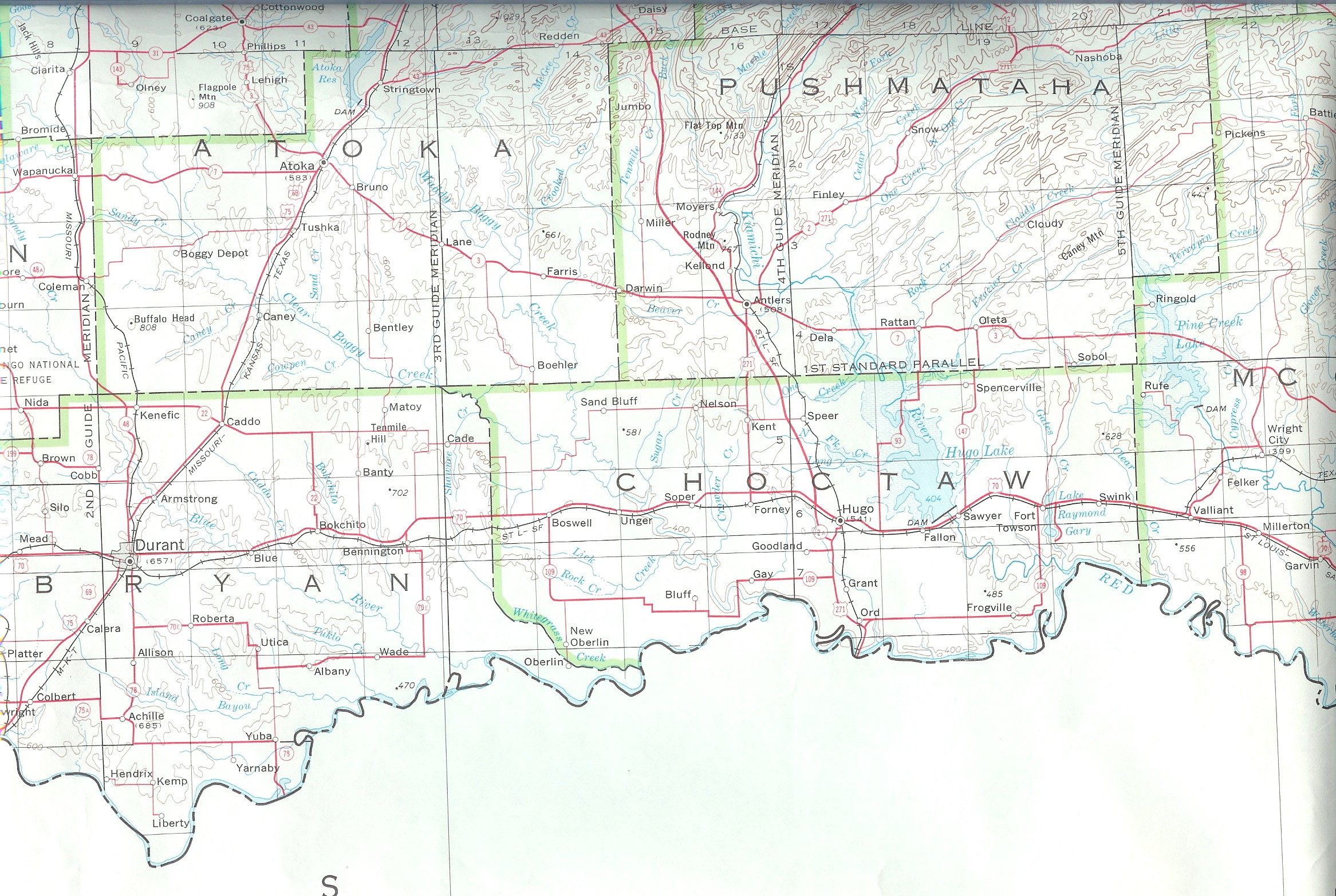
| Atoka |
Choctaw Nation |
Sketch |
Atoka
1915 |
USGS
Color |
Atoka
DoT |
99, 101, 105, 111, 112, 113, 182 |
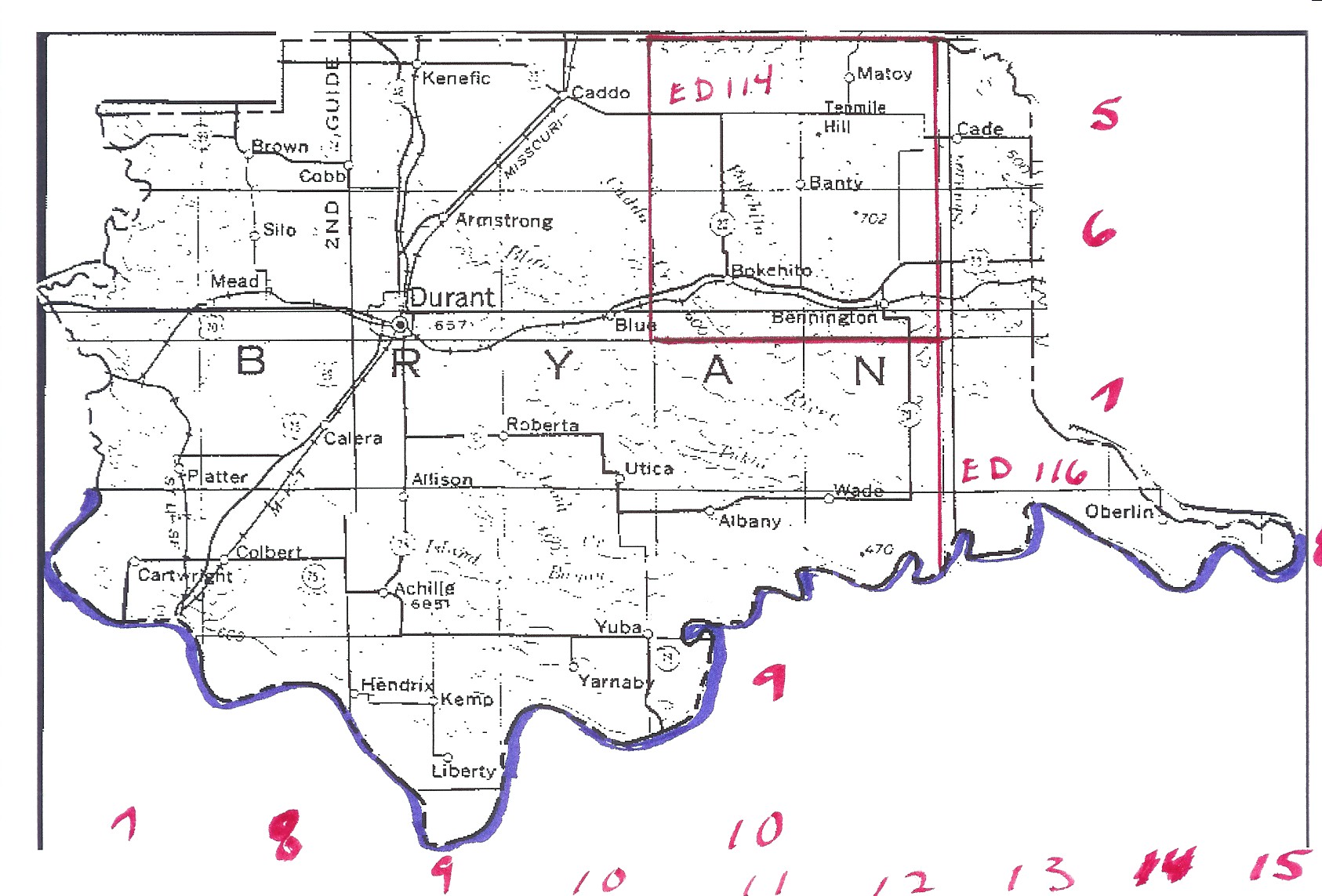
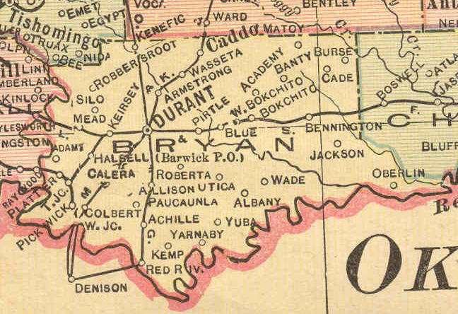
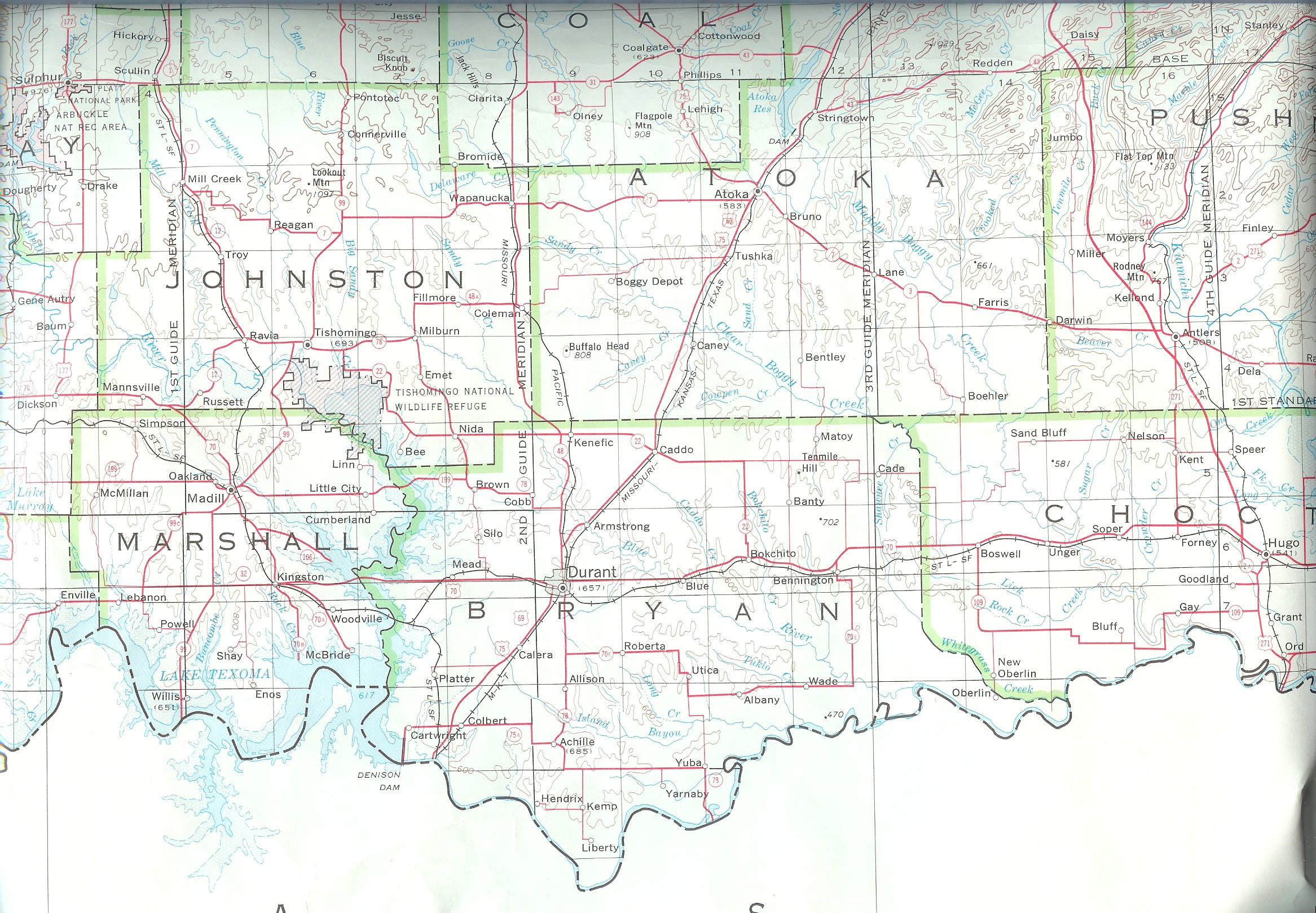
| Bryan |
Chickasaw Nation |
Incomplete |
Bryan
1915 |
USGS
Color |
Bryan
DoT |
? |
| Bryan |
Choctaw Nation |
Incomplete |
Bryan
1915 |
USGS
Color |
Bryan
DoT |
114, 116 |
| Carter |
Chickasaw Nation |
Carter |
Carter
1915 |
USGS
Color |
Carter
DoT |
? |
| Cherokee |
Cherokee Nation |
Incomplete |
Cherokee
1915 |
USGS
Color |
Cherokee
DoT |
28, 33, 34, 37, 43 |
| Choctaw |
Choctaw Nation |
Sketch |
Choctaw
1915 |
USGS Color |
Choctaw
DoT |
116 & 117 |
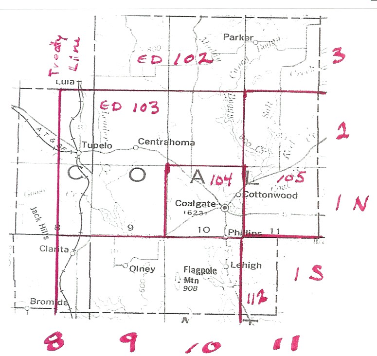
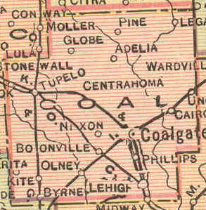
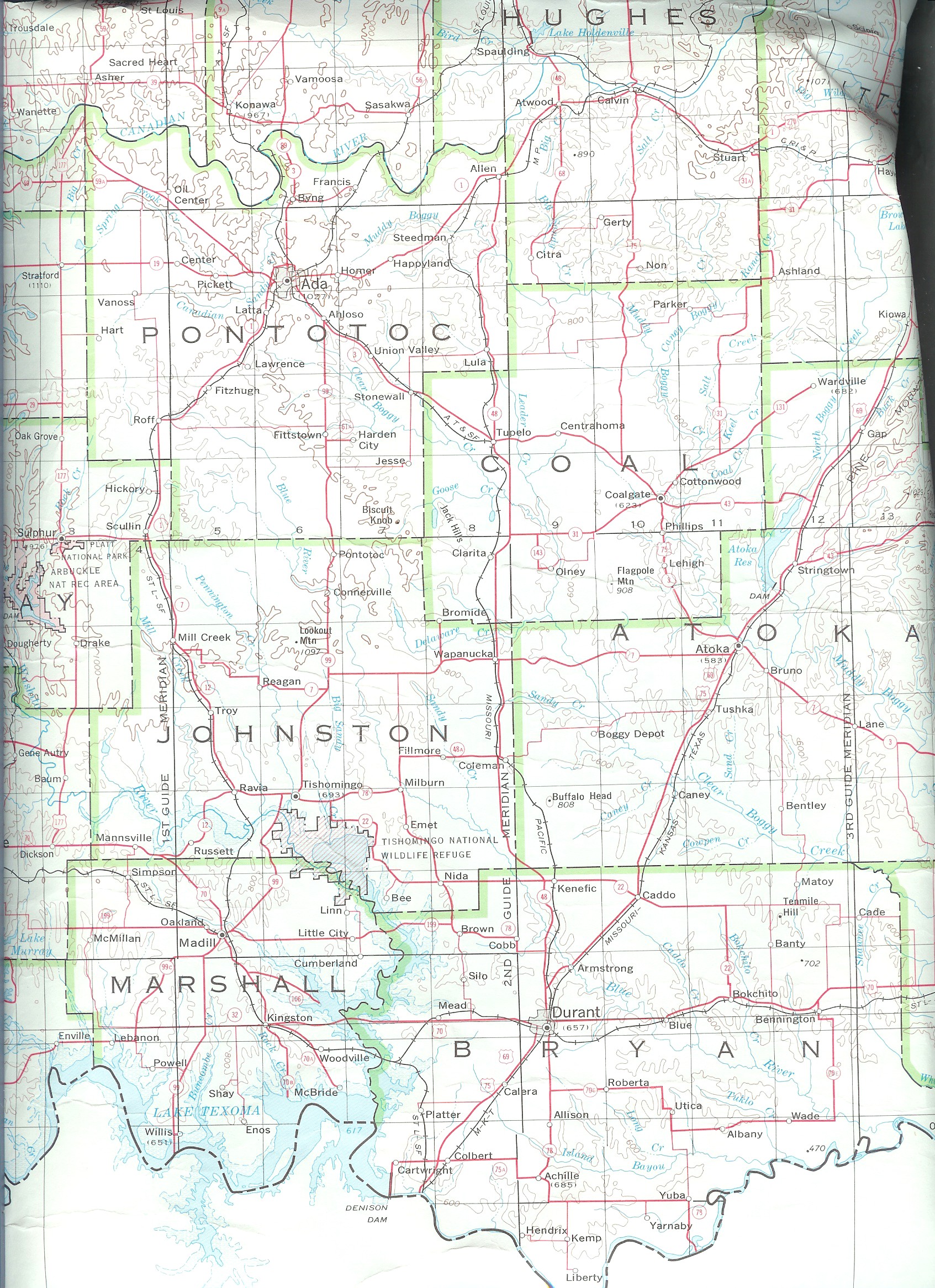
| Coal |
Chickasaw Nation |
Sketch |
Coal
1915 |
USGS
Color |
Coal
DoT |
? |
| Coal |
Choctaw Nation |
Sketch |
Coal
1915 |
USGS
Color |
Coal
DoT |
102, 103, 104, 105, 112, 181, 182 |
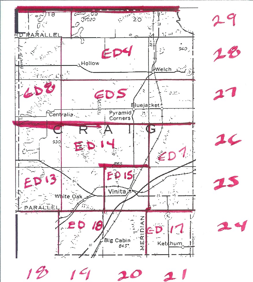
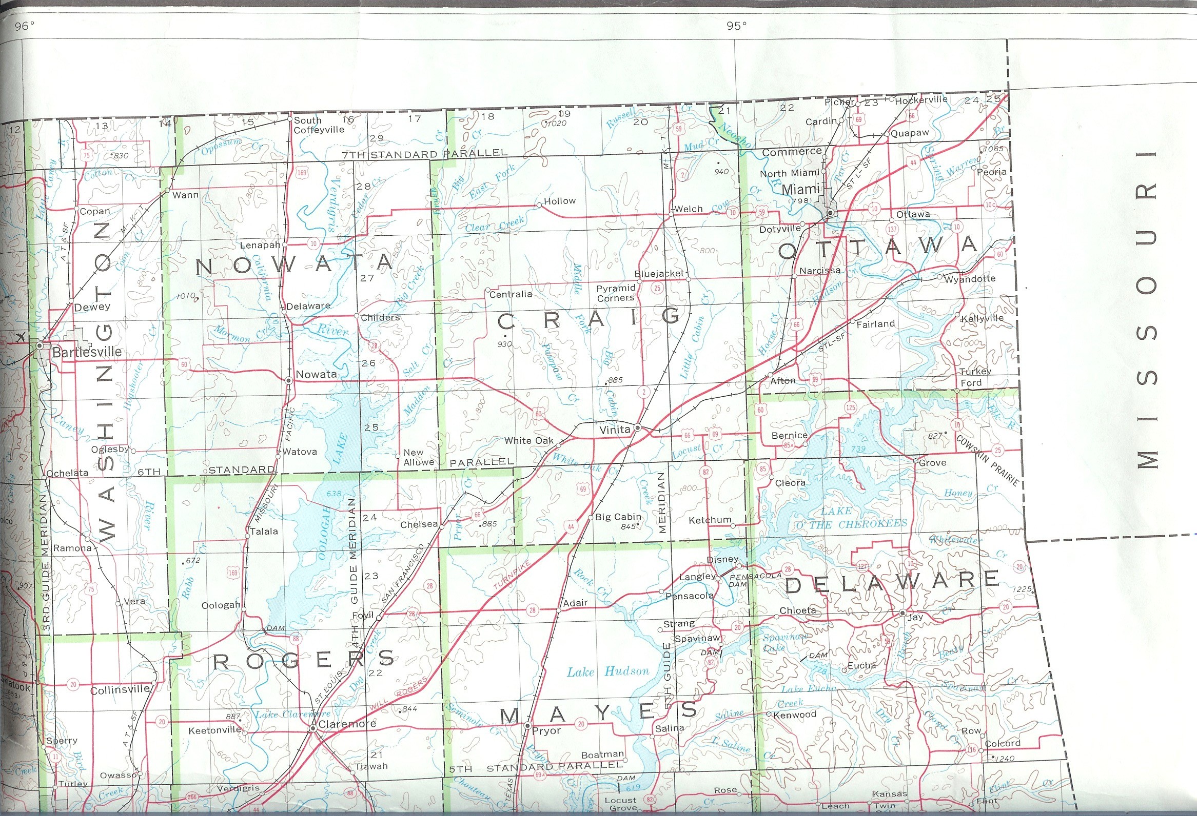
| Craig |
Cherokee Nation |
Sketch |
Craig
1915 |
USGS
Color |
Craig
DoT |
4, 5, 7, 8, 13, 14, 15, 17, 18 ED Map |
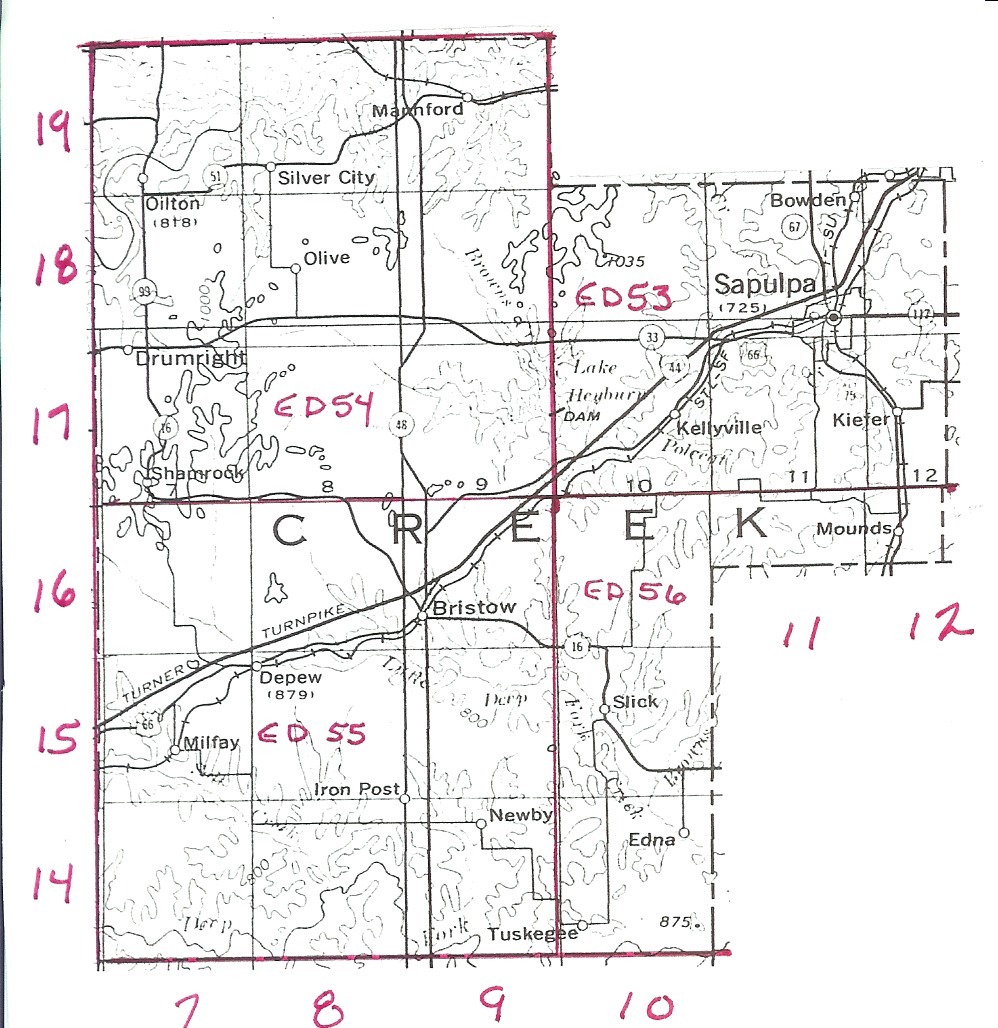
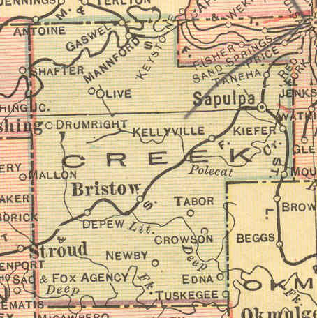
| Creek |
Creek Nation |
Sketch |
Creek
1915 |
USGS Color |
Creek
DoT |
53, 54, 55, 56 Partial Map |
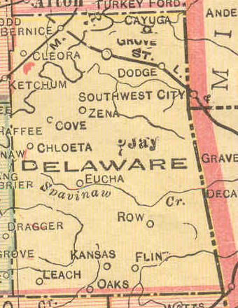
| Delaware |
Cherokee Nation |
Incomplete |
Delaware
1915 |
USGS
Color |
Delaware
DoT |
7, 26, 27, 28 |
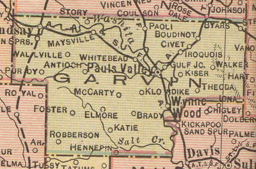
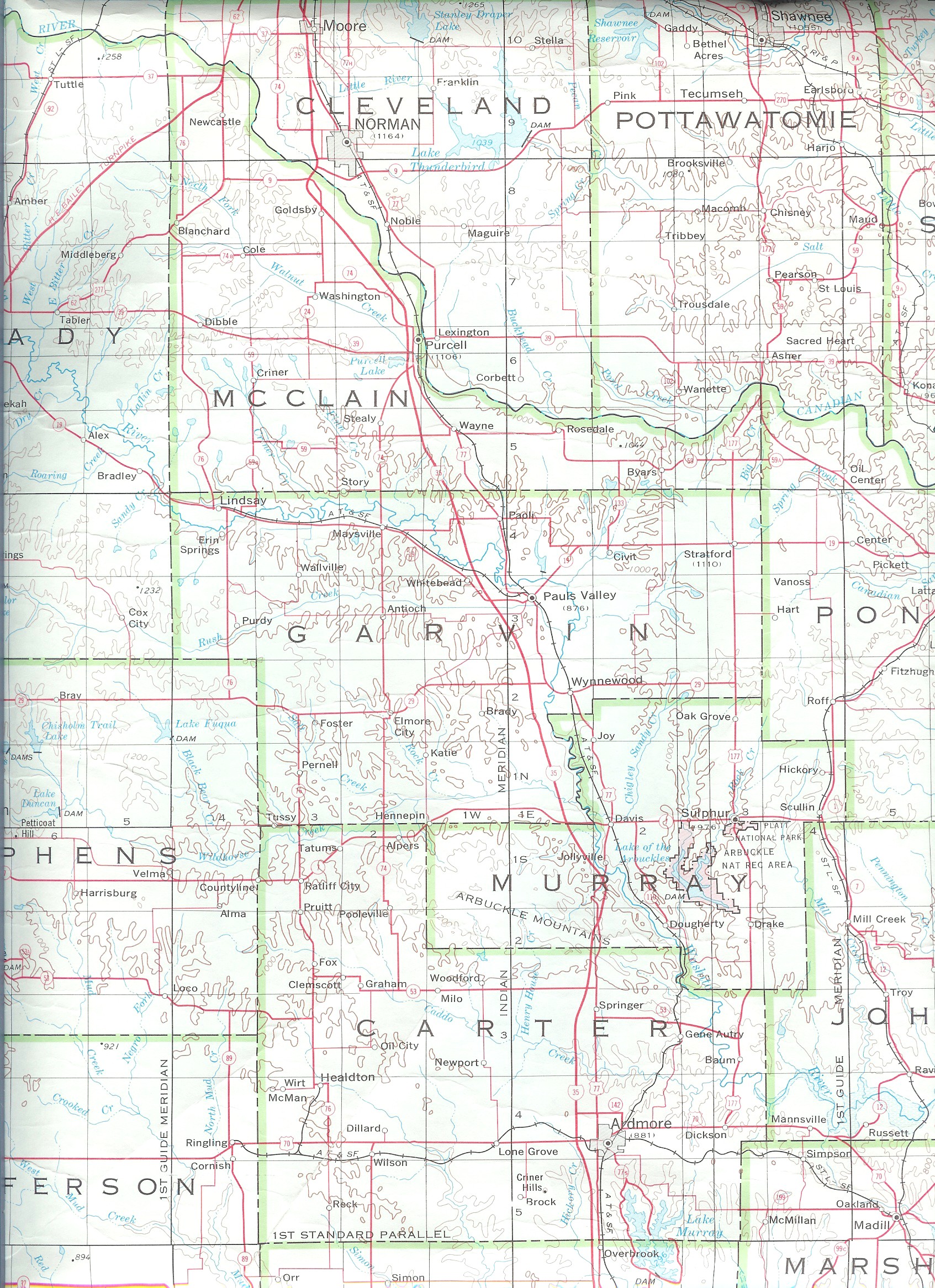
| Garvin |
Chickasaw Nation |
Garvin |
Garvin
1915 |
USGS
Color |
Garvin
DoT |
? |
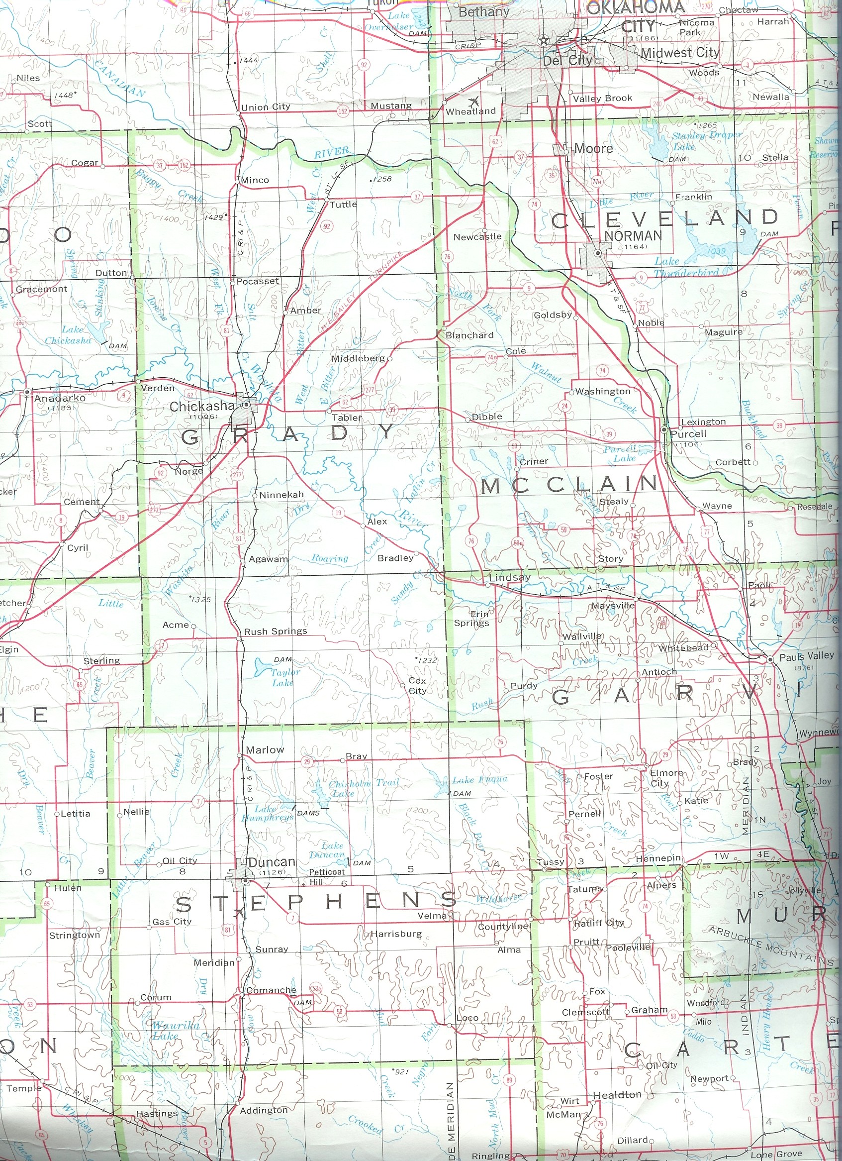
| Grady |
Chickasaw Nation |
Grady |
Grady
1915 |
USGS
Color |
Grady
DoT |
? |
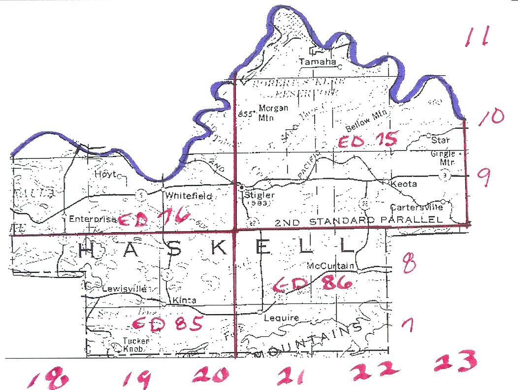
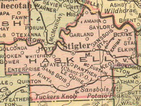
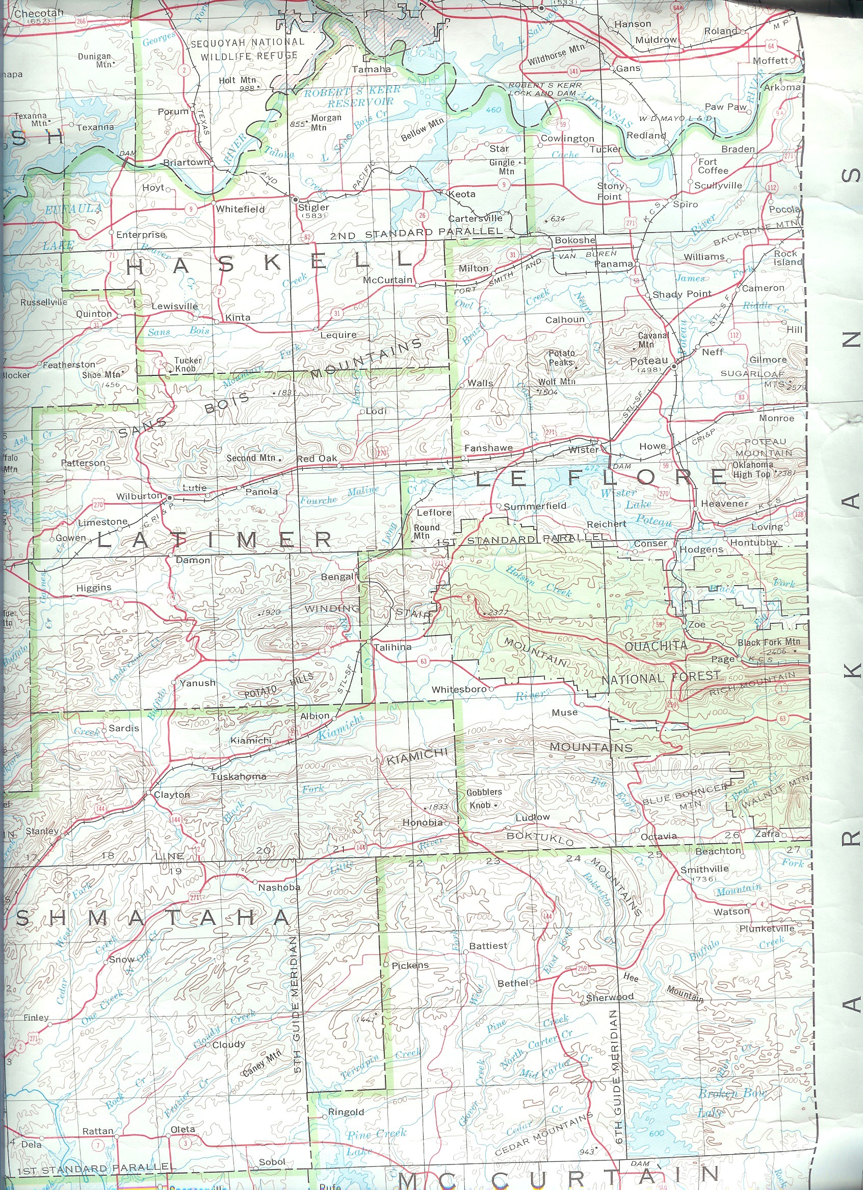
| Haskell |
Choctaw Nation |
Sketch |
Haskell
1915 |
USGS Color |
Haskell
DoT |
75, 76, 85, 86 |
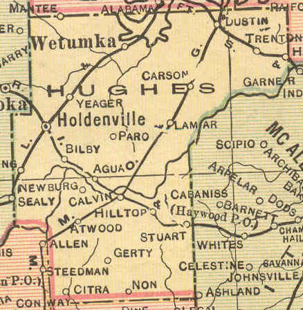
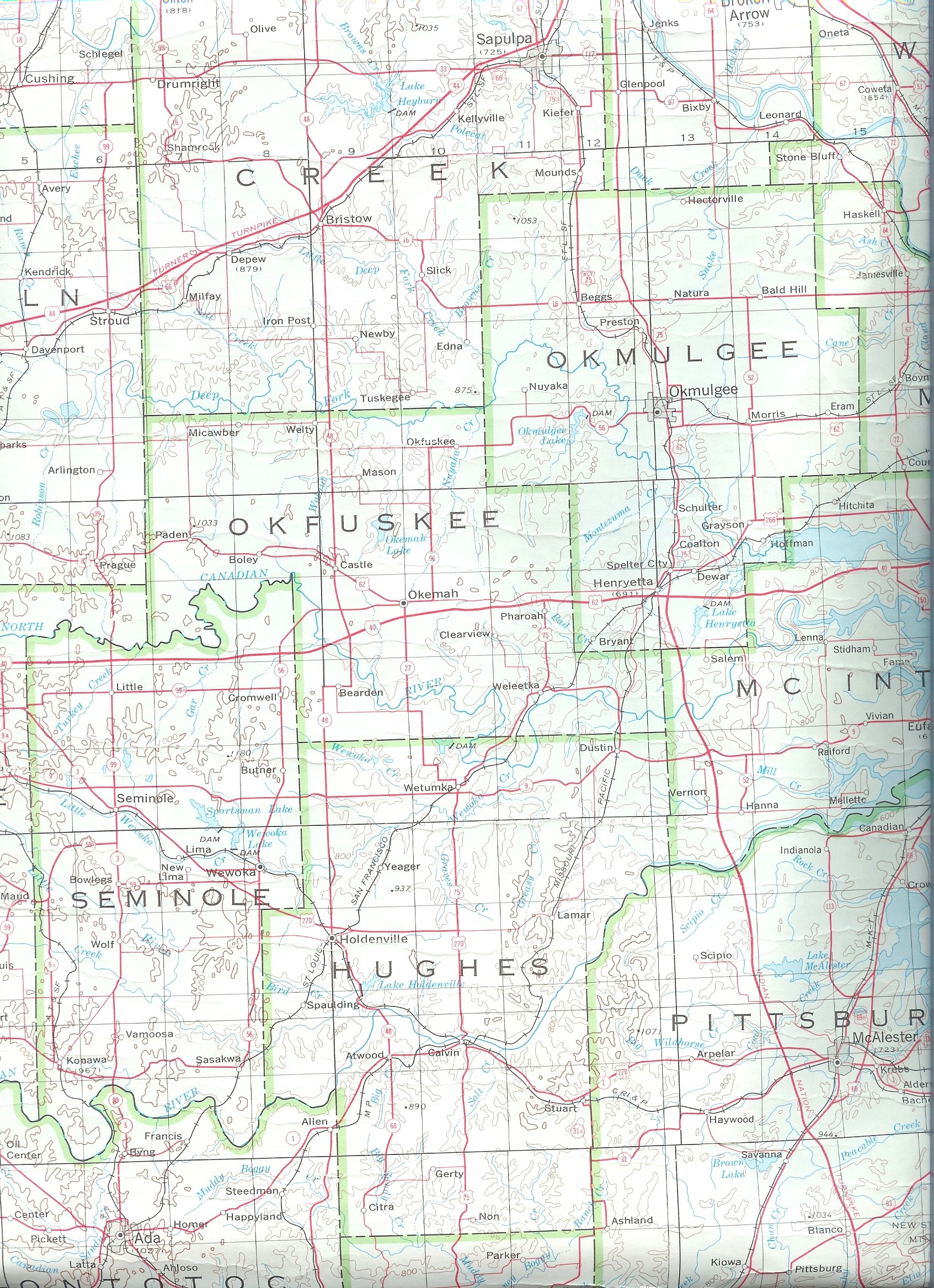
| Hughes |
Choctaw Nation |
Hughes |
Hughes
1915 |
USGS
Color |
Hughes
DoT |
102 |
| Hughes |
Creek Nation |
Hughes |
Hughes
1915 |
USGS
Color |
Hughes
DoT |
68 |
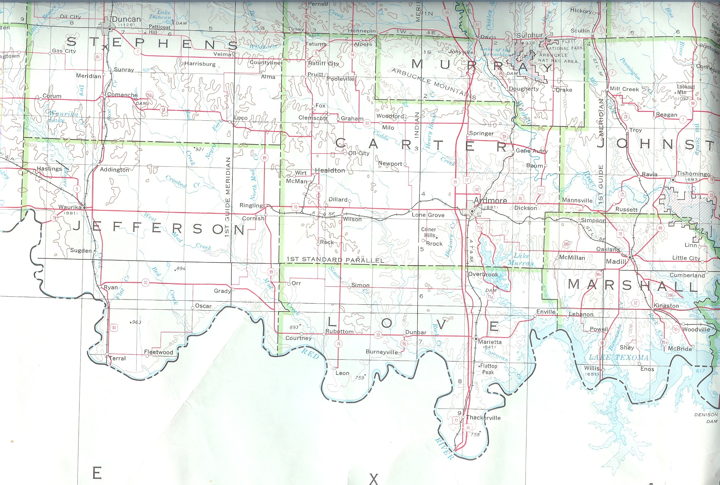
| Jefferson |
Chickasaw Nation |
Jefferson |
Jefferson
1915 |
USGS
Color |
Jefferson
DoT |
? |
| Johnston |
Choctaw Nation |
Johnston |
Johnston
1915 |
USGS Color |
Johnston
DoT |
113, 182 |
| Johnston |
Chickasaw Nation |
Johnston |
Johnston
1915 |
USGS Color |
Johnston
DoT |
? |
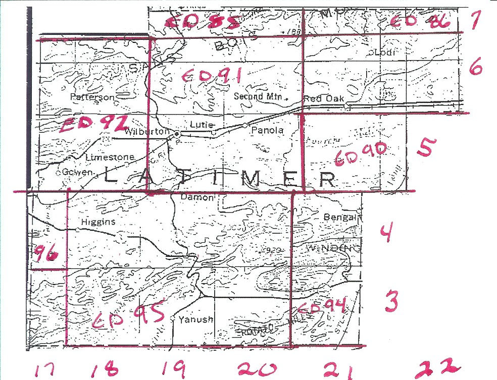
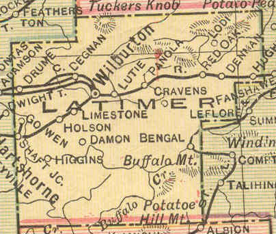
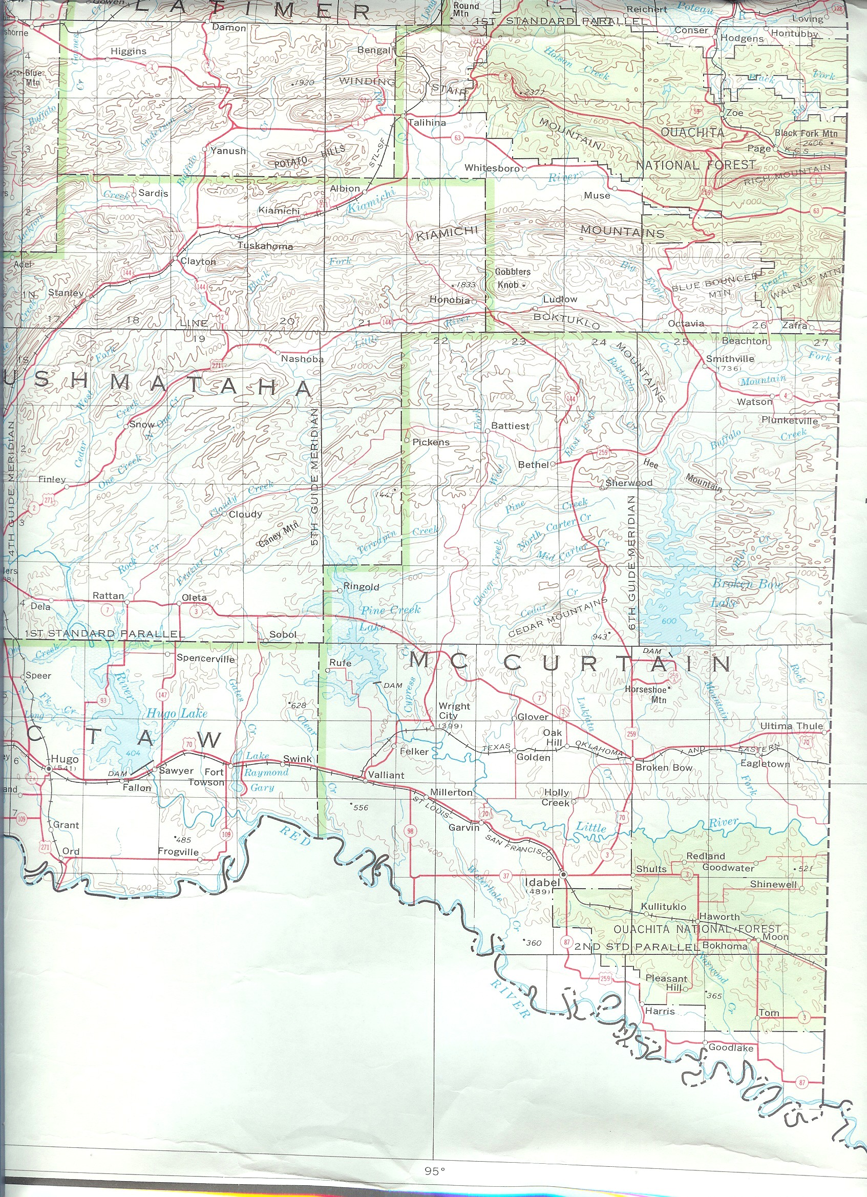
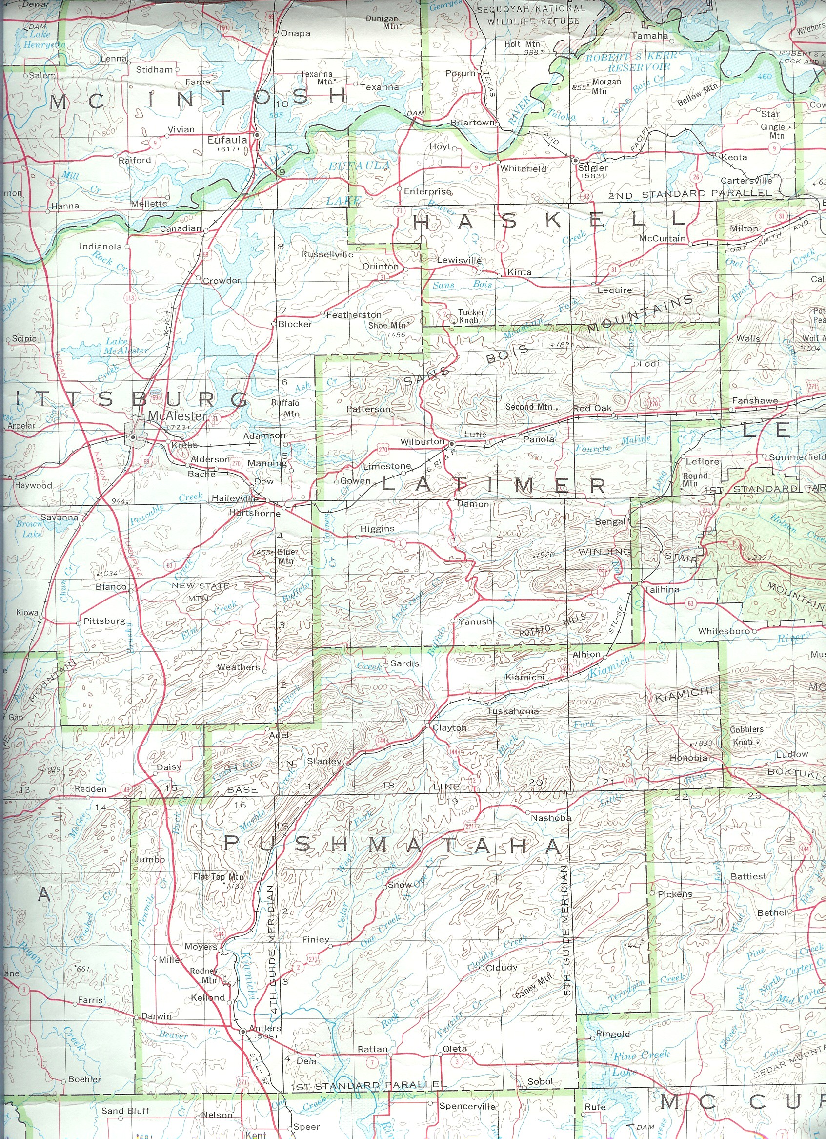
| Latimer |
Choctaw Nation |
Sketch |
Latimer 1915 |
USGS Color |
Latimer
DoT |
85, 86, 90, 91, 92, 94, 95, 96 |
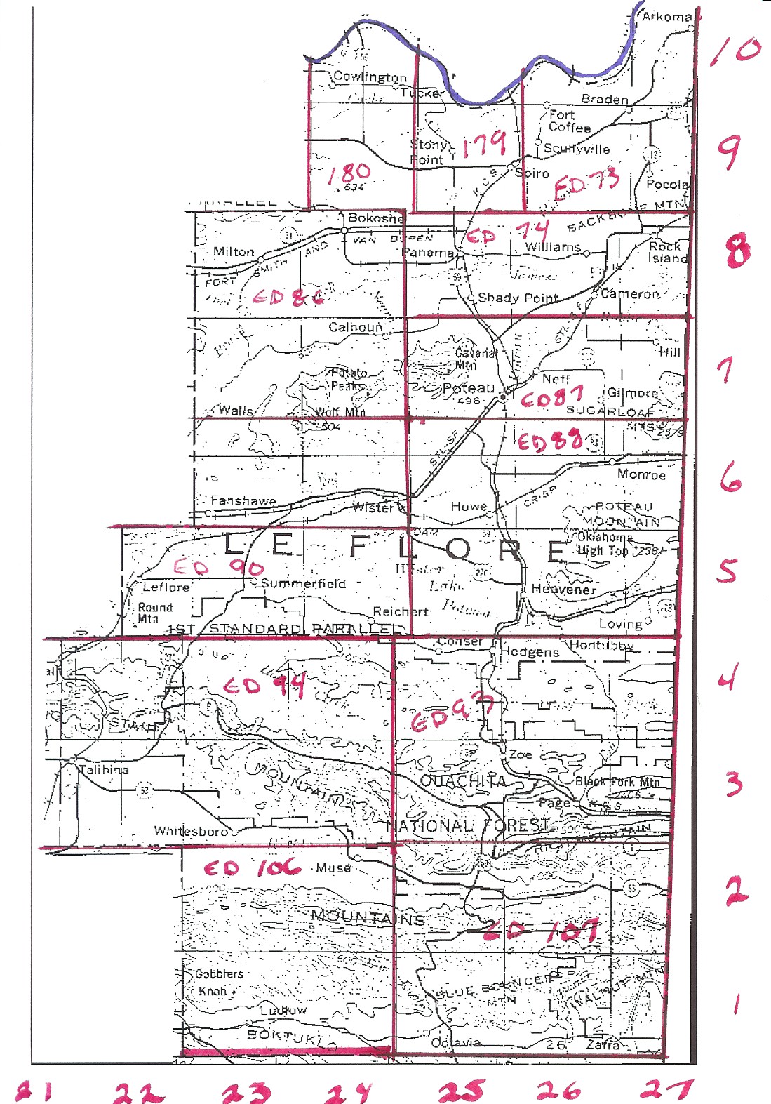
| LeFlore |
Choctaw Nation |
Incomplete |
LeFlore 1915 |
USGS Color |
LeFlore
DoT |
73, 74, 86, 87, 88, (89?), 90, 93, 94,
106, 107, 179, 180 |
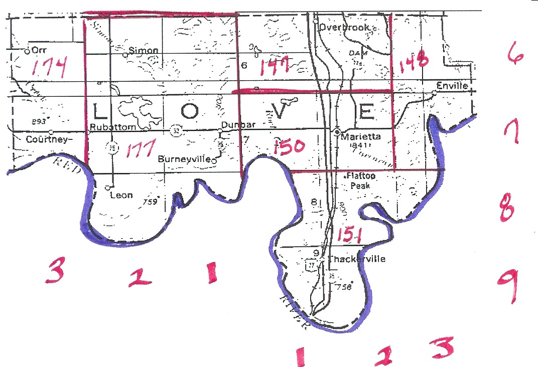
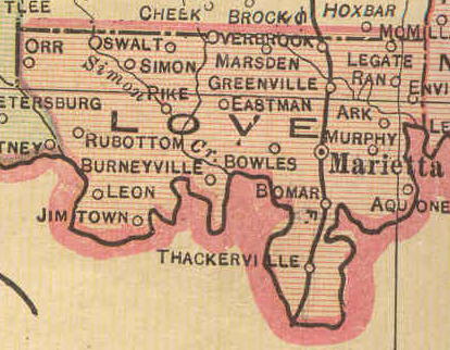
| Love |
Chickasaw Nation |
Sketch |
Love
1915 |
USGS
Color |
Love
DoT |
147, 148, 150, 151, 174, 177 |
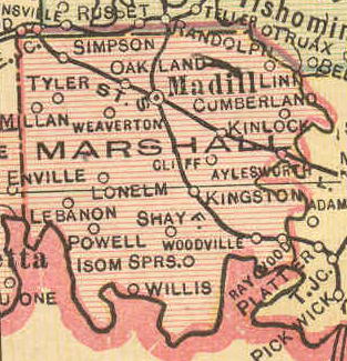
| Marshall |
Chickasaw Nation |
Marshall |
Marshall
1915 |
USGS Color |
Marshall
DoT |
? |
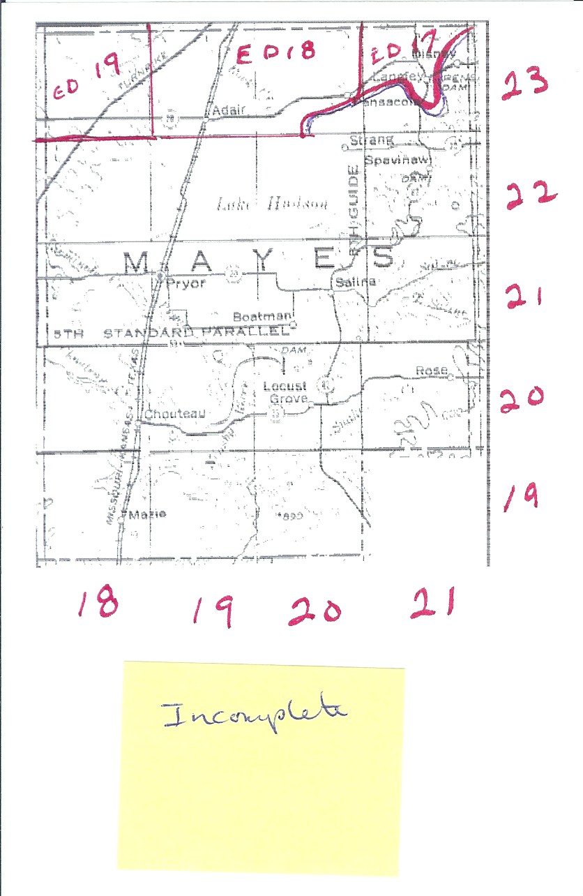
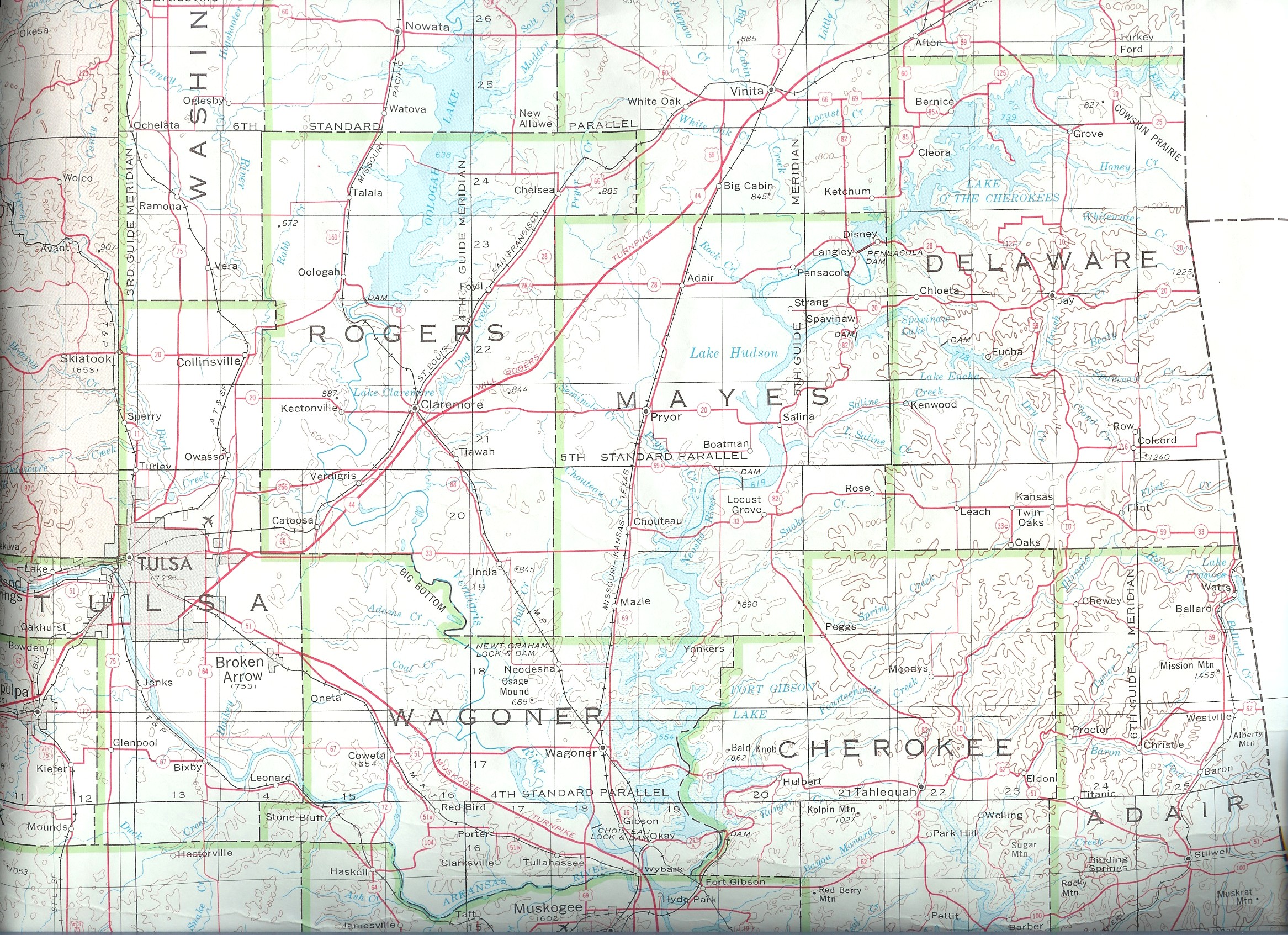
| Mayes |
Cherokee Nation |
Incomplete |
Mayes 1915 |
USGS Color |
Mayes
DoT |
17, 18, 19, 24, 28 |
| McClain |
Chickasaw Nation |
McClain |
McClain
1915 |
USGS
Color |
McClain
DoT |
? |
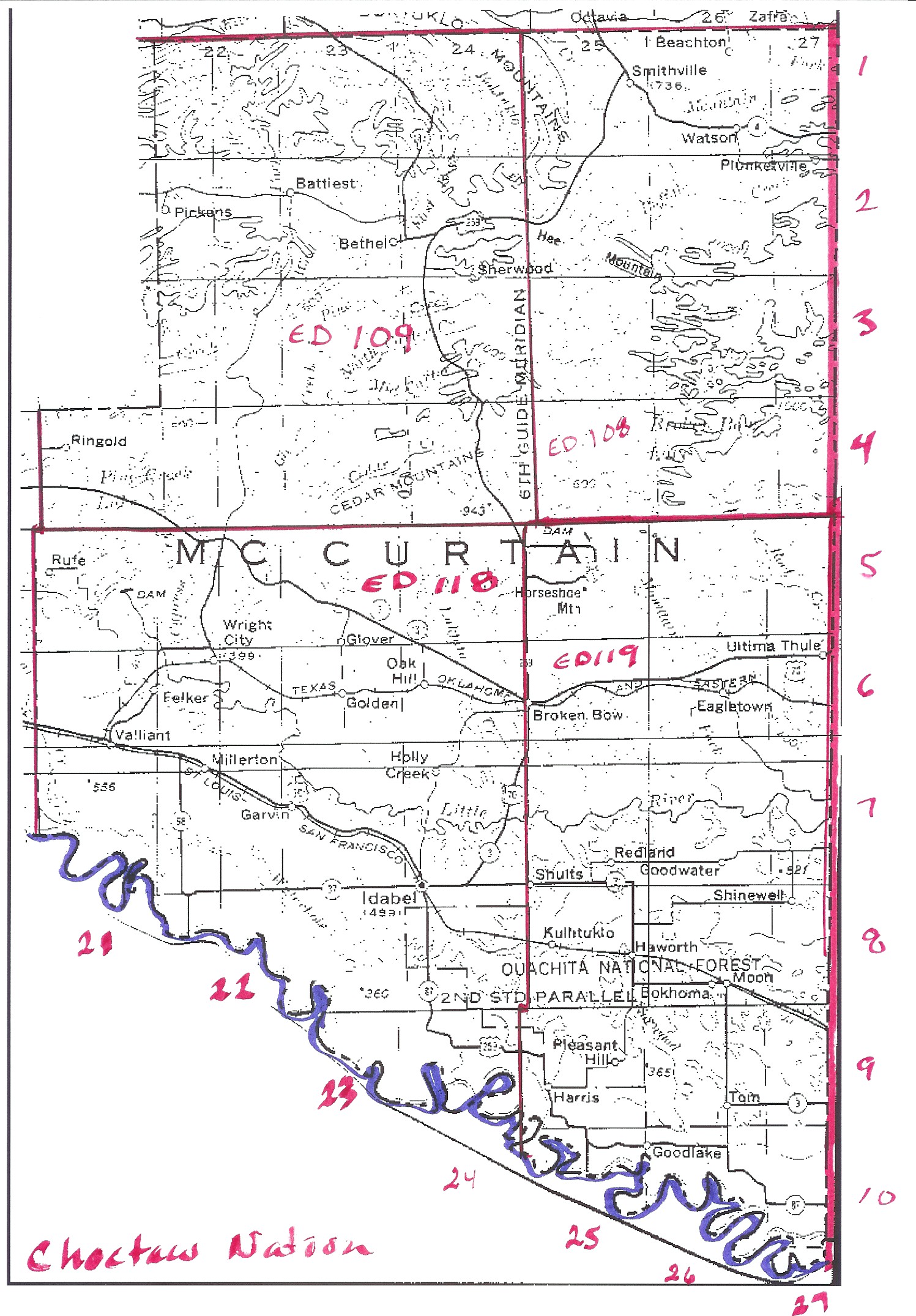
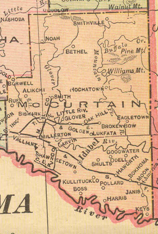
| McCurtain |
Choctaw Nation |
Sketch |
McCurtain 1915 |
USGS Color |
McCurtain
DoT |
108, 109, 118, 119 |
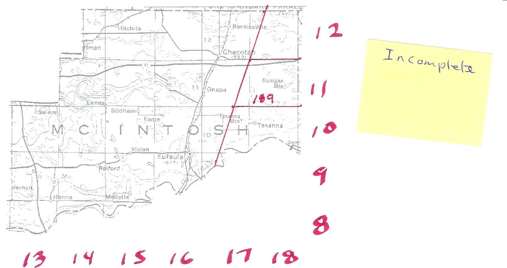
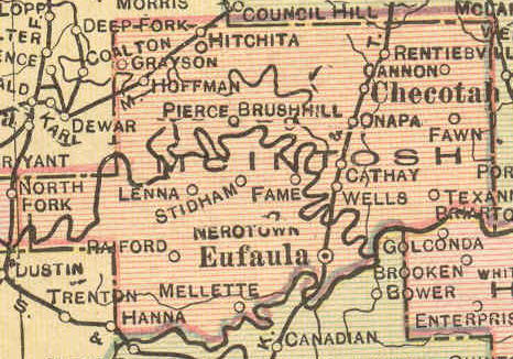
| McIntosh |
Cherokee Nation |
Incomplete |
McIntosh 1915 |
USGS
Color |
McIntosh
DoT |
41, 189 |
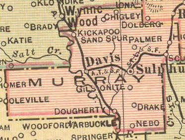
| Murray |
Chickasaw Nation |
Murray |
Murray
1915 |
USGS
Color |
Murray
DoT |
? |
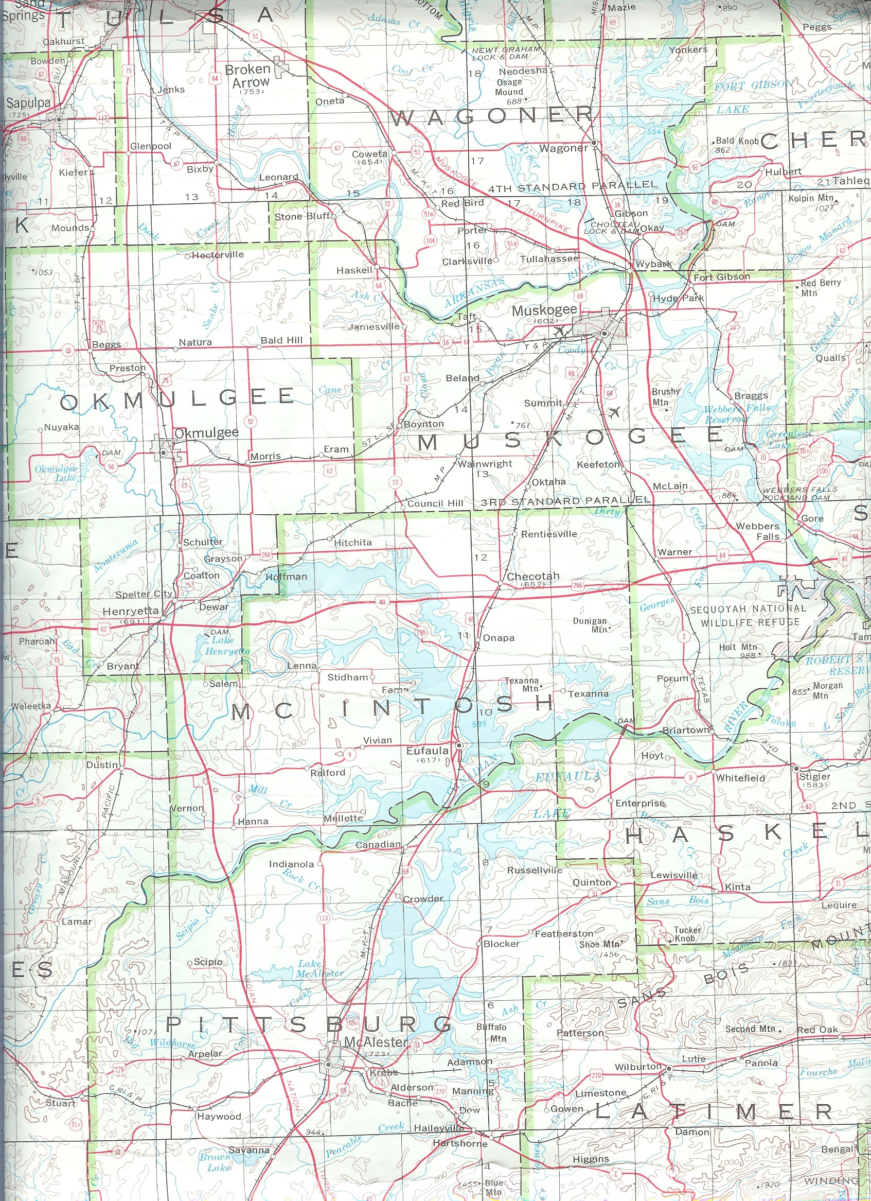
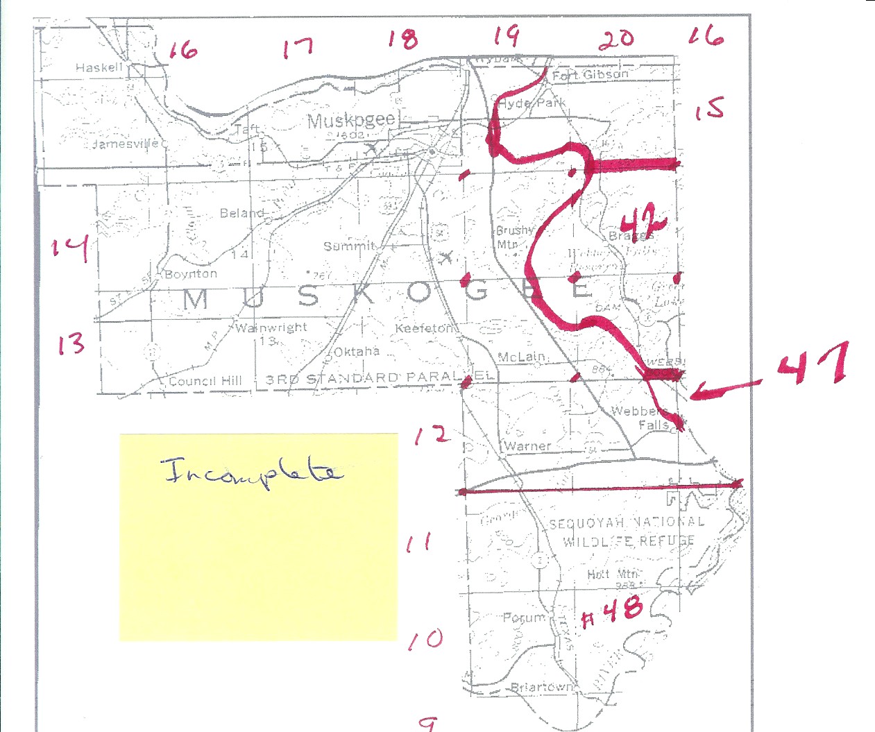
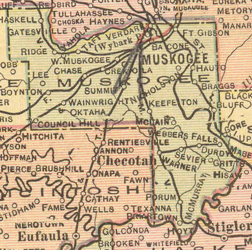
| Muskogee |
Cherokee Nation |
Incomplete |
Muskogee
1915 |
USGS
Color |
Muskogee
DoT |
41, 42, 47, 48 |
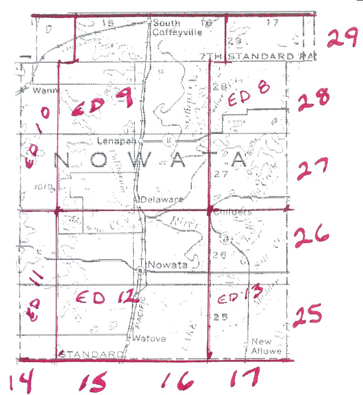
| Nowata |
Cherokee Nation |
Sketch |
Nowata
1915 |
USGS Color |
Nowata
DoT |
8, 9, 10, 11, 12, 13 |
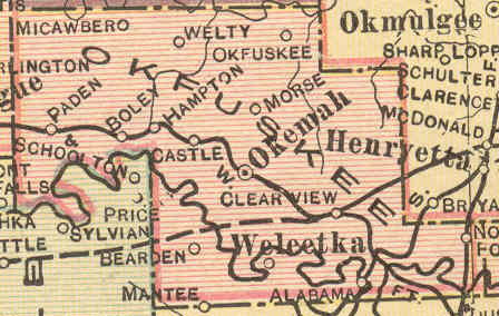
| Okfuskee |
Creek Nation |
Okfuskee |
Okfuskee
1915 |
USGS
Color |
Okfuskee
DoT |
? |
| Okmulgee |
Creek Nation |
Okmulgee |
Okmulgee
1915 |
USGS
Color |
Okmulgee
DoT |
56, 57, 58 |
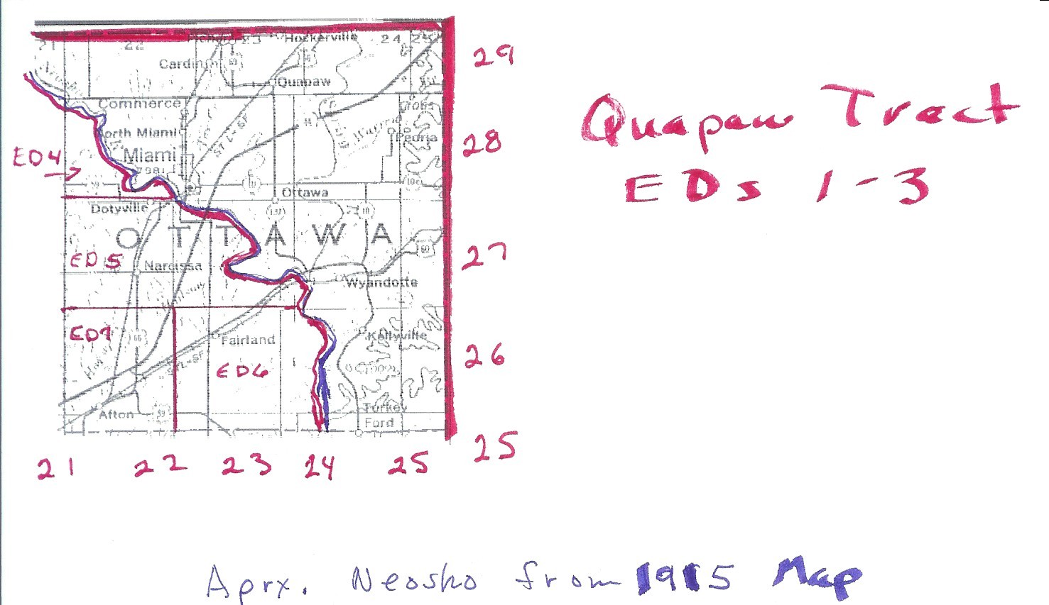
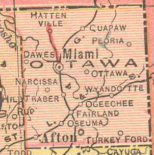
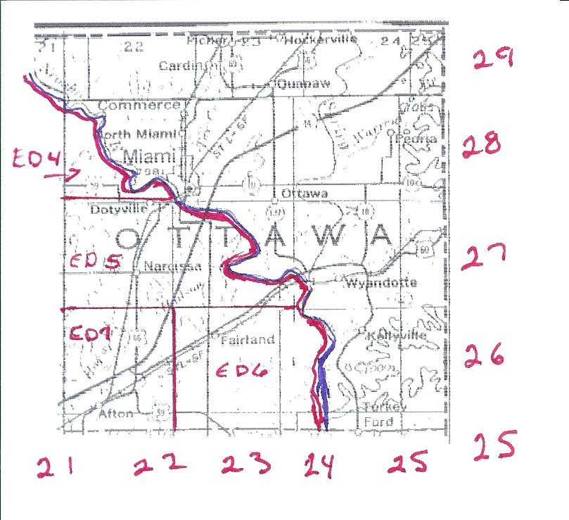
| Ottawa |
Quapaw Tract |
Incomplete |
Ottawa
1915 |
USGS Color |
Ottawa
DoT |
1, 2, 3, 4, 5, 6, 7 Partial Map |
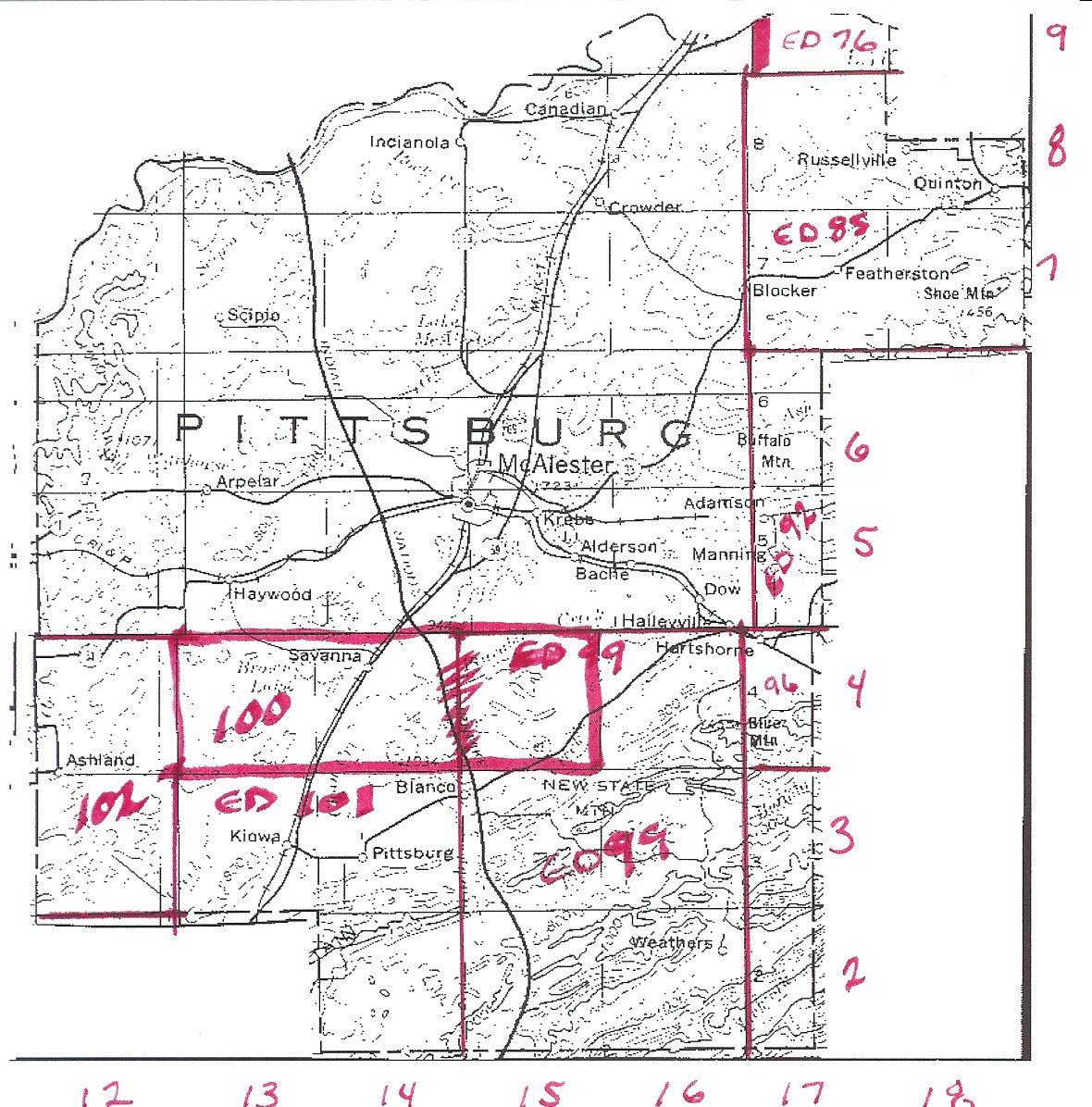
| Pittsburg |
Choctaw Nation |
Incomplete |
Pittsburg
1915 |
USGS
Color |
Pittsburg
DoT |
76, 80, 81, 84, 85, 92, 96, 99, 100,
101, 102 |
| Pontotoc |
Chickasaw Nation |
Pontotoc |
Pontotoc
1915 |
USGS
Color |
Pontotoc
DoT |
? |
| Pontotoc |
Choctaw Nation |
Pontotoc |
Pontotoc
1915 |
USGS
Color |
Pontotoc
DoT |
? |
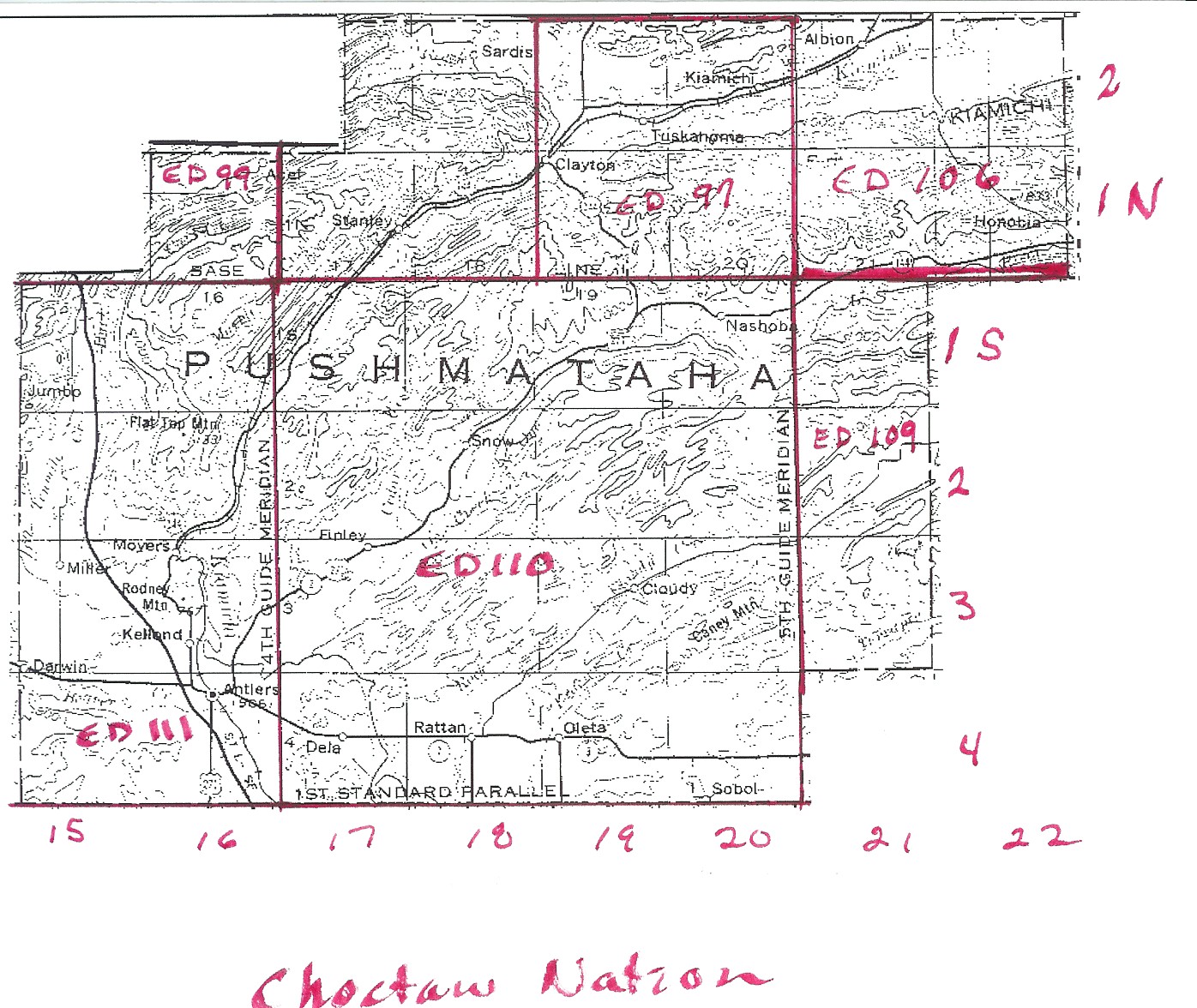
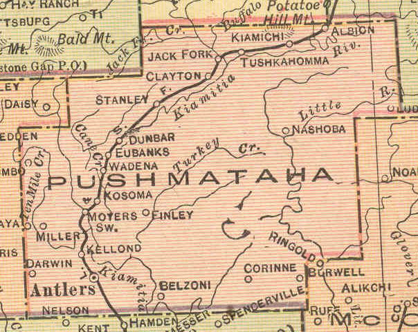
| Pushmataha |
Choctaw Nation |
Incomplete |
Pushmataha
1915 |
USGS
Color |
Pushmataha
DoT |
97, (98?), 99, 106, 109, 110, 111 |
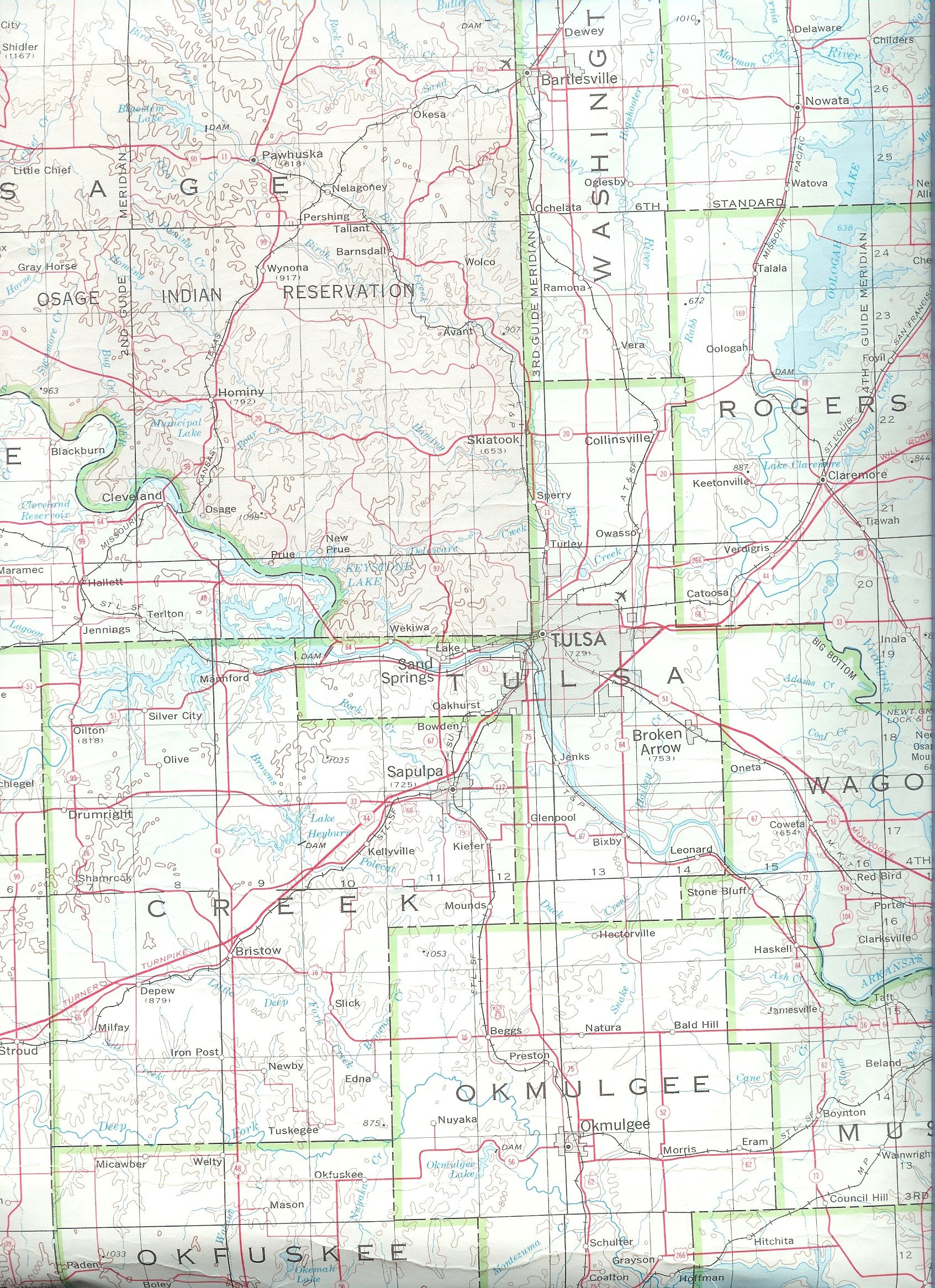
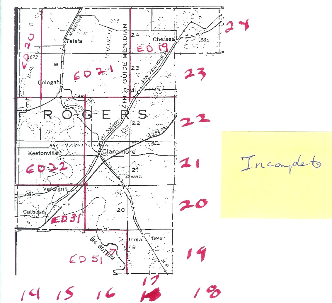
| Rogers |
Cherokee Nation |
Incomplete |
Rogers
1915 |
USGS
Color |
Rogers
DoT |
19, 20, 21 22, 23, 24, 31 |
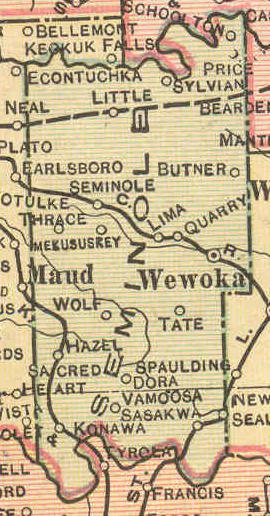
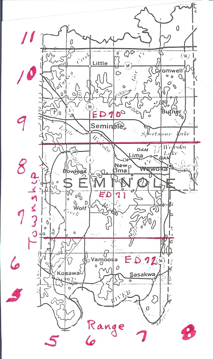
| Seminole |
Seminole Nation |
Sketch |
Seminole
1915 |
USGS
Color |
Seminole
DoT |
70, 71, 72 Partial
Map |
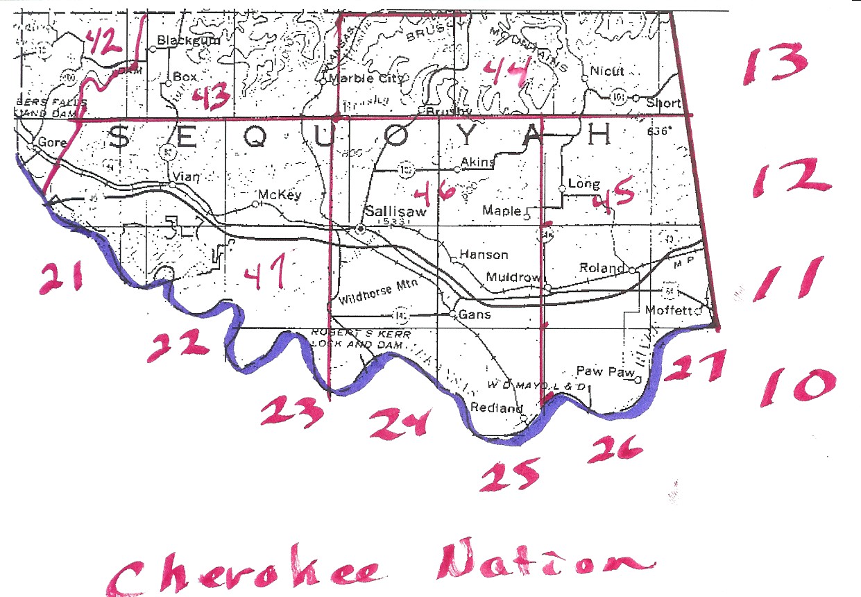
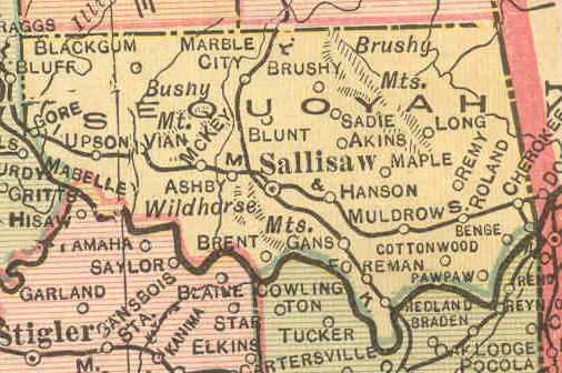
| Sequoyah |
Cherokee Nation |
Sketch |
Sequoyah
1915 |
USGS Color |
Sequoyah
DoT |
42, 43, 44, 46, 46, 47 Partial
Map |
| Stephens |
Chickasaw Nation |
Stephens |
Stephens
1915 |
USGS
Color |
Stephens
DoT |
? |
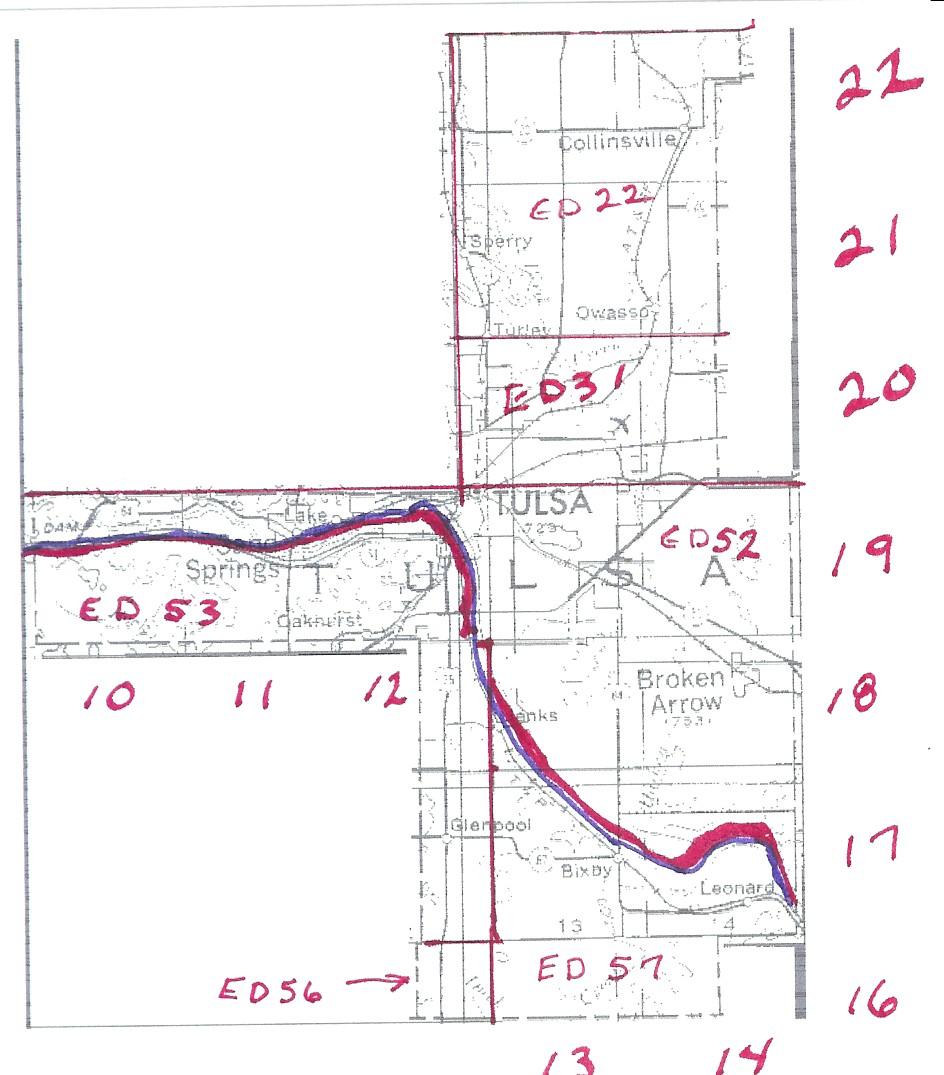
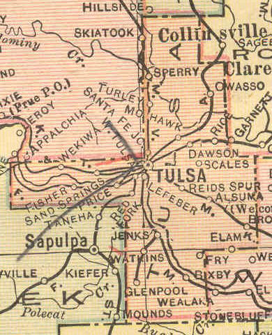
| Tulsa |
Cherokee Nation |
Sketch |
Tulsa
1915 |
USGS Color |
Tulsa
DoT |
22, 31 |
| Tulsa |
Creek Nation |
Sketch |
Tulsa
1915 |
USGS Color |
Tulsa
DoT |
52, 53, 56, 57 |
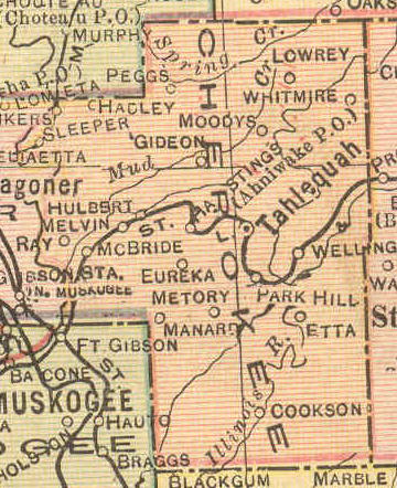
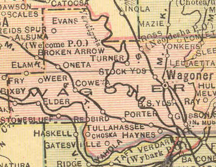
| Wagoner |
Cherokee Nation |
Wagoner |
Wagoner
1915 |
USGS
Color |
Wagoner
DoT |
49, 50, 51 |
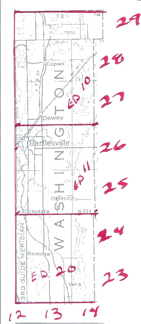
| Washington |
Cherokee Nation |
Sketch |
Washington
1915 |
USGS
Color |
Washington
DoT |
10, 11, 20 |
| USGS Color Map |
Counties Covered |
| Cherokee
Central |
Muskogee,
McIntosh |
| Cherokee
East |
Delaware,
Mayes, Rogers, Wagoner |
| Cherokee
North |
Washington,
Nowata, Craig, Ottawa |
| Cherokee
South |
Mayes,
Cherokee, Adair, Sequoyah |
| Creek Plus |
Creek,
Tulsa |
| Choctaw
Northeast |
Haskell,
Latimer, LeFlore |
| Choctaw
North |
Pittsburg,
Atoka |
| Choctaw --
Pushmataha Area |
Latimer,
Pushmataha |
| Choctaw
Southeast |
McCurtain |
| Choctaw
Southwest |
Choctaw |
| Choctaw/Chickasaw
North |
Pontotoc,
Coal |
| Chickasaw
North |
McClain,
Garvin, Murray, Carter |
| Chickasaw
Southeast |
Marshall,
Bryan, Johnston |
| Chickasaw
Southwest |
Jefferson,
Love, Carter |
| Chickasaw
West |
Grady,
Stephens |
| Seminole
Plus |
Seminole,
Hughes, Okfuskee, Okmulgee |
Questions or comments? E-mail: Sharon McAllister
|


