
Maps
'n' More
Created
By
Sharon McAllister

|
|
Maps
'n' More |
|
|
|
||
|
|
|
||
|
|
|
|
|
|
|
|
|
|
|
|
|
|
|
|
|
|||
|
Download File Containing a Detailed County Map |
View a Reduced Version of the County Map |
Access Individual Township Maps by Township |
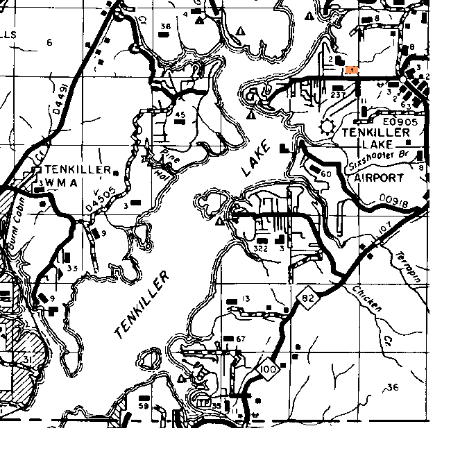
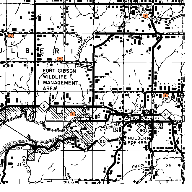
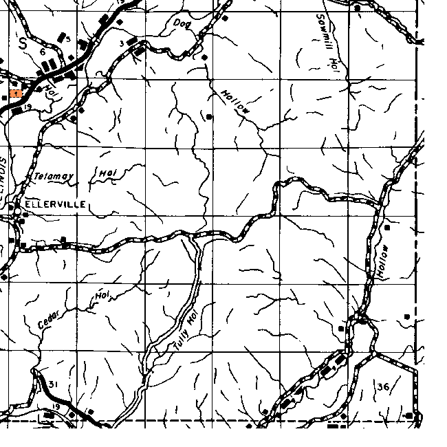
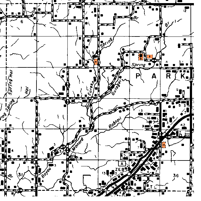
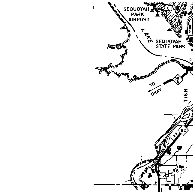
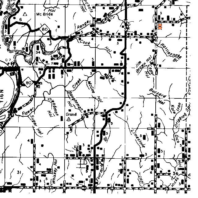
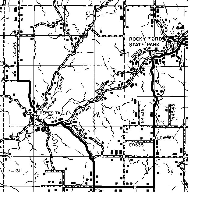
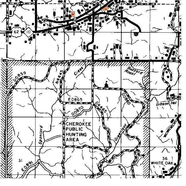
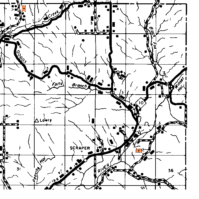
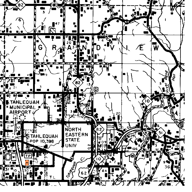
Key to Maps of Towns in Cherokee County
This table includes a link to every map on which I've found each town. If an entry in the Township Map column shows a link to only the Township & Range, then that town does not actually appear on the current map but I've found out which township and sometimes which section it was in from other sources.
| RR Station or P.O. |
1895 |
1915 |
1972 |
Detailed Township Map |
| Ahniwake | No | Yes | No | 34 17N 21 E |
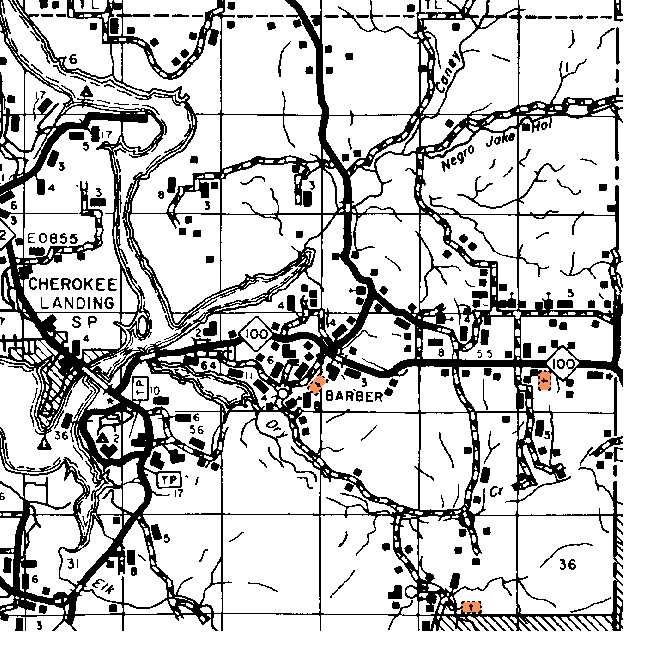
| Barber | No | No | Yes | 21 15N 23E |
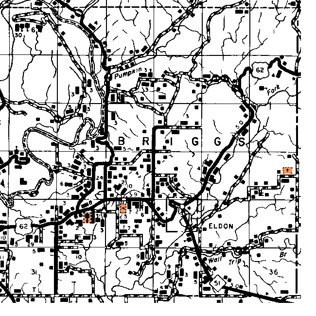
| Briggs | No | No | No | 20 17N 23E |
| Buffington | No | No | No | 24 16N 22E |
| Cap | No | No | No | ? |
| Cherokee | No | No | No | 20-30 16N 22E |
| Chronister | No | No | No | 21 15N 23E |
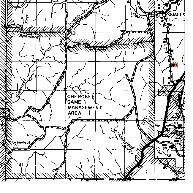
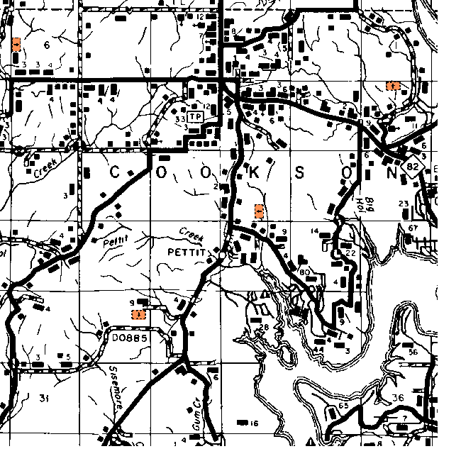
| Cookson | Yes | Yes | Yes | 10 14N 22E |
| Crittenden | No | No | No | 17N 21 E |
| Eldon | No | No | Yes | 22 17N 23E |
| Eli | No | No | No | 1 17N 20E |
| Ellerville | No | No | No | 18 18N 23E |
| Etta | No | Yes | No | 6 15N 23E |
| Eureka | No | Yes | No | 8 16N 21E |
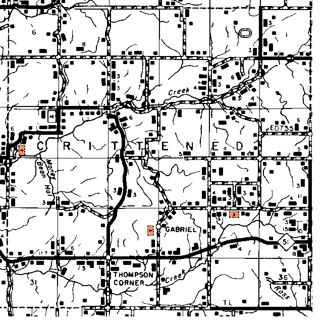
| Gabriel | No | No | No | 27 17N 21 E |
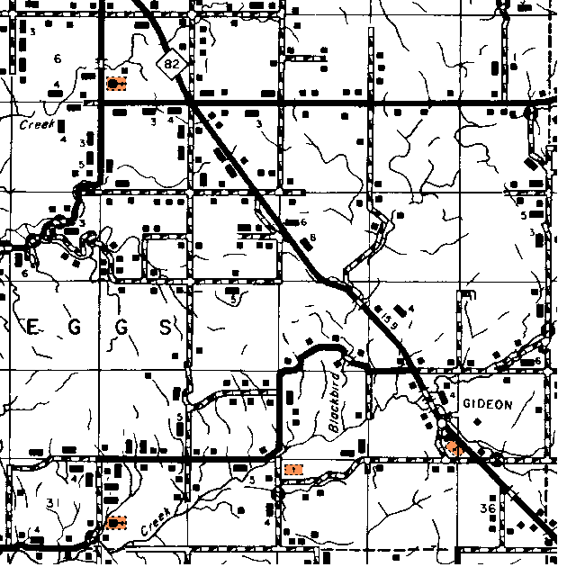
| Gideon | No | Yes | No | 26 18N 21E |
| Golden | No | No | No | 20 18N 21E |
| Greenleaf | No | No | No | 5 14N 21E |
| Hadley | No | Yes | No | 6 18N 20E |
| Hastings | No | Yes | No | 34 17N 21 E |
| Hulbert | No | Yes | Yes | 23 17N 20E |
| Kelsey | No | No | No | 7 16N 23E |
| Keough | No | No | No | 15 16N 19E |
| Kriener | No | No | No | 19 16N 20E |
| Leake Jct. | No | No | No | 18 16N 20E |
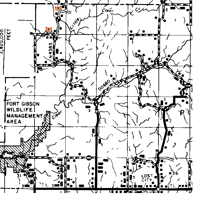
| Lost City | No | No | No | 36 18N 20E |
| Lowery | No | Yes | No | 25 19N 22E |
| Luckey | No | No | No | 2 18N 21E |
| Manard | Yes | Yes | No | 6 15N 21E |
| McBride | No | Yes | No | 7 16N 20E |
| Melvin Jct. | No | Yes | No | 28 17N 20E |
| Metory | No | Yes | No | 23 16N 21E |
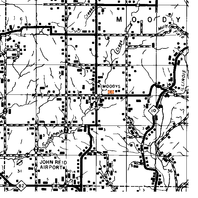
| Moodys | Yes | Yes | Yes | 16 18N 22E |
| Oil City | No | No | No | 3 18N 23E |
| Ozark | No | No | No | 27 14N 21E |
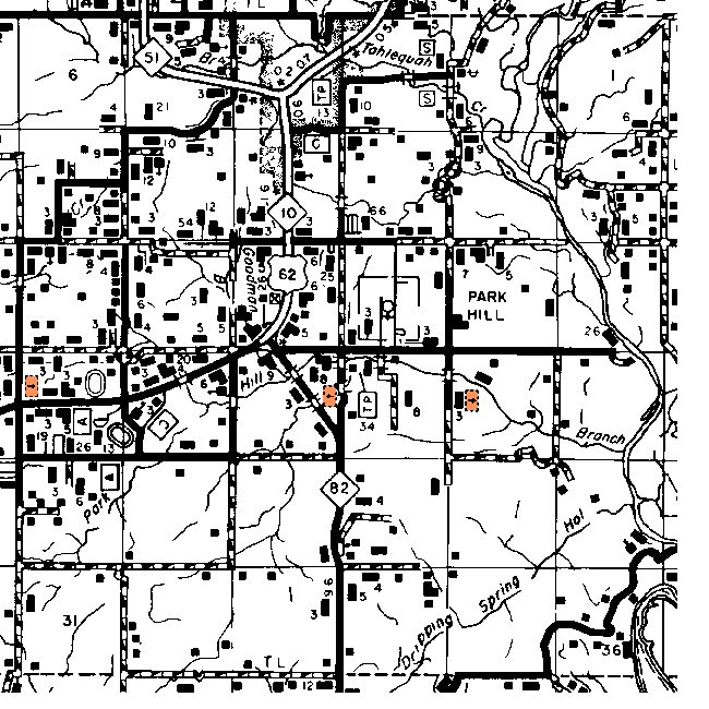
| Parkhill | Yes | Yes | Yes | 15 16N 22E |
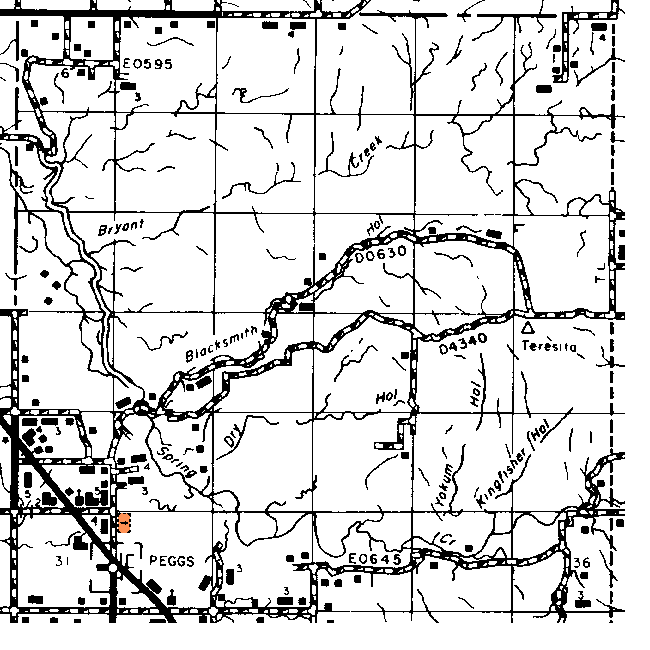
| Peggs | No | Yes | Yes | 31-12 19N 21E |
| Pettit | No | No | Yes | 21 15N 22E |
| Pitts | No | No | No | ? |
| Qualls | No | No | Yes | 1 14N 21E |
| Ray | No | Yes | No | 26 17N 19E |
| Robbins | No | No | No | 4 16N 23E |
| Scraper | No | No | No | 33 19N 23E |
| Seminary | No | No | No | 12 17N 21 E |
| Sleeper | No | Yes | No | 21 18N 19W |
| Standing Rock | No | No | No | 25 15N 22E |
| Tahlequah | Yes | Yes | Yes | 28-32 17N 22E |
| Talley | No | No | No | 17N 19E |
| Teresita | No | No | No | 20 19N 22E |
| Thomas Corner | No | No | No | 32 17N 21E |
| Tuscania | No | No | No | 32 18N 23E |
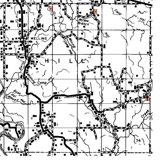
| Welling | No | Yes | Yes | 7 16N 23E |
| Whiteoak | No | No | No | 1 15N 21E |
| Whitmire | No | Yes | No | 2 18N 23E |
| Yonkers * | No | No | No | 10 18N 19W |
| Zeb | No | No | No | 35 16N 21E |
|
* This appears to have been a transcription error on the DoT list as Yonkers appears on the 1915 and 1972 maps of neighboring Wagoner County as well as on the DoT map itself. |
||||
![]()
|
Page last updated
on
Wednesday, July 15, 2026
This site maintained by
Mel Owings
![]()