OKGenWeb Logo

Maps 'n' More
Created By Sharon McAllister

USGenWeb Logo

Index Coal McIntosh Okfuskee Pittsburg Pontotoc Seminole

Hughes  County Township Maps

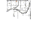
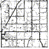
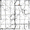
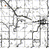
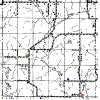
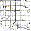
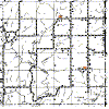
The gridlines on this map are the Township and Range boundaries. Click on any point on the County map to see a much more detailed map showing the 36 sections that make up the numbered Township surrounding it or use the links provided on the List of Towns in Hughes County to find the right map. 

  Range 8E Range 9E Range 10E Range 11E Range 12E
9N

hughes-9n-8e-cem.gif (10183 bytes)

hughes-9n-9e-cem.gif (20074 bytes)

hughes-9n-10e-cem.gif (24214 bytes)

hughes-9n-11e-cem.gif (21188 bytes)

hughes-9n-12e-cem.gif (20118 bytes)

8N

hughes-8n-8e-cem.gif (10150 bytes)

hughes-8n-9e-cem.gif (22501 bytes)

hughes-8n-10e-cem.gif (22333 bytes)

hughes-8n-11e-cem.gif (18314 bytes)

hughes-8n-12e-cem.gif (18145 bytes)

7N

hughes-7n-8e-cem.gif (21830 bytes)

hughes-7n-9e-cem.gif (24851 bytes)

hughes-7n-10e-cem.gif (20990 bytes)

hughes-7n-11e-cem.gif (19029 bytes)

hughes-7n-12e.gif (9013 bytes)

6N

hughes-6n-8e-cem.gif (19032 bytes)

hughes-6n-9e-cem.gif (24126 bytes)

hughes-6n-10e-cem.gif (23266 bytes)

hughes-6n-11e-cem.gif (19746 bytes)


5N hughes-5n-8e-cem.gif (9913 bytes) hughes-5n-9e.gif (23064 bytes) hughes-5n-10e-cem.gif (18962 bytes) hughes-5n-11e-cem.gif (21675 bytes)  
4N   hughes-4n-9e-cem.gif (21082 bytes) hughes-4n-10e-cem.gif (21122 bytes) hughes-4n-11e-cem.gif (21161 bytes)  

Thanks for stopping by!
Maps 'n' More

State-wide resources formerly found on Ceil's Corner 
Created By Sharon McAllister
Became an OKGenWeb Special Project  March 31, 2001
© 2001 - 2025 OKGenWeb

mini envelope E-mail Maps 'n' More

bug  Find any bugs or broken links?
Please Report them here
bug

Page last updated on
 Monday, January 06, 2025 

This site maintained by Mel Owings