
Maps
'n' More
Created
By
Sharon McAllister

|
|
Maps
'n' More |
|
|
|
||
|
|
|
||
|
|
|
|
|
|
|
|
|
|
|
|
|
|
|
|
|
|||
| Back to Hughes County Township Maps | Back to Hughes County Cemetery Lists |
Hughes - T6N-R10E
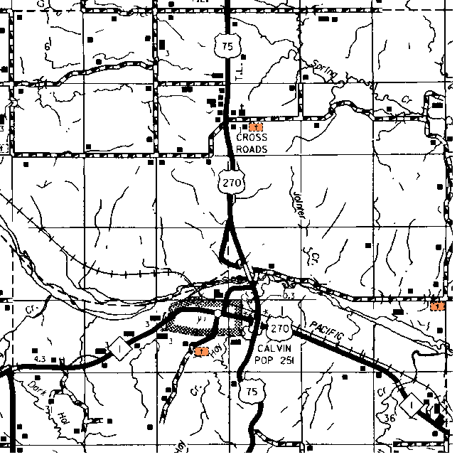
| Cemetery | Sec | Latitude | Longitude | Quad | |||
| Calvin Cemetery | See Above Map | 28 | 345739N | 0961519W | Calvin West | ||
| Crossroads | Sec 10-SE1/4 16N R10E ; On Highway 270, North of Calvin, Oklahoma, app. 3 miles; turn East on dirt road ½ mile. Metal sign over gate. Well marked, well kept and clean. | 10 | |||||
| Unknown | The small cemetery in the NE corner is shown on the topographical map, but not named. | 25 | |||||
Click on cemetery name for more details from GNIS. Use Lat/Long and Quad name for consulting conventional maps or searching Topozone.
![]()
|
Page last updated
on
Wednesday, July 15, 2026
This site maintained by
Mel Owings
![]()