Maps
'n' More
Created
By
Sharon McAllister
|
Maps
'n' More |
||
|
|
||
| Back to Oklahoma County Township Maps | Back to Oklahoma County Cemetery Lists |
Oklahoma County - T12N-R2W
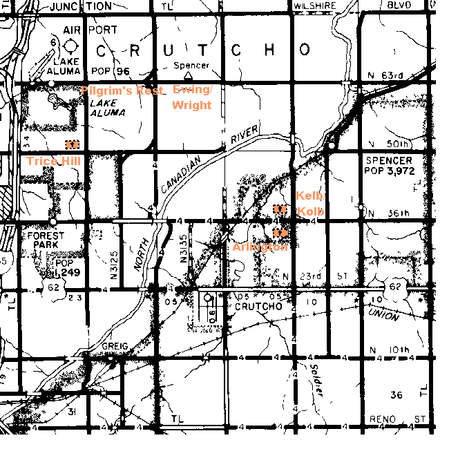
Click on Cemetery Name for links to online information such as canvasses.

| Cemetery | Directions/Comments/Links | Sec. | Latitude | Longitude | Quad |
| Arlington | NE corner of Section 22, no cemetery is shown in NE of Section 23 on the topographic maps. Go to GNIS Map. | 22 | 353021N | 0972333W | Spencer |
| Ewing | Ewing is shown in Section 9 on the topographical map, where driving directions lead to Wright. Go to the GNIS Map. See Wright Canvass. | 9 | 353212N | 0972451W | Spencer |
| Kelb/Kolb | SE quarter of Sec 15. Go to GNIS Map. | 15 | 353031N | 0972320W | Spencer |
| Pilgrim's Rest | In Section 8, on north border about the midpoint. Go to GNIS Map. | 8 | 353209N | 0972553W | Spencer |
| Trice Hill | See Above Map. Go to GNIS Map. | 7 | 353124N | 0972632W | Spencer |
| Wright | Section 9, N.E. 63rd St, East of Sooner Road, south side of road, where Ewing is shown on the topographic maps. Wright Canvass | 9 |
![]()
|
Page last updated
on
Friday, January 09, 2026
This site maintained by
Mel Owings
![]()