 An OKGenWeb
Project
An OKGenWeb
Project
| OKGenWeb | | OKBits | | ITGenWeb | | OKArchives | | USArchives | | USGenWeb | | Genie Angels |
An OKGenWeb
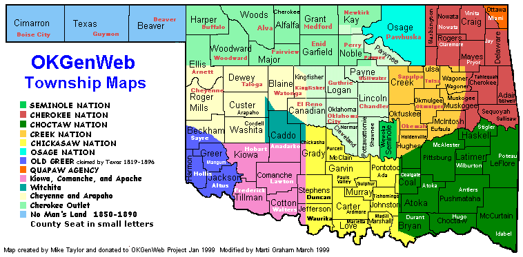
Project| Oklahoma Township Maps
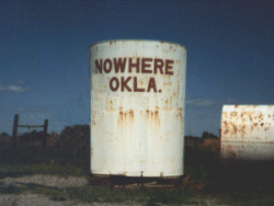
Picture on right taken in Caddo County THIS SITE IS UNDER CONSTRUCTION |
 |
 |
Sections measure one mile square. These sections are numbered
beginning with sec.1 on the northeast corner and continues to the west, south
to 7, east to 12. The pattern is repeated until all 36 sections are number
.This represents 36 Sq. Miles
|

Oklahoma Counties-
Search The Web