Place Names
BERRY: 6 miles east of Moore in Section 2-10N-2W. A post office established 23 June 1892 and name changed to MORGAN, 24 April 1901. Named for George G. Berry, early-day resident.
BLUE HOLE: A favorite swimming hole in the 1920s where Boggy Creek emptied into the Canadian River about four and one-half miles due west of downtown Norman on Main Street.
BOX: Located in the extreme southeastern part of the county in Section 25-6N-1E. Named for first postmaster, George Box. Post office, no longer in existence, operated from 7 May 1898 to 2 January 1907.
BUCKHEAD: 6 miles west of Wanette in Section 36-6N-1E. A post office operated from 3 March 1893 to 30 November 1906.
CASE: 12 miles east of Moore. A post office from 1 December 1890 to 31 July 1906. Named for George Case, first postmaster.
COLO: Located near the southeast corner of 84th Avenue SE and Cedar Lane Road. A post office operated here between 10 September 1900 and 15 April 1906.
CORBETT: 7 miles southeast of Lexington in Section 20-6N-1E. Formerly HIGBEE. Name changed to Corbett 19 February 1902, and discontinued 2 January 1907. Named for first postmaster, James P. Corbett.
CRAM'S GROVE: Located on the left bank of Little River in the southeast corner of Section 10-9N-2W. This was the scene of early-day community celebrations.
DENVER: 6 miles east of Norman in Section 35-9N-1W. A post office from 24 May 1892 to 14 April 1906. The post office was reopened on October 1, 1906, operating as a relay station for many years. Named for the youngest son of Denver Runyan, who had a business nearby.
ETOWAH: 11 miles east of Noble in Section 23-8N-1E. A post office from 17 August 1894 to 31 May 1907. Name is from a Cherokee settlement in Forsyth County, Georgia.
FERGUSON GROVE: On Ferguson Creek near present day intersection of East Brooks Street and Carey Drive, Norman. Scene of early-day celebrations in Norman, such as the first speech made near Norman by the first territorial governor, George Steele on 8 August 1891.
FORT HILL: prominent natural landmark northeast of Noble on the site of the former Arbuckle Trail in the northwest part of the southwest quarter of Section 13-8N-2W.
FRANKLIN: 11 miles northeast of Norman in Section 5-9N-1W. A post office from 10 May 1892 to 14 April 1906. Named for Franklin Blackburn, a local long-time resident.
HALL: 6 miles southeast of Noble in Sections 30 and 31-8N-1E. A post office from 7 March 1891 to 15 November 1906. Named for first postmaster Carrie Hall, widow to Gervase Hall.
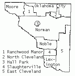
HALL PARK: A municipality incorporated 26 August 1960 adjoining Norman on the northeast in Section 20-9N-2W. Named for town site developer, Ike Hall.
HELL'S HALF ACRE: Favorite outdoor site during the first third of the 20th Century. Located on the left bank of the South Canadian River where 12th Avenue SE enters the flood plain of the river.
HELSEL: Located in the southwest corner of the southeast quarter of Section 21-7N-1E. Operated a post office between 24 Jan 1900 and circa 1906. Named for Steve Helsel, nearby store owner.
HENDERSON: Located in the northwest corner of the east half of the northeast quarter of Section 24-7N-1E. Operated a post office between 5 June 1894 and 2 January 1907. Named for a local store owner.
HICO: Located on the southwest quarter of Section 2-9N-1W. Operated a post office between 11 June 1892 and 14 April 1906.
HIGBEE: 7 miles southeast of Lexington in Section 20-6N-1E. Post office established 23 August 1901, and name changed to CORBETT 19 February 1902. Named for Joseph B. Higbee, local Pottawatomie Indian.
HOLLYWOOD: Located in the northeast corner of Section 7-9N-1W or at 4700 North Porter Avenue in Norman.
JONESBOROUGH: Located at the northwest corner of Section 26-10N-4W (the southeast corner of Meridian Avenue and southwest 149th Street in Oklahoma City). Operated a post office between 31 January 1891 and 16 April 1892.
KICHAI INDIAN VILLAGE: Located near four miles north of Lexington, likely on the left bank of the Chouteau Creek, east of Duffy Corner. A band of Kichai Indians lived at this site during the 1850s. Only permanent Indian village known to exist within Cleveland County.
LEXINGTON: Post office established 21 February 1890. The name comes from Lexington, Kentucky.
LINDEN: 7 miles south of Newalla in Section 1-9N-1E. A post office from 17 October 1893 to 14 February 1906. Took its name from the basswood or lime tree. No longer in existence.
MAGUIRE: 4 miles east of Noble in Section 28-8N-1W. A post office from 29 May 1900 to 2 January 1907. Named for James D. Maguire, Norman's first hardware dealer.
MARDOCK: 14 miles east of Norman. No longer in existence. A post office from 31 January 1900 to 2 January 1907. Mardock Mission is listed on National Registry of Historic Places. Named for Quaker Missionary, J.F. Mardock.
McKIDDYVILLE: Located in the southwest corner of Section 9-7N-1E, seven miles east of SLAUGHTERVILLE.
MILAN: Assigned to Oklahoma County 21 September 1891.
MOORE: Post office established 27 May 1889. Reportedly named for a Santa Fe Railway conductor. The original railroad name was VERBECK.
MORGAN: Formerly BERRY. 6 miles east of Moore. Post office name changed to Morgan 24 April 1901 and discontinued 31 July 1906. Named for first postmaster, M. G. Morgan.
NEEDMORE: Located in the northwest corner of Section 33-8N-1E.
NOBLE: 7 miles southeast of Norman. Post office established after 8 July 1889. Named for John W. Noble, secretary of the interior under President Benjamin Harrison, under whose direction the Run occurred.
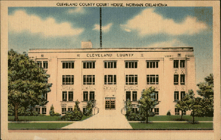
NORMAN: County seat of Cleveland County. Post office established 27 May 1889. Took its name from Norman Switch, established by the Santa Fe railway at the site of Camp Norman, named for Aubrey Norman, surveyor.
NORTH GROUNDS: Ceremonial grounds for the Absentee Shawnee Indian splinter group. Located on the north side of Franklin Road between 144th and 156th Avenue NE, Norman.
PECAN: 9 miles southeast of Lexington. No longer in existence. A post office from 20 January 1896 to 31 May 1905. Named for a nearby grove of pecan trees.
QUINCY: 6 miles west of Moore. No longer in existence. A post office from 21 March 1892 to 29 February 1904. Named by Vincent E. Breese, first postmaster, for his hometown of Quincy, Illinois.
ROSEDALE: Assigned to Oklahoma County 21 September 1891.
SILVER: Assigned to Oklahoma County 21 September 1891.
SLUSHER: Located in the northeastern part of the county. No longer in existence. It was a post office from 13 June 1894 to 14 August 1905. Named for William P. Slusher, first postmaster.
SOUTH GROUND: Ceremonial ground of the Big Jim Band of the Absentee-Shawnee tribe. Located on the original Chief Big Jim allotment in the southeast corner of Section 28-9N-1E.
STELLA: In the extreme northeastern corner of the county. A post office from 23 November 1892, to 14 February 1906. Named for Stella Guilliams, mother of William D. Guilliams, early-day resident.
VERBECK: Original railroad name for MOORE. The name was coined from the telegraphic call "VK."
WADE: Rural store located in the southwest corner of Section 29-9N-1E. Now inundated by Lake Thunderbird. Also called GREASY CORNER.
WALKER: Railroad siding and platform on the Santa Fe right-of-way, along the east side of Section 10-7N-2W, a short distance from the railroad bridge across the South Canadian River.


