
Maps
'n' More
Created
By
Sharon McAllister

|
|
Maps
'n' More |
|
|
|
||
|
|
|
||
|
|
|
|
|
|
|
|
|
|
|
|
|
|
|
|
|
|||
| Back to Alfalfa Co. Map Links |
1915 Atlas
Alfalfa County
![]()
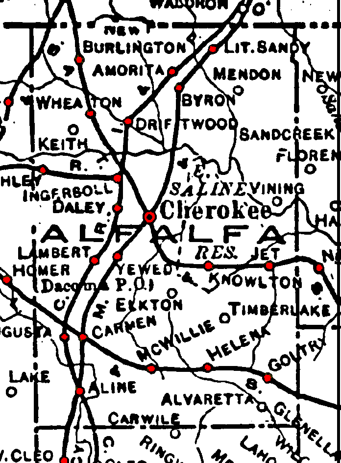
Railroad Stations are shown in red.
The line running through the northwest corner of the county and the one running from northwest to southeast are branches of the Atchison, Topeka & Santa Fe. Both were still in operation in 1972.
The line north-south line through Aline, Cherokee and Lit. Sandy is the Kansas Ciry, Mexico and Orient. Later acquired by the Santa Fe, it was still operational in 1972.
The north-south line though Aline, Ingersol and Amorita is the Chicago, Rock Island & Pacific. It had been abandoned by 1972.
The "R" Short Line extending west from Ingersol was abandoned by 1972.
The east-west line through the southern part of the county is the St. Louis & San Francisco. It was still operational in 1972.
The Atlas shows no roads in Alfalfa County. The thin lines are rivers and creeks.
![]()
|
Page last updated
on
Wednesday, July 15, 2026
This site maintained by
Mel Owings
![]()