
Maps
'n' More
Created
By
Sharon McAllister

|
|
Maps
'n' More |
|
|
|
||
|
|
|
||
|
|
|
|
|
|
|
|
|
|
|
|
|
|
|
|
|
|||
|
Present-day Maps of Counties and Townships In Oklahoma Last Updated:2/14/2004 |
||
|
Jump to the County Links |
||
|
Learn About the Project |
||
| Index to Towns | Index to Townships | |
visitors since January 31, 2000 - thanks for stopping by!
Warning! This page contains such an extensive selection of links that it loads rather slowly. While you're waiting for it to load, here's a summary of the types of maps you're going to get.
In the first column, if the County Name is itself a clickable link, it leads to a list of places in that county that have appeared on one or more of the maps indexed on this site or Oklahoma Department of Transportation records. Each such county page provides individual links from those places to the corresponding maps, as well as all of the general links provided for that county here. A red * indicates that the actual links for a particular county are still under construction but the information itself is there so you should find it a convenient one-stop-shop for finding places.
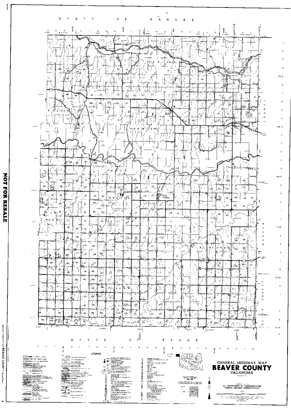
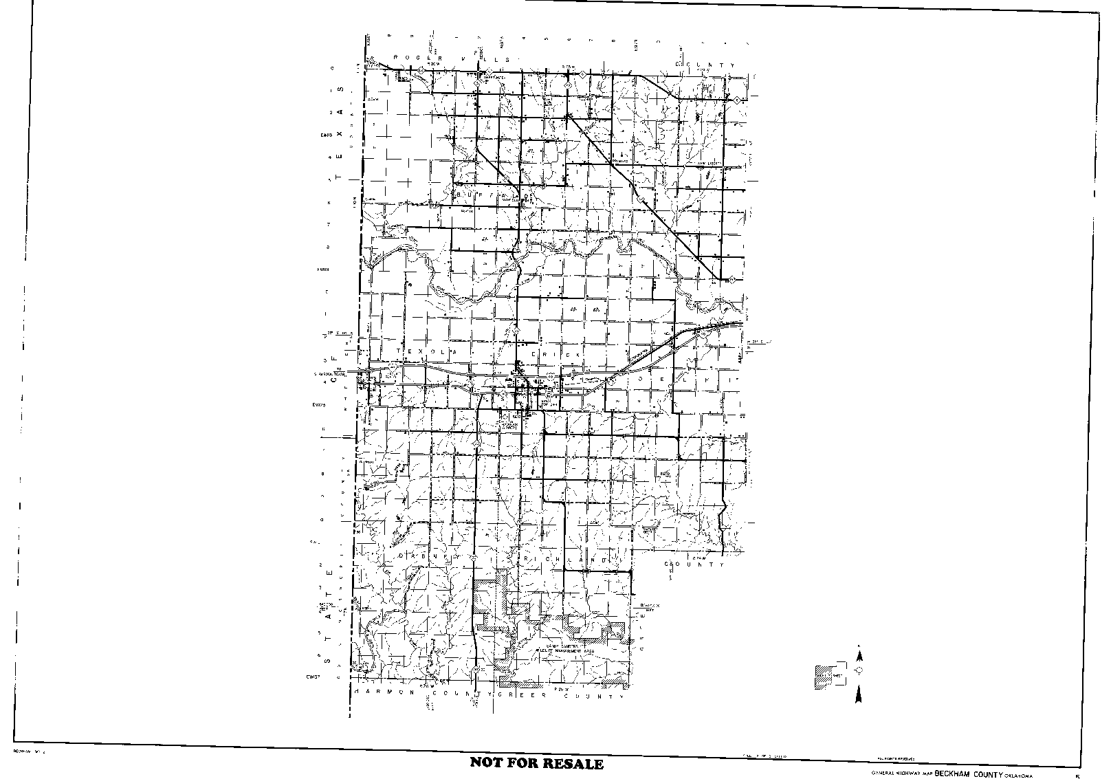
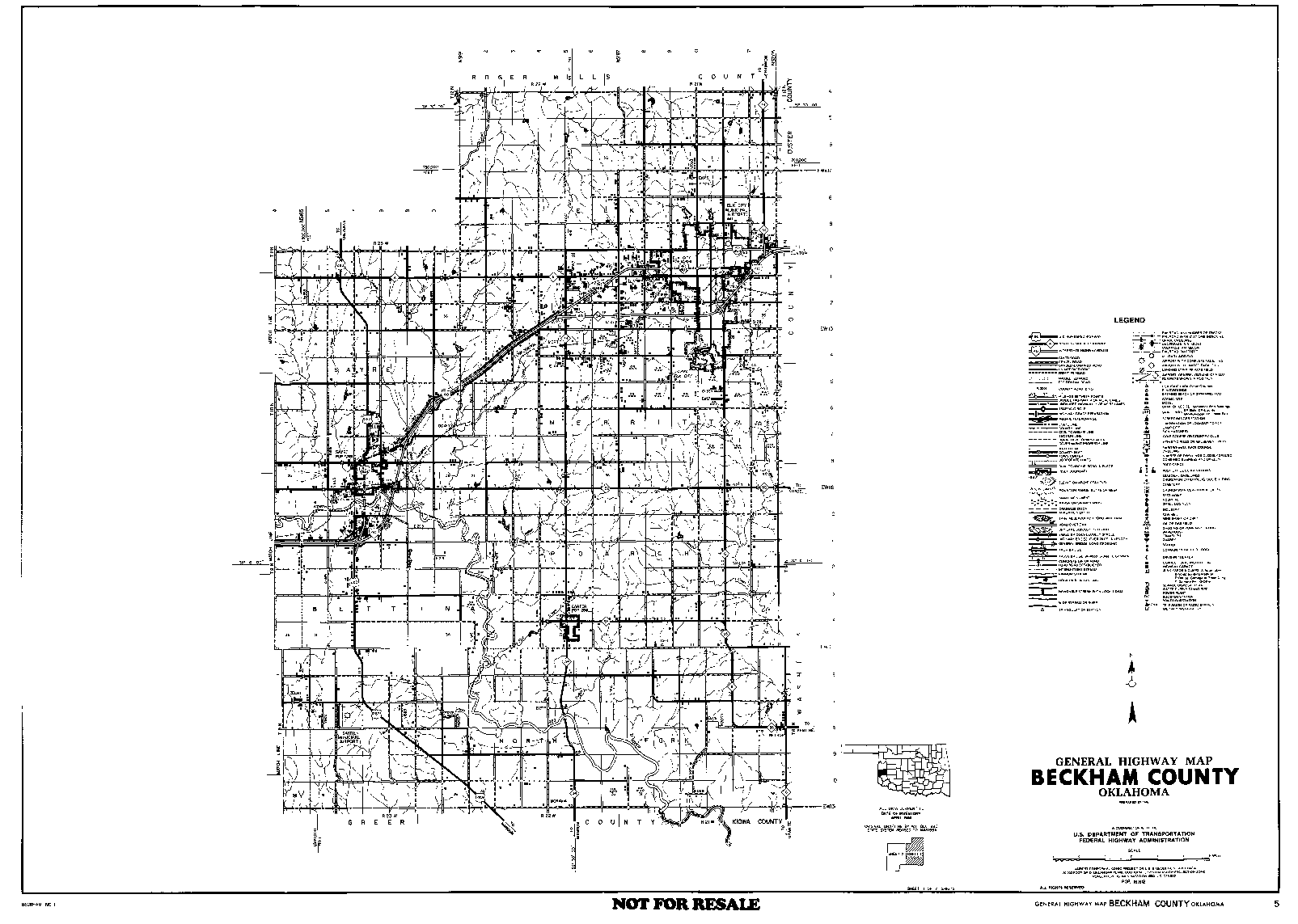
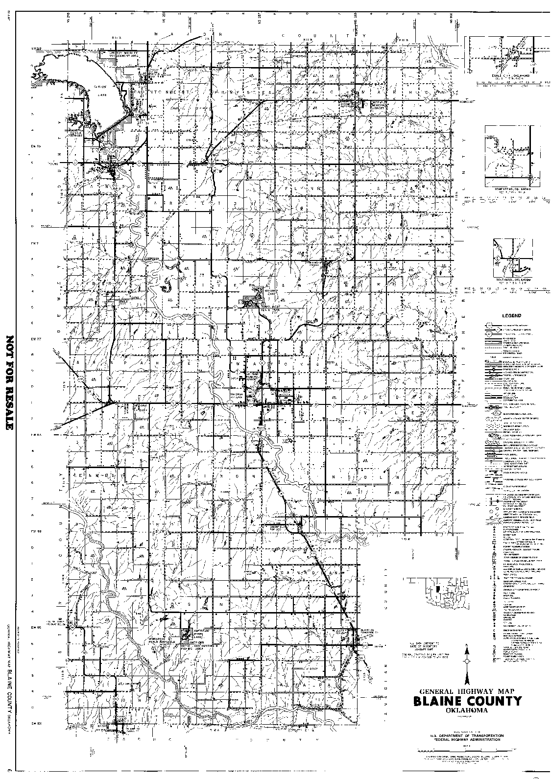
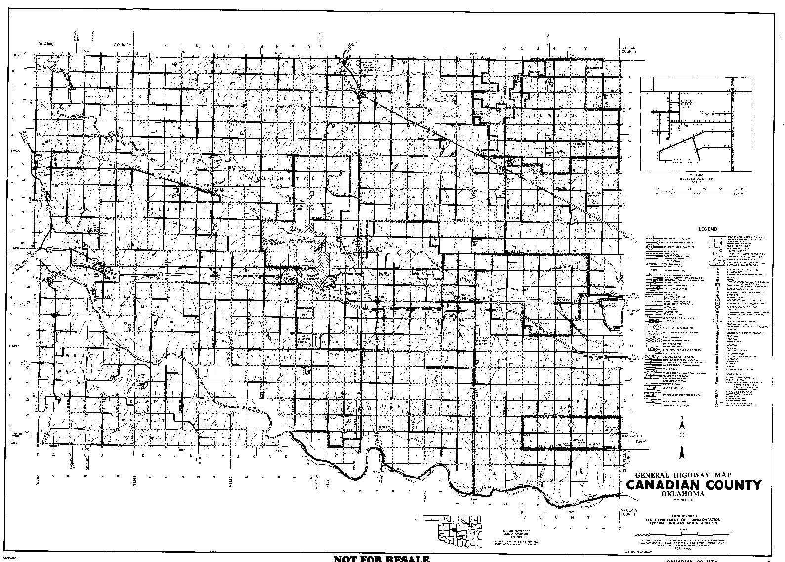
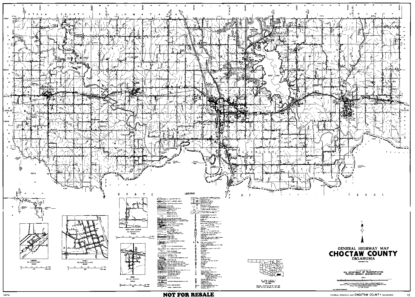
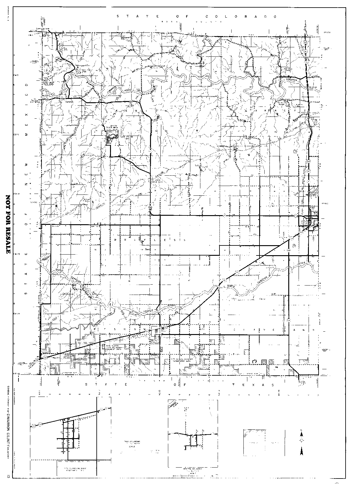
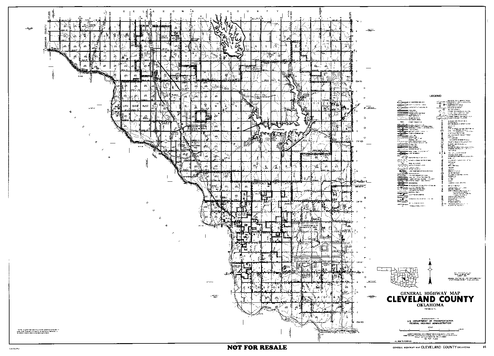
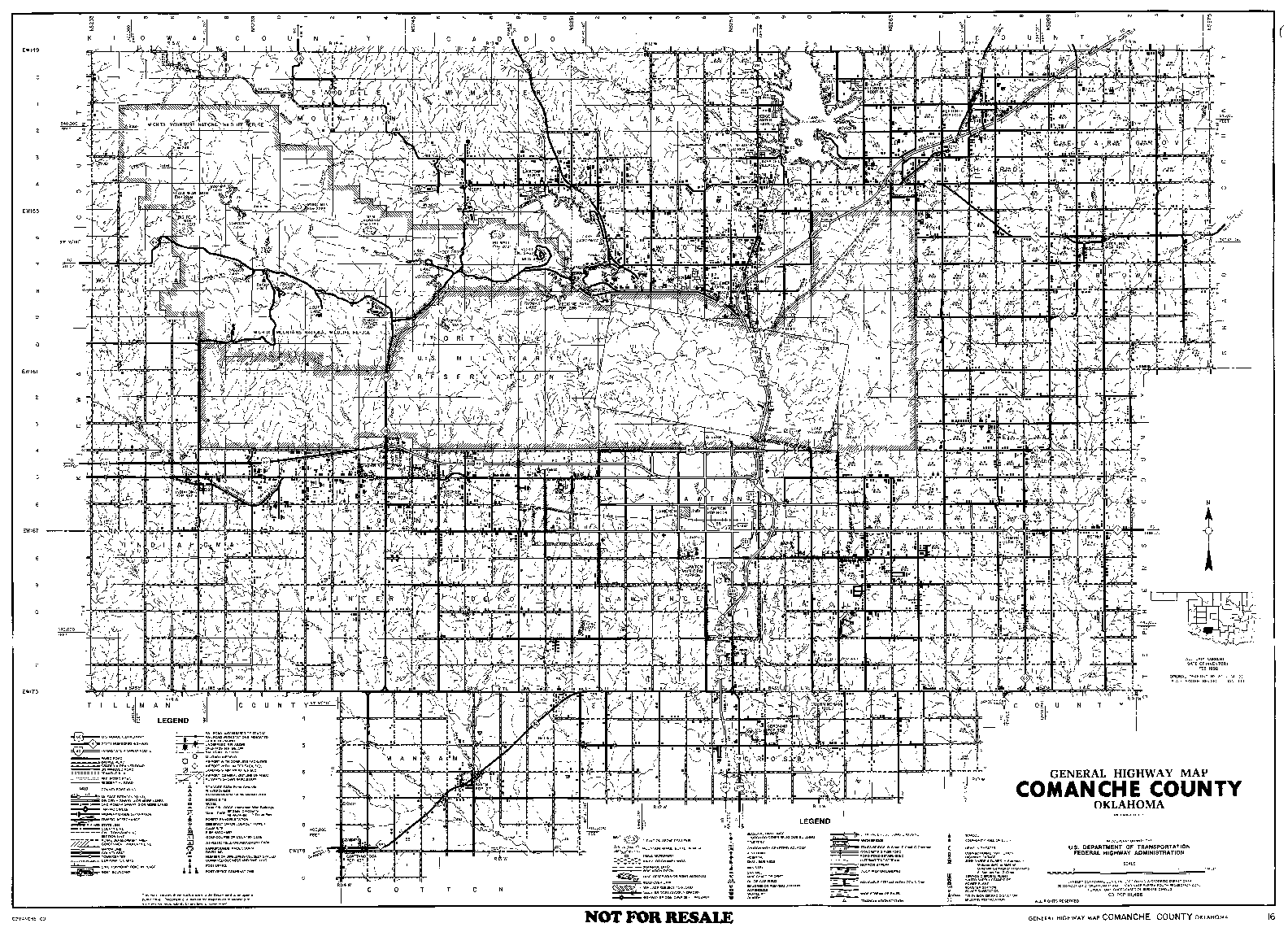
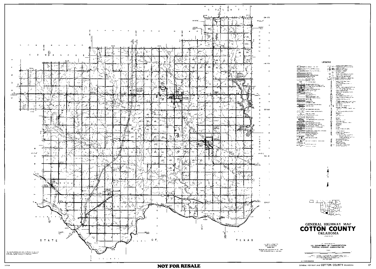
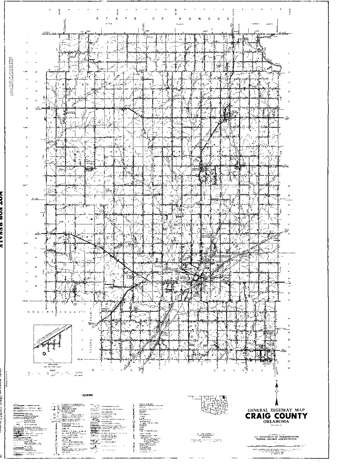
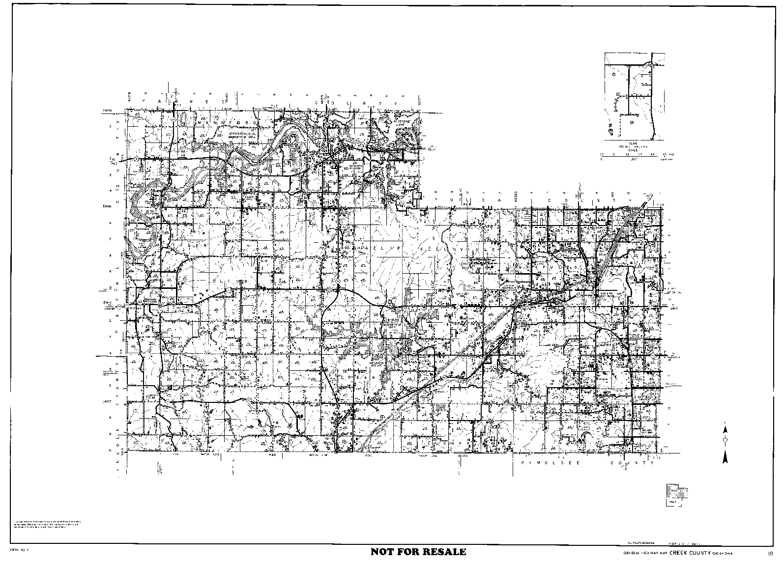
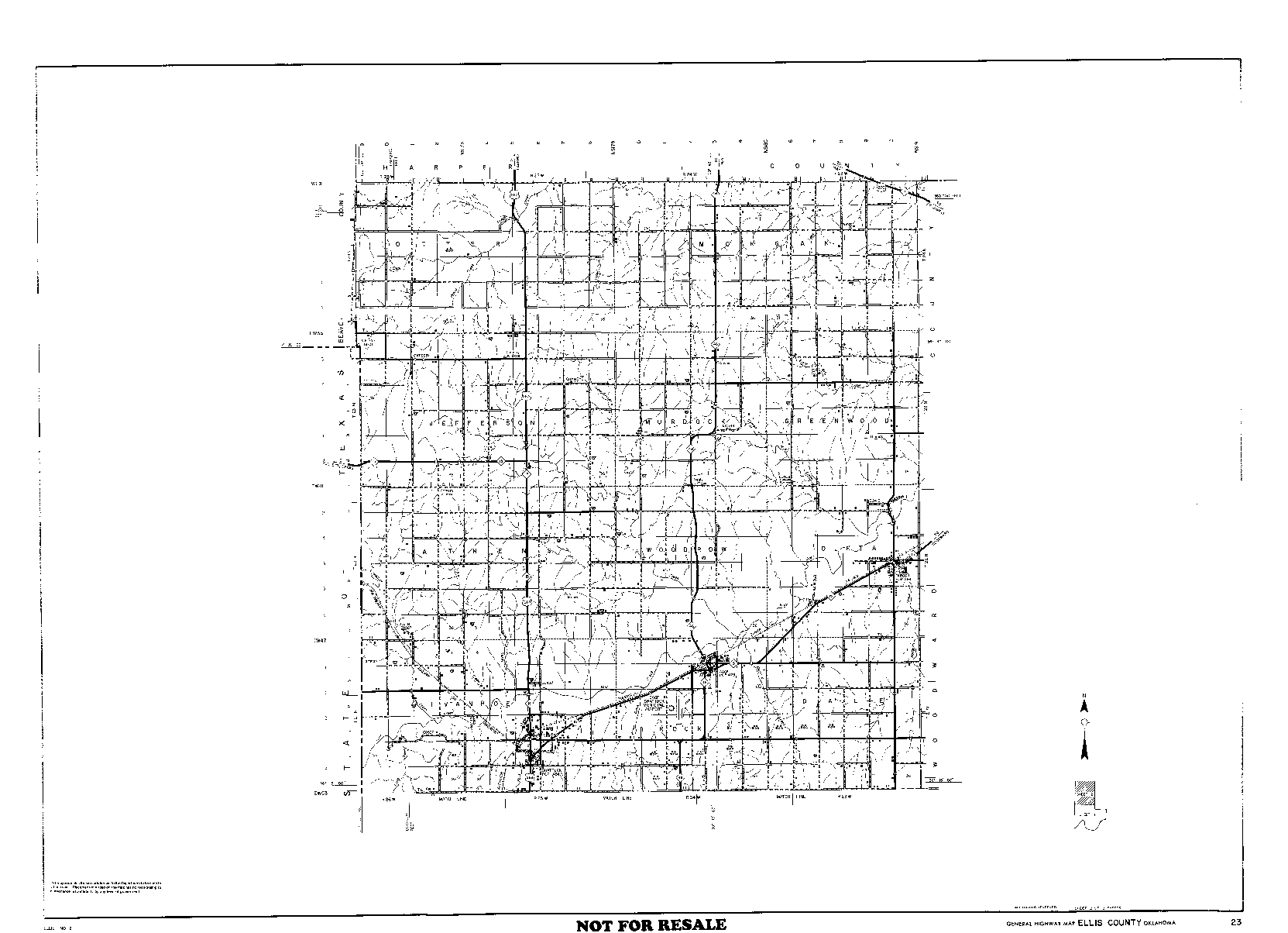
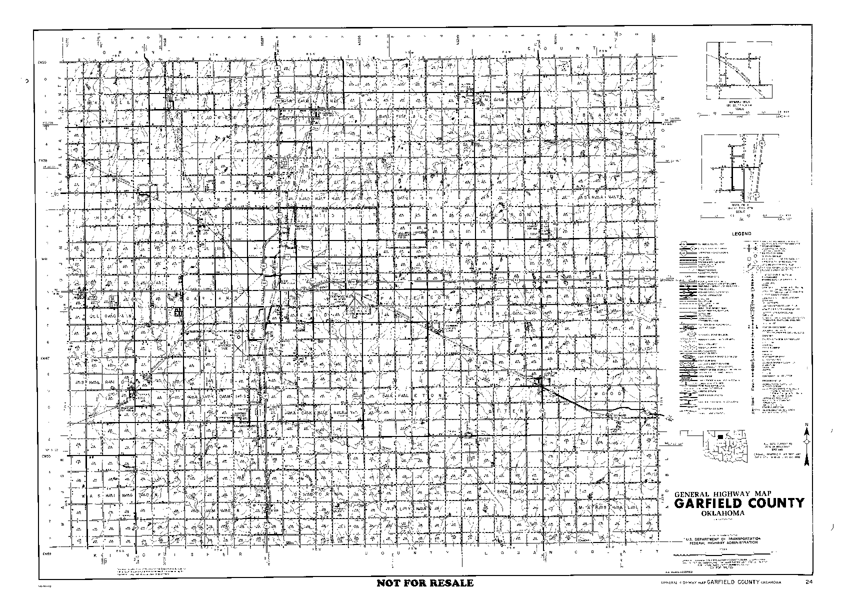
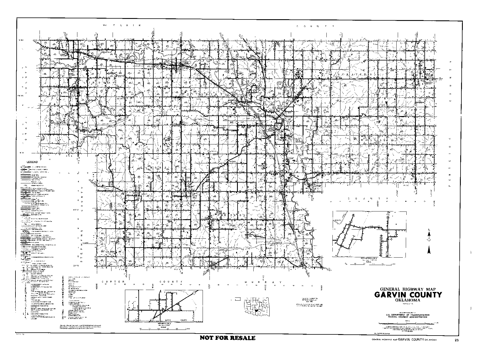
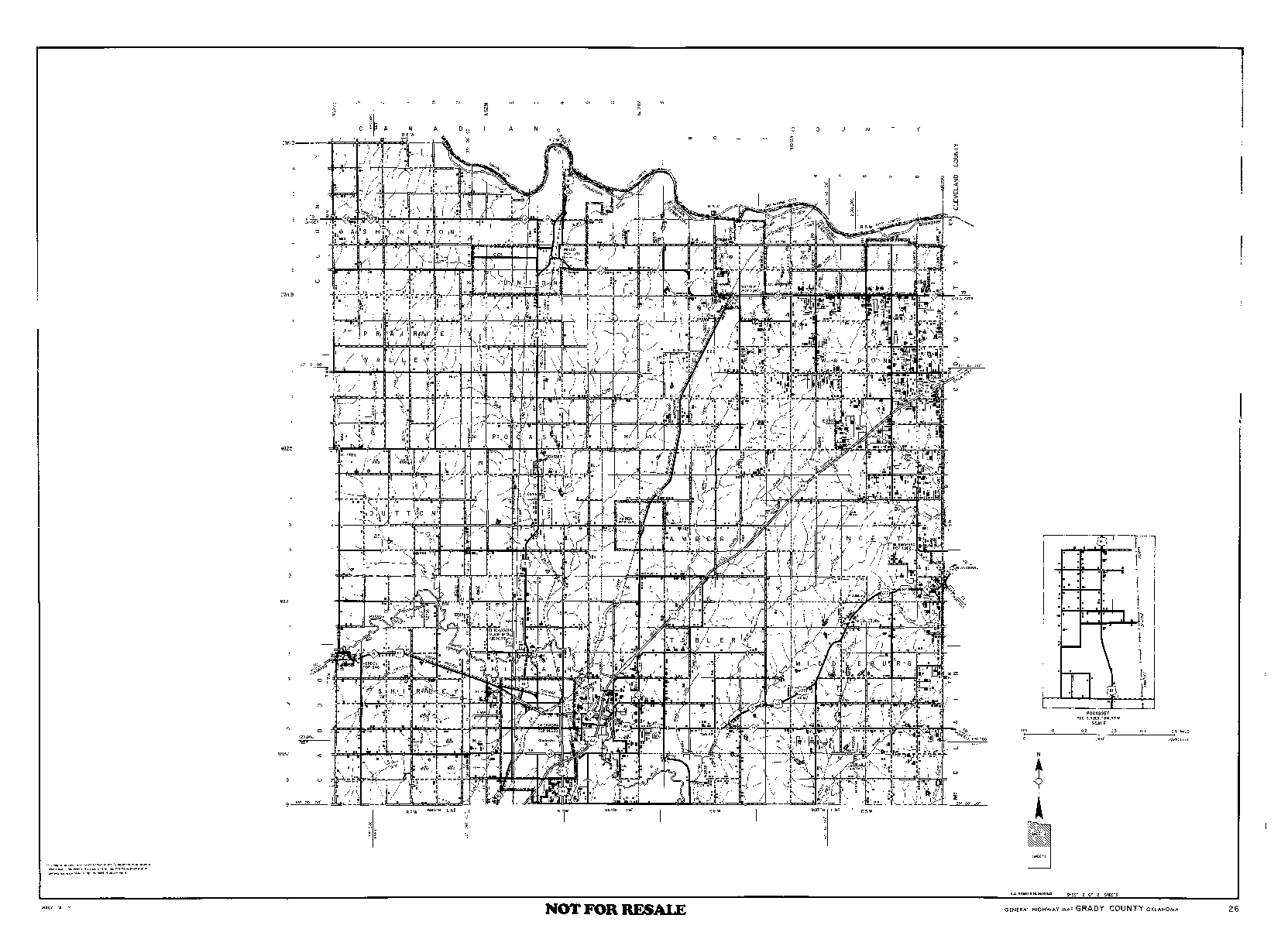
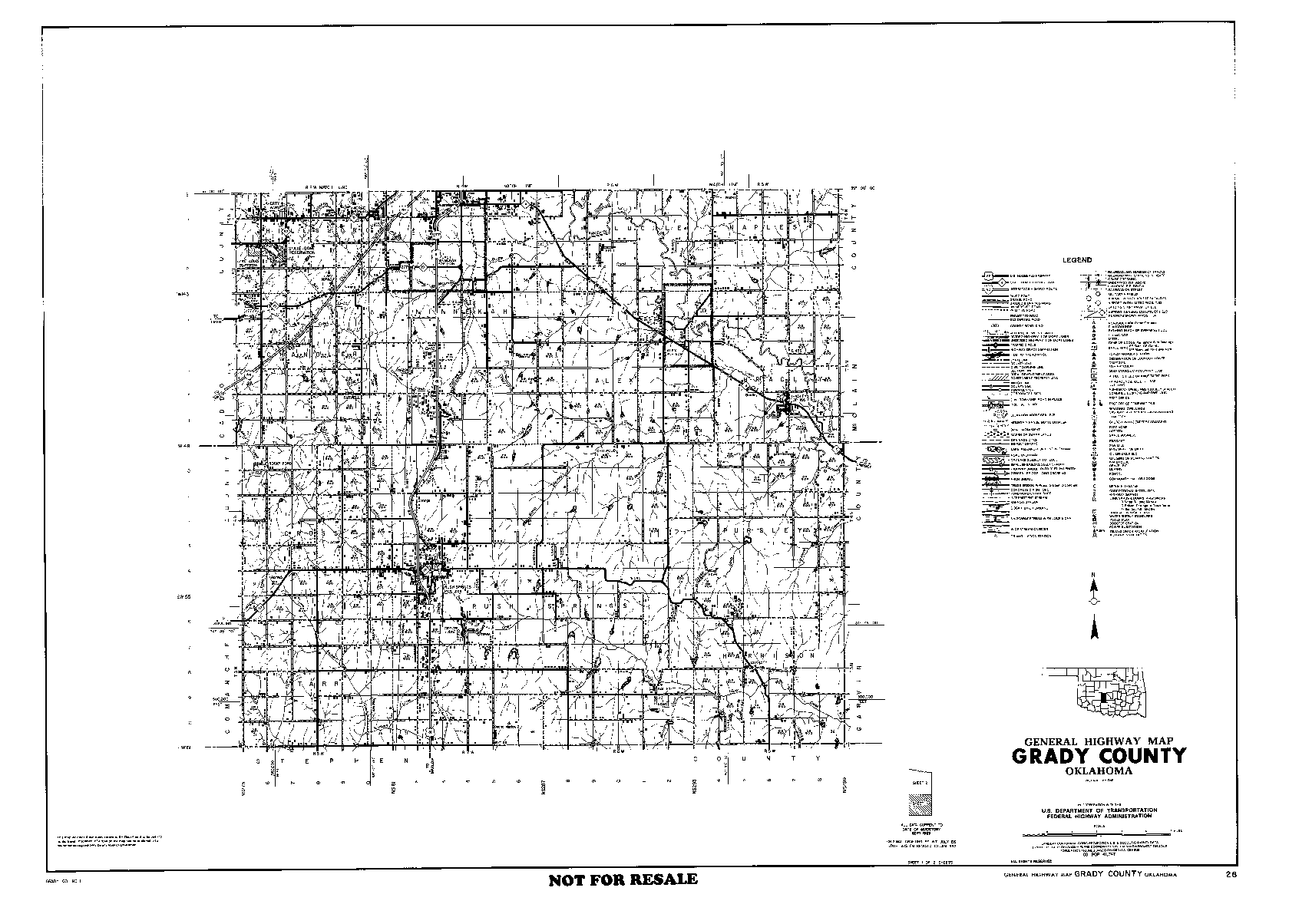
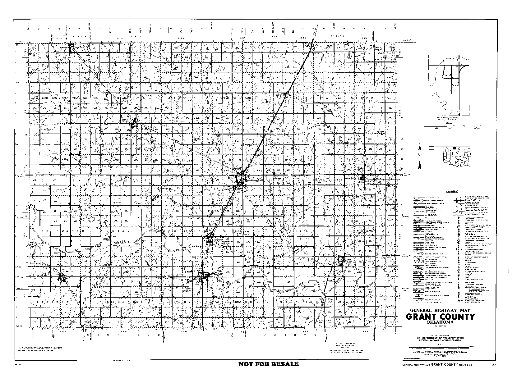
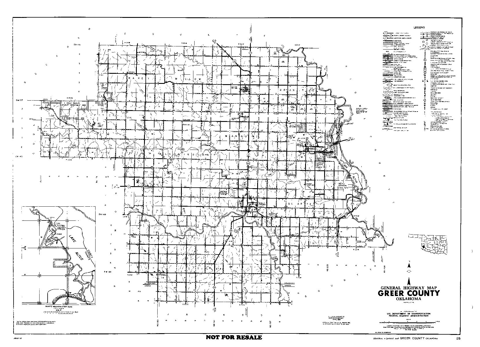
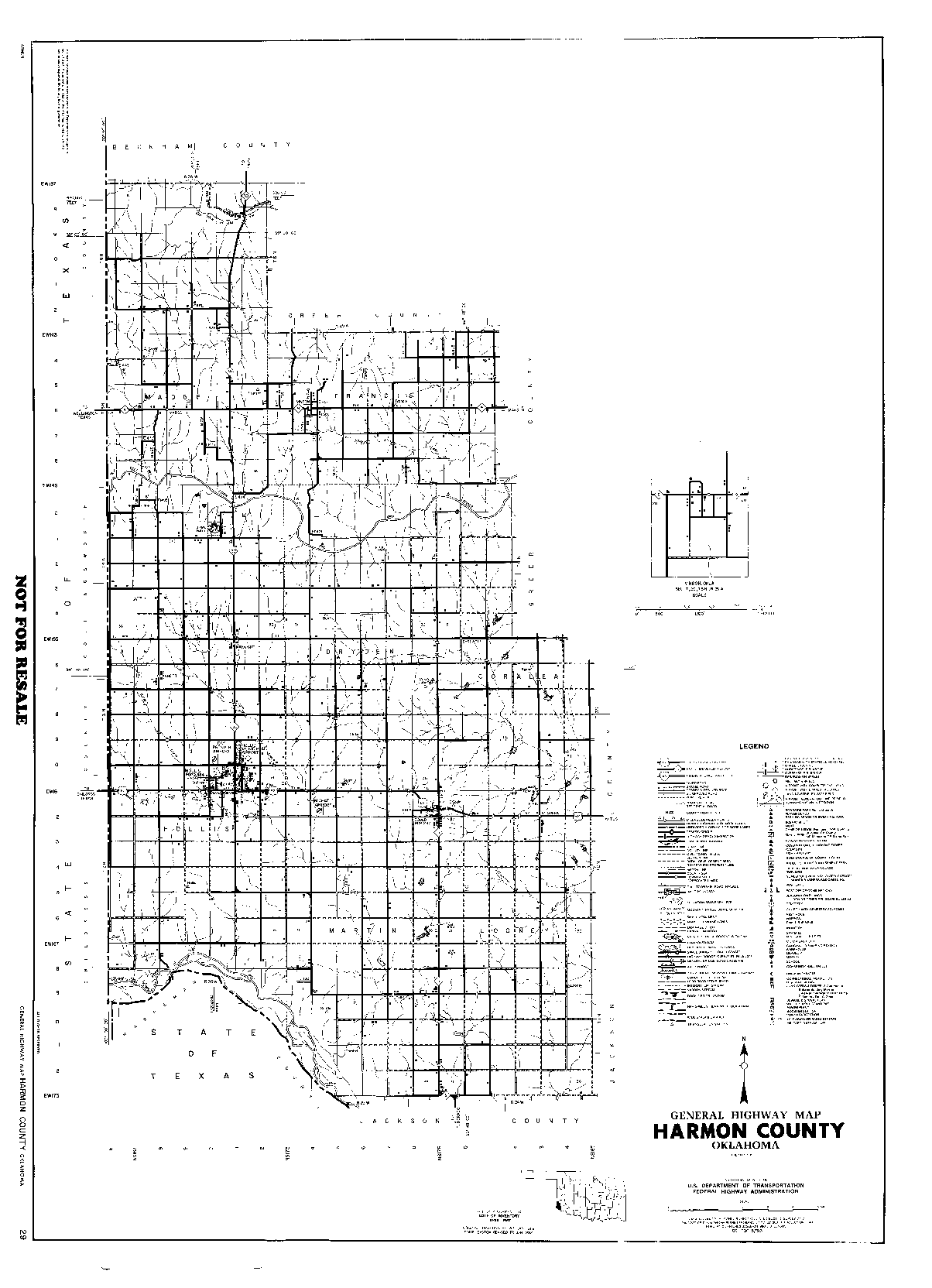
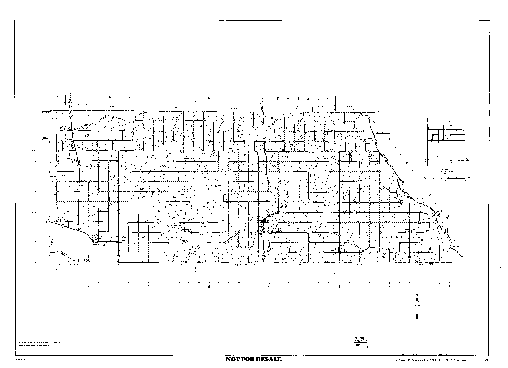
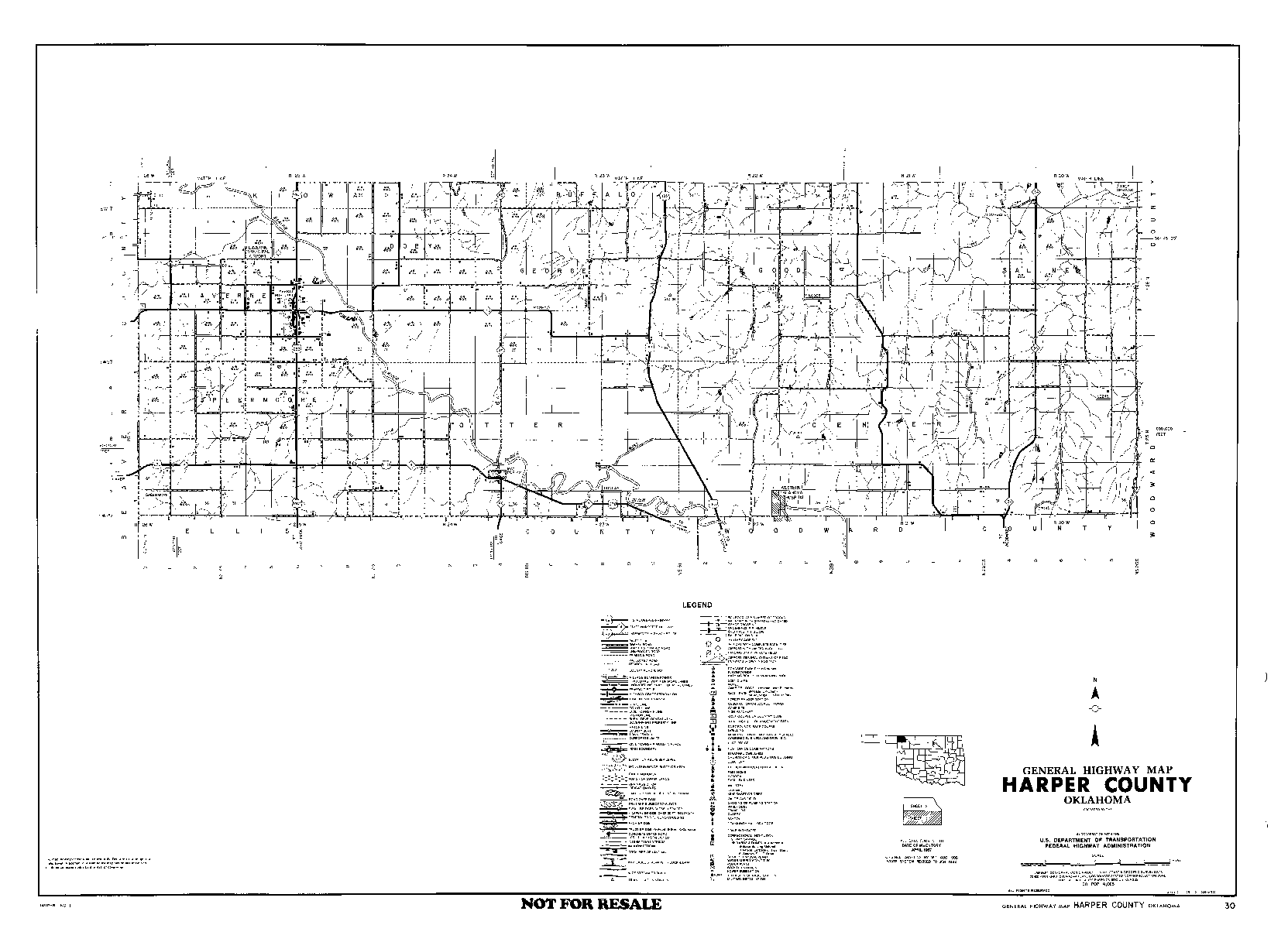
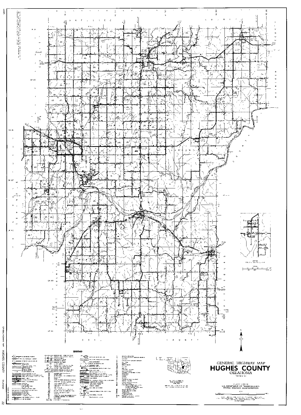
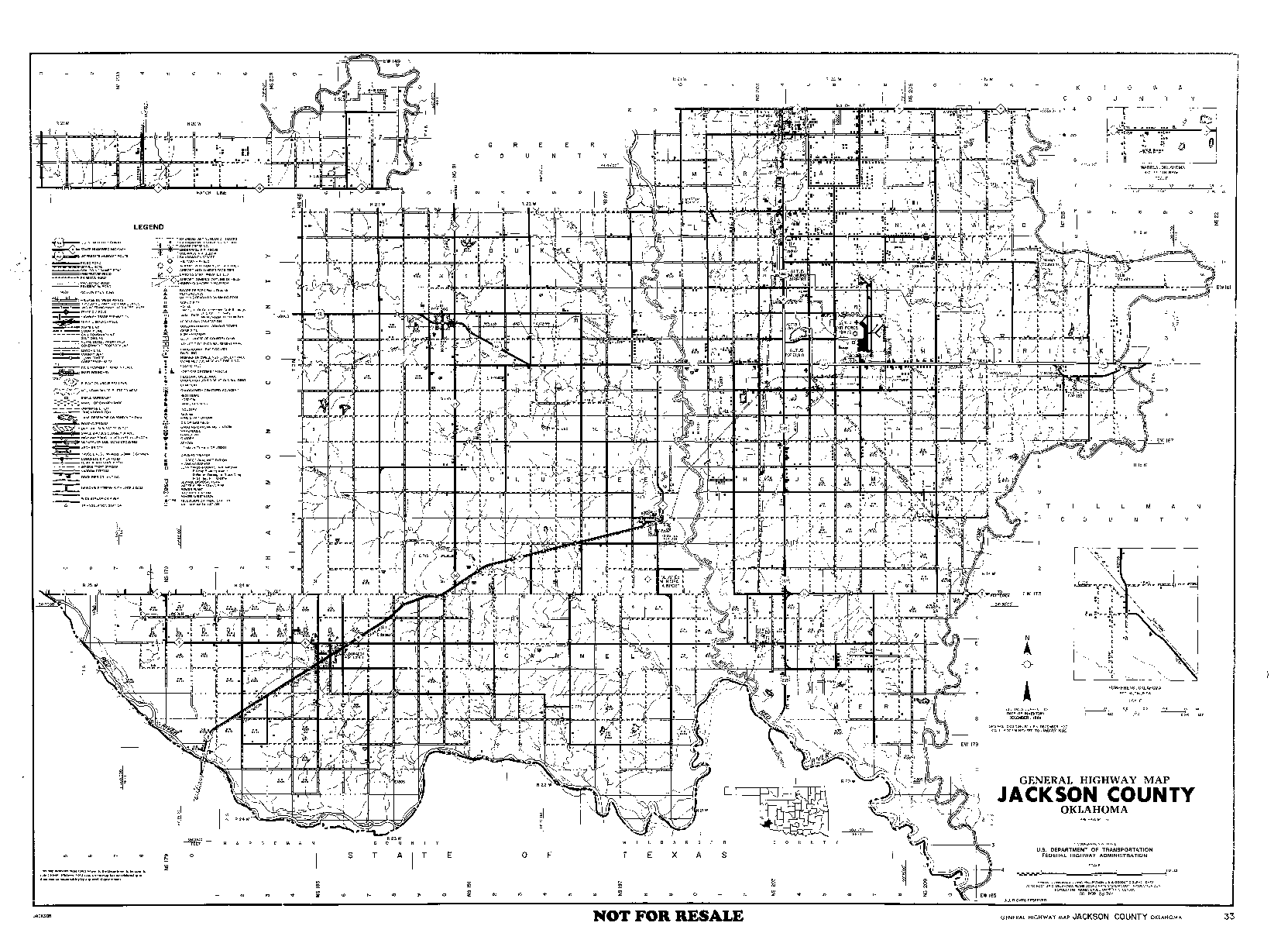
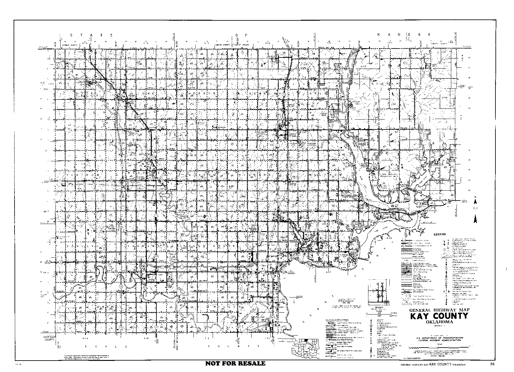
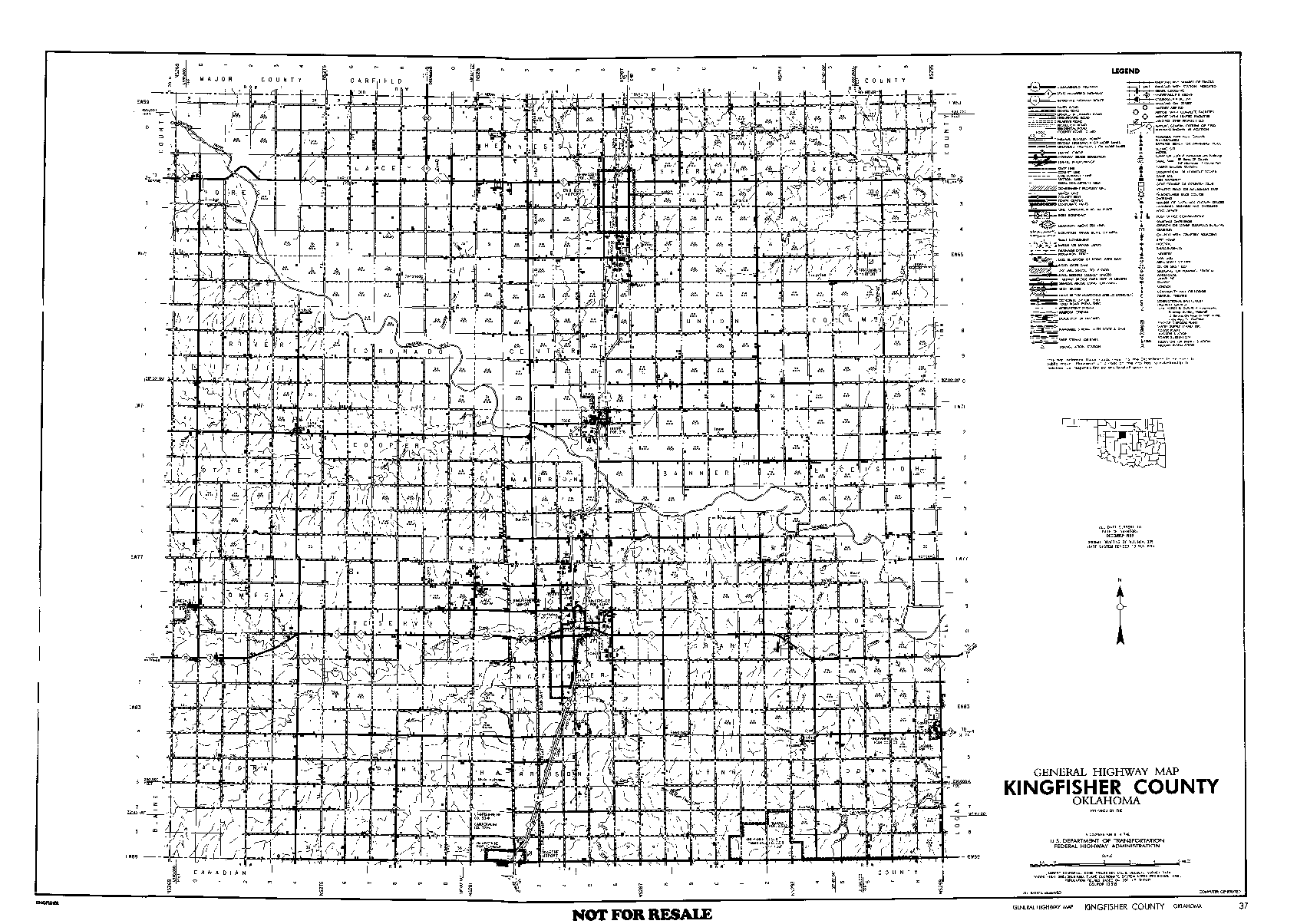
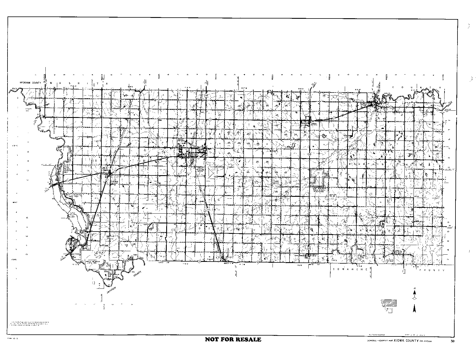
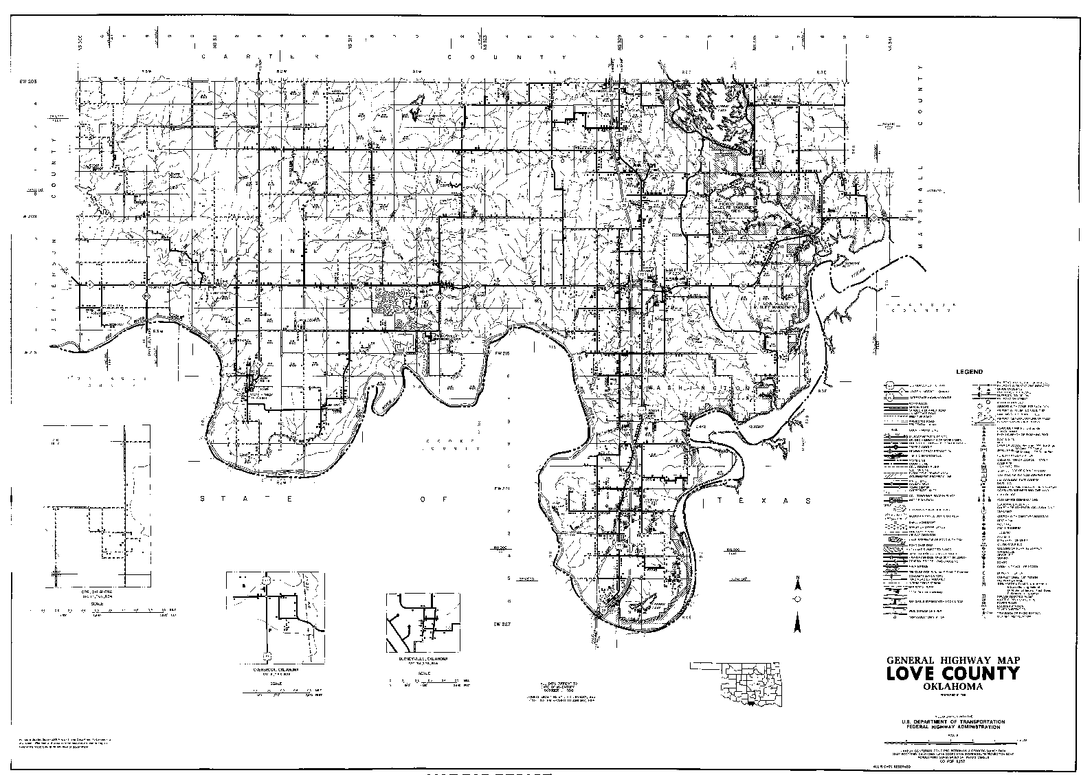
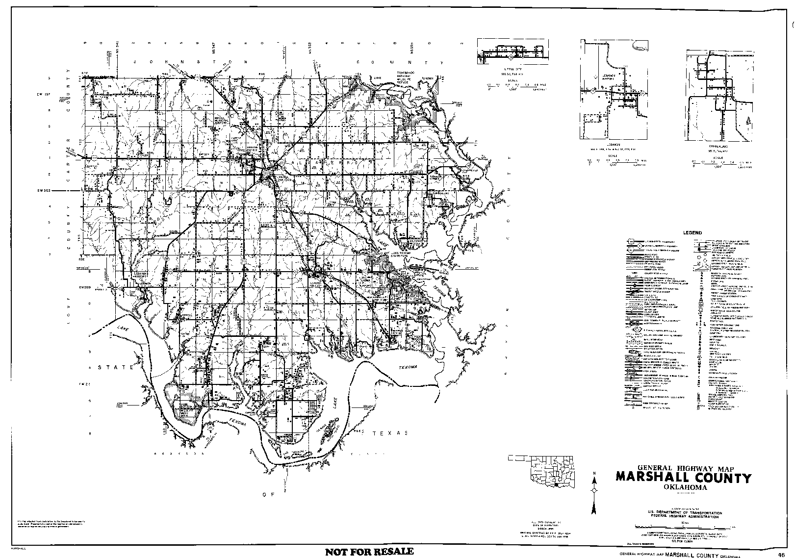
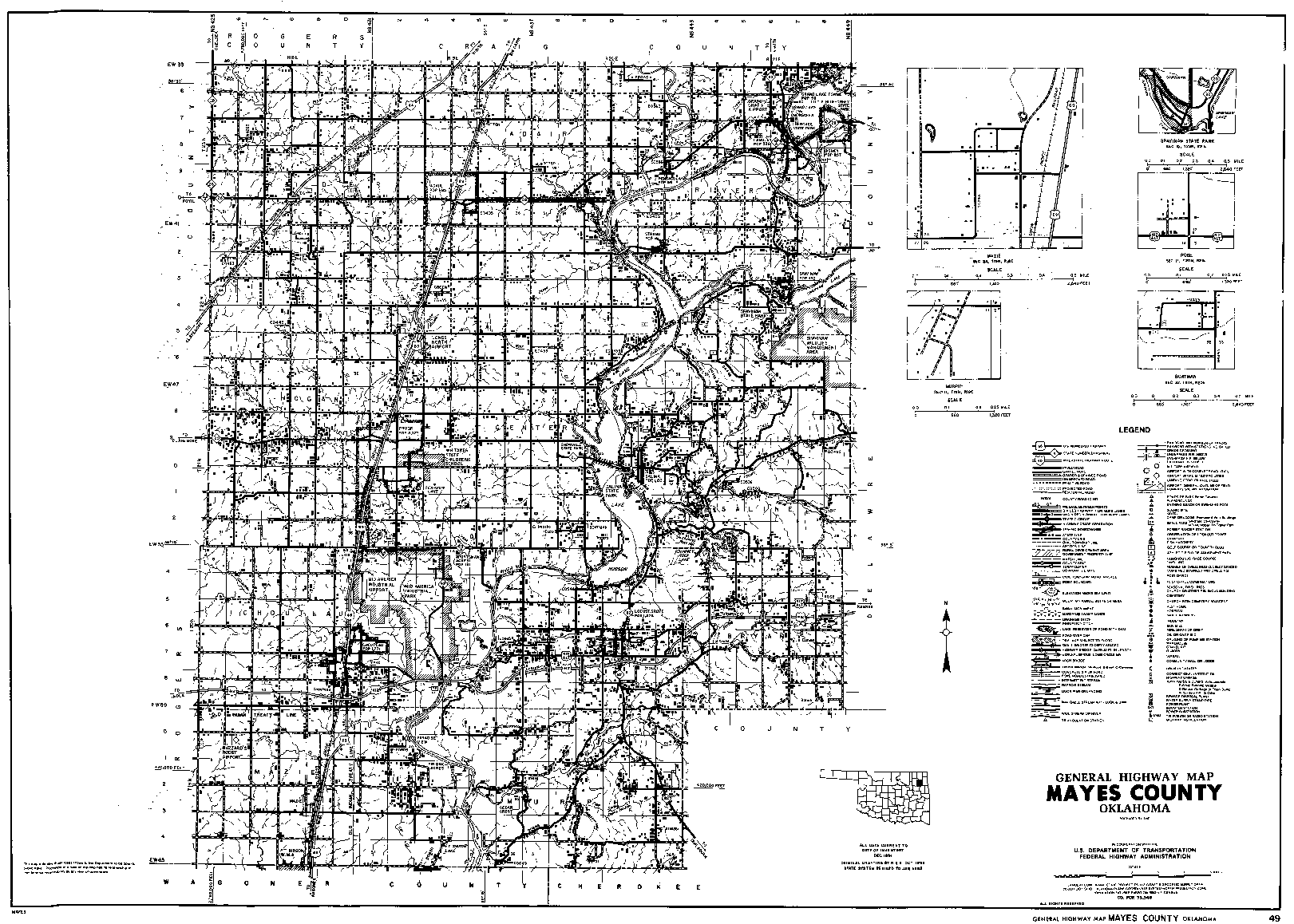
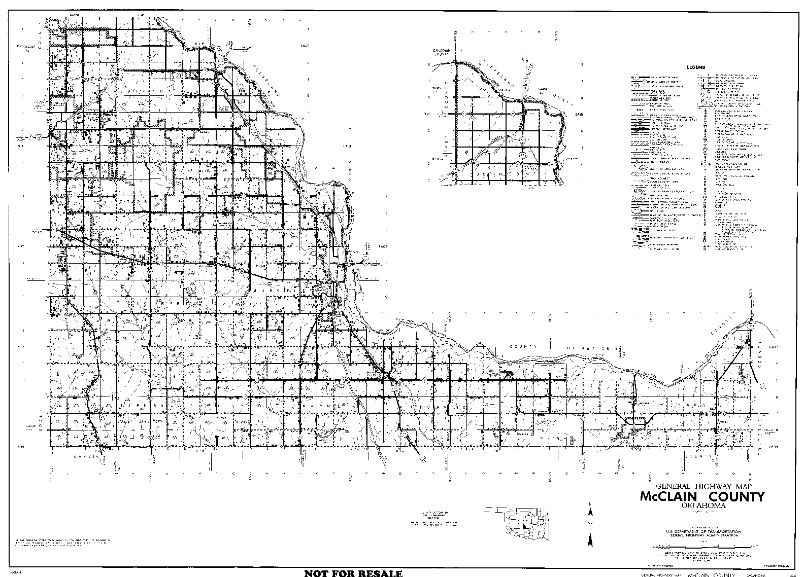
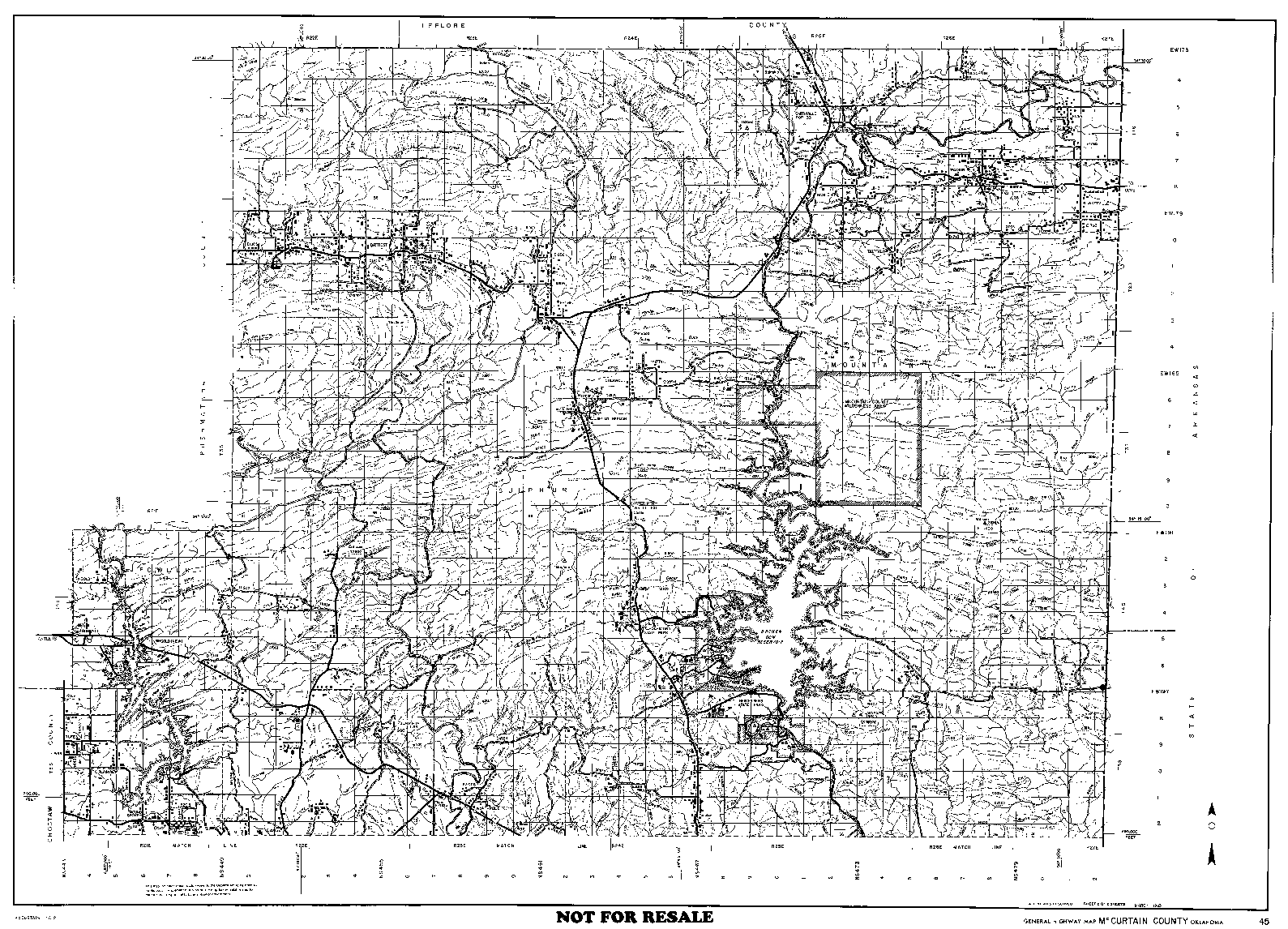
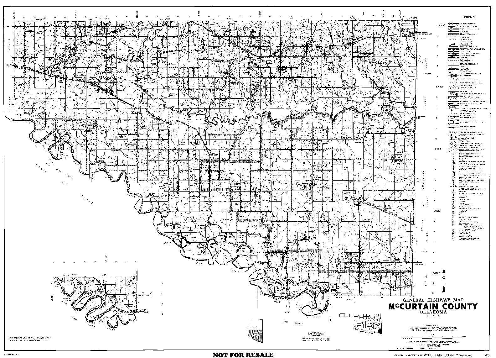
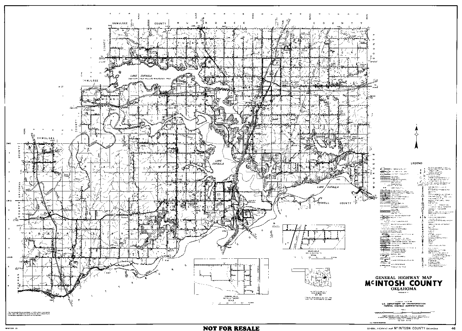
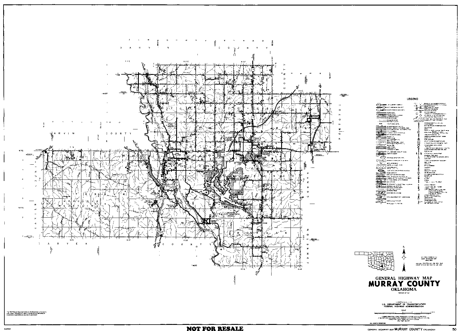
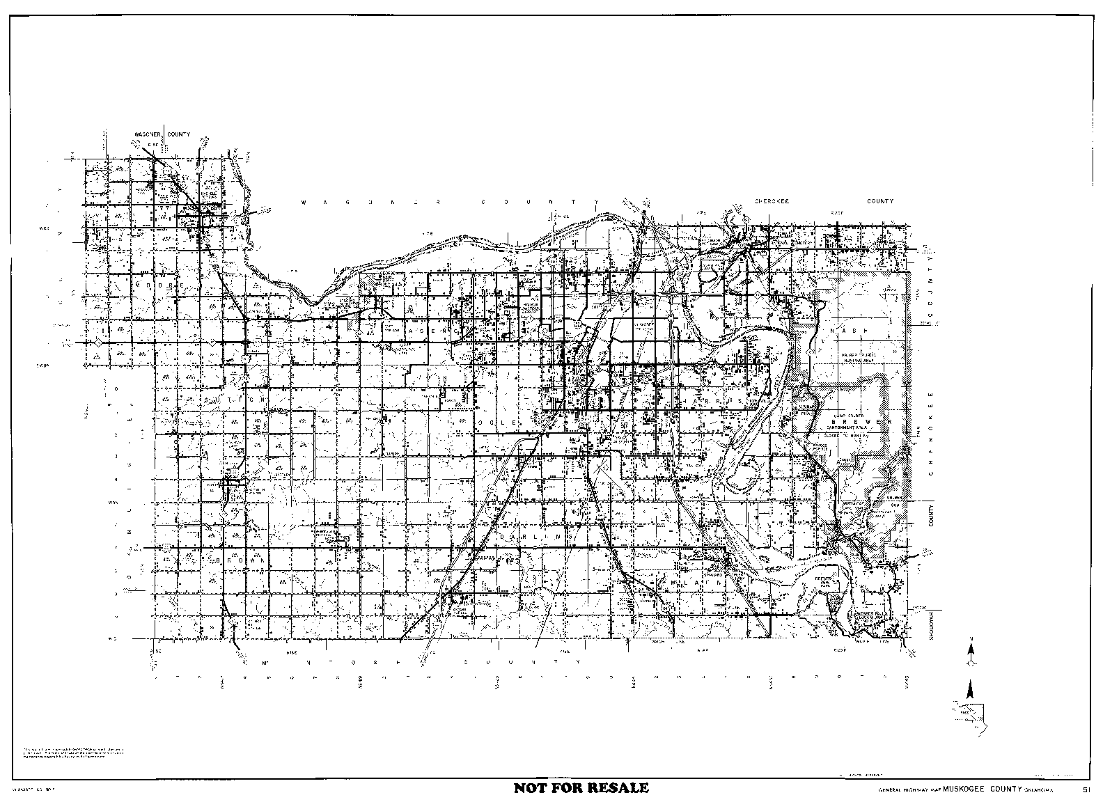
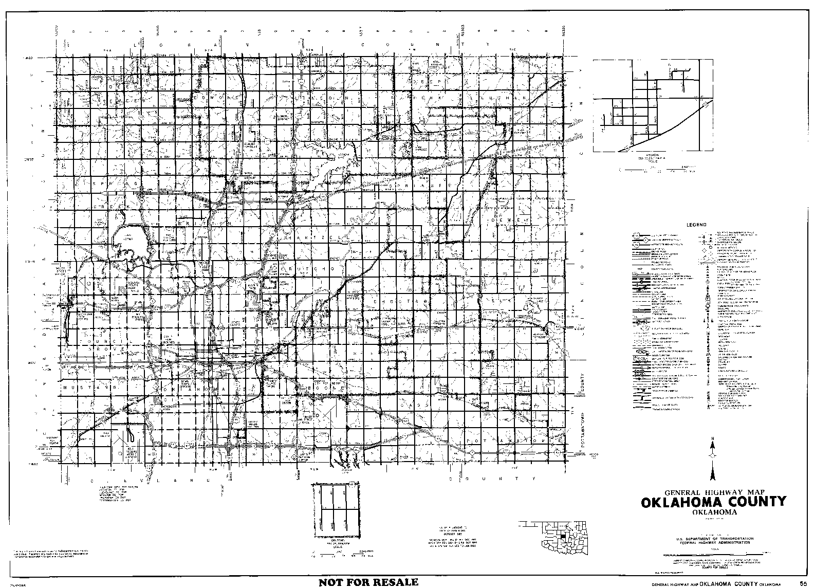
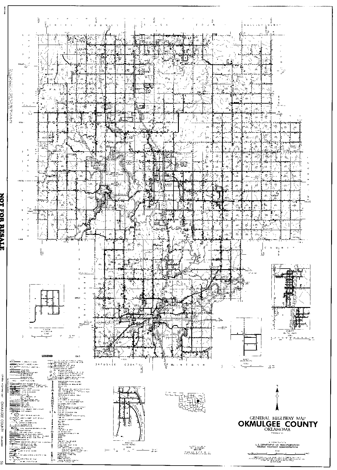
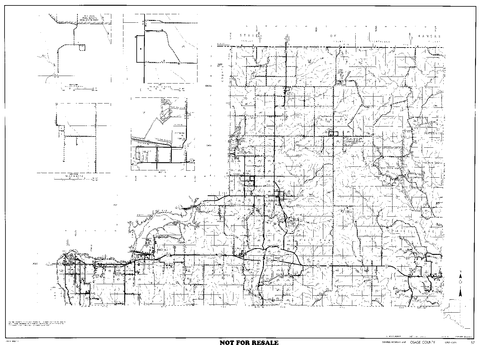
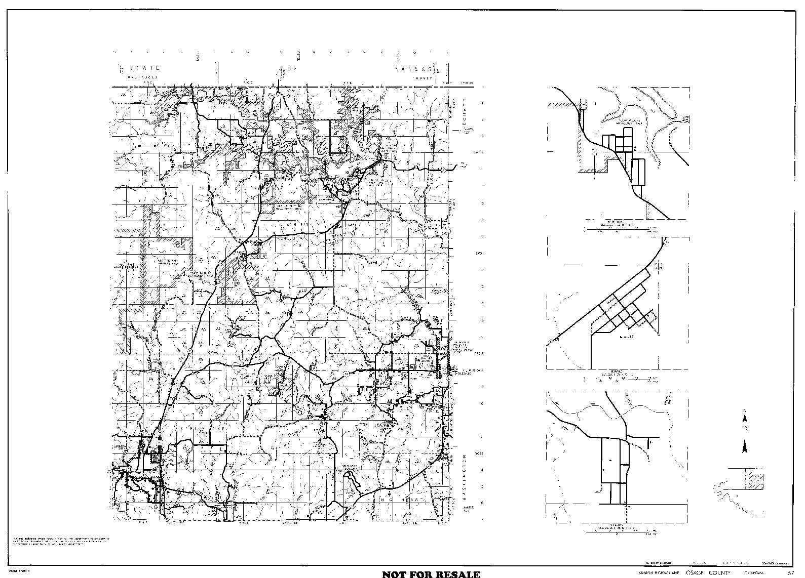
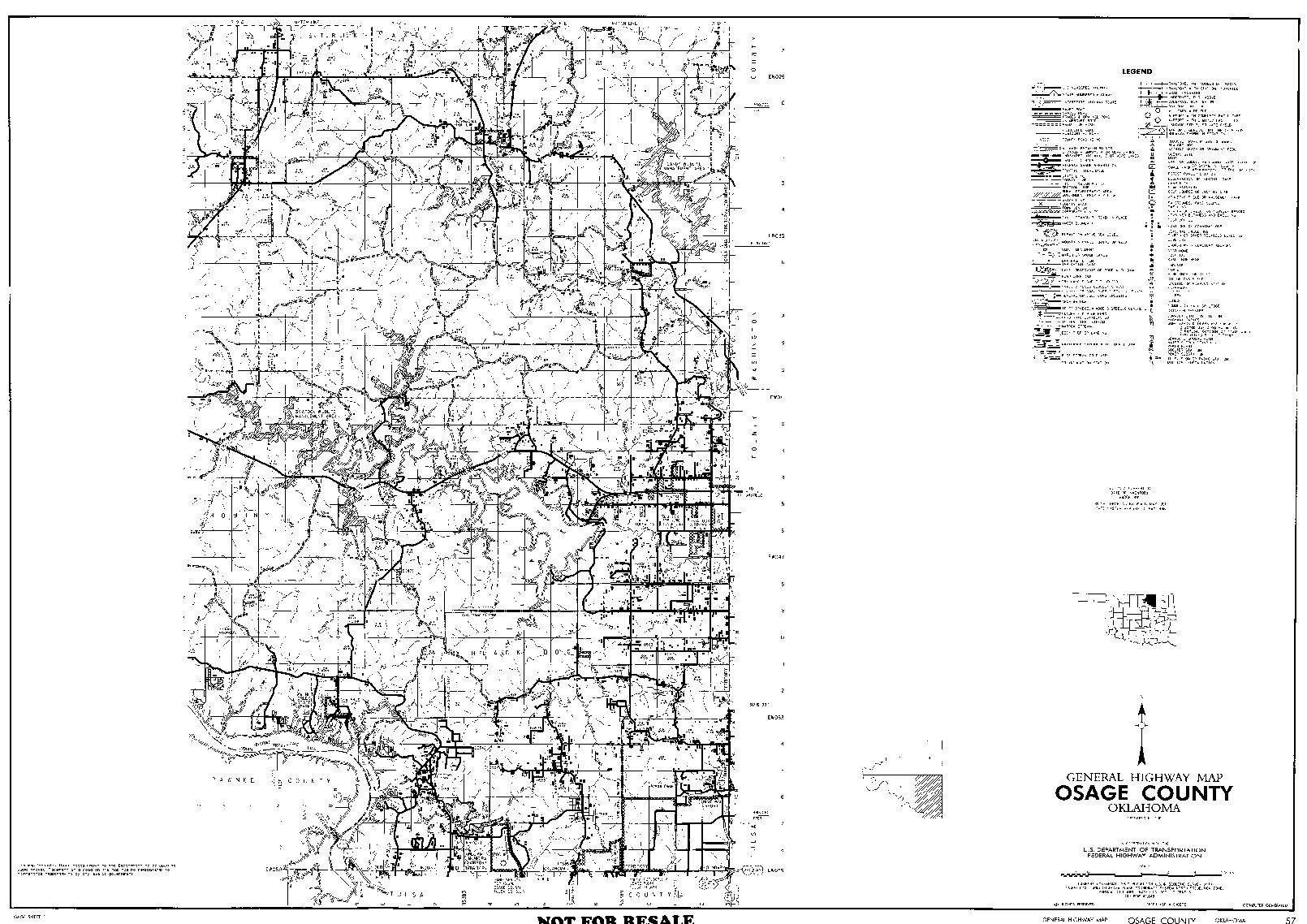
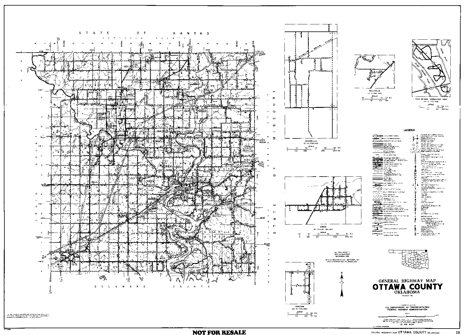
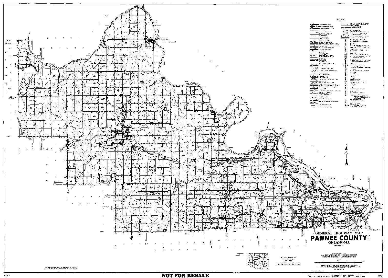
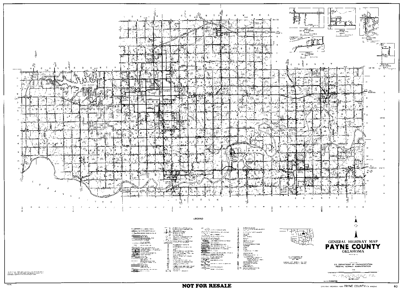
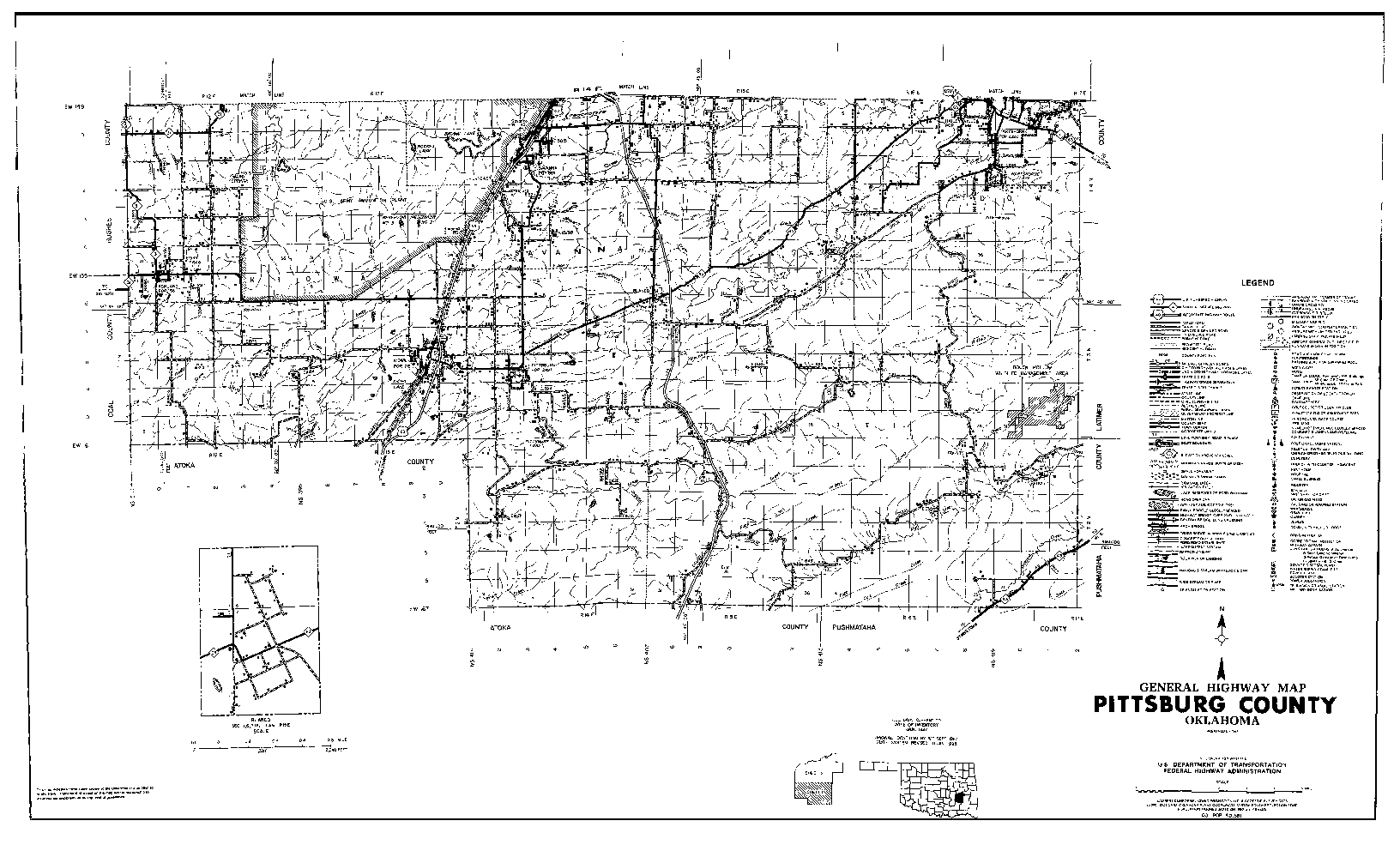
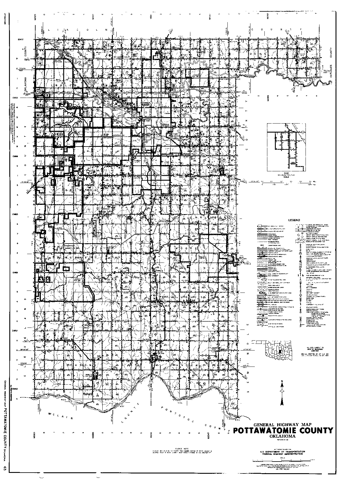
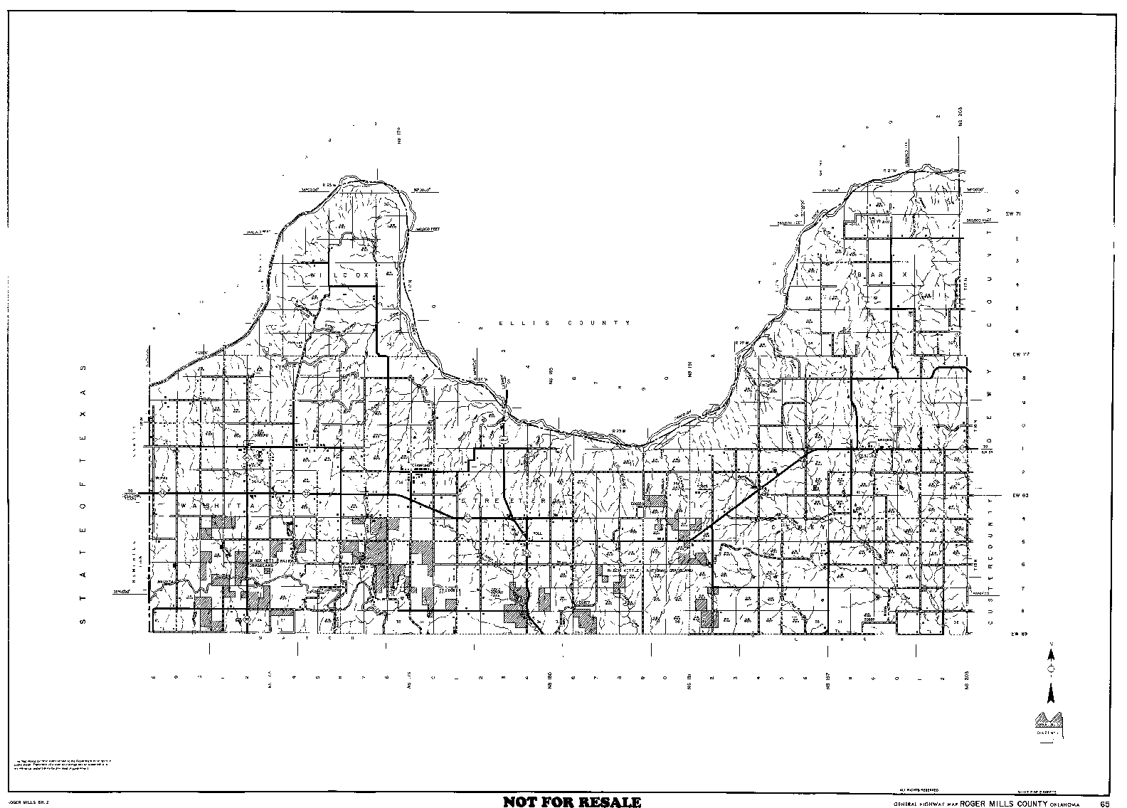
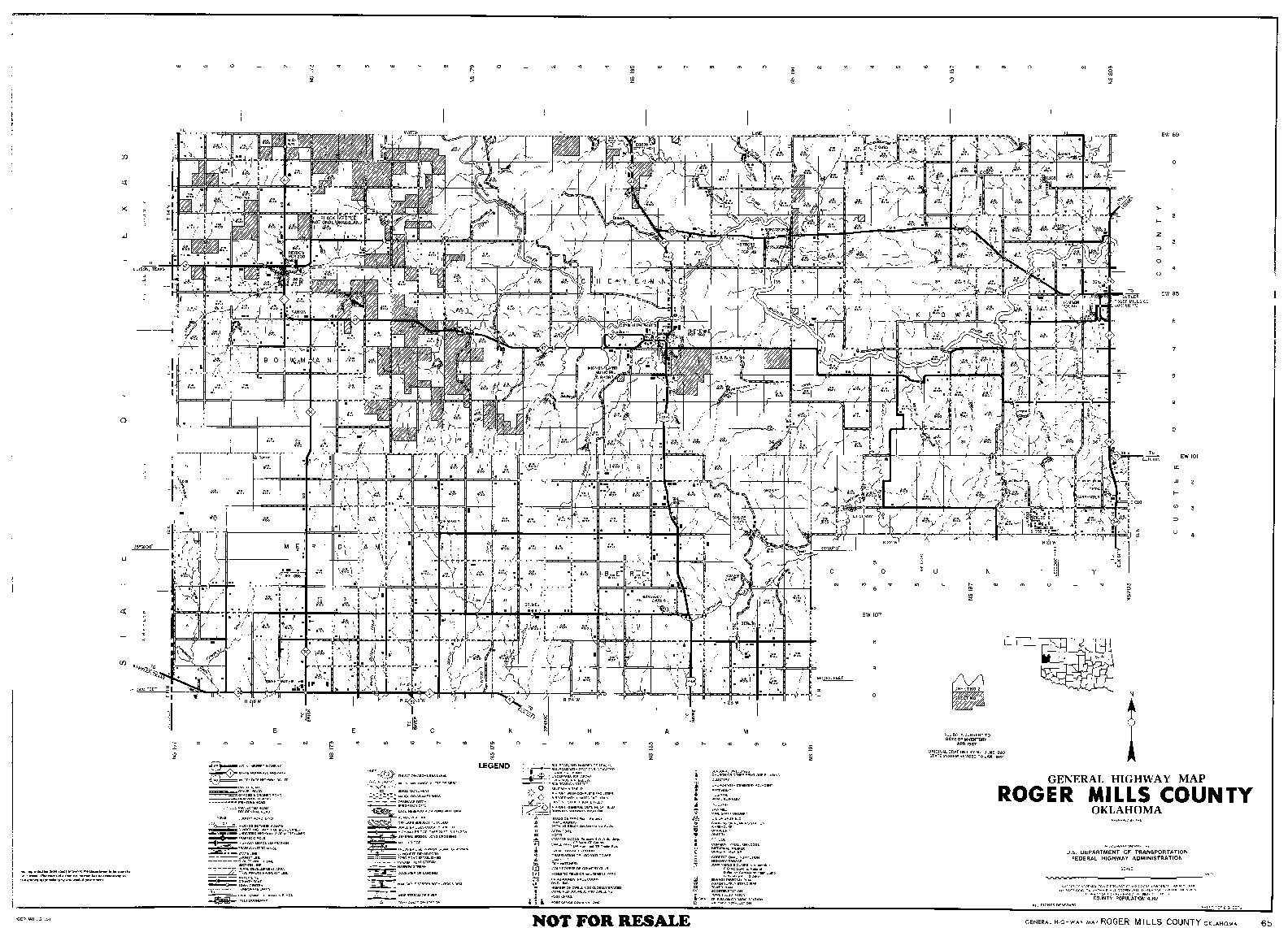
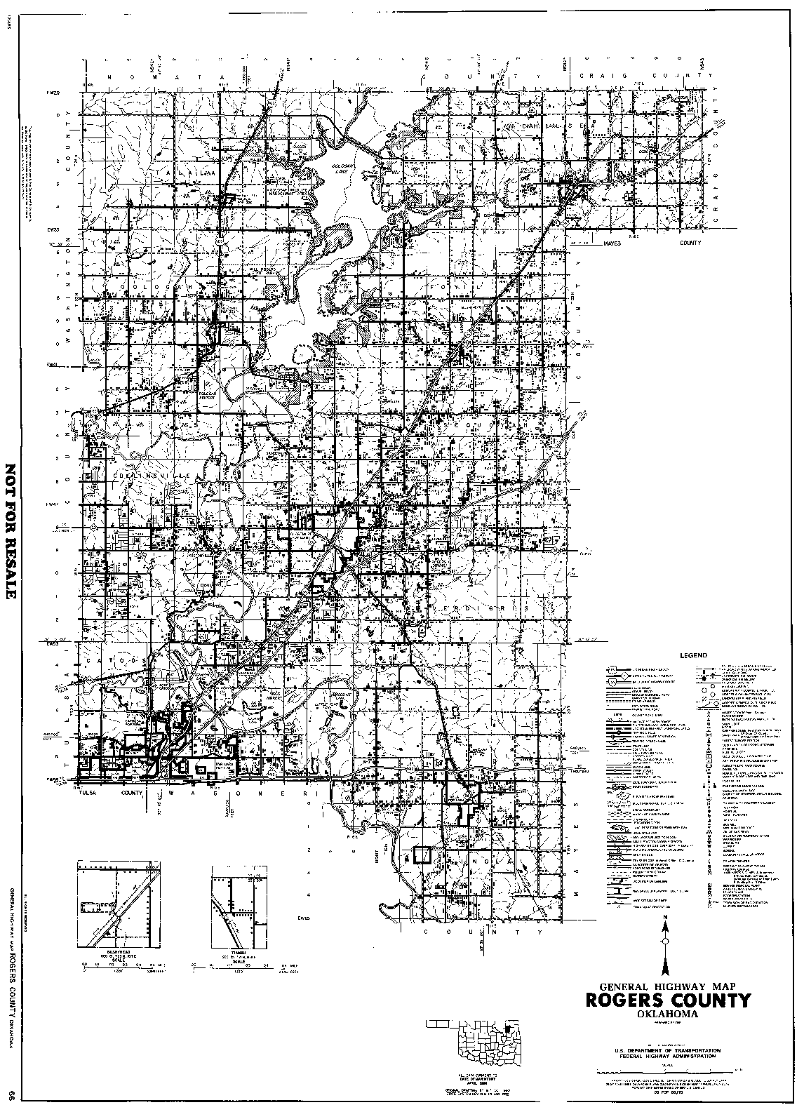
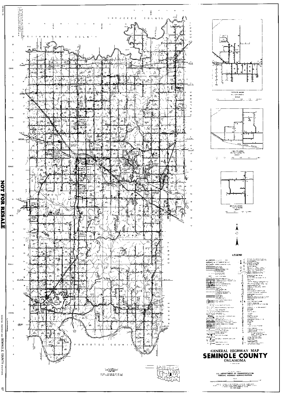
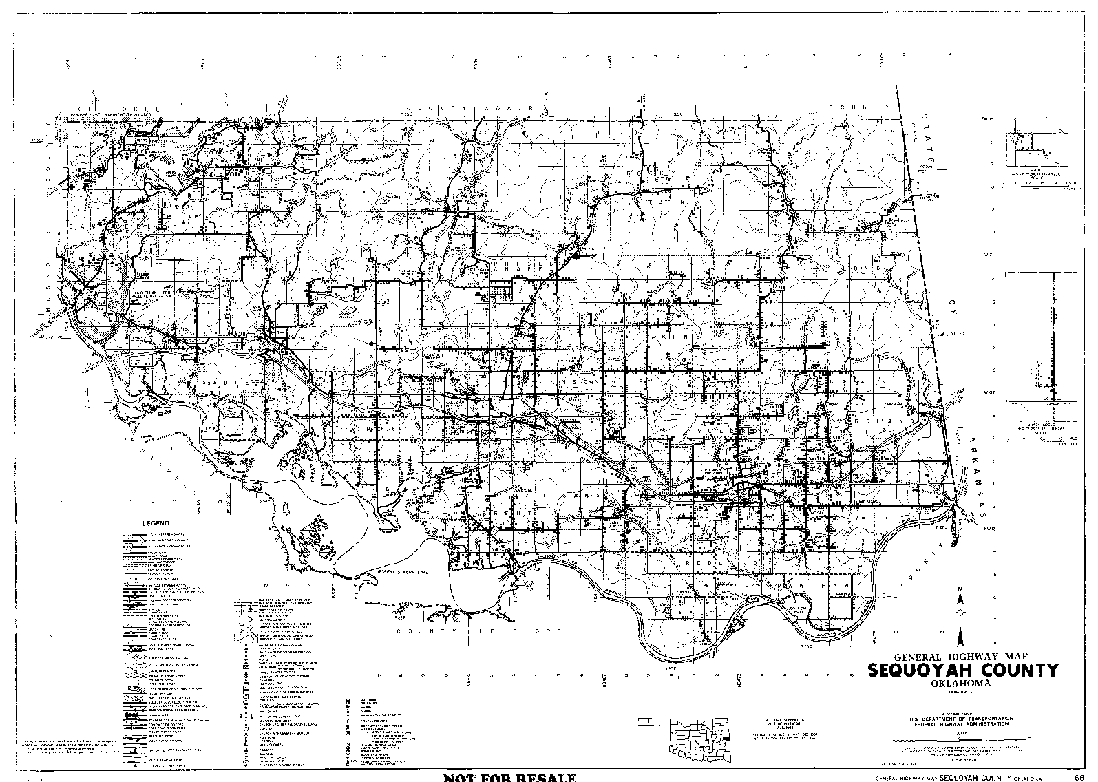
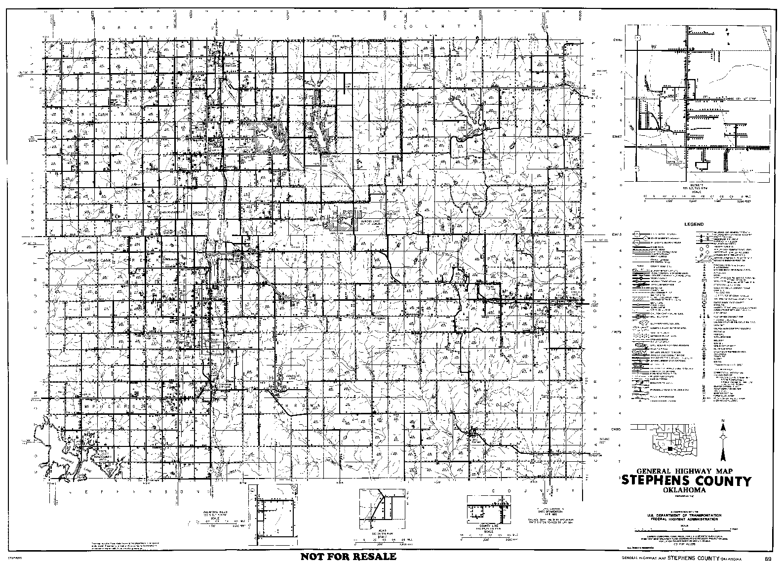
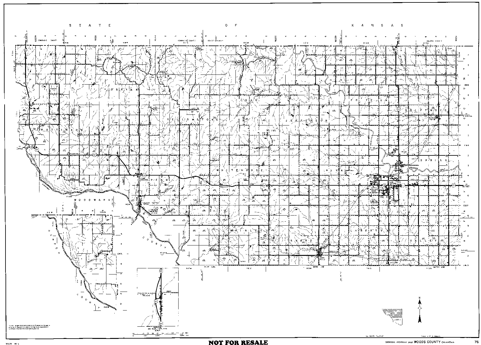
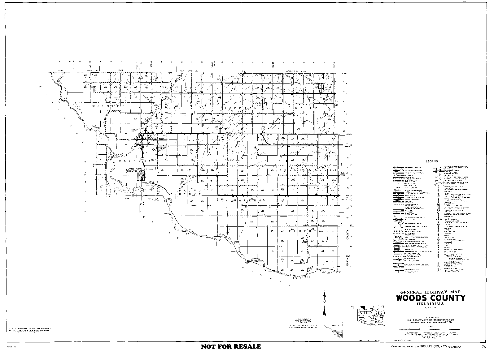
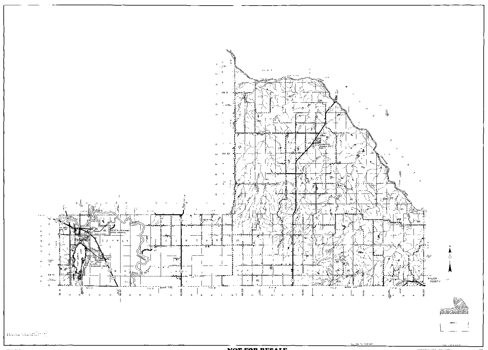
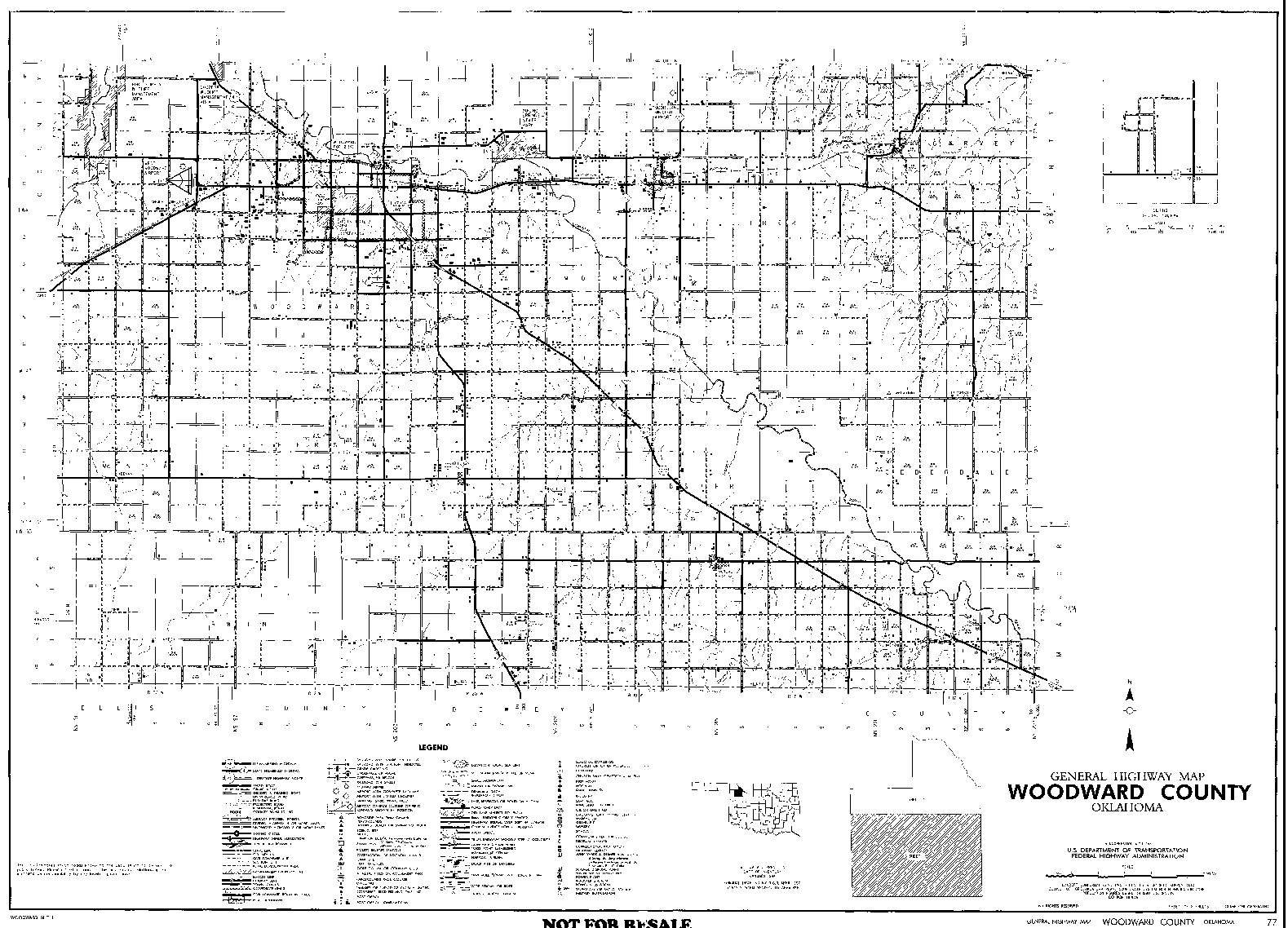
The second column gives you access to Original Map Files, which have been downloadable from OKGenWeb for several years. If you are searching one county intensively, you will probably find it much more convenient to download and then work with one of these offline using your own graphics editor than use any of the on-line adaptations.
The third column provides Reduced Map Files. These are just smaller versions of those same images that have been downsized enough that they can be viewed online without downloading. They may provide the answers you seek themselves, or help you to decide which files you want to download.
The fourth column provides access to the County/Township maps prepared by Sharon Crawford. For each county, they show the Township boundaries and names on a background of Section-Township-Range grids. If you know the name of a Township but not the numbers, this is the easiest way to find a location. These also show the locations of towns from many eras, which eliminates the need to know the time period during which they place you seek existed. [Some of these ephemeral places are very difficult to find on conventional maps.] A red * indicates that one of the map for a particular county is still under construction.
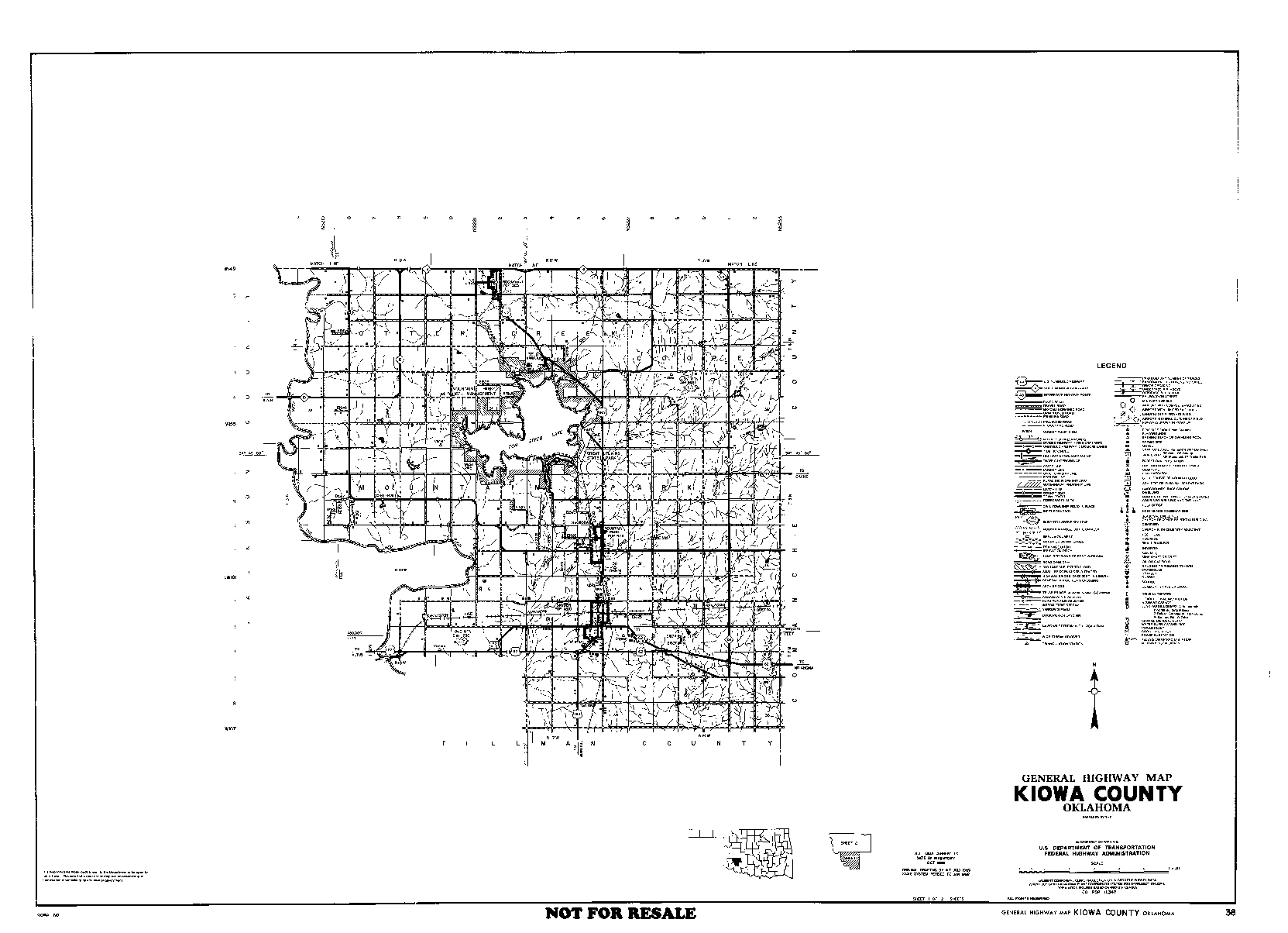
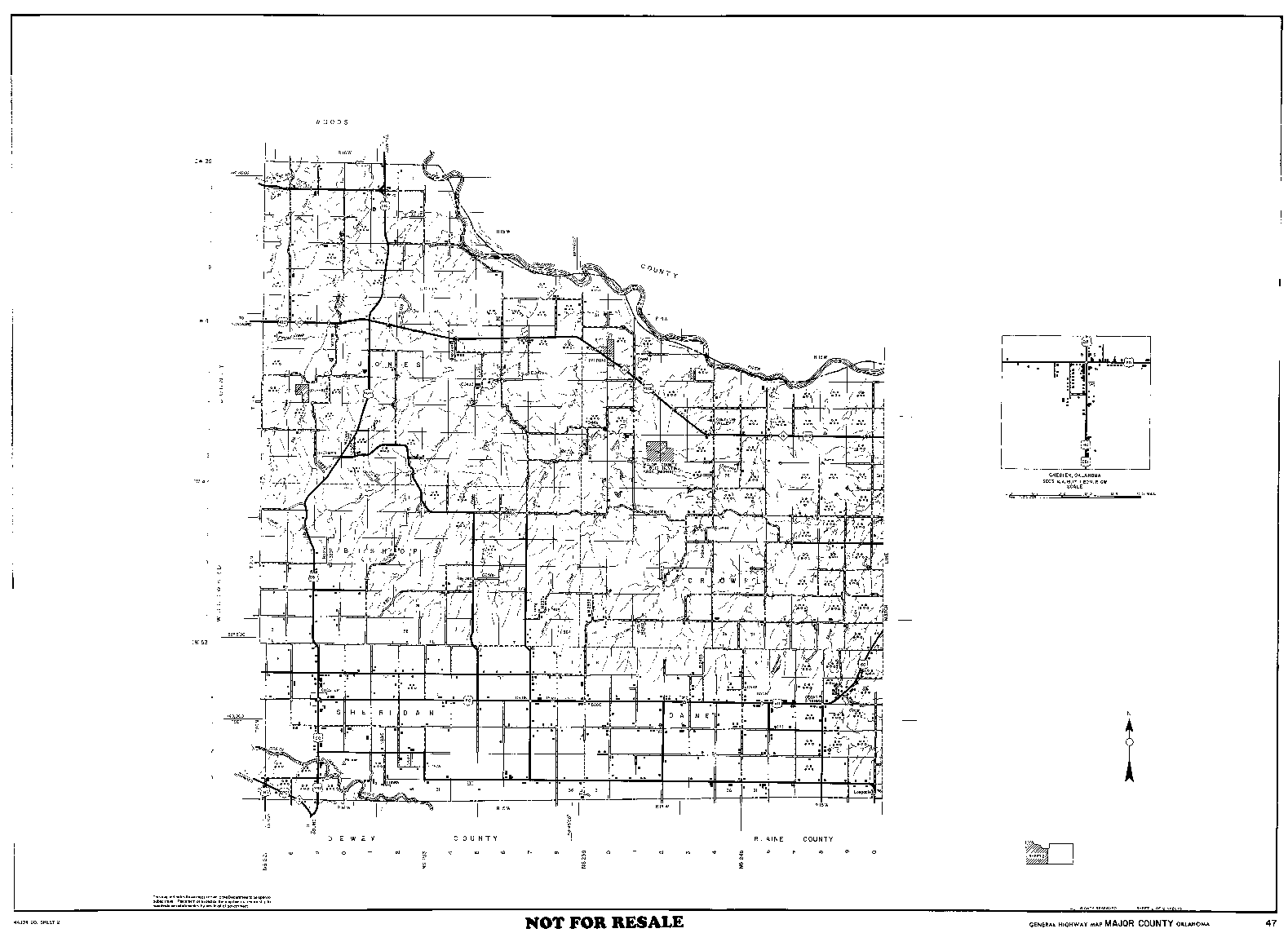
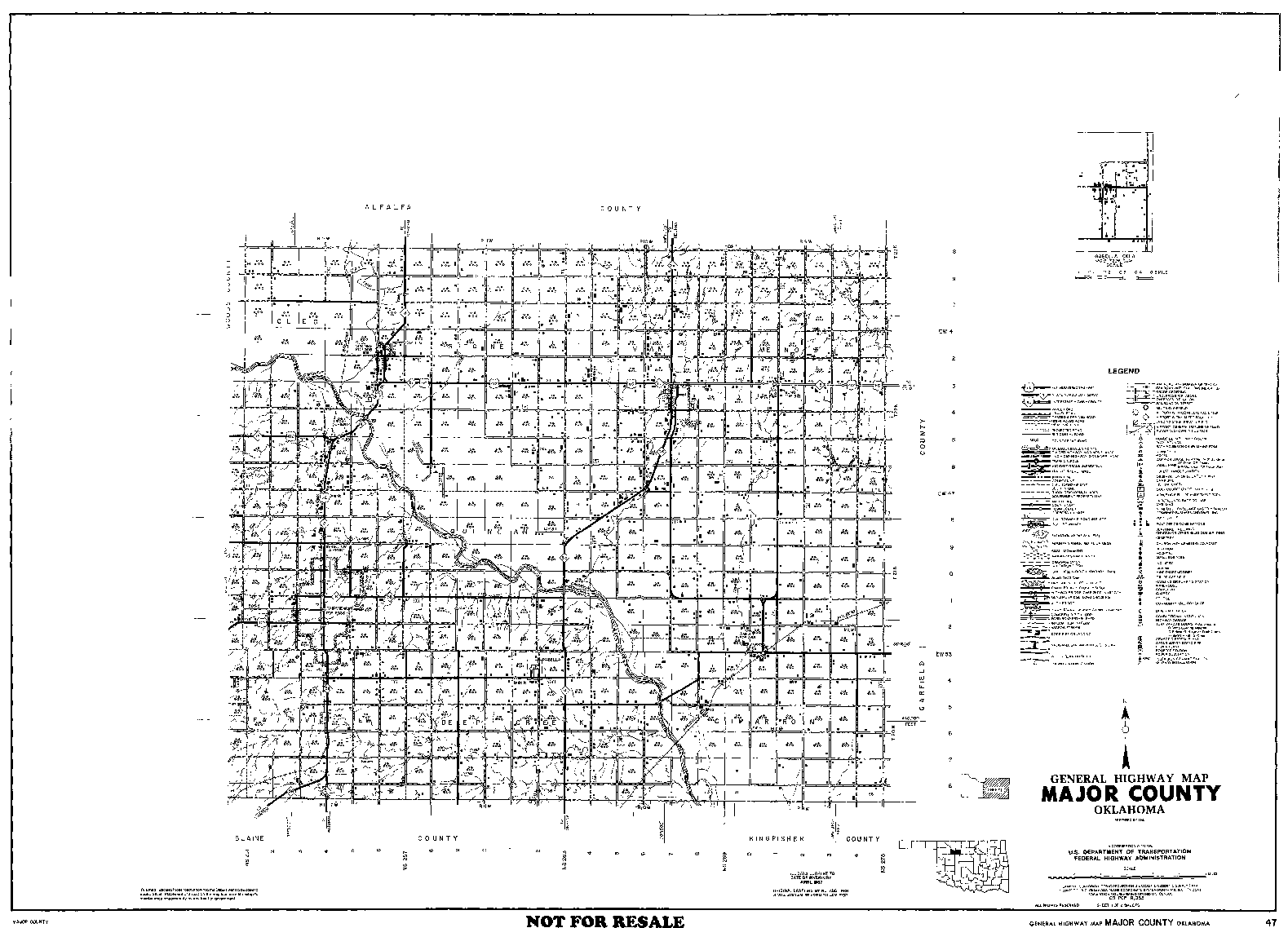
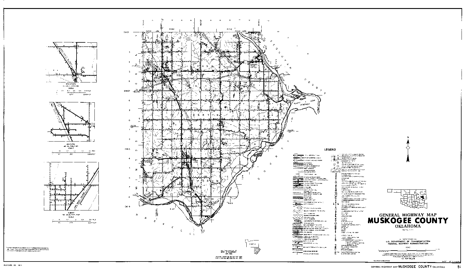
The final column provides links to Detailed Maps. These images were processed from the original DoT files, preserving full detail by presenting only one 36-section Township on each screen. Click on "[Townships]" to access the complete set of maps for that county. If you know the Township and Range you can select the appropriate map directly. If you just know the general part of the county, you can browse. Links shown in red are still under construction.
More information about the project's background.
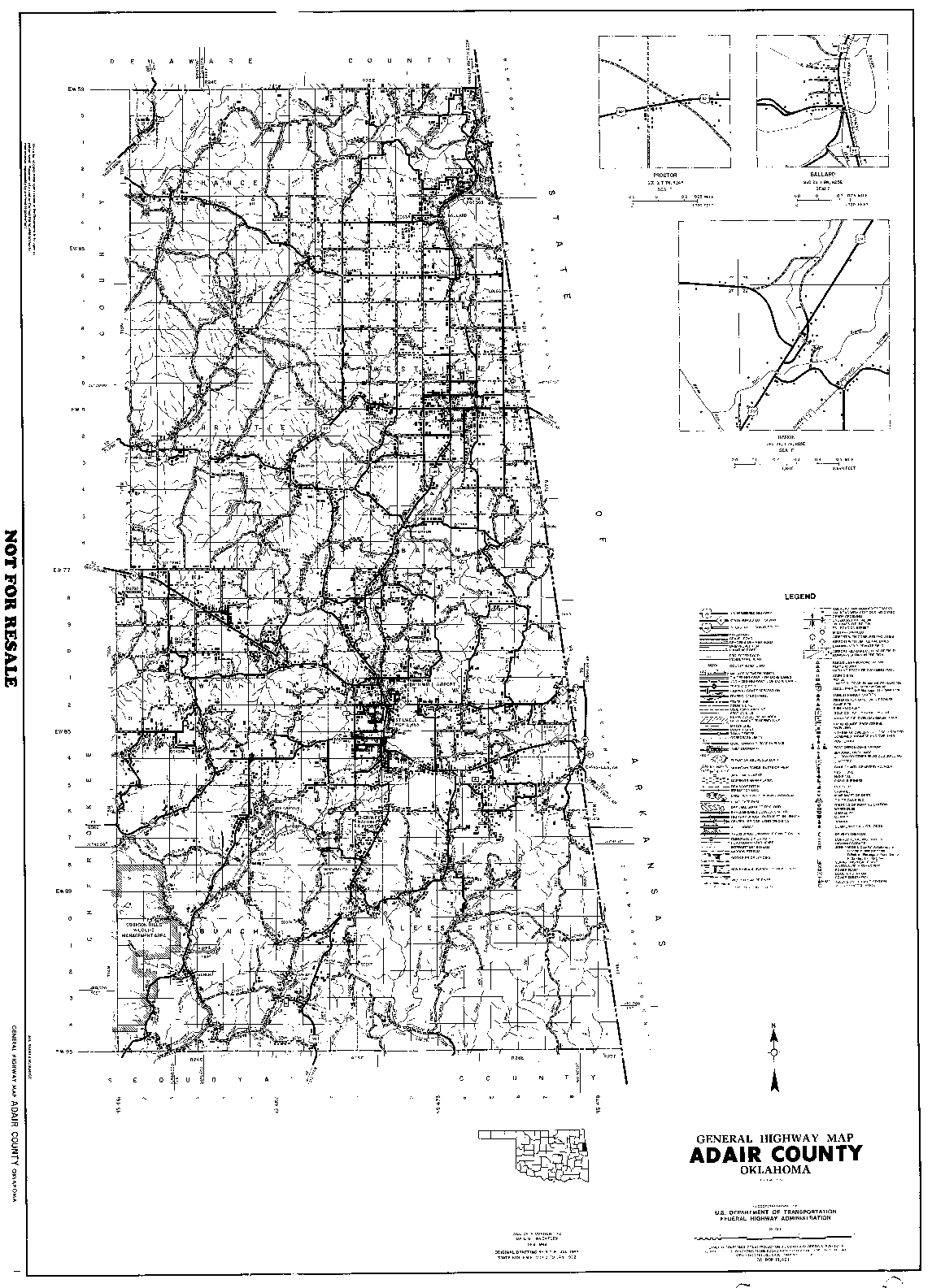
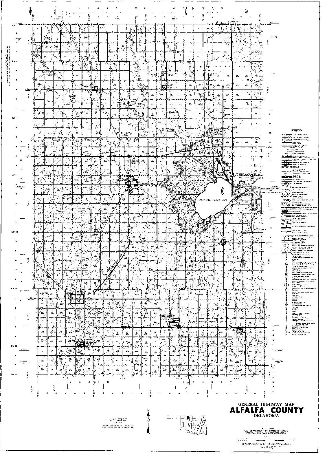
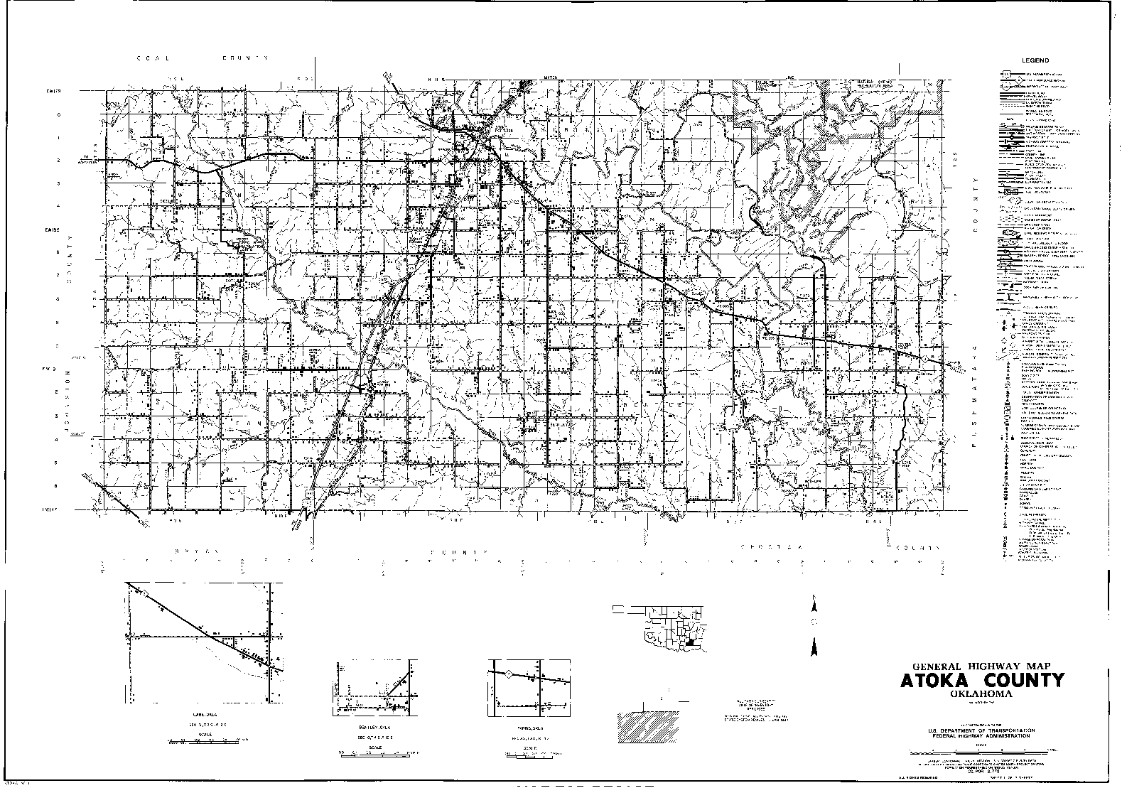
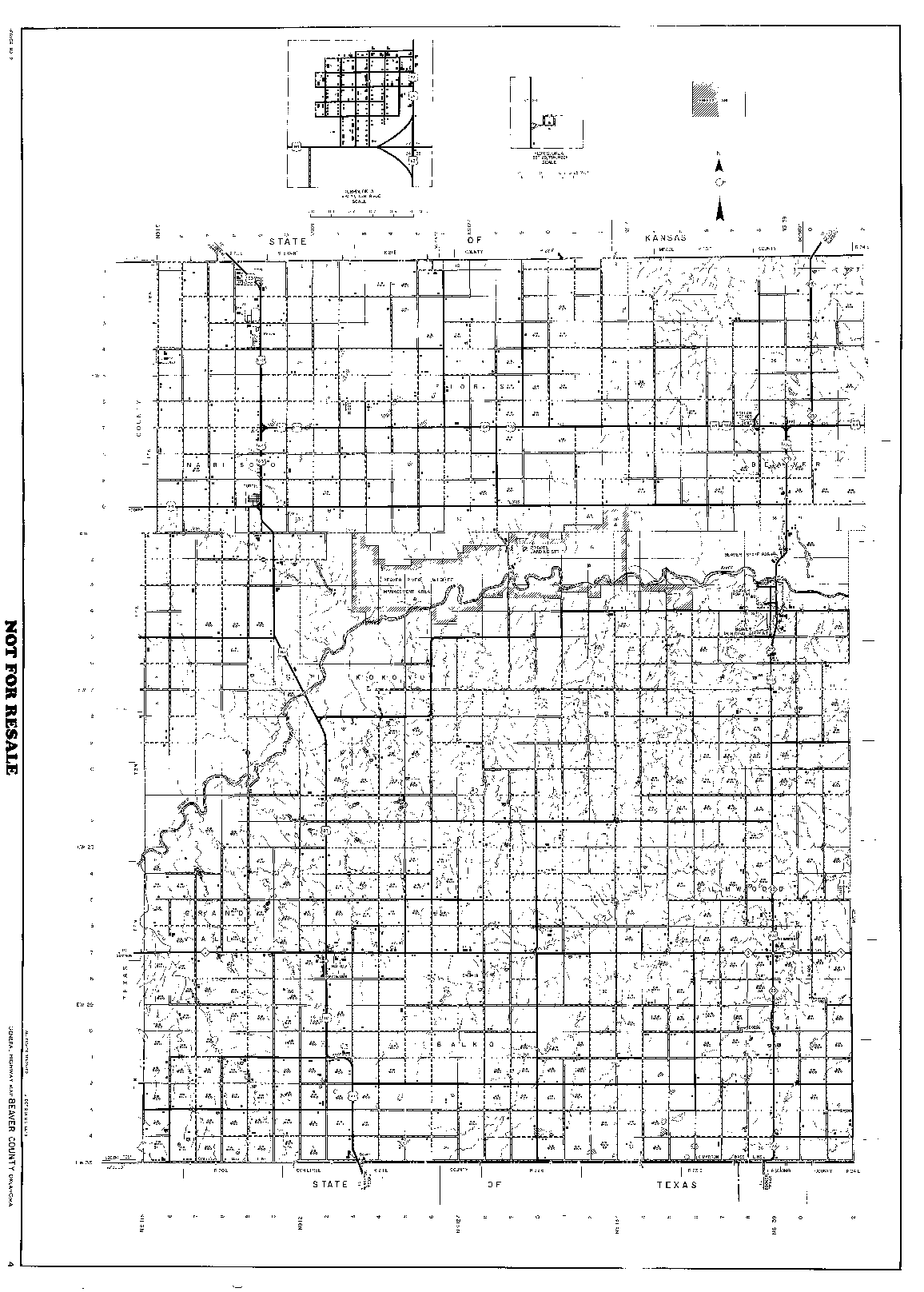
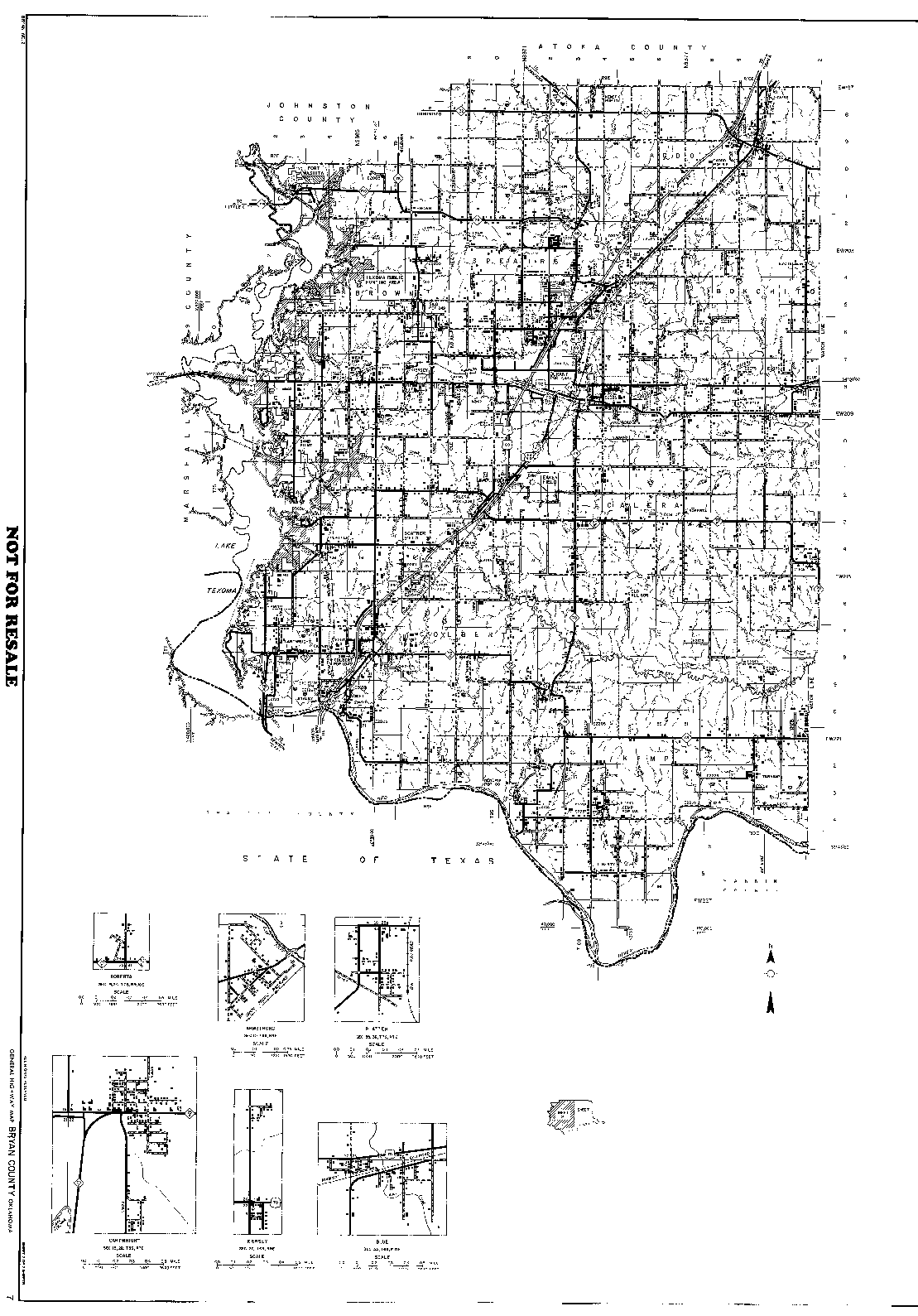
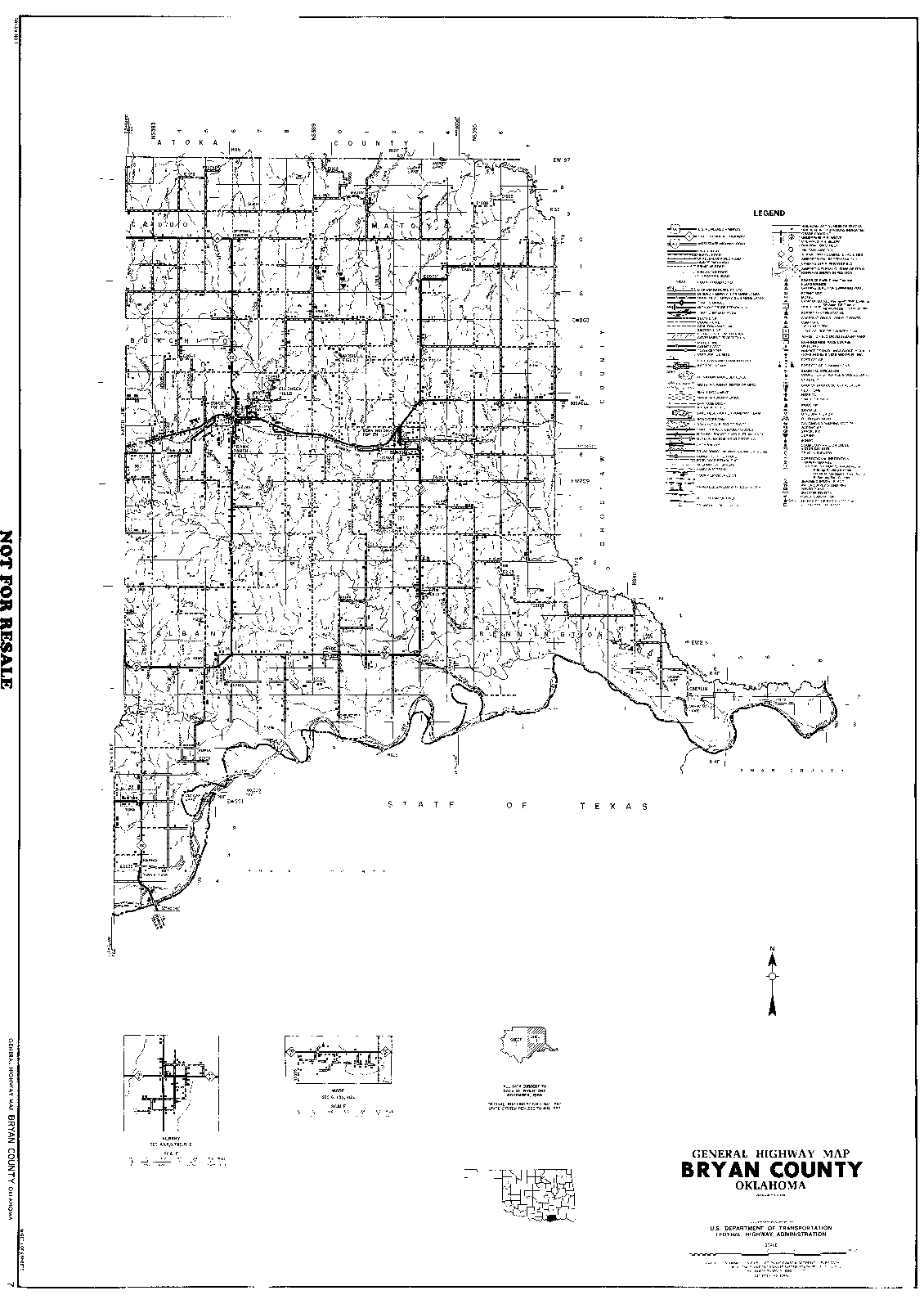
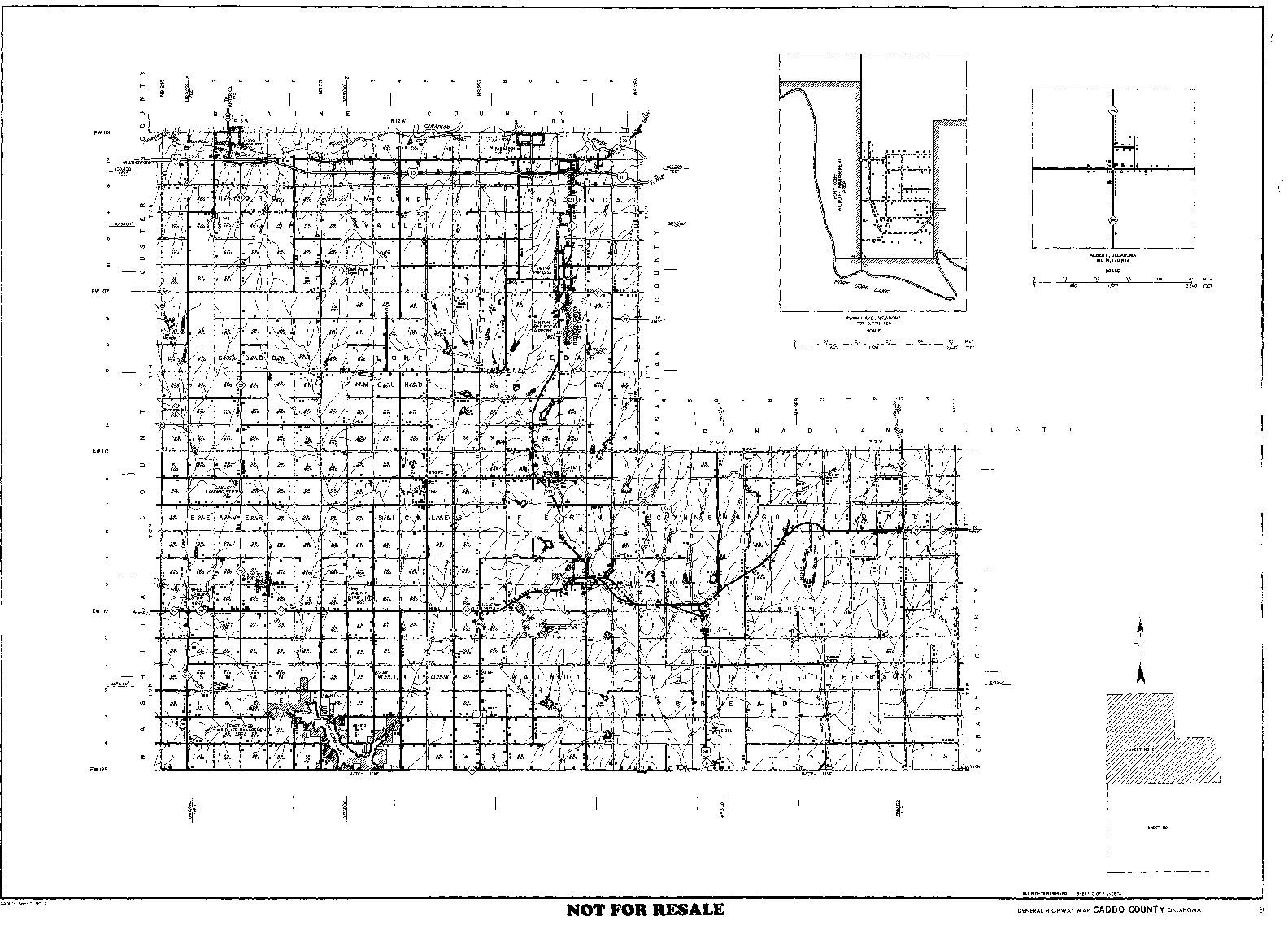
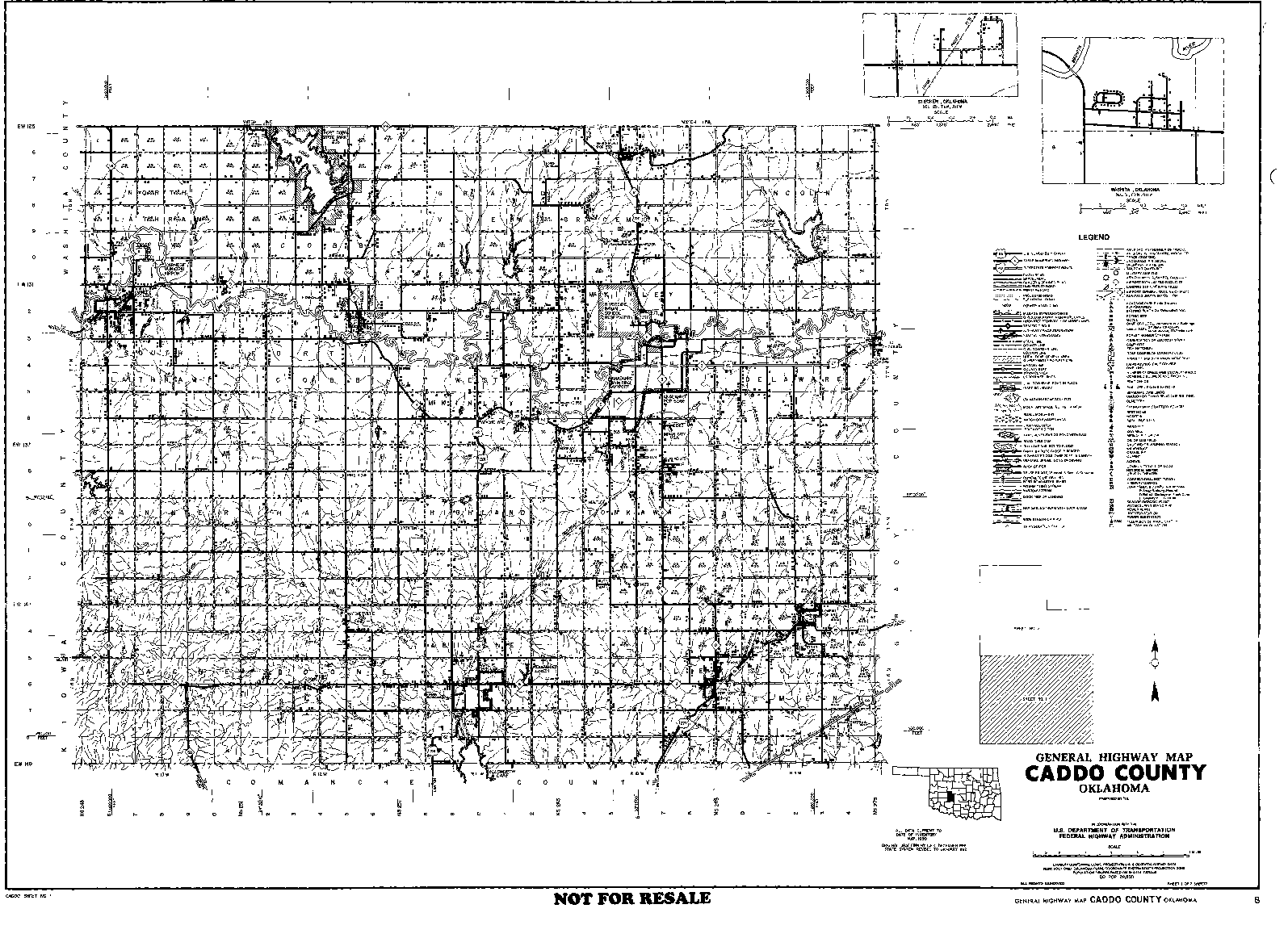
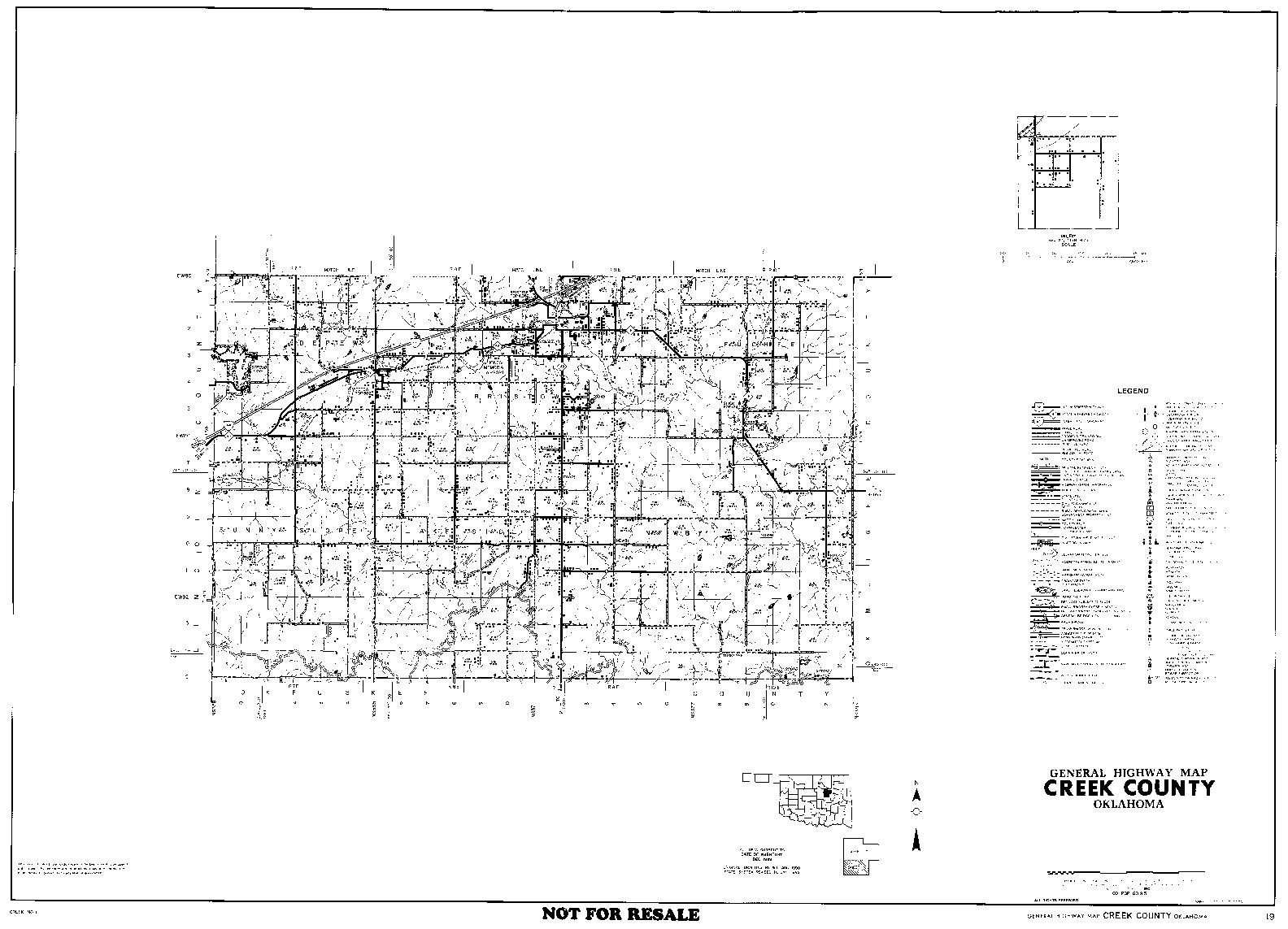
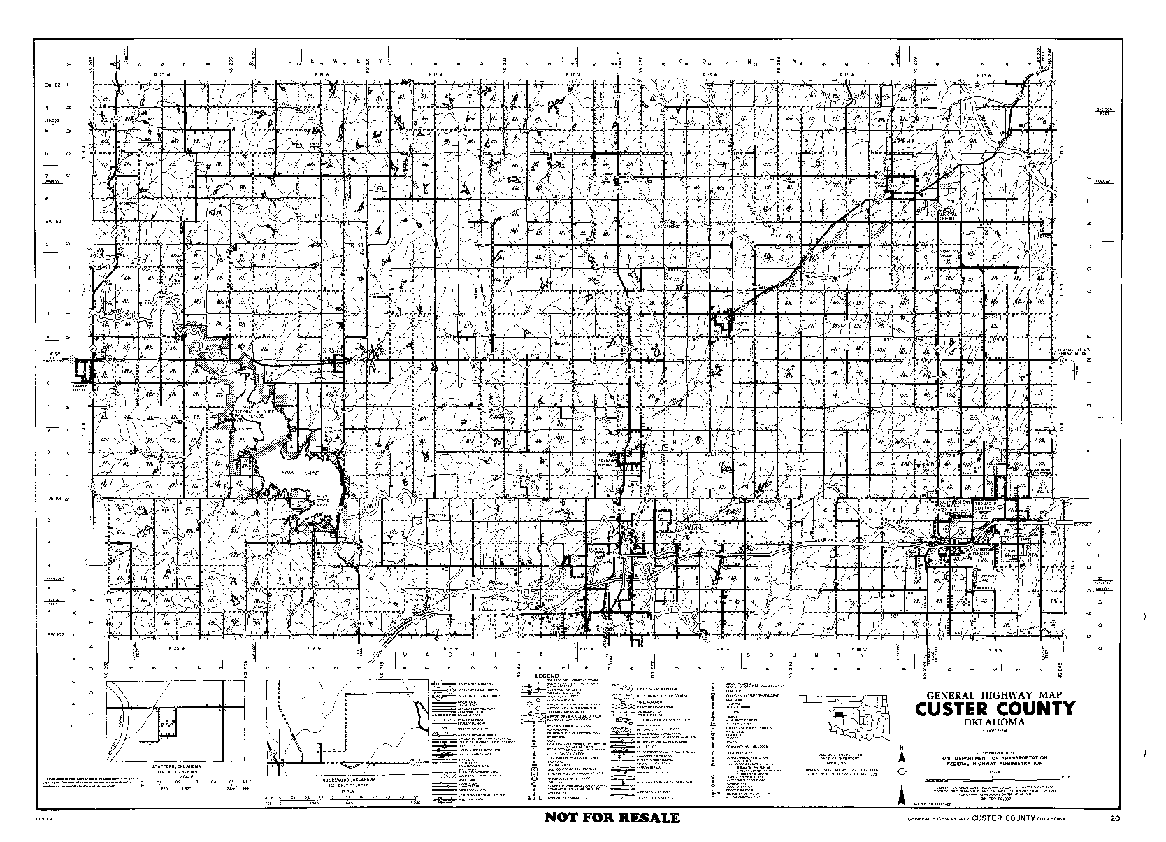
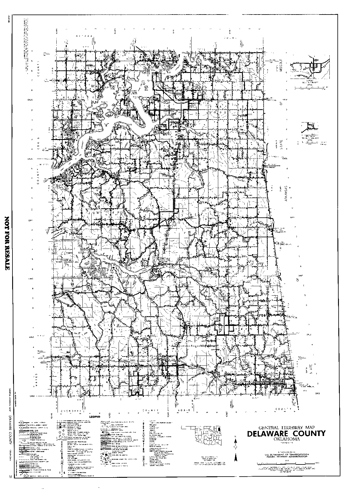
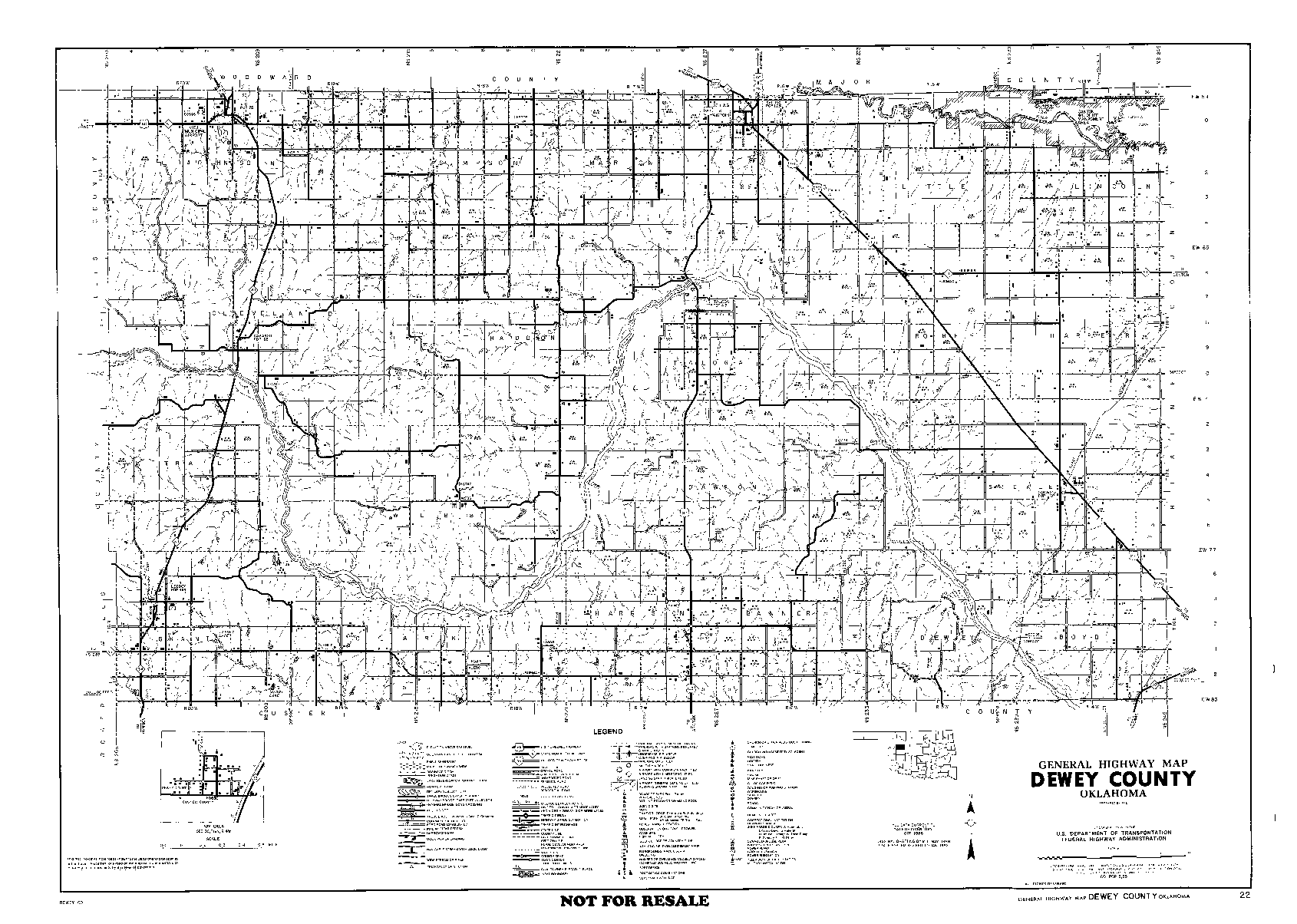
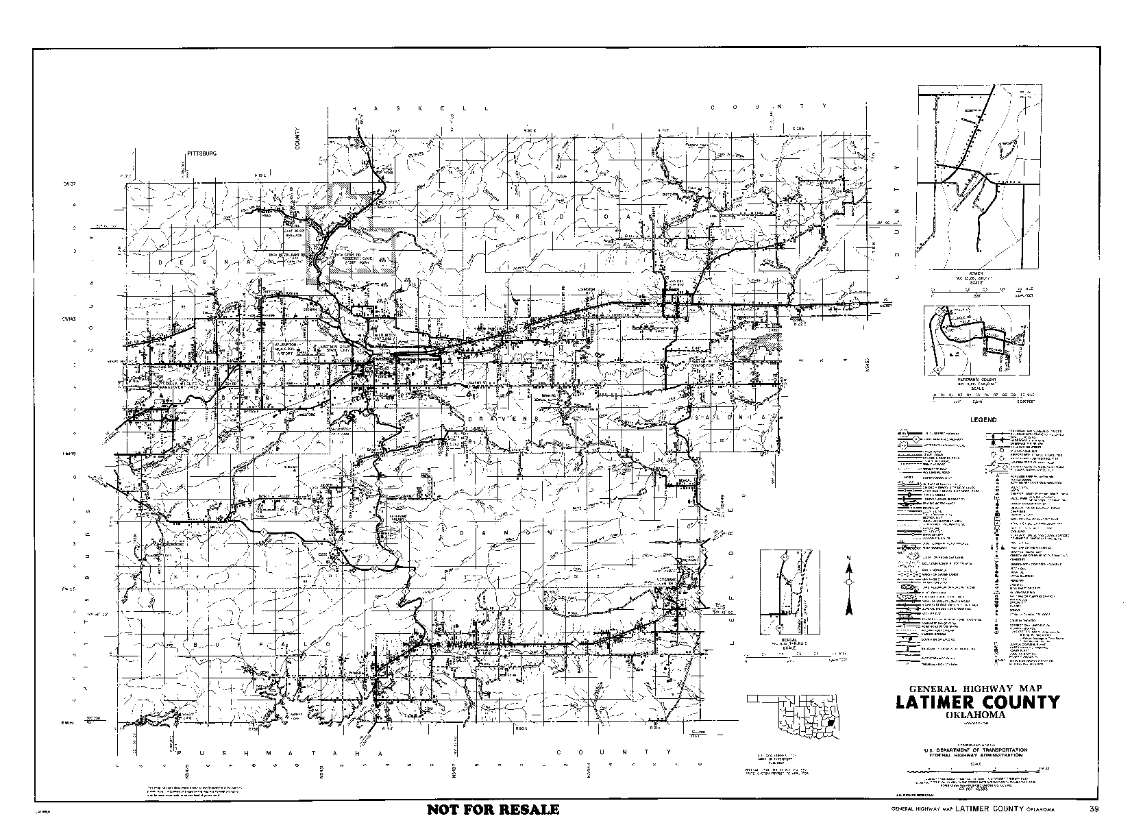
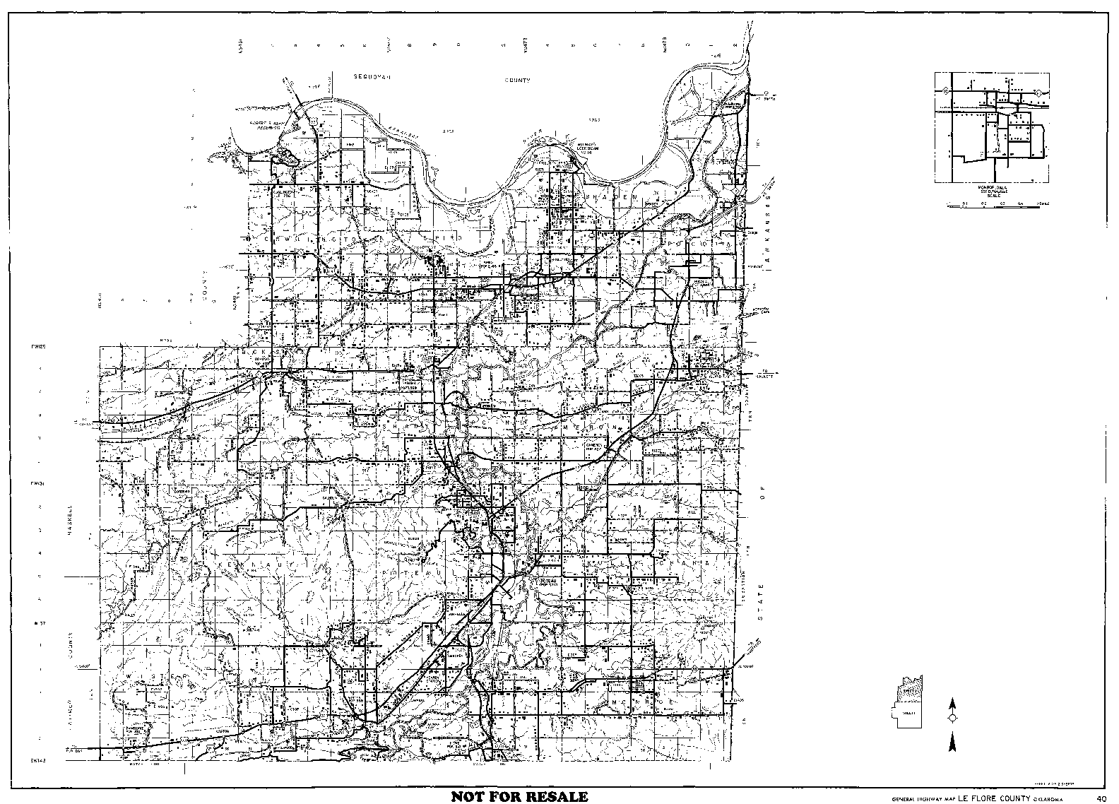
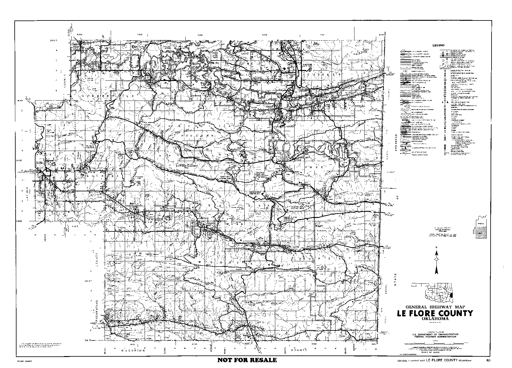
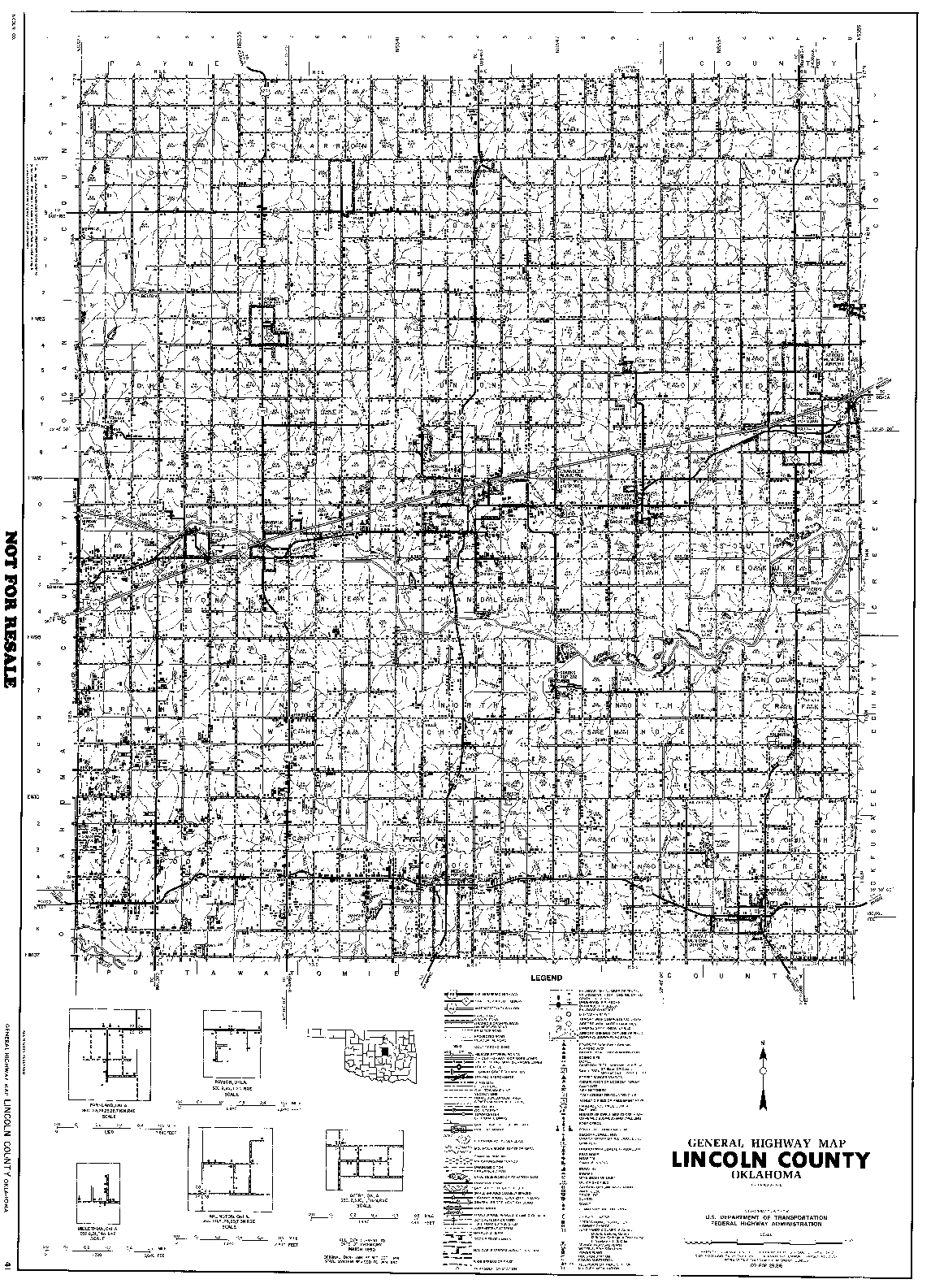
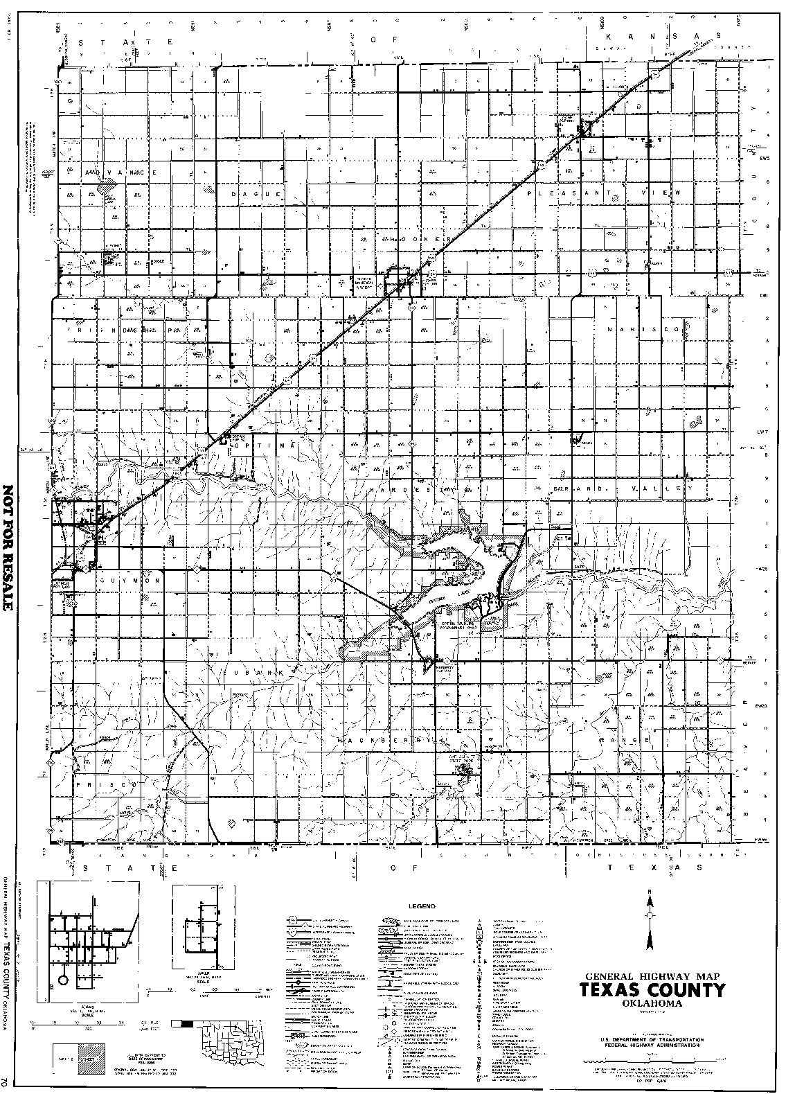
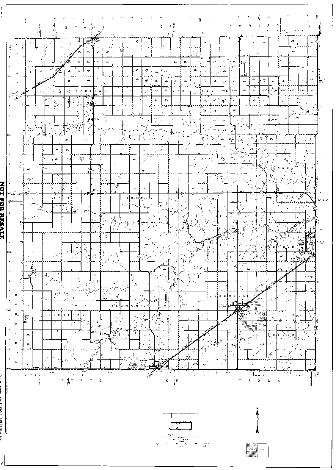
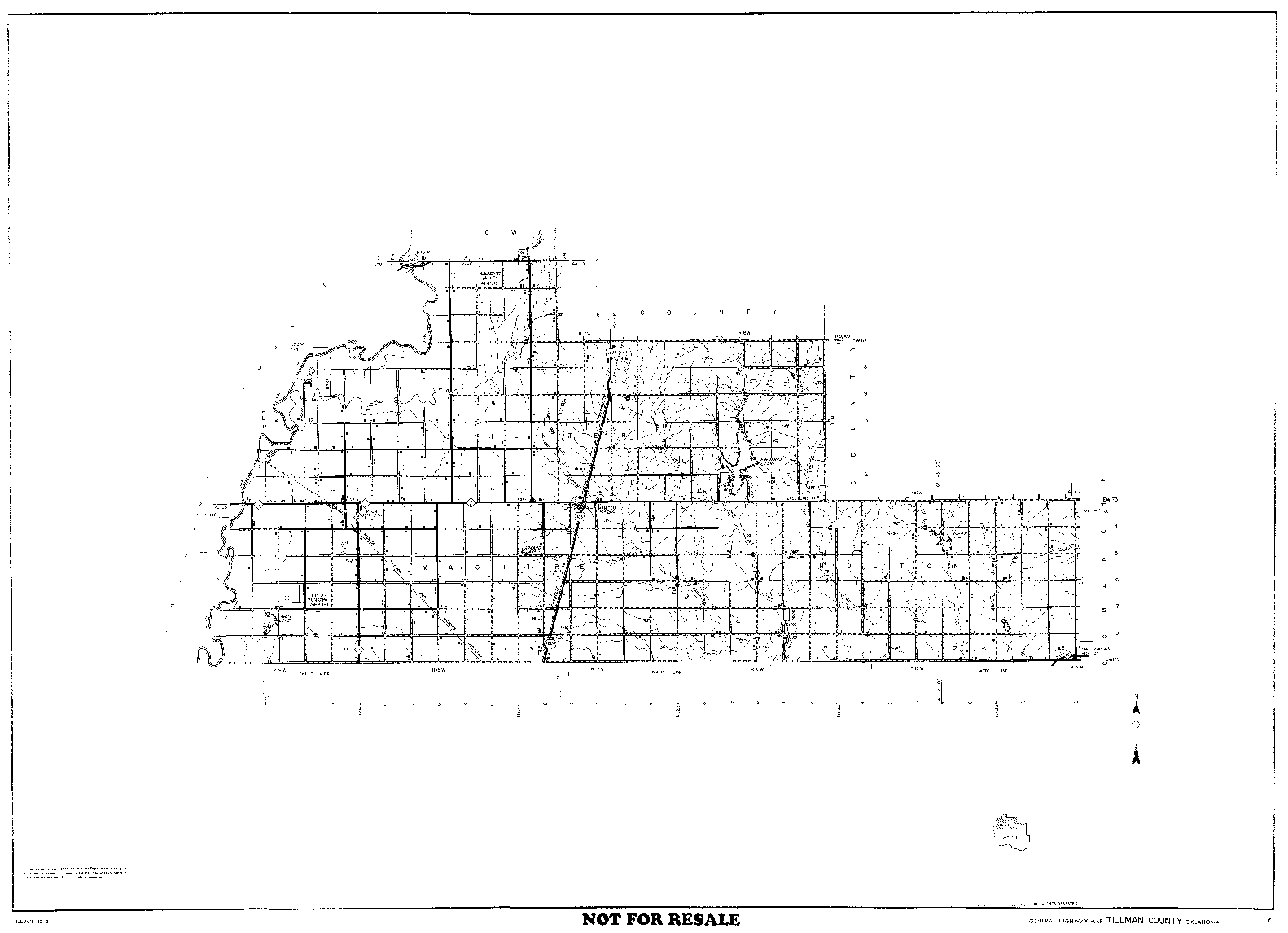
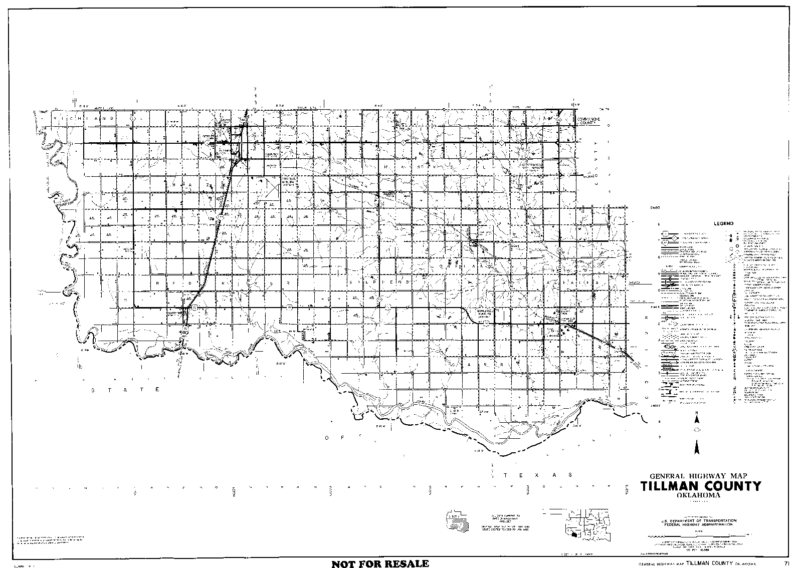
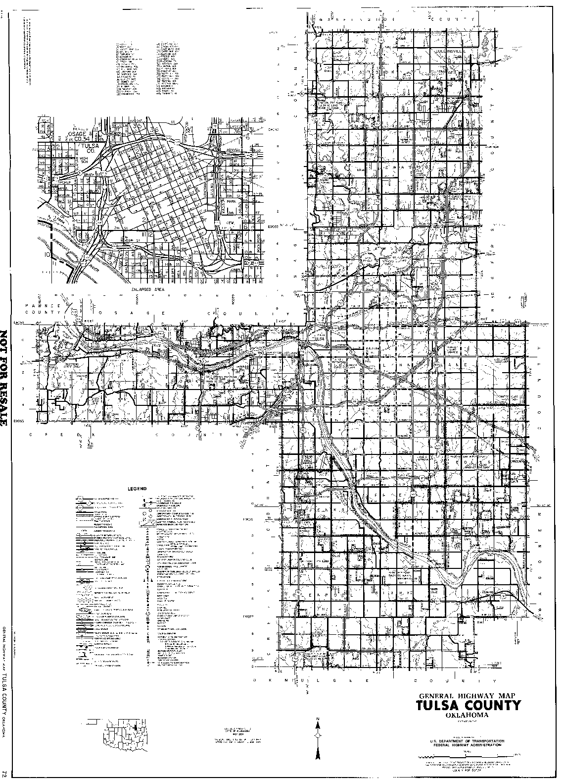
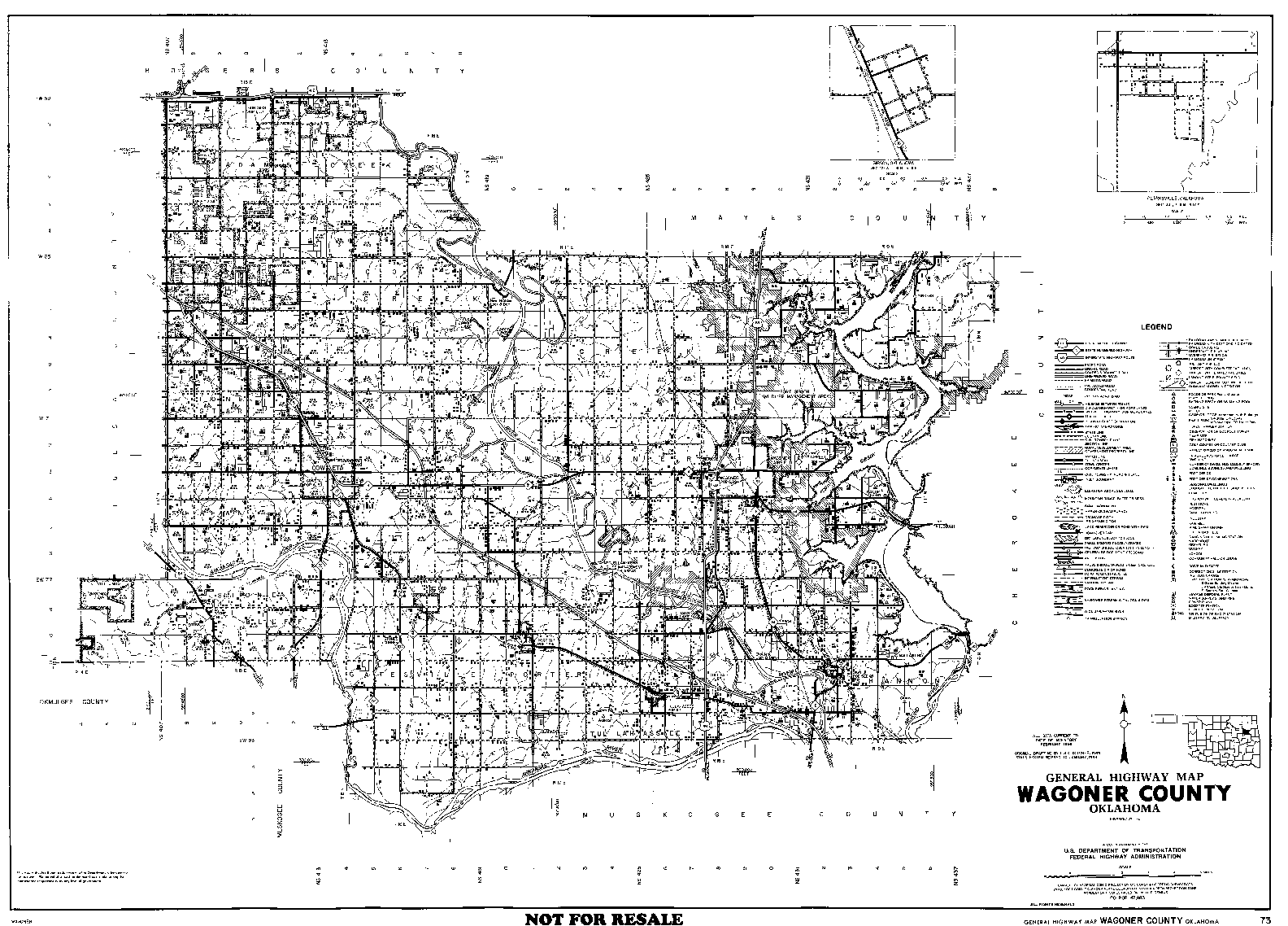
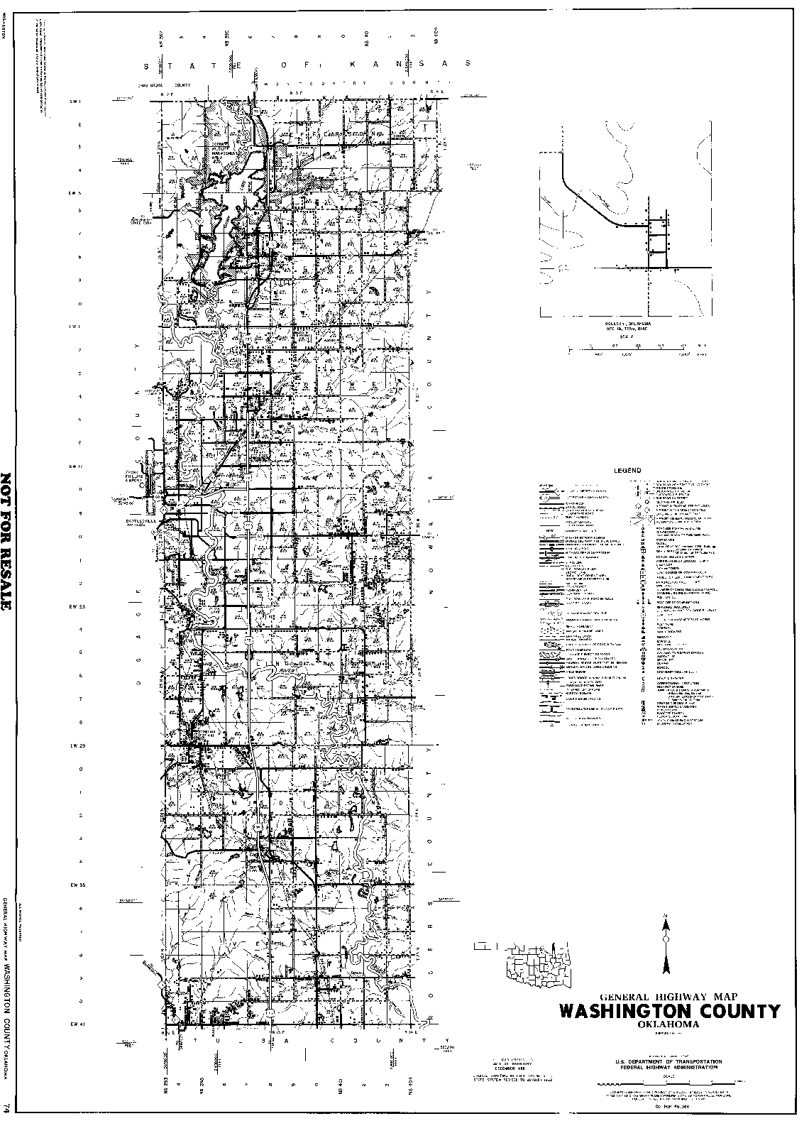
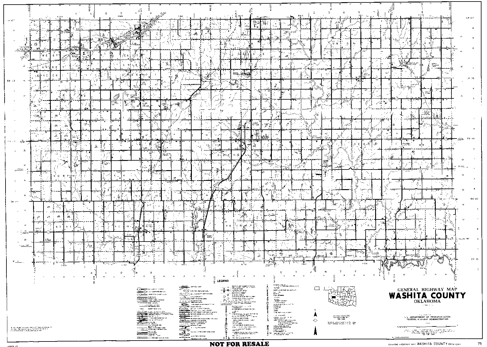
These detailed county maps were originally scanned by Mike Taylor and presented on OKGenWeb with permission of the Oklahoma Highway Department. For details, see his Oklahoma Towns page. They may be freely distributed or printed and included in publications as reference material, but must not be resold. These files are still available for downloading, but some are extremely large so the goal of this latest project has been to provide versions that can be viewed online.
The viewable County Maps have been reduced to 33%, which was the best compromise we found. These files are small enough to view online, yet their images are large enough to be readable if you know what you are looking for or have very good eyesight. This is obviously not the ideal solution, so the Township Map Project was born.
The Township Displays are much closer to the original scale and have been prepared by simply cropping segments from the extremely detailed county maps. Most of the individual maps cover a single numbered township consisting of 36 sections, but irregular county lines sometimes result in more or less than 36 sections per page. These detailed maps show roads, creeks, cemeteries - even churches, schools, and rural dwellings.
Related Projects
If you are interested in the location of a named township within a known county, rather than the details of the township itself, Sharon Crawford has provided a site with County Maps that include Township names and Section-Township-Range grids. These help you find the location of a specific piece of land, with respect to county boundaries and populated places. These are included in the above table of County Links as "S-T-R Grids".
| If you don't already know which county to look in, but have a place name, you can use our cross-reference lists to identify the county. | |
| In most cases, this provides the Township & Range as well as the name of the county the town is/was in. | |
| When there have been several towns bearing the same name, the dates each P.O. was active can help narrow your search. These lists also include some long-gone rural communities that aren't on the Towns Index. | |
| If you don't know the county or the Township-Range number but do know the Township Name, this will help you find the Counties that have Townships by that name. Sometimes a Township Name is unique and your search will be ended. Sometimes a Township Name has been used more than once, but at least this eliminates some of the 77 counties. | |
| If you have nothing but a land description, the page that links to numbered Townships with each Region will help you find not just which county that land is in but also its exact location within that county. | |
![]()
|
Page last updated
on
Tuesday, July 21, 2026
This site maintained by
Mel Owings
![]()